Pockets of Heavy Lake Effect Snow in the Great Lakes
Special Stories
15 Feb 2019 11:00 AM
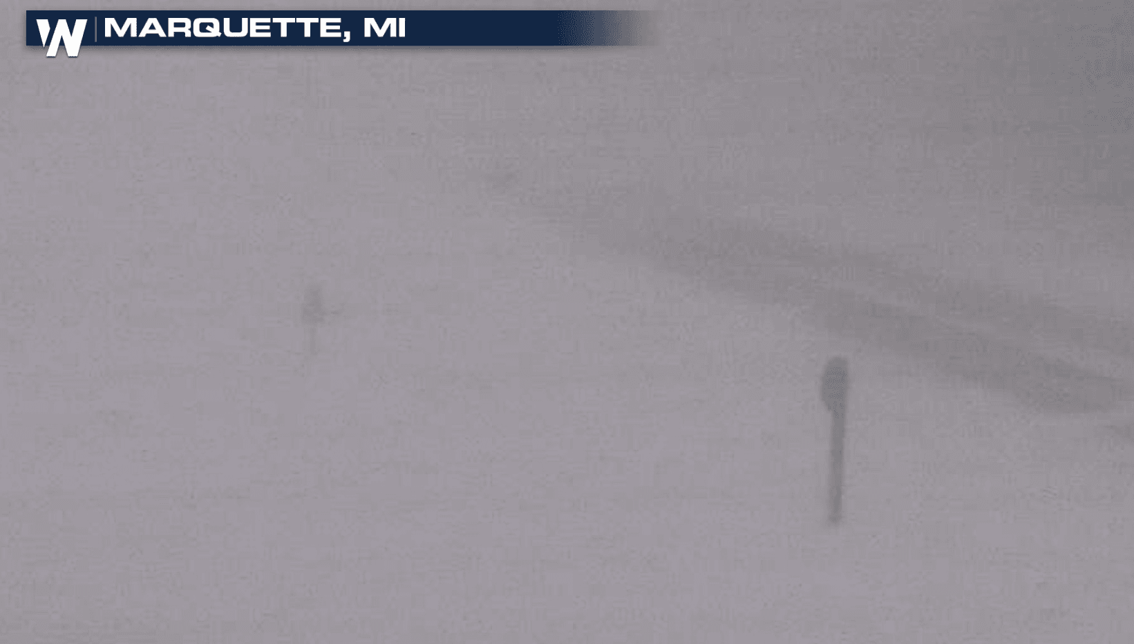
[Along M-28 east of Marquette, Michigan. From MDOT]
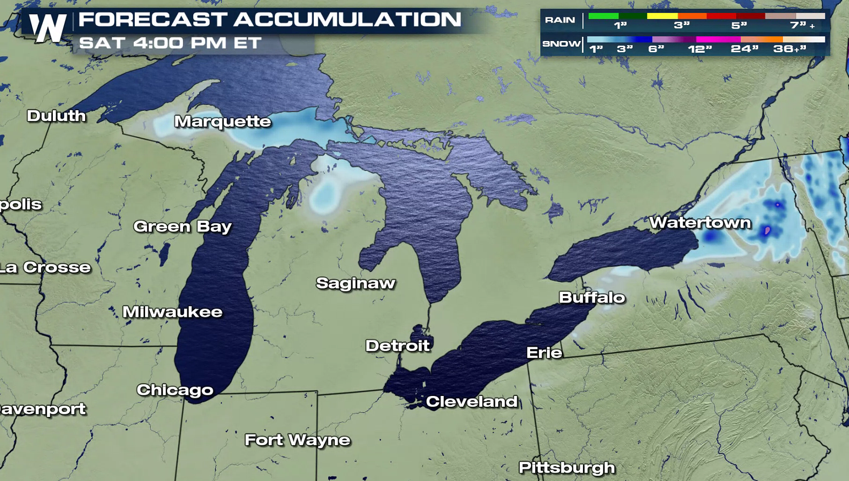
SNOW ACCUMULATIONS
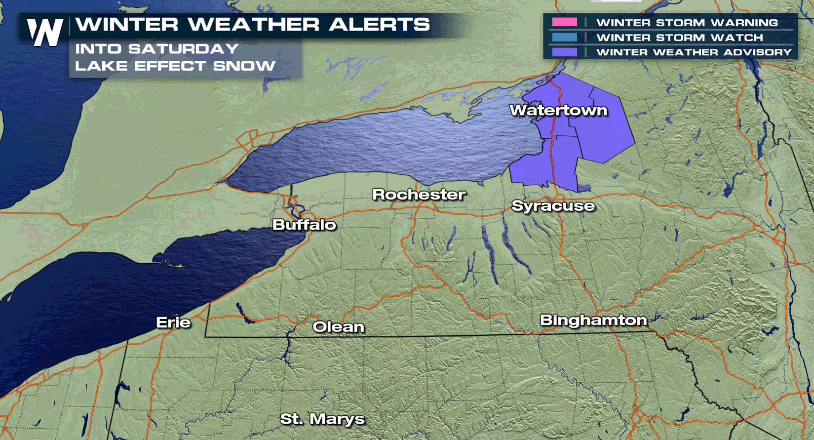
Cold air will be pushing across the Great Lakes to start this weekend, fueling focused lake effect snow. In the heaviest lake effect snow bands, accumulations may also reach to 10". The heaviest squalls are expected in the Upper Peninsula of Michigan along Lake Superior into tonight (Friday). Totals of 3" to 5" are likely downstream of Lake Ontario in New York.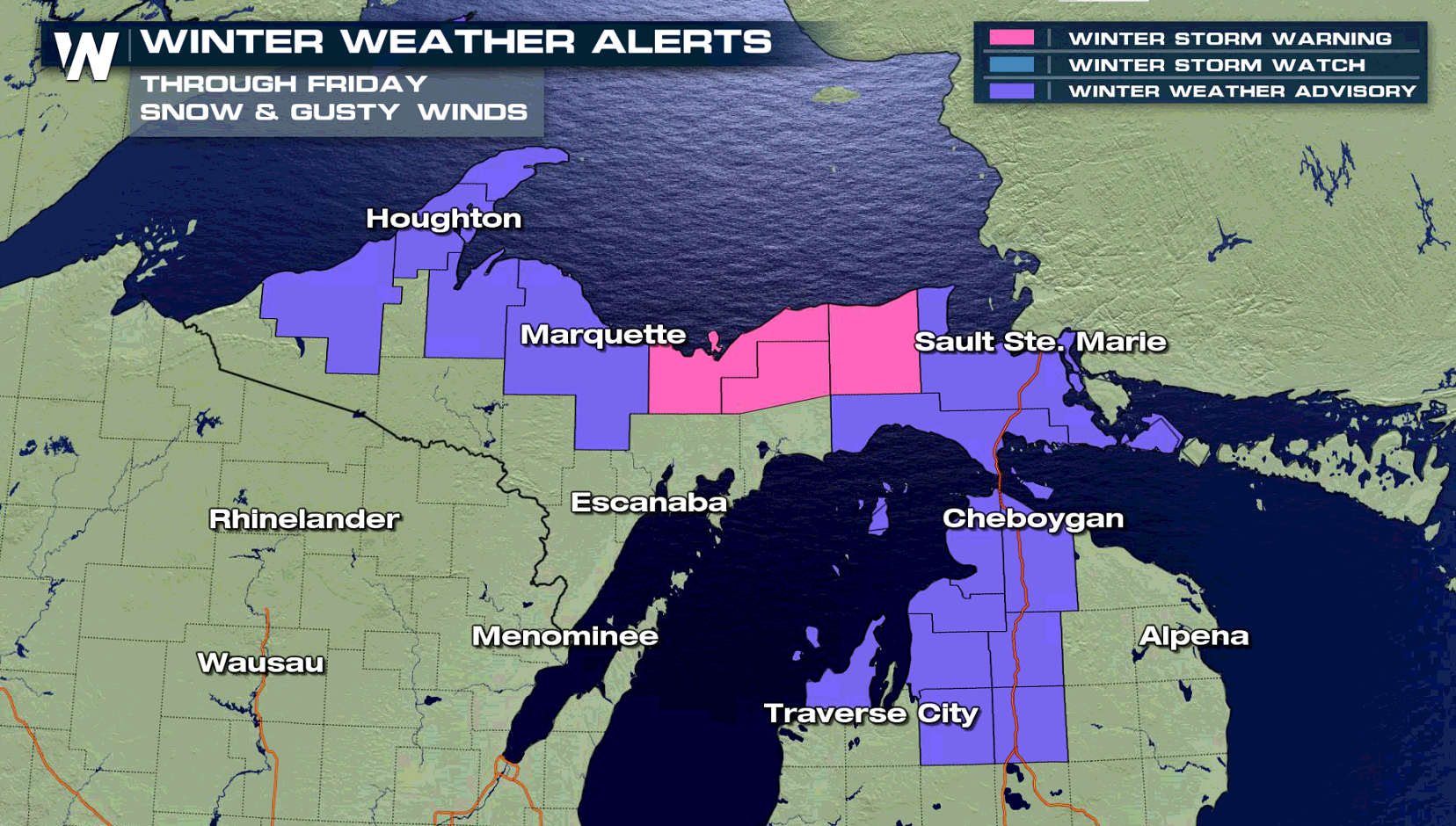
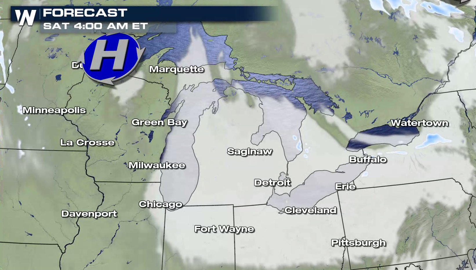
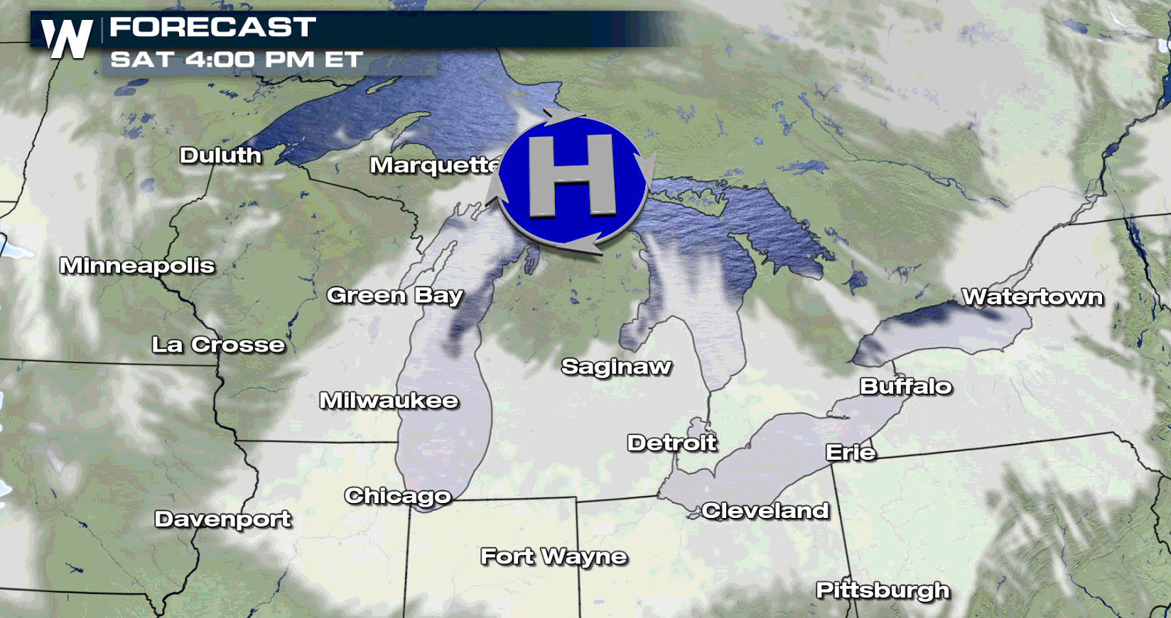
 FORECAST
Cold air circulating across the warmer waters of the Great Lakes, coupled with a low pressure center, will produce areas of heavy snow through Saturday. The wind will gust to 40 mph, creating low visibility with blowing and drifting snow. M-28 remains closed to the west of Munising, Michigan. White out conditions are expected near Lake Superior and in open inland areas.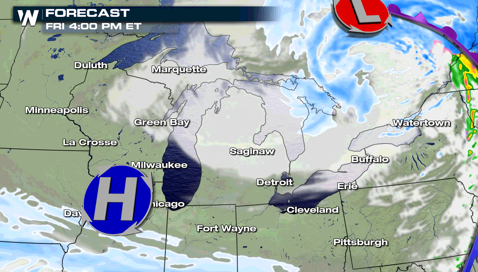
 Stay tuned to WeatherNation on-air and online for updates.
Cold air will be pushing across the Great Lakes to start this weekend, fueling focused lake effect snow. In the heaviest lake effect snow bands, accumulations may also reach to 10". The heaviest squalls are expected in the Upper Peninsula of Michigan along Lake Superior into tonight (Friday). Totals of 3" to 5" are likely downstream of Lake Ontario in New York.
FORECAST
Cold air circulating across the warmer waters of the Great Lakes, coupled with a low pressure center, will produce areas of heavy snow through Saturday. The wind will gust to 40 mph, creating low visibility with blowing and drifting snow. M-28 remains closed to the west of Munising, Michigan. White out conditions are expected near Lake Superior and in open inland areas.
Stay tuned to WeatherNation on-air and online for updates.All Weather News
More


More Storms for the East Sunday and Monday
A low-pressure system crashing through the Mi
2 Aug 2026 2:20 AM

After Reaching Category 5, Genevieve Weakens in the Pacific
PacificGenevieve formed on last Friday south
2 Aug 2026 1:30 AM

Flooding, Severe Storms Target the Midwest Again
After an active week of storms across the nor
1 Aug 2026 1:40 AM

Flooding Risk Increases as Heavy Rain Targets the Tri-State Area
Tuesday, heavy rainfall moved across the Nort
30 Jul 2026 12:25 AM

Severe Weather: Energy From the Midwest Now in the Southeast
UPPER MIDWEST - Through Monday, dangerous tor
29 Jul 2026 10:30 PM