Heavy Rain for the Southwest This Week
Top Stories
18 Nov 2019 5:06 AM
Pacific moisture streaming North from the remnants of Raymond and a developing upper-level low will bring increasing shower and thunderstorm chances to the Southwest this week. Some areas of New Mexico, Nevada, California and Arizona could see some very heavy rainfall. Here is the latest forecast.
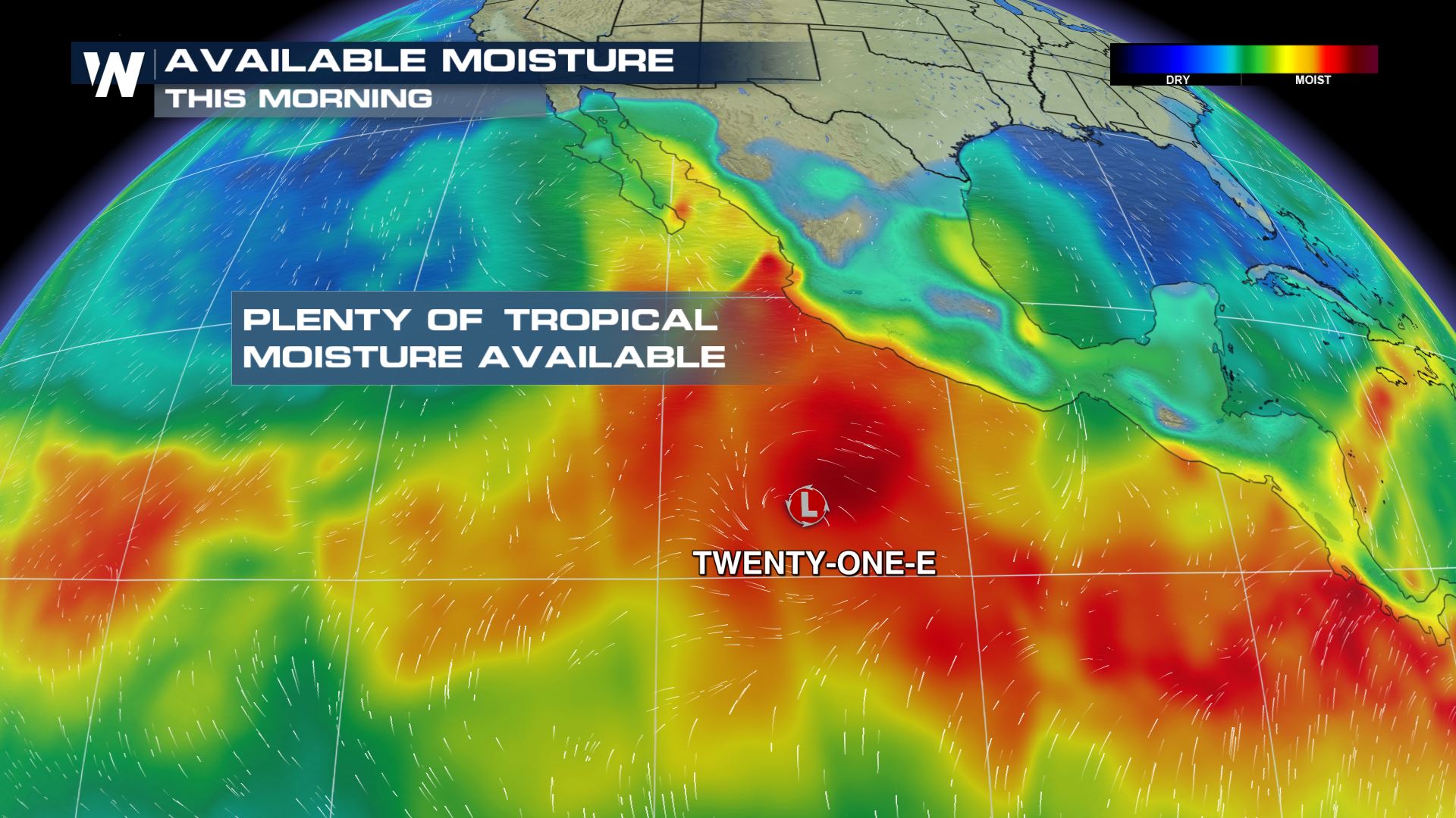
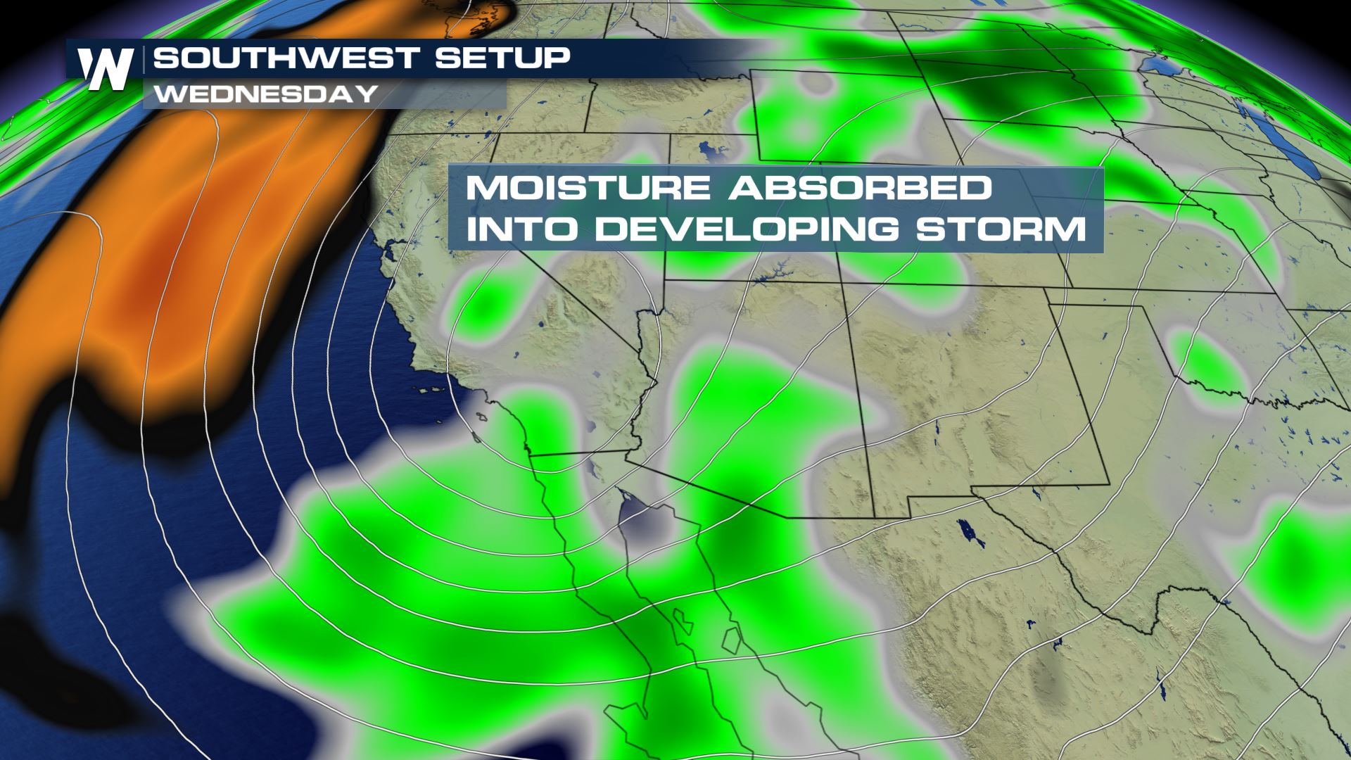 Pacific moisture moving North will interact with a developing upper-level low across the southwest and bring the chance for showers and storms. The severe weather risk will be low, but some areas could see some significant rainfall.
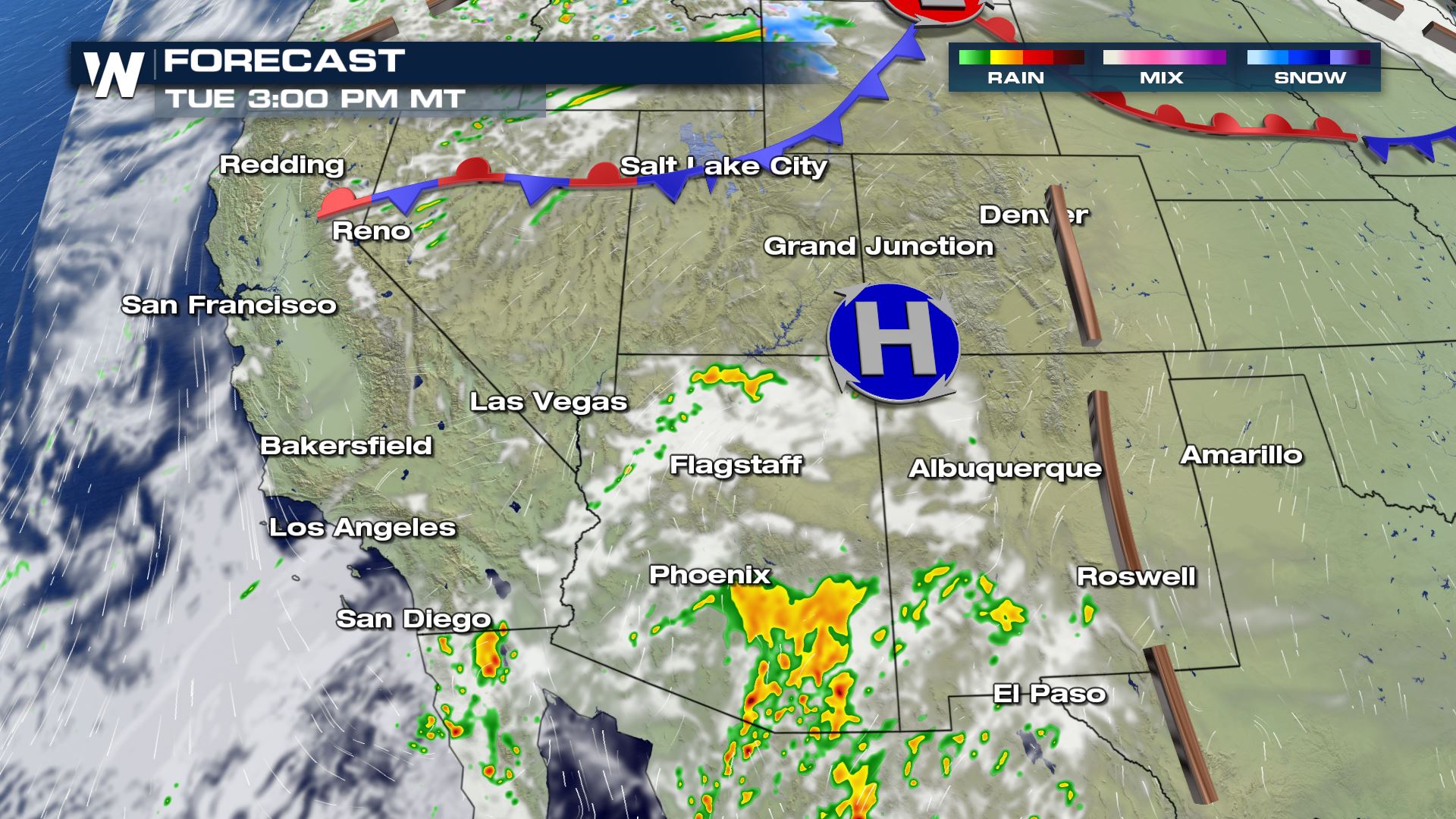
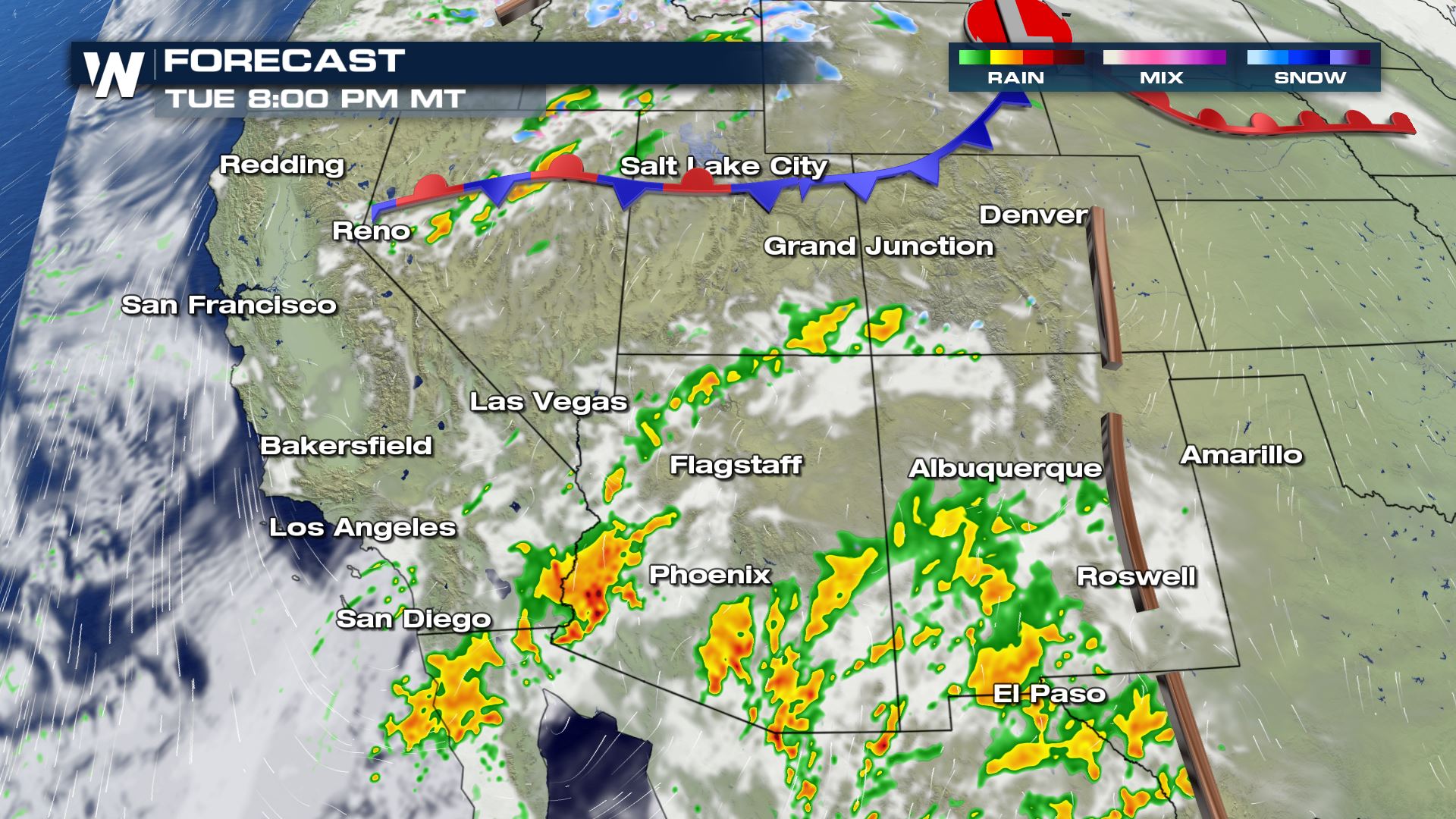
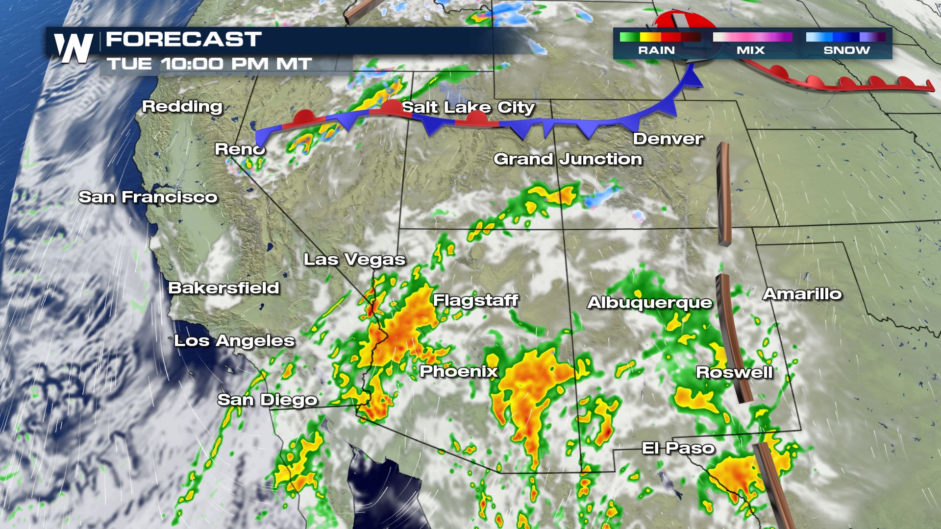
 Monday will be warm and sunny all across the Southwest, but that will start to change late Monday and early Tuesday. Heavy showers and mountain snow will be likely for many areas including Phoenix and Flagstaff. Because of the high amount of moisture areas into Utah and Colorado could also see some heavy precipitation.
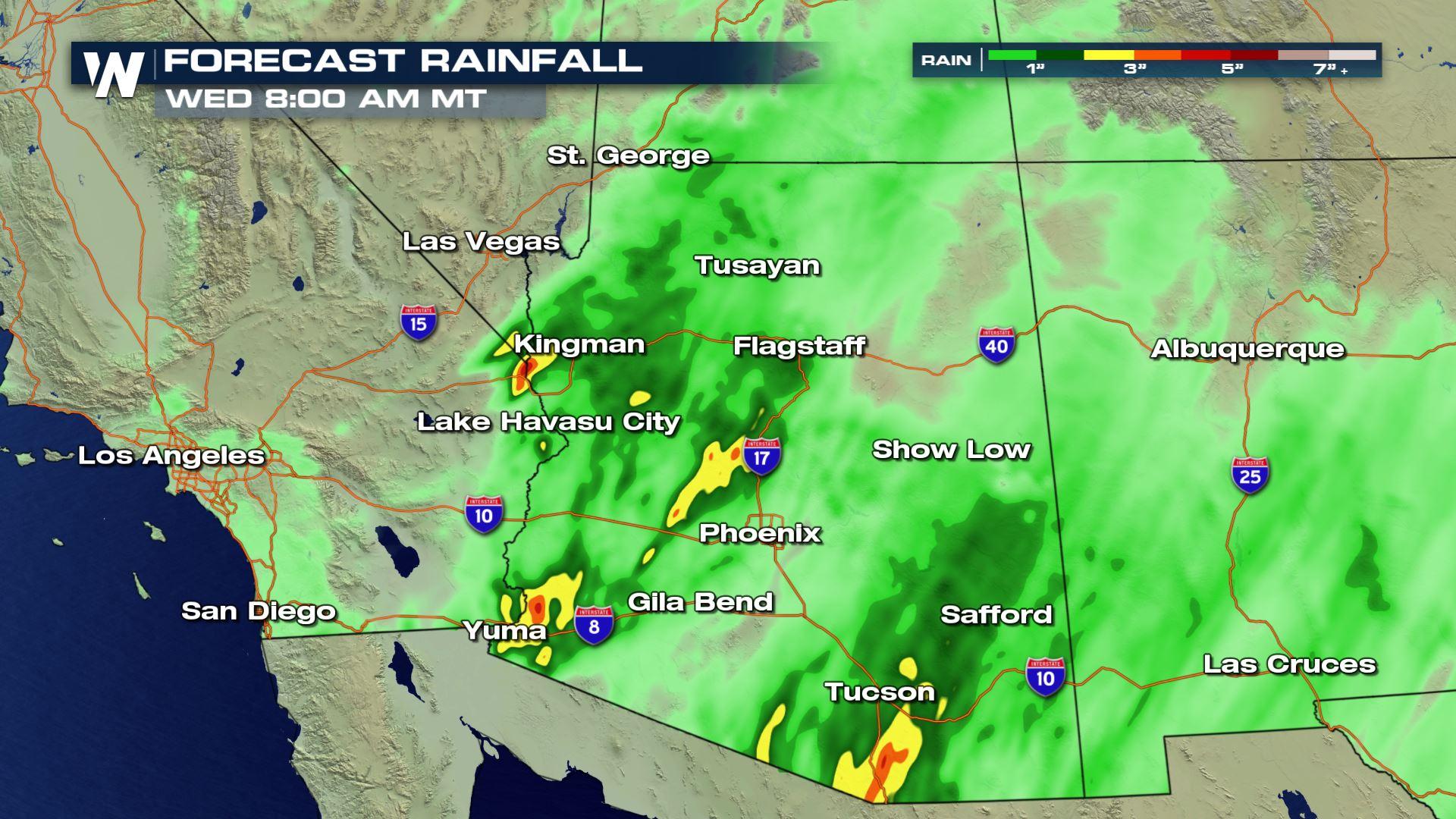
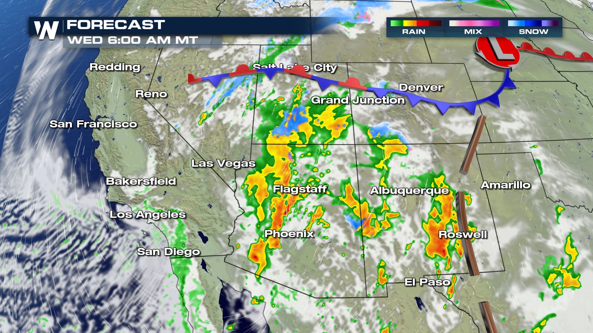
 Here is the latest rainfall forecast through early Wednesday. Yuma, Kingman and Tucson could see over 3 inches of rainfall in just a 24 hour span. These areas are not equipped for heavy rain so be ready for flash flooding and hazardous travel.
Stay tuned to WeatherNation for more updates on the Southwest rain.
Here is the latest rainfall forecast through early Wednesday. Yuma, Kingman and Tucson could see over 3 inches of rainfall in just a 24 hour span. These areas are not equipped for heavy rain so be ready for flash flooding and hazardous travel.
Stay tuned to WeatherNation for more updates on the Southwest rain.
Set-Up
Pacific moisture moving North will interact with a developing upper-level low across the southwest and bring the chance for showers and storms. The severe weather risk will be low, but some areas could see some significant rainfall.
Forecast
Monday will be warm and sunny all across the Southwest, but that will start to change late Monday and early Tuesday. Heavy showers and mountain snow will be likely for many areas including Phoenix and Flagstaff. Because of the high amount of moisture areas into Utah and Colorado could also see some heavy precipitation.
Rainfall Potential
Here is the latest rainfall forecast through early Wednesday. Yuma, Kingman and Tucson could see over 3 inches of rainfall in just a 24 hour span. These areas are not equipped for heavy rain so be ready for flash flooding and hazardous travel.
Stay tuned to WeatherNation for more updates on the Southwest rain.All Weather News
More
East Gears Up for Stormy, Wet Weekend
A low pressure system crashing through the Mi
1 Aug 2026 11:35 AM


Flooding, Severe Storms Target the Midwest Again
After an active week of storms across the nor
1 Aug 2026 1:40 AM

After Reaching Category 5, Genevieve Weakens in the Pacific
PacificFausto is now a post-tropical cyclone.
31 Jul 2026 1:30 AM

Flooding Risk Increases as Heavy Rain Targets the Tri-State Area
Tuesday, heavy rainfall moved across the Nort
30 Jul 2026 12:25 AM

Severe Weather: Energy From the Midwest Now in the Southeast
UPPER MIDWEST - Through Monday, dangerous tor
29 Jul 2026 10:30 PM