Flash Flooding Threat Continues in Texas

It has been 10 days since the devastating floods swept through the Texas Hill Country, and our hearts remain with the communities still recovering. And before they could catch their breath more rain inundated the same region once again. Over the past three days, torrential rains overwhelmed rivers, roads, and communities from July 12 to July 14.
Emergency services were stretched thin, and water rescues were carried out across the region. In San Saba County, a flash flood emergency was declared, and search operations along the Guadalupe River were temporarily suspended due to dangerous conditions.
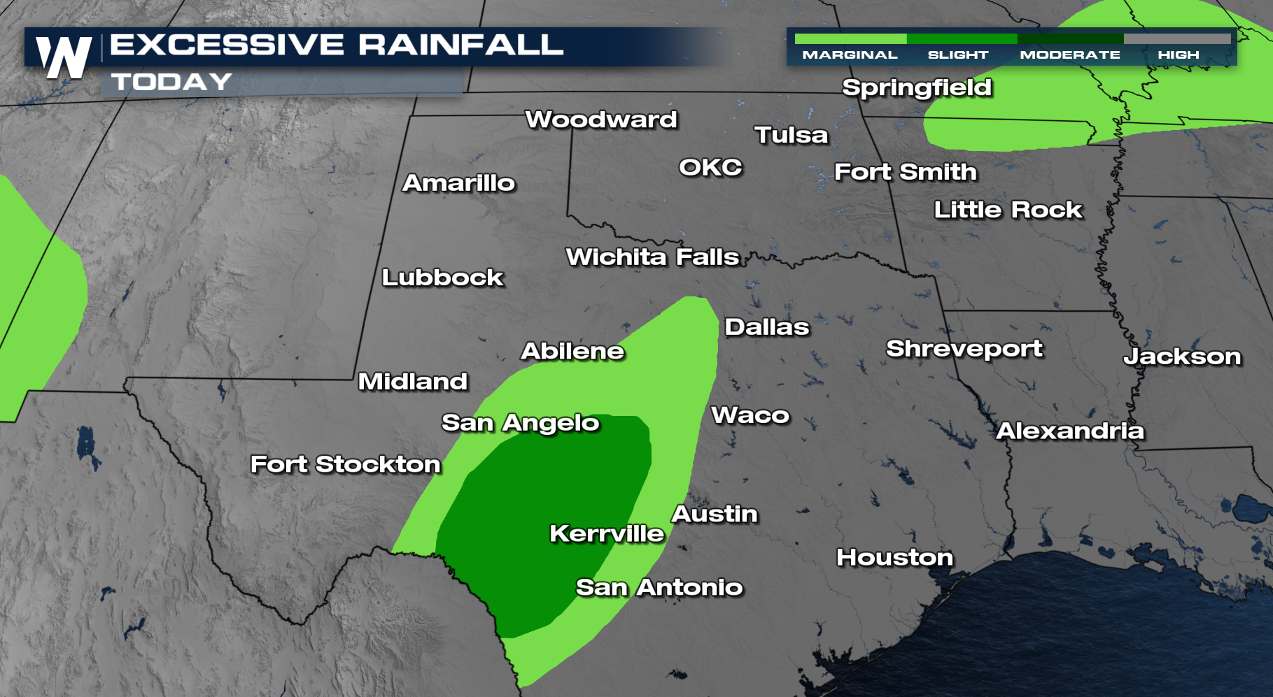
The Weather Prediction Center has kept a Slight risk along the Big Bend of Texas. Localized heavy rain will be possible on top of the already saturated soils, bringing more flooding concerns.
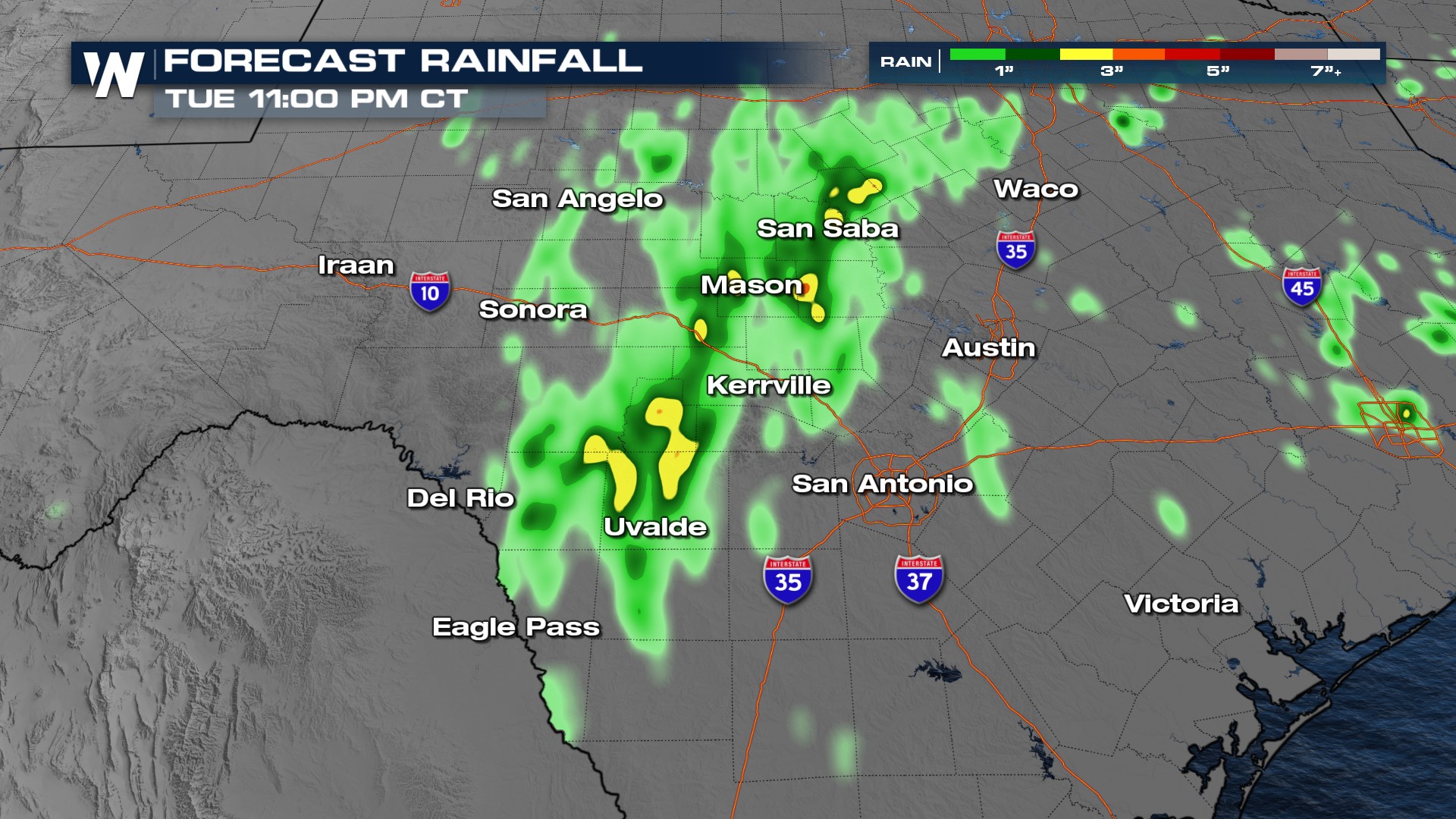
 Rain Forecast
We're forecasting a few pockets of 1-3 inches of rain accumulation.
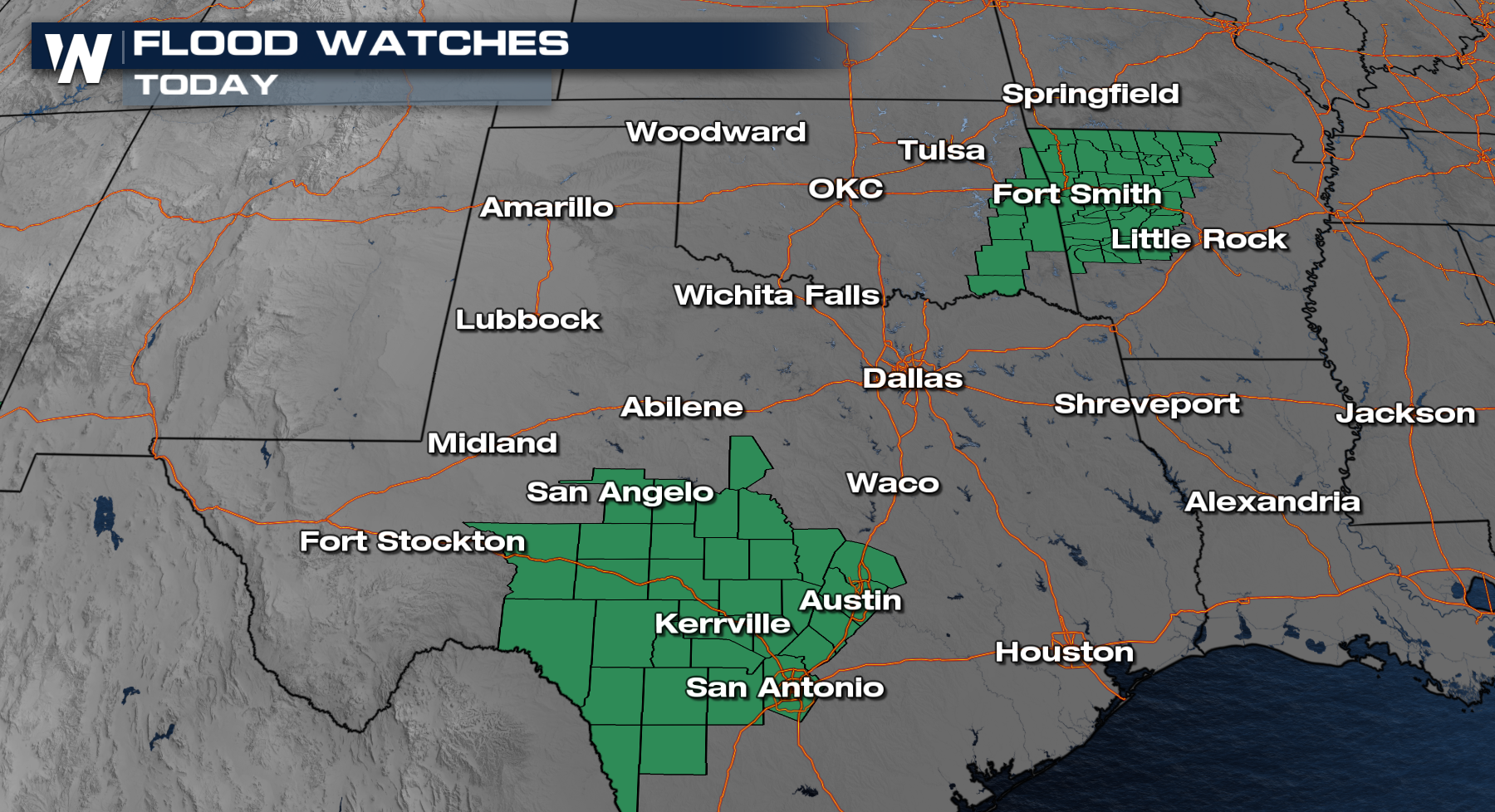
Flood Watches continue for Texas for the potential of continued heavy rain. Additional watches have been issued for eastern Oklahoma and Arkansas too.
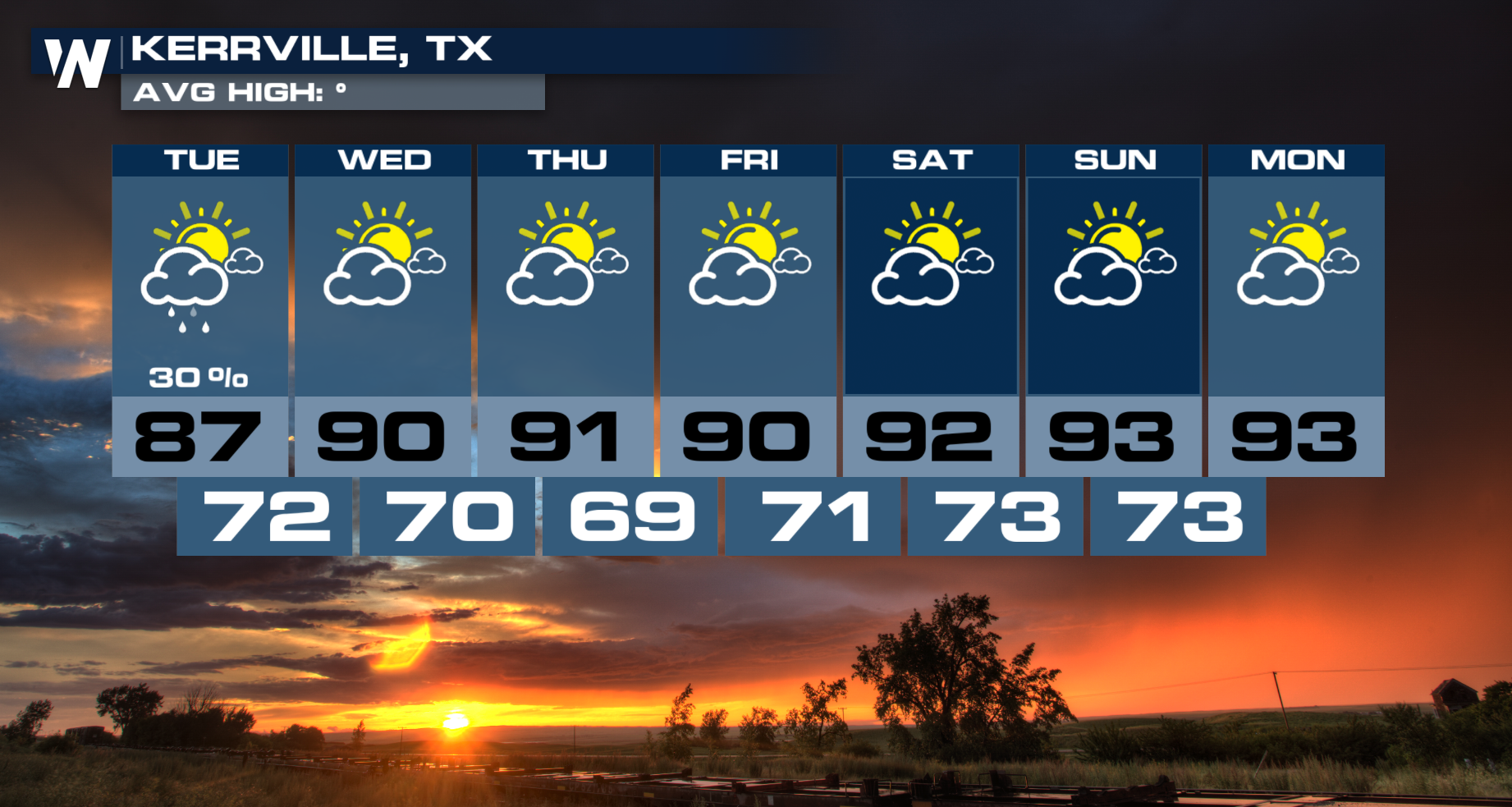
 Although this week shows a significant drying trend, there will be some very isolated rain potential, mainly during the afternoon hours.
Tune in to WeatherNation for live updates throughout the hour.


