Heavy Rain Showers Move Into The Pacific Northwest
Special Stories
27 Oct 2018 4:10 PM
Heads up, Northwest! You'll be turning much wetter and consistently cloudier as the weekend rolls on. Hopefully you have taken advantage of your time to enjoy the dry conditions, because that window to do so is quickly closing!
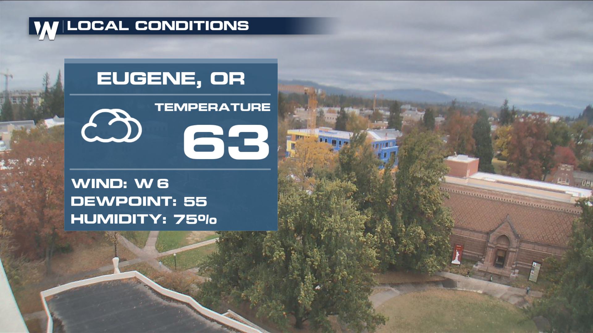 The weather conditions in Eugene, Oregon on Saturday afternoon
The clouds were already streaming into Oregon on Saturday afternoon, the visual precursor to the next weather event.
The weather conditions in Eugene, Oregon on Saturday afternoon
The clouds were already streaming into Oregon on Saturday afternoon, the visual precursor to the next weather event.
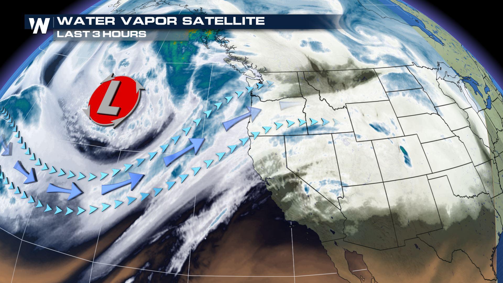
 The weather set-up on Saturday afternoon featured an approaching upper-level low, pictured by the big 'L' above. Note the fetch, or the arrows crossing the ocean and carrying the moisture, that was coming in all the way from the central Pacific! That means it'll be a steady stream of showers ahead for the Pacific Northwest.
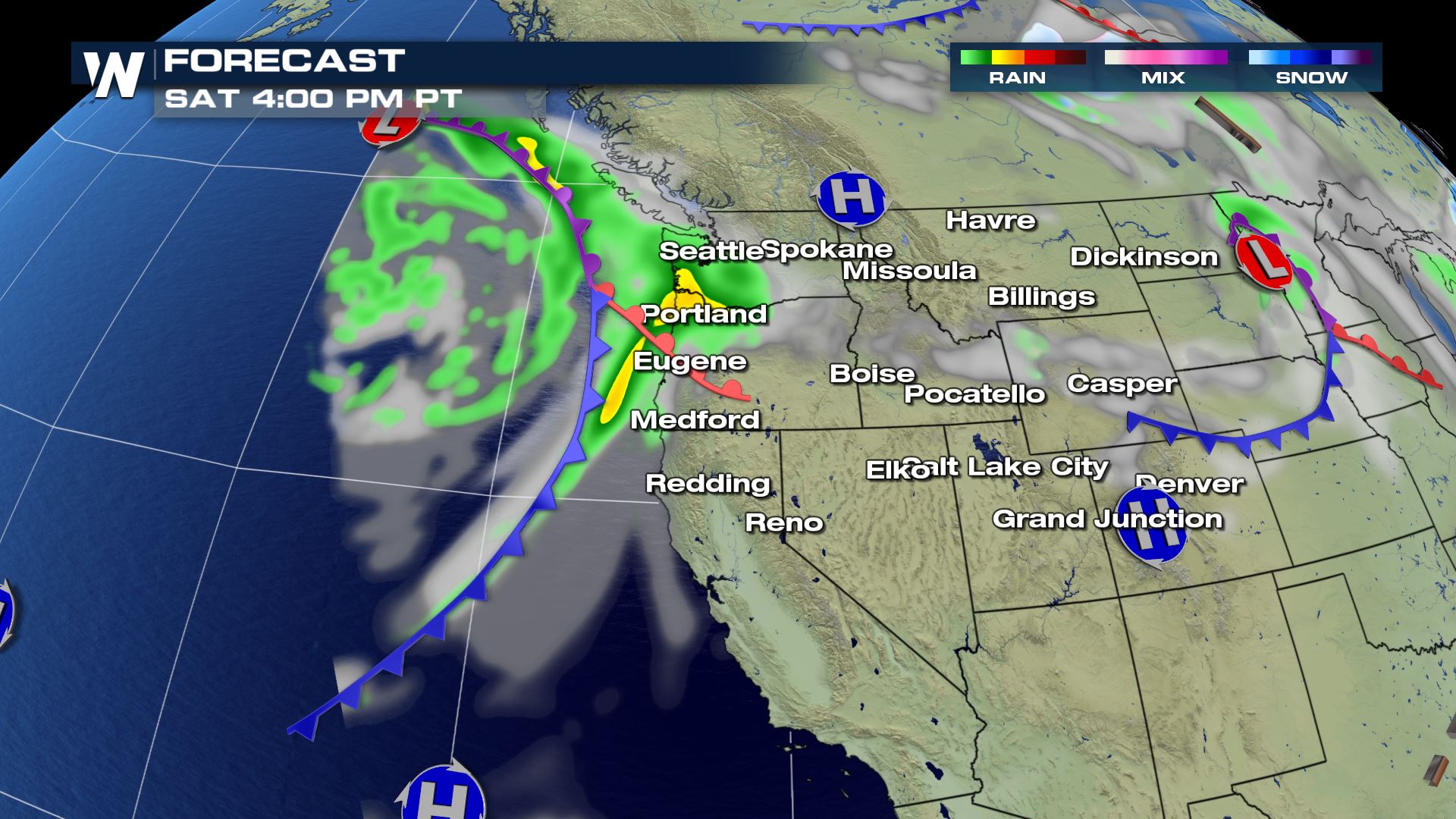 The forecast map Saturday afternoon, October 27 where greens and yellows show rain and heavy rain respectively
The first bout of heavy showers will come in by sunset Saturday and continue into Sunday morning.
The forecast map Saturday afternoon, October 27 where greens and yellows show rain and heavy rain respectively
The first bout of heavy showers will come in by sunset Saturday and continue into Sunday morning.
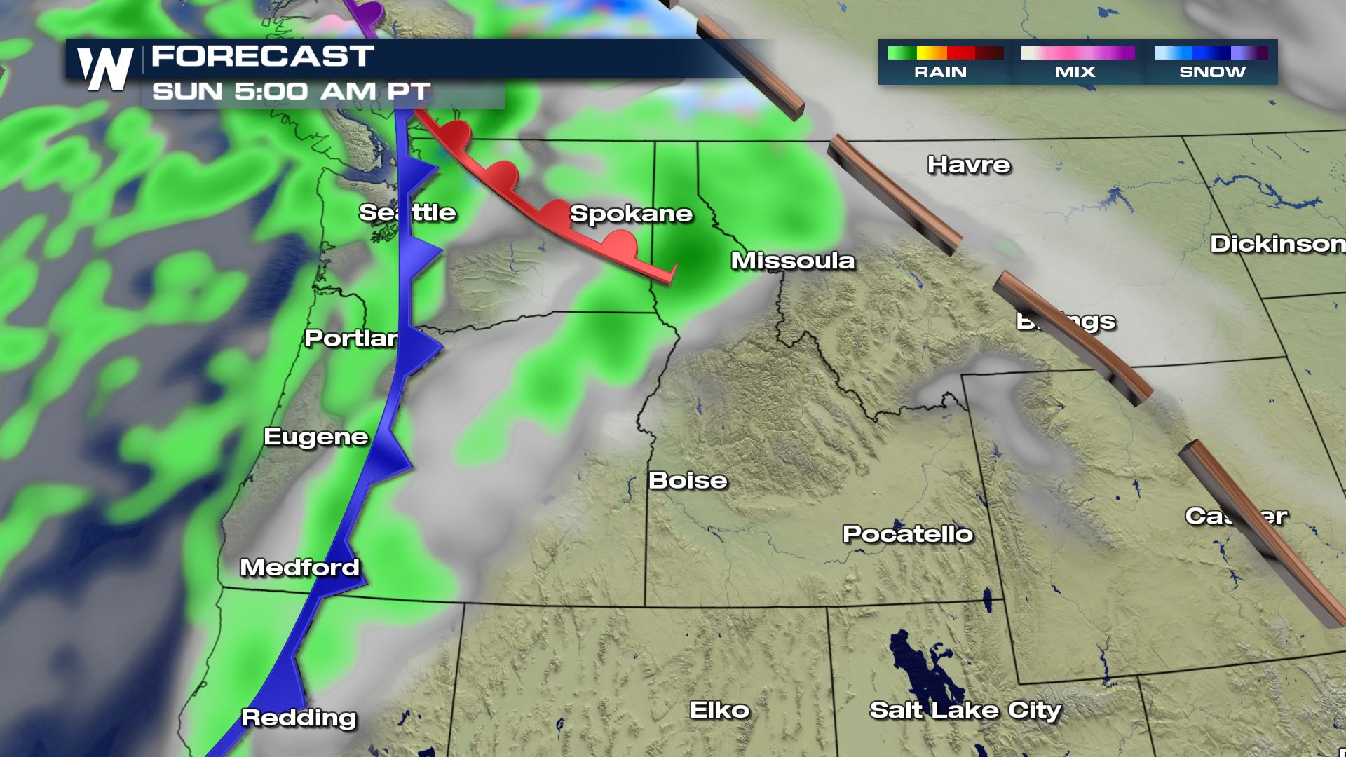 The forecast map on Sunday morning, October 28 where green shows rain and blue shows snow
On and off rain showers will greet us out the door on Sunday morning, as well as Sunday evening. Fortunately, it *does not* look like this rain Sunday will prompt widespread flooding. Instead, some bigger puddles and nuisance, very minor flooding will be likely.
The forecast map on Sunday morning, October 28 where green shows rain and blue shows snow
On and off rain showers will greet us out the door on Sunday morning, as well as Sunday evening. Fortunately, it *does not* look like this rain Sunday will prompt widespread flooding. Instead, some bigger puddles and nuisance, very minor flooding will be likely.
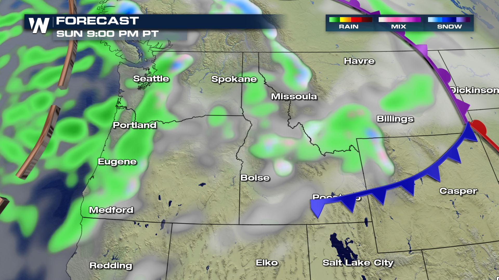 The forecast map on Sunday night, October 28 where green shows rain and blue shows snow
Sunday will be just the beginning! Through Tuesday, even more precipitation will be moving in! Still, it looks light enough not to produce widespread flooding, but rather slower travel. One good thing is that it could drop nice snow at the highest of elevations!
The forecast map on Sunday night, October 28 where green shows rain and blue shows snow
Sunday will be just the beginning! Through Tuesday, even more precipitation will be moving in! Still, it looks light enough not to produce widespread flooding, but rather slower travel. One good thing is that it could drop nice snow at the highest of elevations!
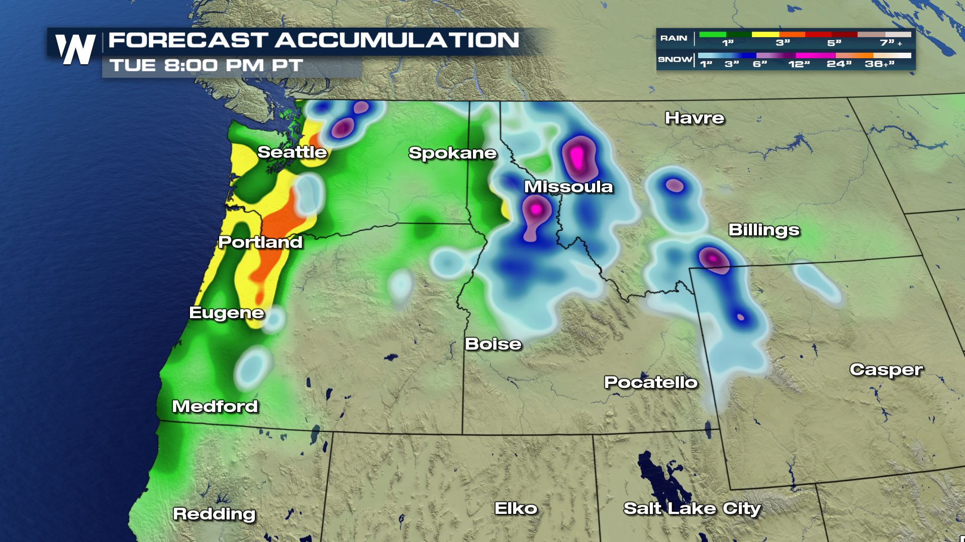 Forecast rainfall and snowfall through Tuesday, October 30
Seattle is one of the cities that now features at least a raindrop on each of the forecast days...
Forecast rainfall and snowfall through Tuesday, October 30
Seattle is one of the cities that now features at least a raindrop on each of the forecast days...
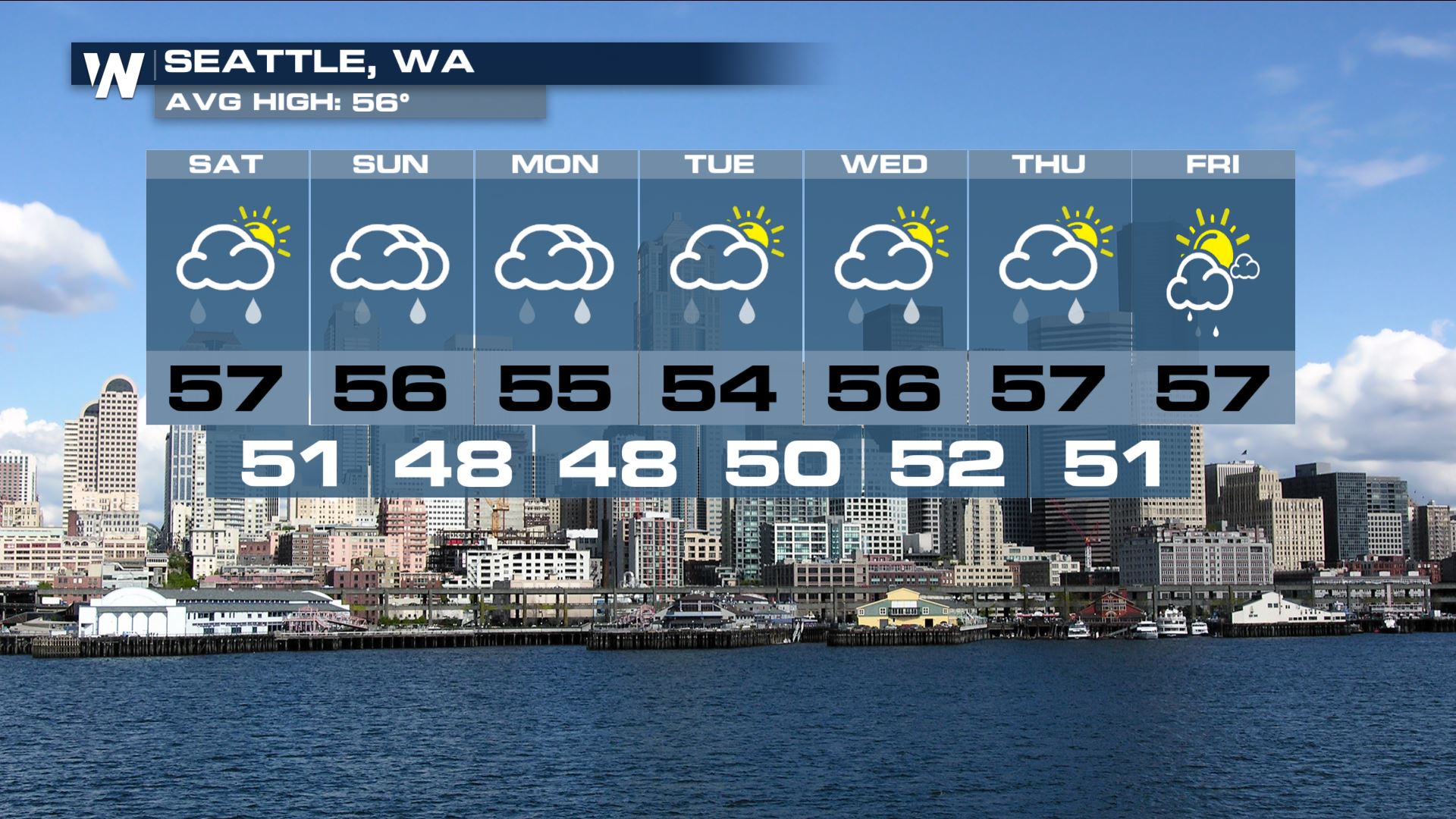 Seattle's forecast through Friday, November 2
This system will eventually bring rain and snow to parts of the central United States in time for Halloween! We will continue to follow every piece of it as it moves east and we hope you stay with us here at WeatherNation.
For WeatherNation, Meteorologist Steve Glazier
Seattle's forecast through Friday, November 2
This system will eventually bring rain and snow to parts of the central United States in time for Halloween! We will continue to follow every piece of it as it moves east and we hope you stay with us here at WeatherNation.
For WeatherNation, Meteorologist Steve Glazier
The weather conditions in Eugene, Oregon on Saturday afternoon
The clouds were already streaming into Oregon on Saturday afternoon, the visual precursor to the next weather event.
The weather set-up on Saturday afternoon featured an approaching upper-level low, pictured by the big 'L' above. Note the fetch, or the arrows crossing the ocean and carrying the moisture, that was coming in all the way from the central Pacific! That means it'll be a steady stream of showers ahead for the Pacific Northwest.
The forecast map Saturday afternoon, October 27 where greens and yellows show rain and heavy rain respectively
The first bout of heavy showers will come in by sunset Saturday and continue into Sunday morning.
The forecast map on Sunday morning, October 28 where green shows rain and blue shows snow
On and off rain showers will greet us out the door on Sunday morning, as well as Sunday evening. Fortunately, it *does not* look like this rain Sunday will prompt widespread flooding. Instead, some bigger puddles and nuisance, very minor flooding will be likely.
The forecast map on Sunday night, October 28 where green shows rain and blue shows snow
Sunday will be just the beginning! Through Tuesday, even more precipitation will be moving in! Still, it looks light enough not to produce widespread flooding, but rather slower travel. One good thing is that it could drop nice snow at the highest of elevations!
Forecast rainfall and snowfall through Tuesday, October 30
Seattle is one of the cities that now features at least a raindrop on each of the forecast days...
Seattle's forecast through Friday, November 2
This system will eventually bring rain and snow to parts of the central United States in time for Halloween! We will continue to follow every piece of it as it moves east and we hope you stay with us here at WeatherNation.
For WeatherNation, Meteorologist Steve GlazierAll Weather News
More
Wildfire Outbreak in the Pacific Northwest
SPOKANE, WA - On Saturday, August 1st, the Ol
3 Aug 2026 1:55 AM

More Storms for the East Through Monday
A low-pressure system that moved through the
3 Aug 2026 1:50 AM


After Reaching Category 5, Genevieve Weakens in the Pacific
PacificGenevieve formed last Friday south of
3 Aug 2026 12:30 AM

Flooding, Severe Storms Target the Midwest Again
After an active week of storms across the nor
1 Aug 2026 1:40 AM

Flooding Risk Increases as Heavy Rain Targets the Tri-State Area
Tuesday, heavy rainfall moved across the Nort
30 Jul 2026 12:25 AM

Severe Weather: Energy From the Midwest Now in the Southeast
UPPER MIDWEST - Through Monday, dangerous tor
29 Jul 2026 10:30 PM