Heavy Rain & Strong Storms Target the Southern U.S.
Top Stories
21 Jul 2021 4:30 AM
Flooding concerns continue in the south, with rain coming to an end by Wednesday evening. Some areas have seen over 50"+ inches of rain in the last 3 months according to the Weather Prediction Center (WPC). This is most prevalent around Corpus Cristi and Houston, TX.
https://twitter.com/NWSWPC/status/1417853415888101387?ref_src=twsrc%5Egoogle%7Ctwcamp%5Eserp%7Ctwgr%5Etweet
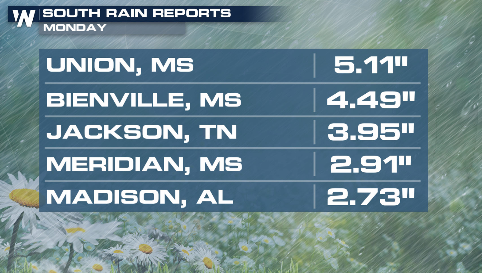
Several days of rainfall across the South and Southeast has lead to high water levels and saturated soils. With more storms possible throughout the rest of the week, there is a concern for flooding. Rainfall totals were between 3" and 6" in several cities, with some setting daily rainfall records.
 Rainfall rates over 2 inches per hour may be possible in the strongest storms. As another center of low pressure develops, the chance for repeated storms over the same areas keeps the concern for flooding.
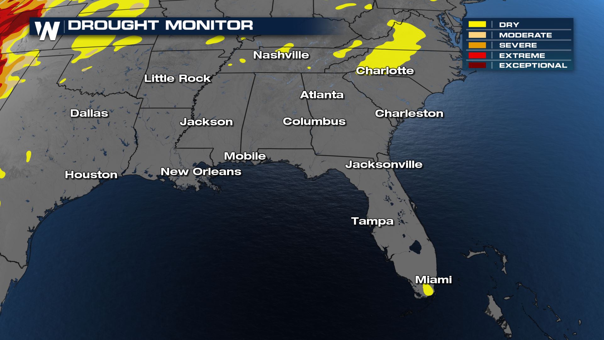
 The bright side: we are in the heart of summer and there is very little drought concern for the Southeast.
 Heavy rain has impacted the South and Southeast this month. Over the last 30 days, rainfall is 2 to 3 times as much as the average for this time period.
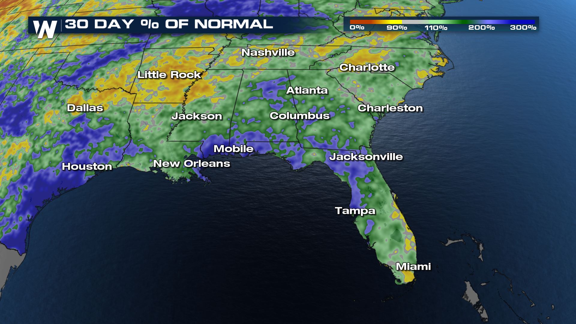 This means the grounds are plentiful when it comes to water. With that said, flash flood alerts will scroll at the bottom of our live feeds. You can always catch the latest forecast for the South Central United States at 30 past each hour.

Flooding Outlook
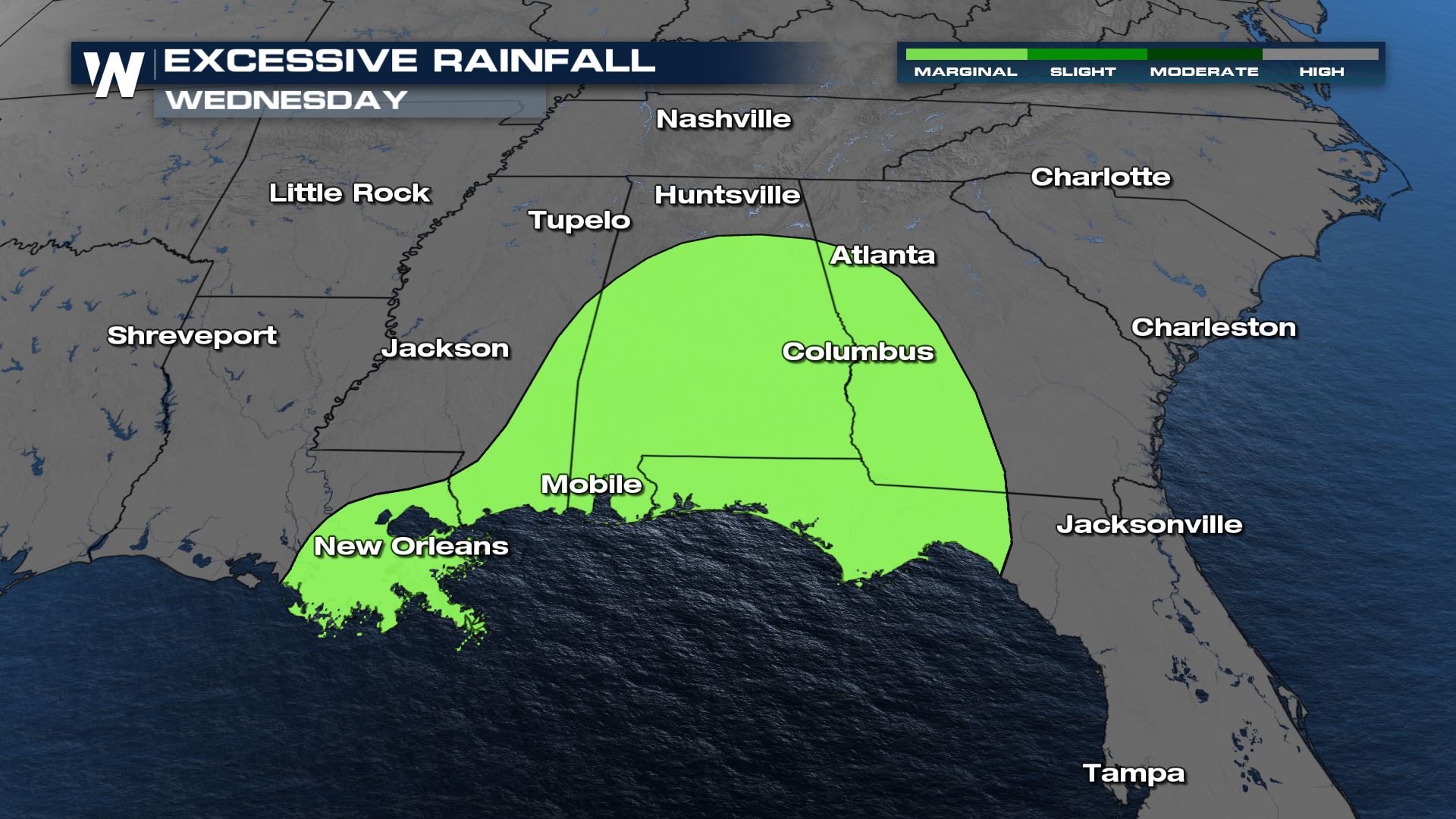
Once the cold front starts moving south, the flooding threat will follow. There is still a possibility for high water through Wednesday as the front moves through the Deep South.
Forecast
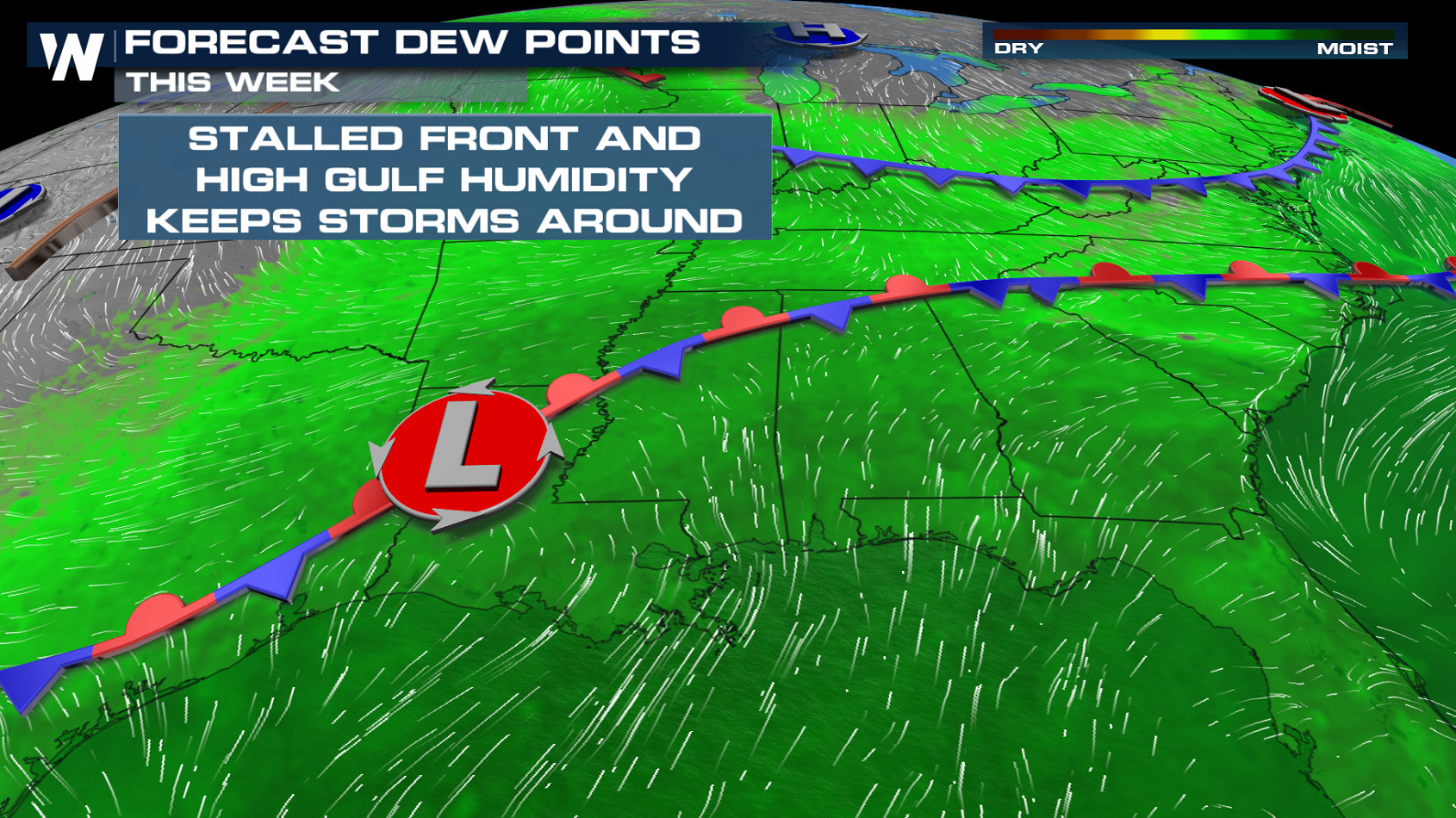
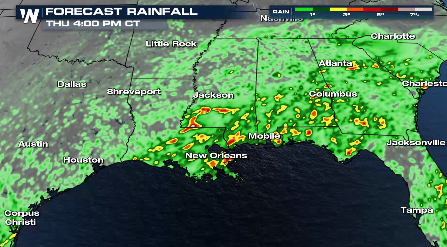
Humidity will remain high throughout the South and Southeast with over-saturated soils from several days of heavy rain. After some of the heaviest of the rain moves away, there is enough time for the water to recede but high water still threatens low lying areas and urbanized locations. This afternoon, training storms become along the stalled boundary will be a cause for concern. Rainfall rates over 2 inches per hour may be possible in the strongest storms. As another center of low pressure develops, the chance for repeated storms over the same areas keeps the concern for flooding.
 The bright side: we are in the heart of summer and there is very little drought concern for the Southeast.
 Heavy rain has impacted the South and Southeast this month. Over the last 30 days, rainfall is 2 to 3 times as much as the average for this time period.
 This means the grounds are plentiful when it comes to water. With that said, flash flood alerts will scroll at the bottom of our live feeds. You can always catch the latest forecast for the South Central United States at 30 past each hour.
All Weather News
More