Heavy Rain This Week For the Mississippi and Tennessee Valleys
Special Stories
29 Oct 2018 3:02 AM
A strong system coming out of the Rockies this week will lead to the risk of heavy rain across the Mississippi and Tennessee Valleys. Flooding will be the biggest weather threat, but some strong winds and small hail can't be ruled out. Here is the very latest.
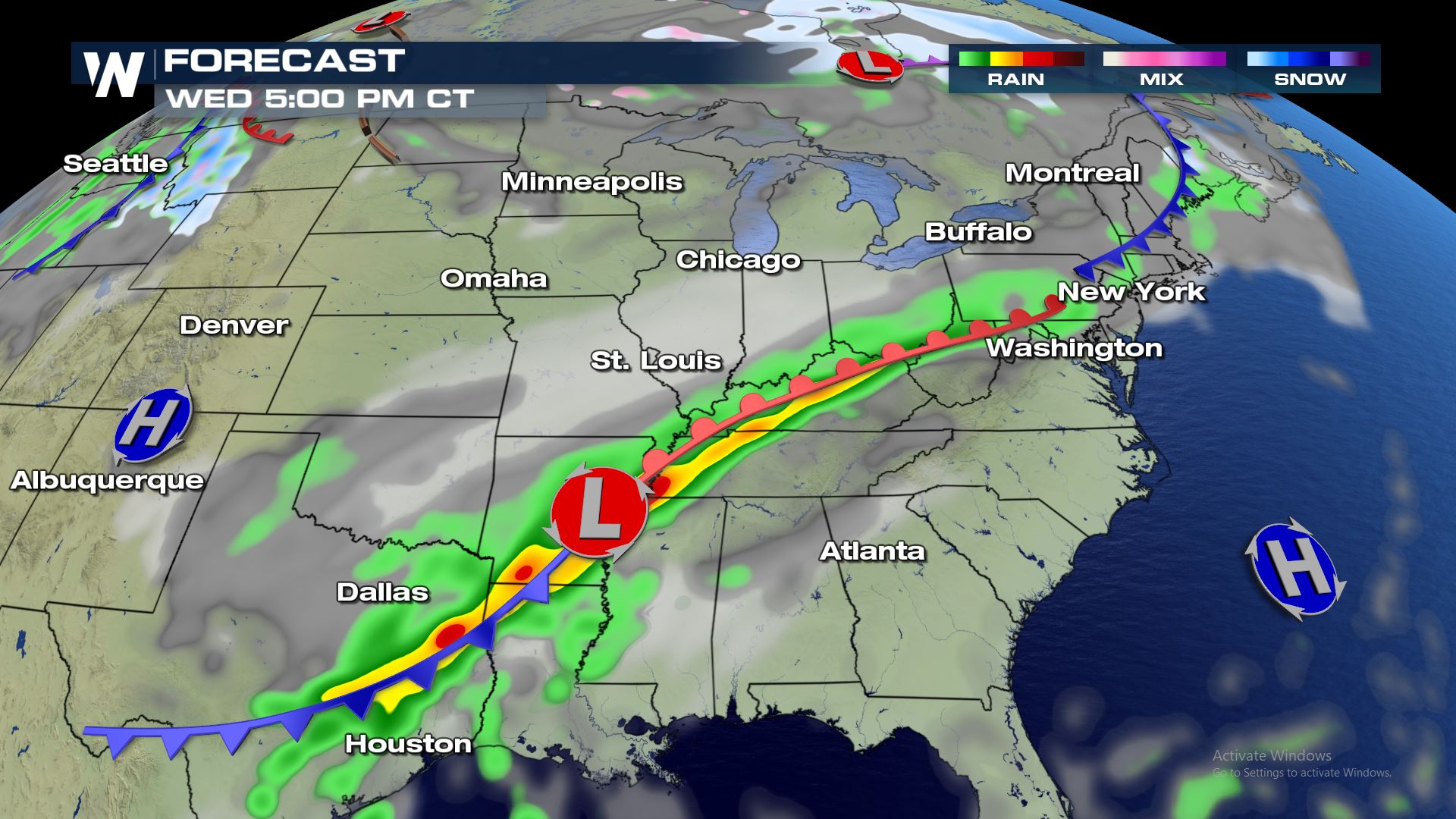 A low pressure system and an attached cold front will bring rain from east Texas through southern Ohio for Halloween Night. This system should become somewhat stationary or at least move very slowly through the Mississippi and Tennessee Valley. This slow movement will bring the risk of training thunderstorms which could lead to flash flooding.
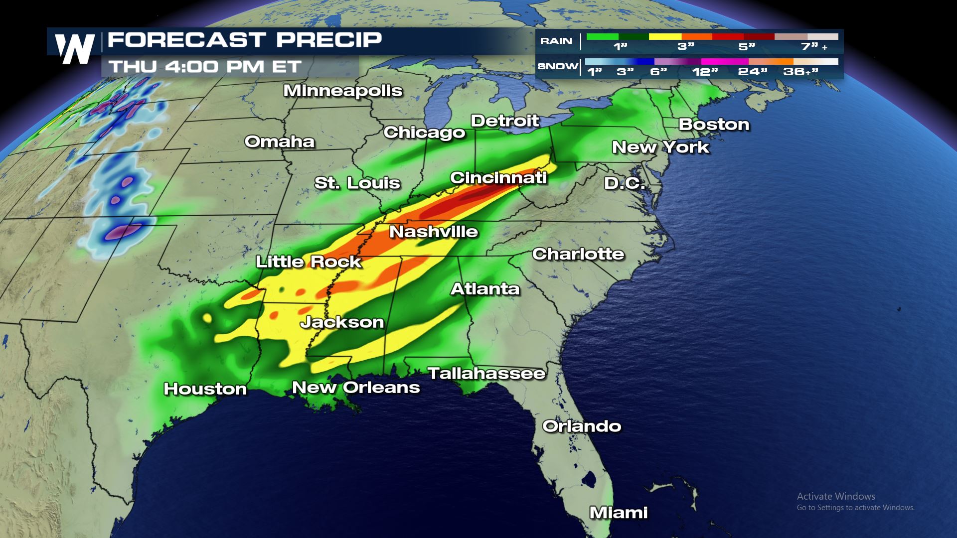
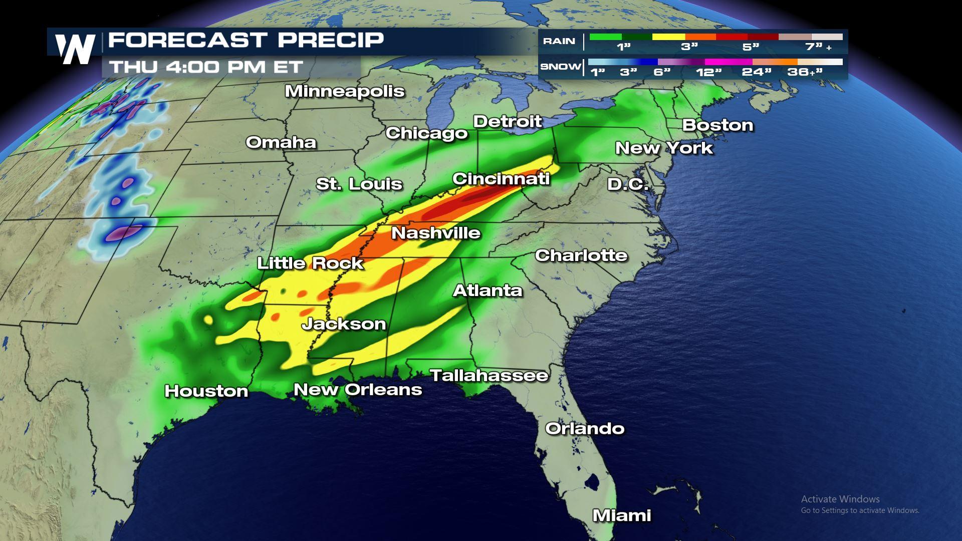
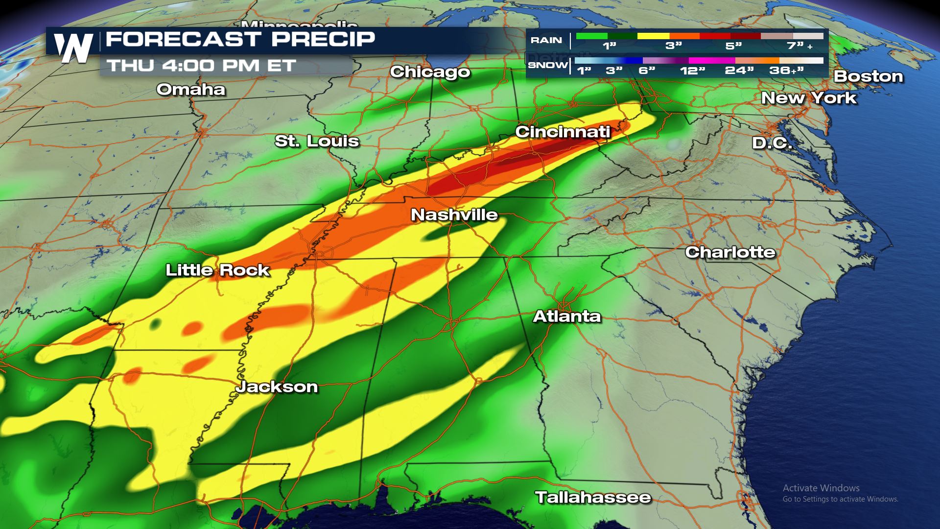 Areas from southern Ohio into eastern Arkansas could see some of the higher rain totals through Thursday afternoon. The potential for 3-5" will be there in those areas and that means flash flooding will be increasing over these same areas.
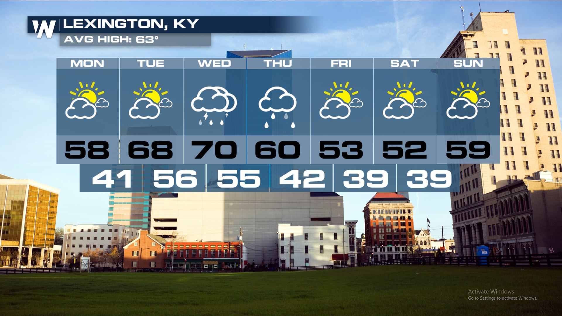
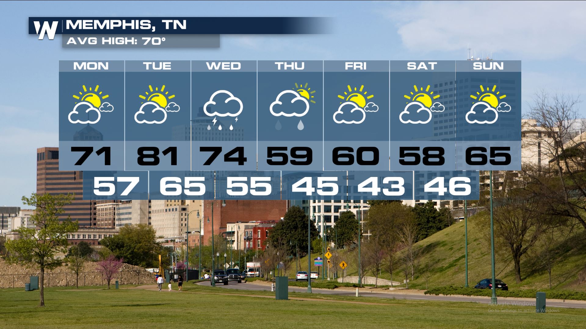 Here is a look at city forecasts where this system will have a big impact...not just with rain, but with the temperature forecast too.
Keep checking WeatherNation for more updates.
Here is a look at city forecasts where this system will have a big impact...not just with rain, but with the temperature forecast too.
Keep checking WeatherNation for more updates.
Forecast
A low pressure system and an attached cold front will bring rain from east Texas through southern Ohio for Halloween Night. This system should become somewhat stationary or at least move very slowly through the Mississippi and Tennessee Valley. This slow movement will bring the risk of training thunderstorms which could lead to flash flooding.
Rainfall Potential
Areas from southern Ohio into eastern Arkansas could see some of the higher rain totals through Thursday afternoon. The potential for 3-5" will be there in those areas and that means flash flooding will be increasing over these same areas.
Extended Forecast
Here is a look at city forecasts where this system will have a big impact...not just with rain, but with the temperature forecast too.
Keep checking WeatherNation for more updates.All Weather News
More

More Storms for the East Through Monday
A low-pressure system that moved through the
3 Aug 2026 12:20 PM


After Reaching Category 5, Genevieve Weakens in the Pacific
PacificGenevieve formed last Friday south of
3 Aug 2026 12:30 AM

Flooding, Severe Storms Target the Midwest Again
After an active week of storms across the nor
1 Aug 2026 1:40 AM

Flooding Risk Increases as Heavy Rain Targets the Tri-State Area
Tuesday, heavy rainfall moved across the Nort
30 Jul 2026 12:25 AM