Heavy Rain Triggers Flash Flood Emergencies Tuesday

Flash Flood Emergencies were issued on Tuesday after heavy rain overwhelmed parts of Maryland and Virginia. A cut-off low continues to spin, bringing more chances for rain to many of the same locations on Wednesday.
Rain reports last 24 hours:
 Setup:
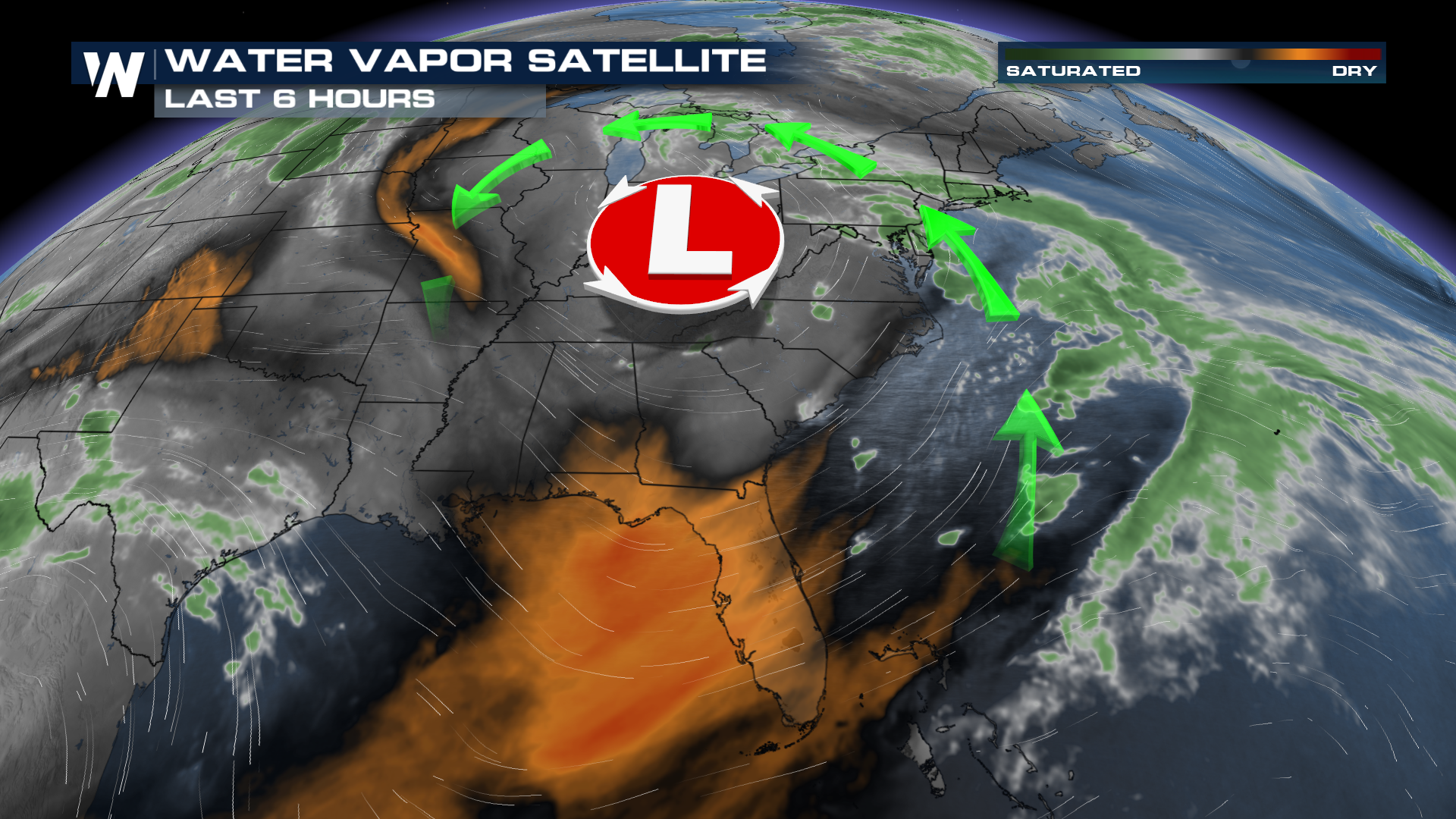
WHAT IS A CUT-OFF LOW?
It's a ship without a sail. Sort of. Lows will dig out locations to go with the help of the jet stream. However, sometimes a low will become detached from the jet stream winds when they retreat to the north, leaving behind a persistent area of spin. That's been the case for much of this week, powering daily severe chances and heavy rain around the southeast.
SLOW SYSTEM + TERRAIN
On Tuesday, that low started to lift northeast and brought the rain threat up the I-95 corridor. However, this area is when topography becomes an issue, in the Appalachians. Heavy rain can often be exacerbated by elevation change, often acting to focus some of the worst impacts in localized areas. A pretty wide stripe of 3-6 inches of rain fell in mountainous terrain and brought life-threatening problems to western Maryland and Virginia.


