Storm Unloads Rain and Snow in California, Clearing for the Weekend

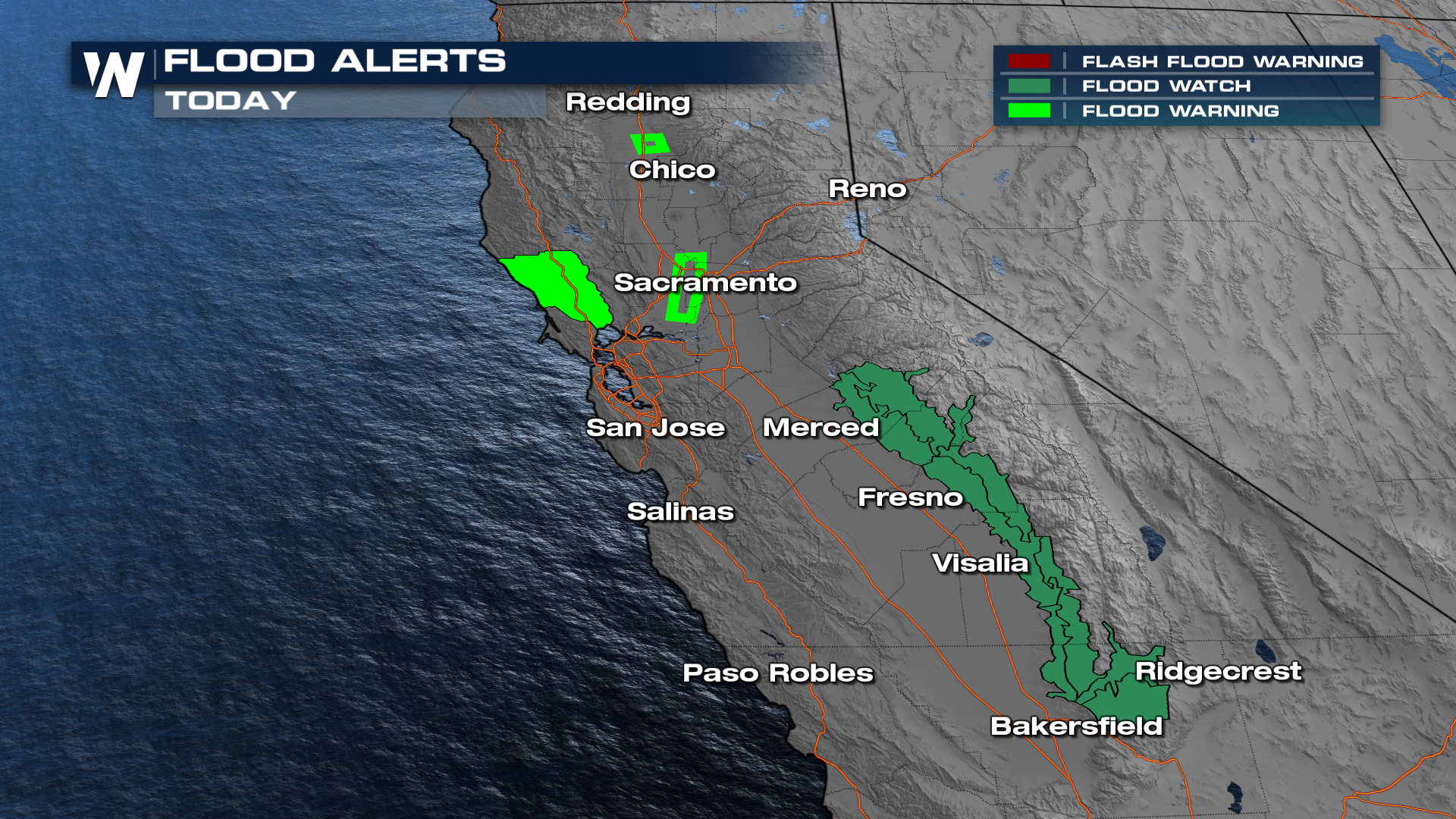
Heavy rain caused several issues in California on Thursday, including closing roads to due flooding or mudslides. The Pacific Palisades fire burn scar saw several inches of rain, leading to mud and debris washing over US 1 near the coast, making the roadway impassable.
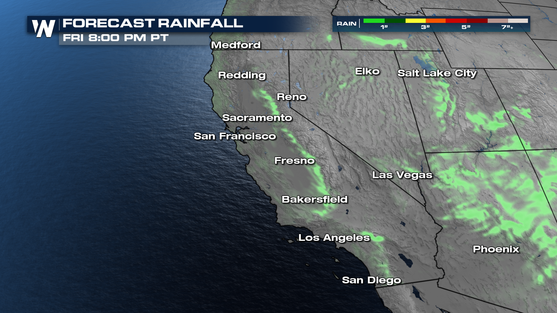
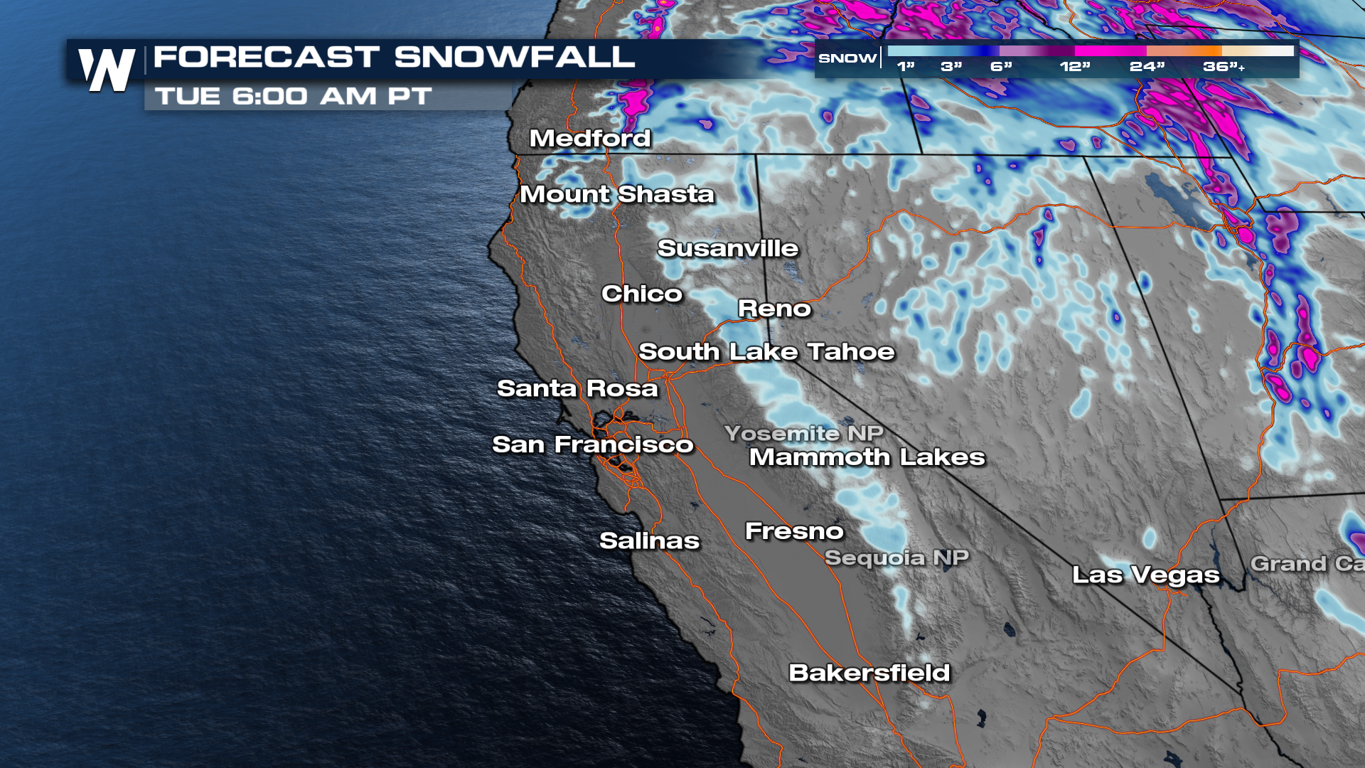
Snowfall has surpassed 2 feet in the mountains, and rain totals have been over 5-6 inches. Rain and snow chances are now winding down as the storm system pushed east. A few rain showers remain possible across the foothills of the Sierra and the Transverse Ranges in southern California.
 Road conditions should quickly improve this evening in well-traveled areas, though snow removal on more isolated roads may remain difficult to impossible with several feet of snow that need to be cleared.
A Flash Flood Watch remains in effect through Friday evening for the foothills of the southern Sierra. Because of the previous rounds of rain, these areas will still be susceptible to flooding with any additional rainfall.
Winter Storm Warnings are also now confined to the mountains of the southern Sierra. Any snow through Friday afternoon looks to target the central and southern Sierra, with lower elevations adding a couple inches of snow.
 Stay tuned to WeatherNation for the latest details. The Western Regional Forecast can also always be found :50 past the hour on WeatherNation.


