Heavy Lake Effect Snow for the Great Lakes
Top Stories
28 Feb 2020 8:30 AM
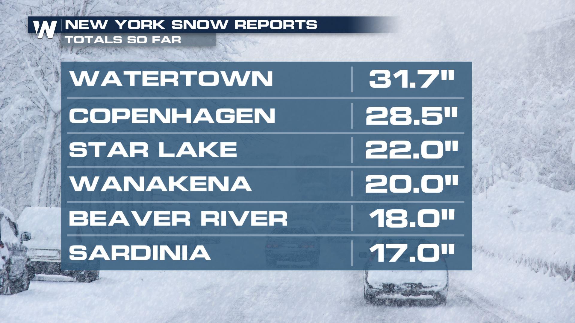
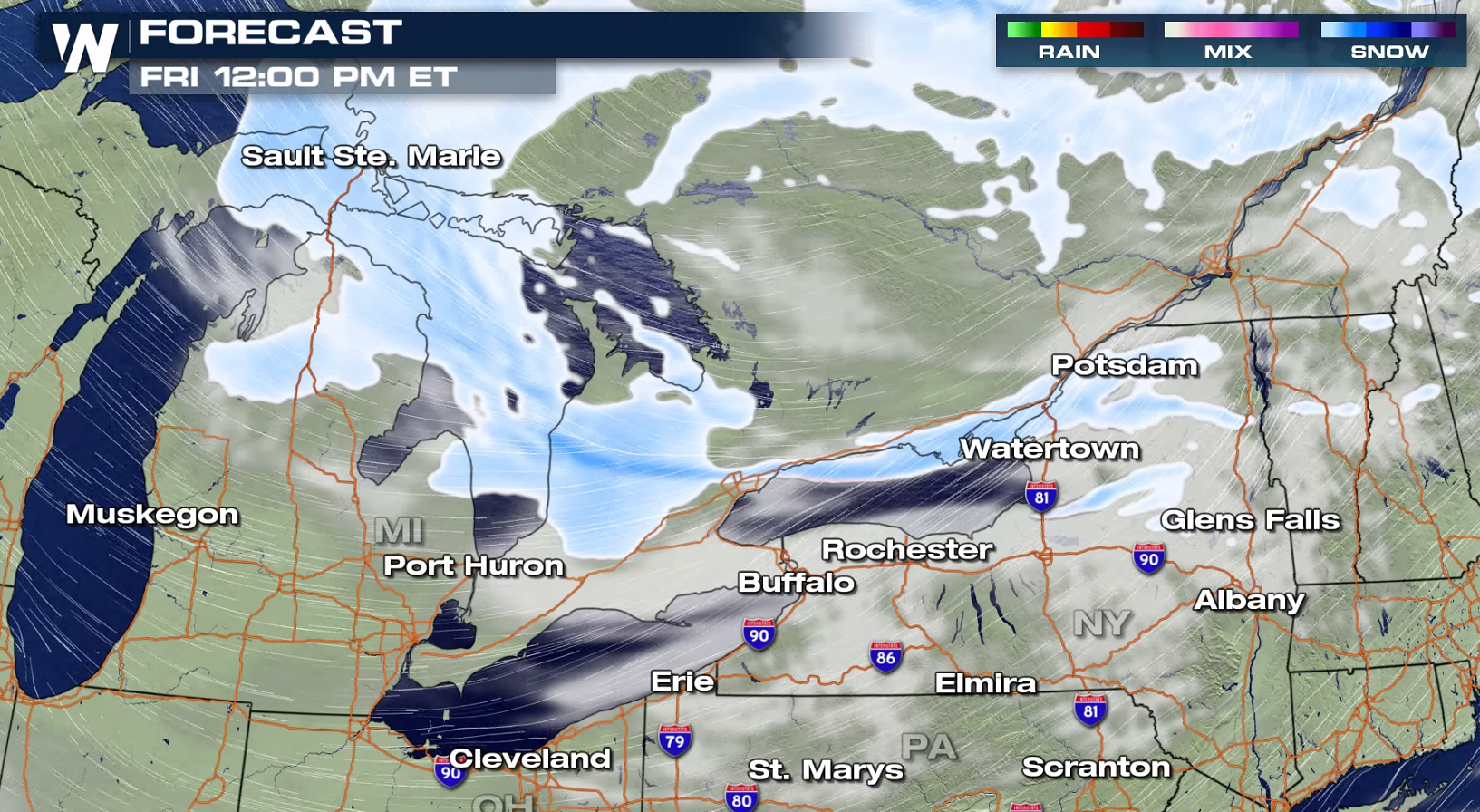
A strong low pressure center has moved through the Northeast into Ontario, circulating cold air across the Great Lakes. This has lead to heavy lake effect snow, with some areas seeing already over a foot of accumulations. Strong wind gusts greater than 40 mph are creating significant blowing and drifting snow.
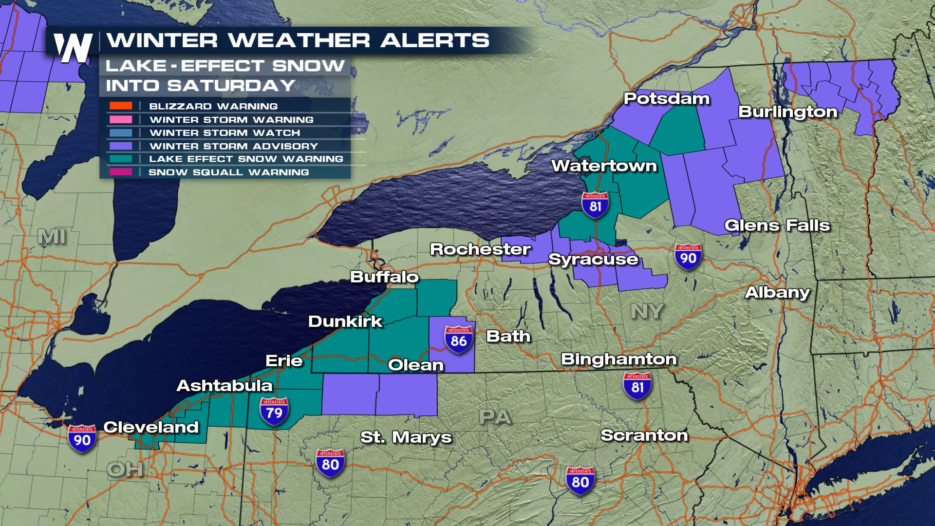
 The lake effect snow will continue into early Saturday, with heaviest snowfall near Lake Erie and Lake Ontario in New York. Additional snowfall will likely be measured in feet instead of inches.
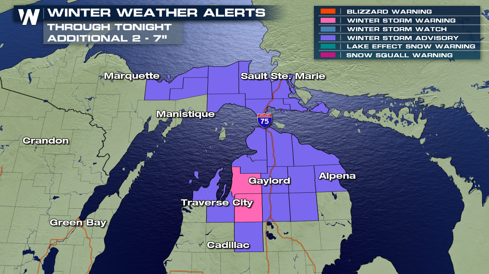
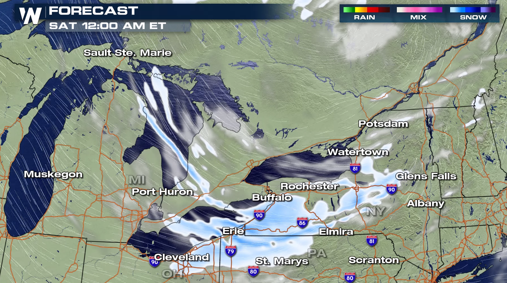
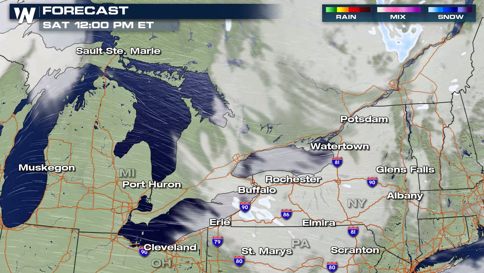
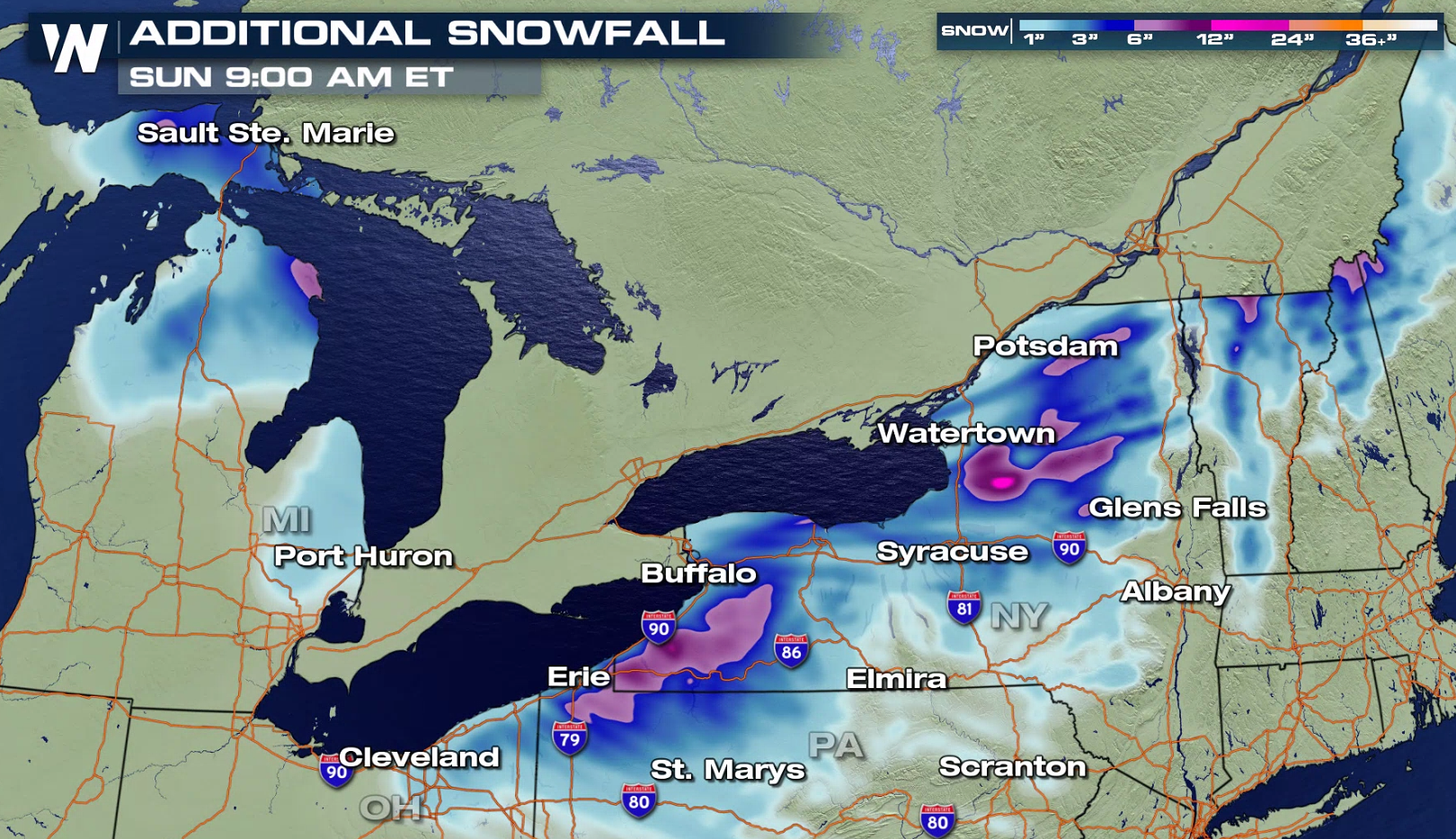 The intense northwest winds on the backside of this system will continue to bring significant lake-effect snow to from Lake Superior to Lake Ontario. As the atmosphere starts to warm Saturday and the wind begins to shift, lake effect snow bands will diminish.
 WeatherNation will keep you updated on-air and online with the latest forecast.
The lake effect snow will continue into early Saturday, with heaviest snowfall near Lake Erie and Lake Ontario in New York. Additional snowfall will likely be measured in feet instead of inches.
The intense northwest winds on the backside of this system will continue to bring significant lake-effect snow to from Lake Superior to Lake Ontario. As the atmosphere starts to warm Saturday and the wind begins to shift, lake effect snow bands will diminish.
WeatherNation will keep you updated on-air and online with the latest forecast.All Weather News
More
Fronts Continue To Spark Severe Weather Across the Plains
A cold front that brought record lows to the
18 Jul 2025 10:40 PM

Extreme Heat Impacts for the East Coast & South
Extreme heat continues to impact several area
18 Jul 2025 10:05 PM

Flooding Threat Remains Elevated in the East
A cold front pushing through the Eastern Seab
18 Jul 2025 9:10 PM

EF-2 Firenado from the Deer Creek Fire in Utah
A fire tornado was spotted near La Sal, Utah
18 Jul 2025 7:30 AM

Tropical System Brings Flood Risk to the Central Gulf
Time has run out for notable tropical develop
18 Jul 2025 3:05 AM

Heavy Rain, Flooding Threat Returns to Florida
Keep the rain boots handy in Florida - heavy
13 Jul 2025 12:50 PM

Severe Storm Risk Pushes into the Great Lakes, Ohio Valley
Friday was another busy day with severe weath
12 Jul 2025 8:00 PM