Heavy Snow Across the Great Lakes
Top Stories
27 Nov 2019 8:00 AM
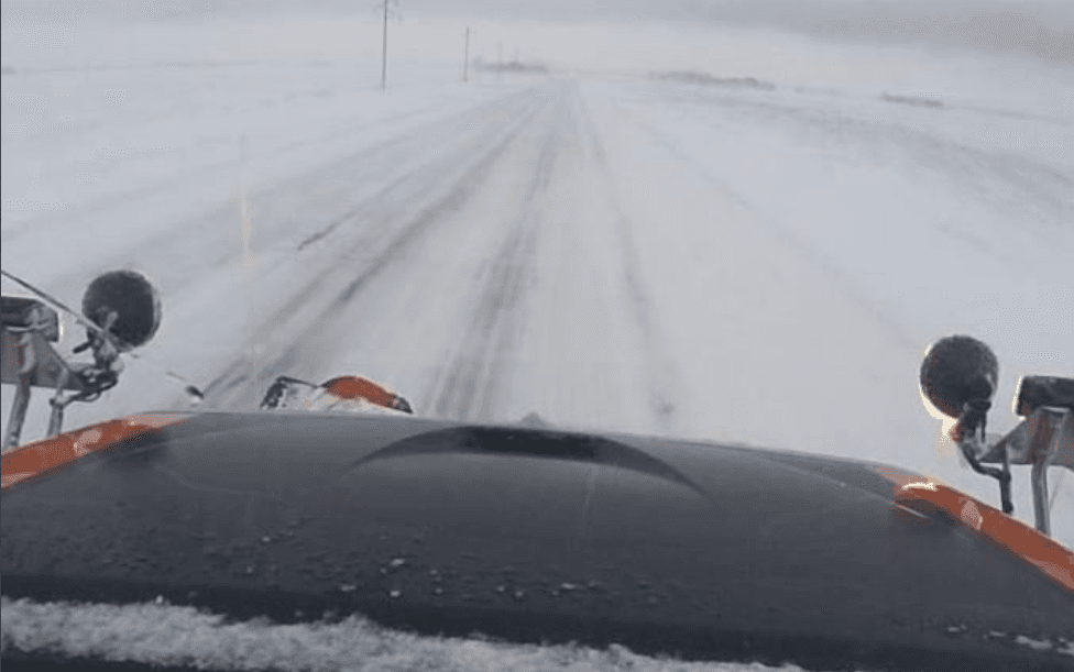
[Plow camera in Minnesota Lake on MN-22 from Wednesday morning. From MNDOT]
A potent winter storm has been producing heavy snow from the Front Range to the Upper Midwest. The snow first hit Colorado with one to two feet of snow
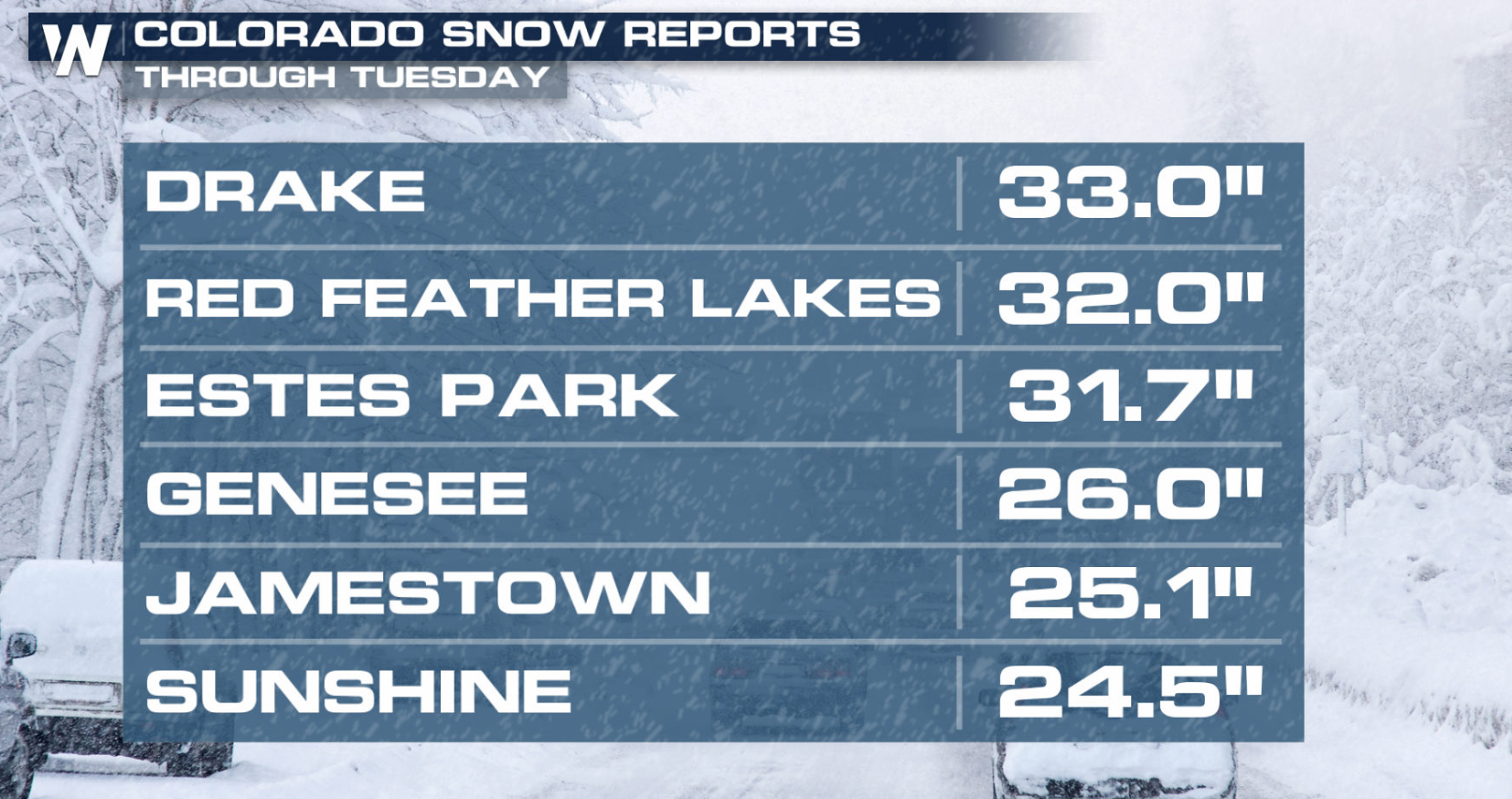
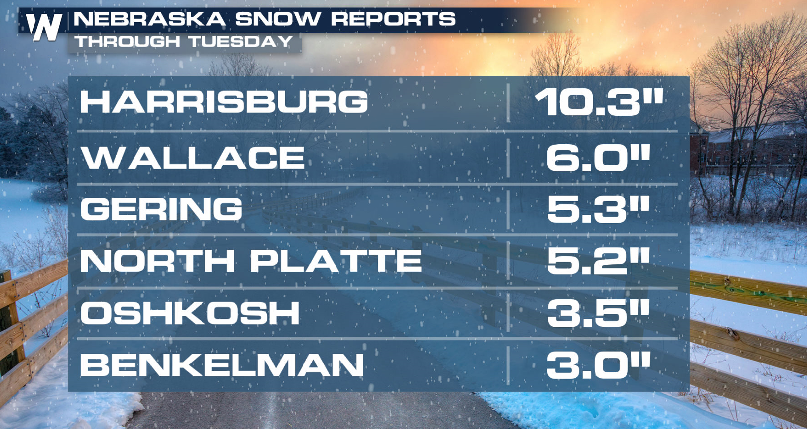
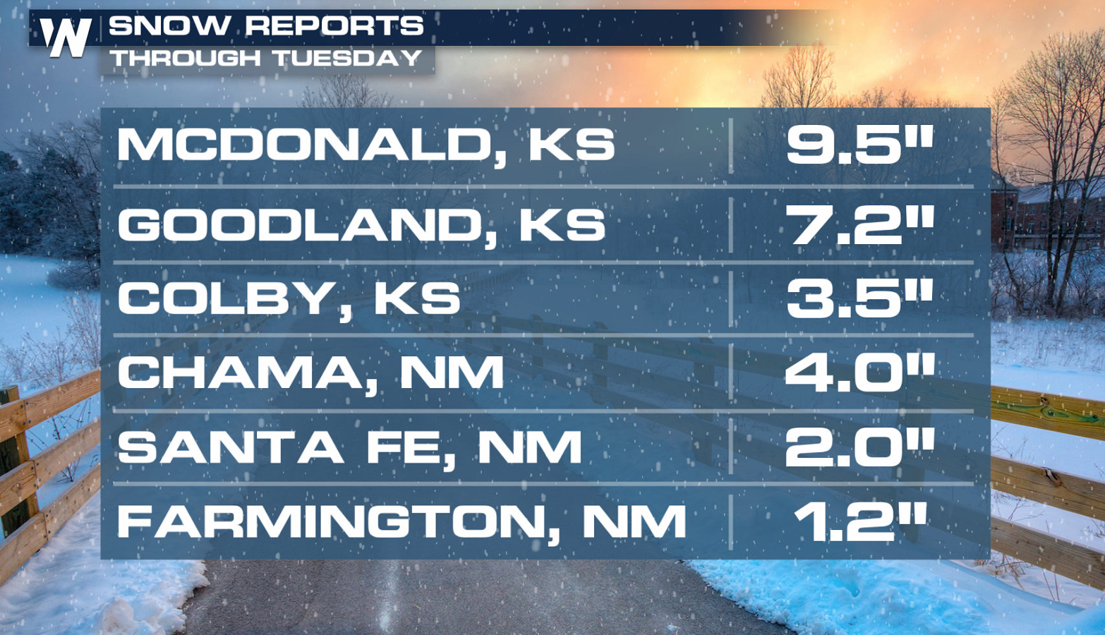
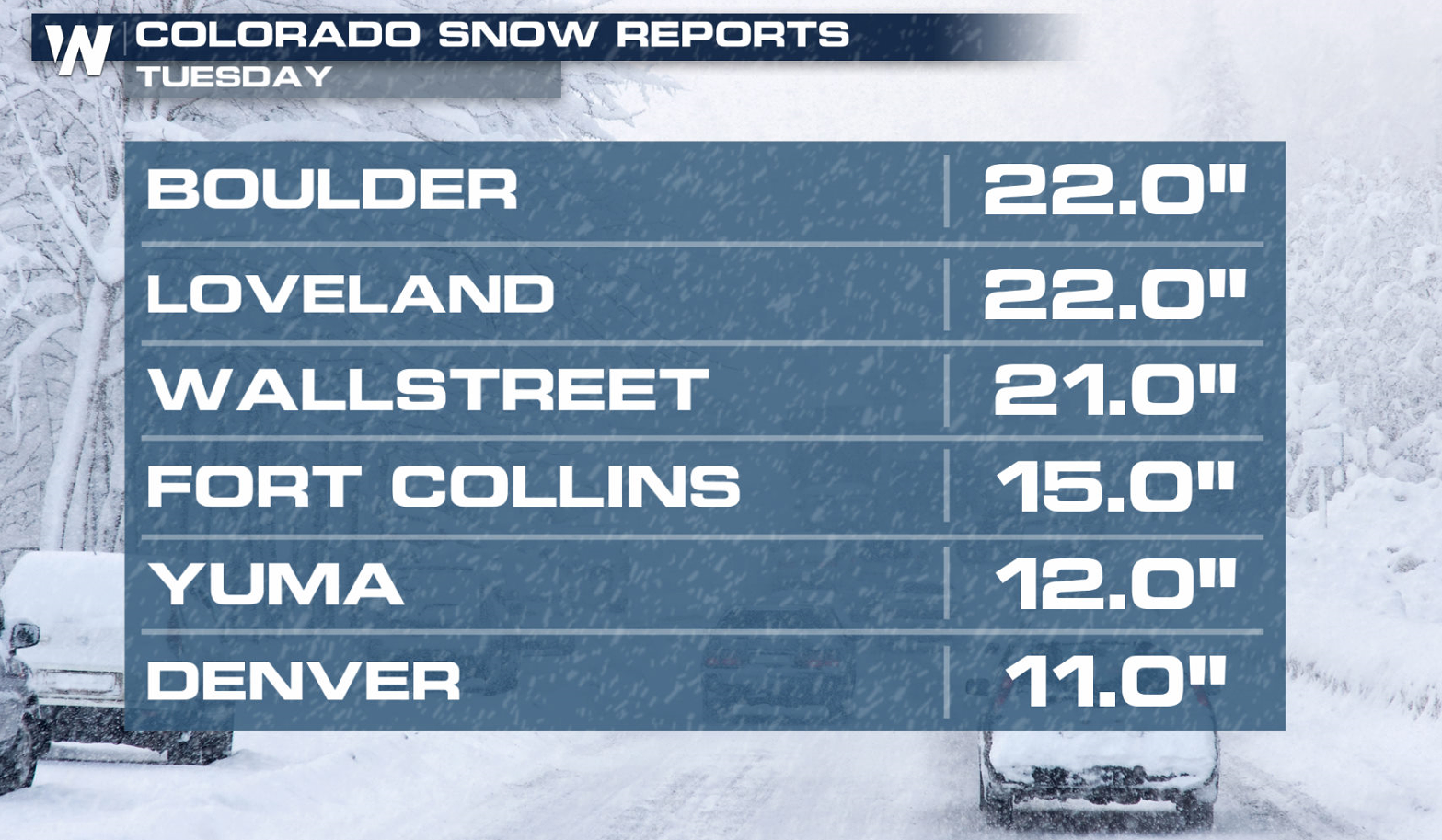 Heavy snow also fell across Nebraska, Kansas and New Mexico with many areas seeing 6" to 12".
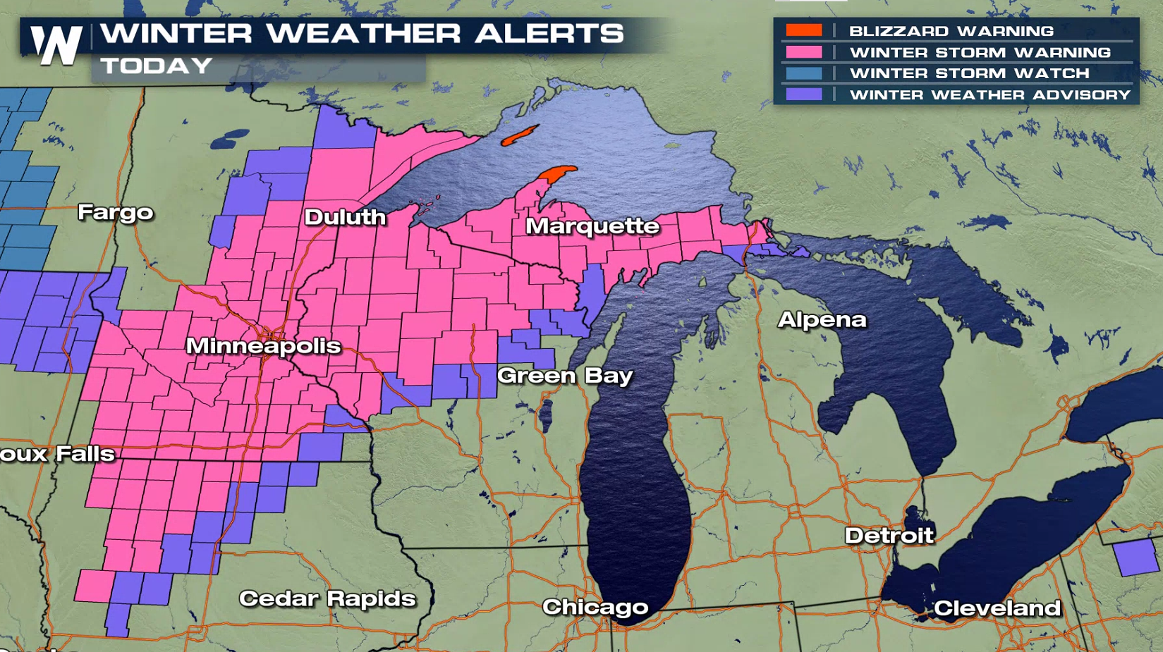
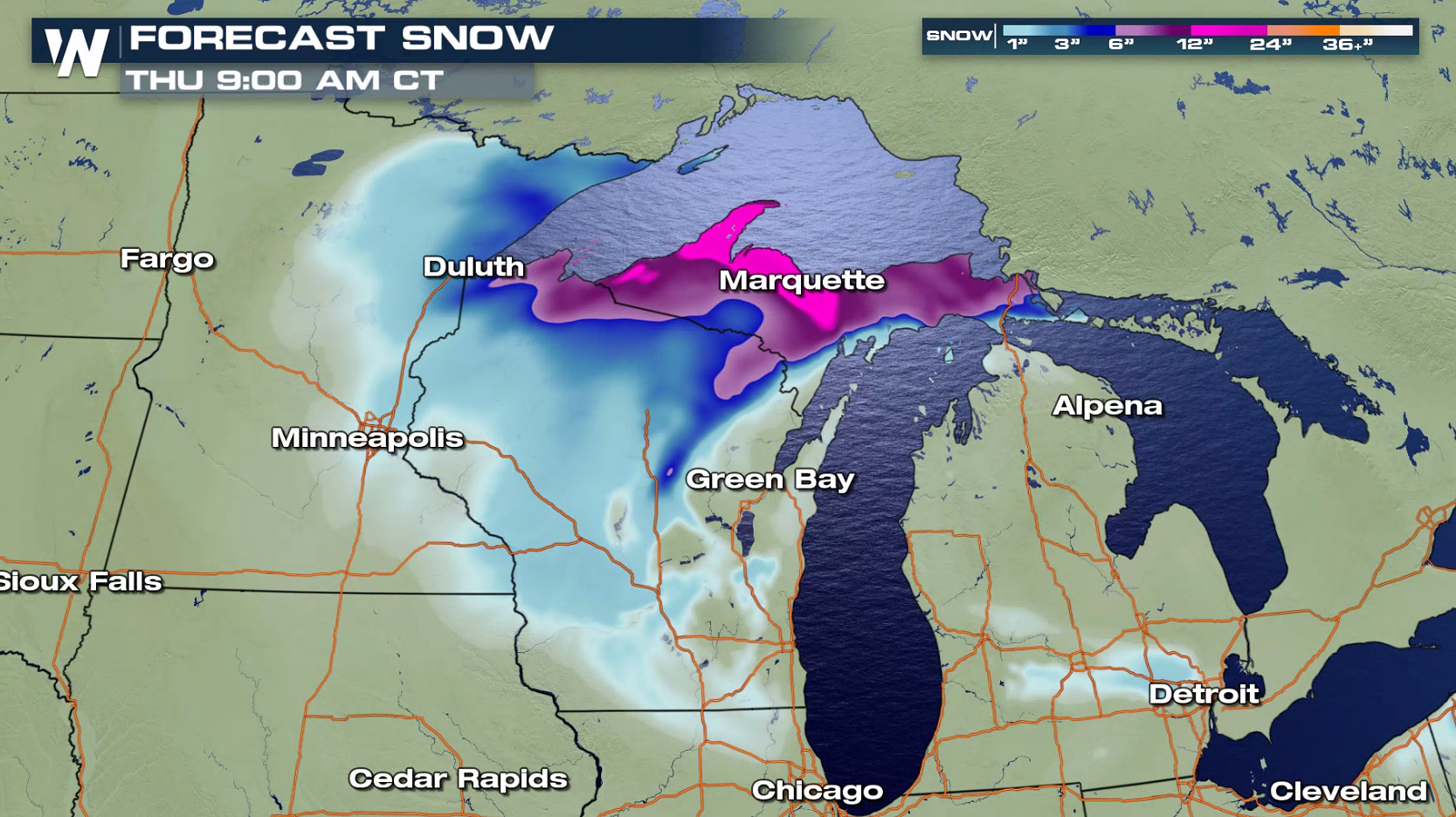
 Winter weather alerts continue from Iowa to Upper Michigan. An additional 6" to 10" of snow is likely across Wisconsin and Michigan.
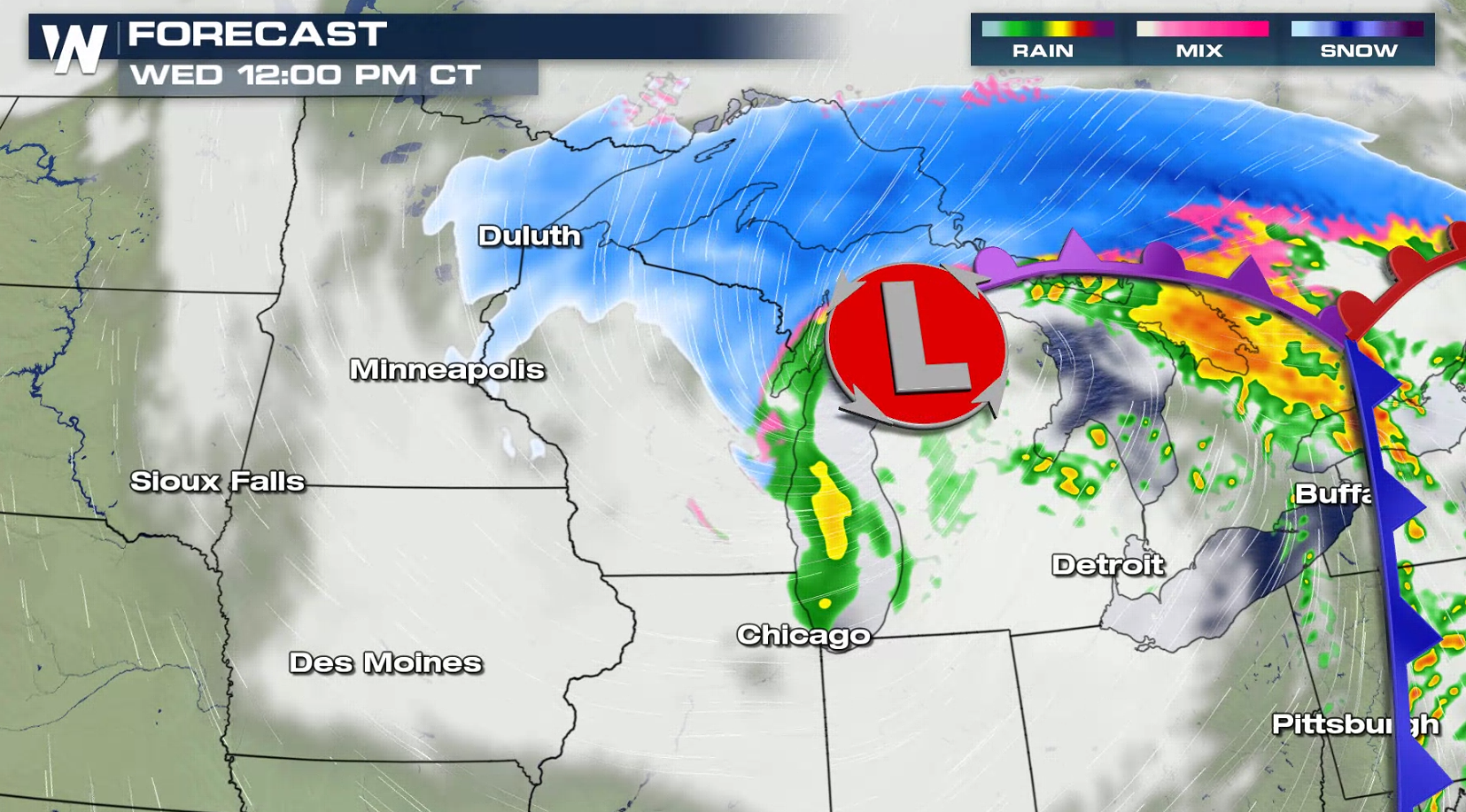
 Eventually the center of this low-pressure system will start to track into the Plains. North winds up to 30 mph may produce some blowing and drifting snow.
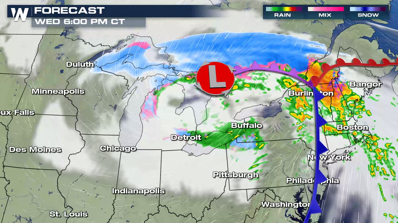
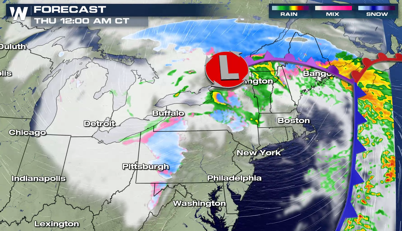 It is a busy travel week leading up to Thanksgiving. Folks planning travel in should monitor the forecast and consider alternate plans. Travel could become very dangerous and roads may be impassible at times.
Heavy snow also fell across Nebraska, Kansas and New Mexico with many areas seeing 6" to 12".
Winter weather alerts continue from Iowa to Upper Michigan. An additional 6" to 10" of snow is likely across Wisconsin and Michigan.
Eventually the center of this low-pressure system will start to track into the Plains. North winds up to 30 mph may produce some blowing and drifting snow.
It is a busy travel week leading up to Thanksgiving. Folks planning travel in should monitor the forecast and consider alternate plans. Travel could become very dangerous and roads may be impassible at times.
All Weather News
More
Wildfire Outbreak in the Pacific Northwest
SPOKANE, WA - On Saturday, August 1st, the Ol
3 Aug 2026 1:55 AM

More Storms for the East Through Monday
A low-pressure system that moved through the
3 Aug 2026 1:50 AM


After Reaching Category 5, Genevieve Weakens in the Pacific
PacificGenevieve formed last Friday south of
3 Aug 2026 12:30 AM

Flooding, Severe Storms Target the Midwest Again
After an active week of storms across the nor
1 Aug 2026 1:40 AM

Flooding Risk Increases as Heavy Rain Targets the Tri-State Area
Tuesday, heavy rainfall moved across the Nort
30 Jul 2026 12:25 AM

Severe Weather: Energy From the Midwest Now in the Southeast
UPPER MIDWEST - Through Monday, dangerous tor
29 Jul 2026 10:30 PM