Heavy Snow Is Unloading On California
Top Stories
17 Mar 2020 7:30 AM
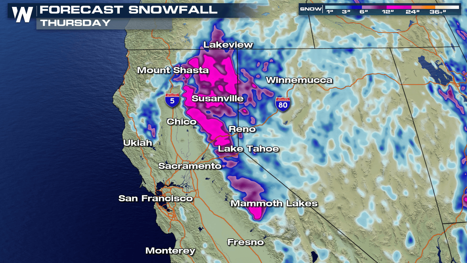
Snowfall forecast through the middle of this week.
Several fresh feet of snow will blanket the Sierra Nevada of California through the middle of this week! This is the result of a very slow-moving storm system along the western United States. Low pressure riding along the boundary of the Pacific Ocean and the western shorelines continues to sit and spin, pumping in a lot of moisture via strong wind. There will be breaks in the precipitation and wind at times, but more or less the active and unsettled weather will last through the early part of the week.
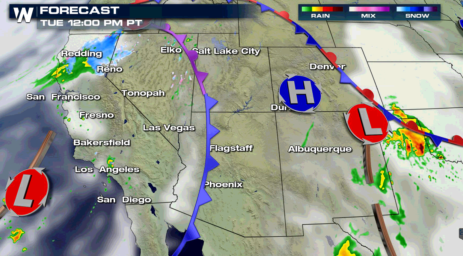
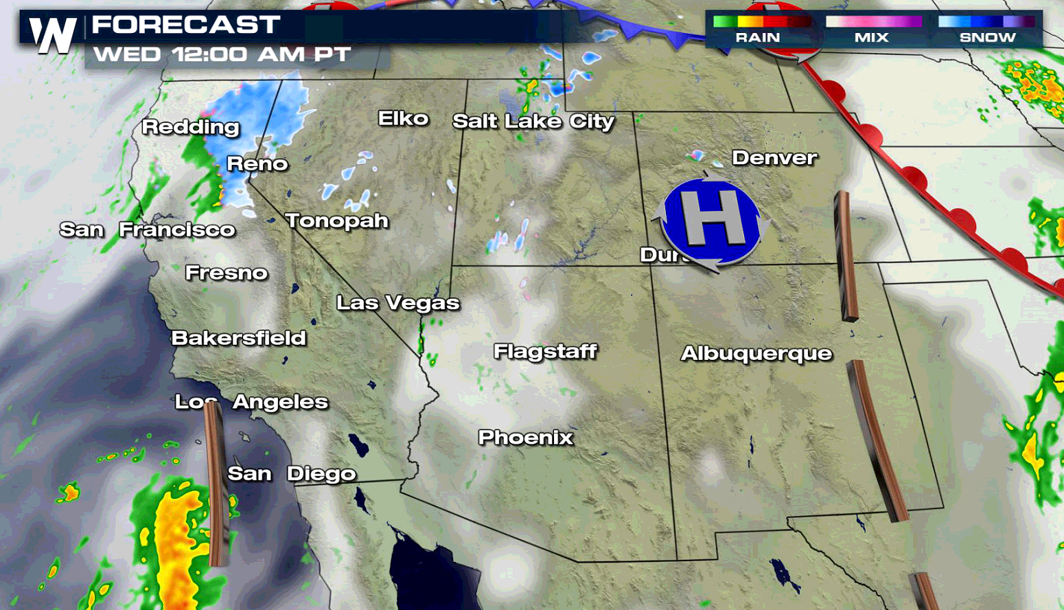
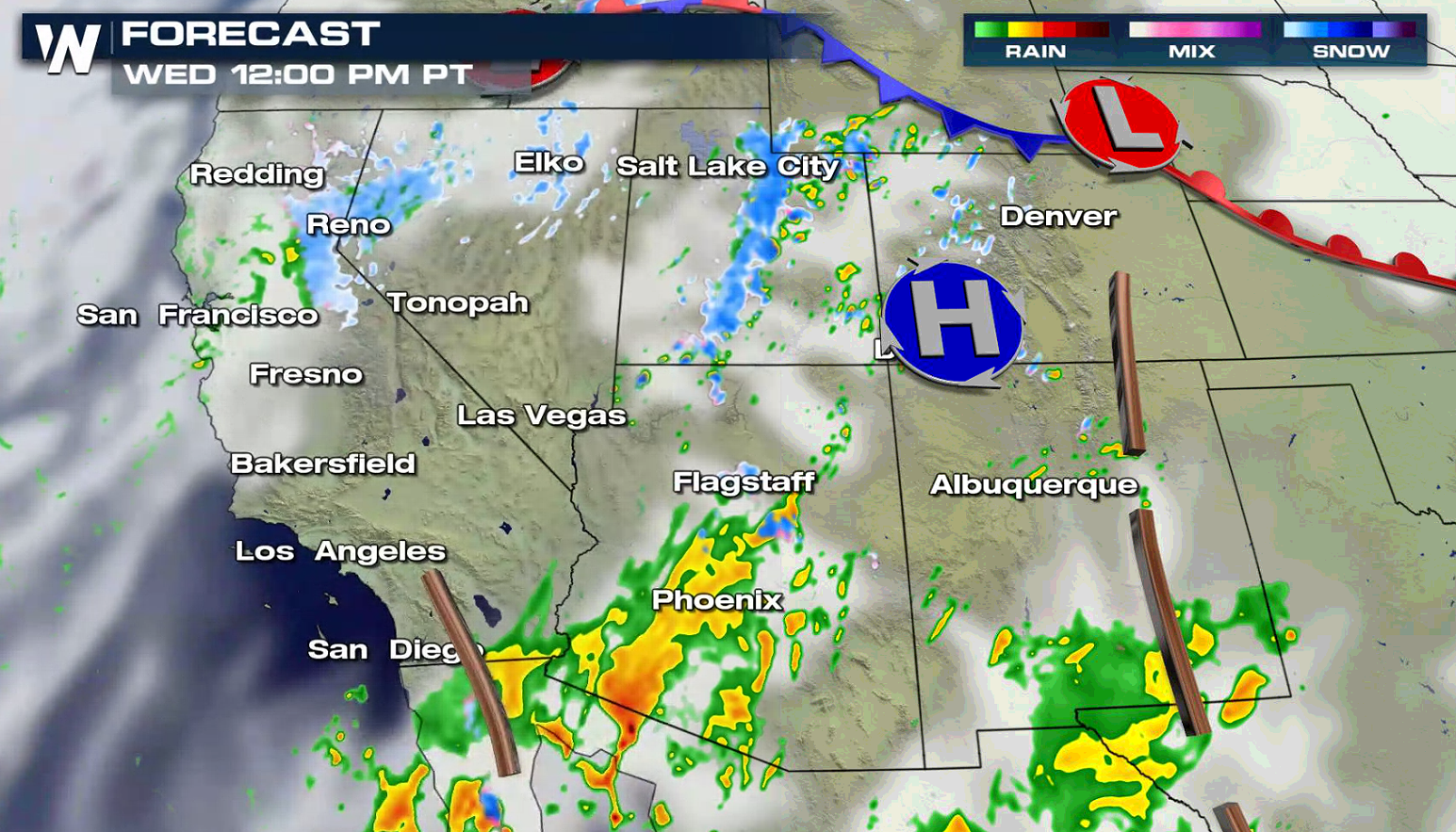 Forecast surface map with precipitation shown as rain in green/yellow and blue in snow. Valid Tuesday - Wednesday, March 16-17.
The precipitation is much needed in the region. As of mid-March (prior to this ongoing event), the Sierra Nevada mountains only had about 35-40 percent of its average snow depth. The melting snow is critical to the water supply throughout the year. This storm system will likely boost that number up closer to average by the time the week is over.
Forecast surface map with precipitation shown as rain in green/yellow and blue in snow. Valid Tuesday - Wednesday, March 16-17.
The precipitation is much needed in the region. As of mid-March (prior to this ongoing event), the Sierra Nevada mountains only had about 35-40 percent of its average snow depth. The melting snow is critical to the water supply throughout the year. This storm system will likely boost that number up closer to average by the time the week is over.
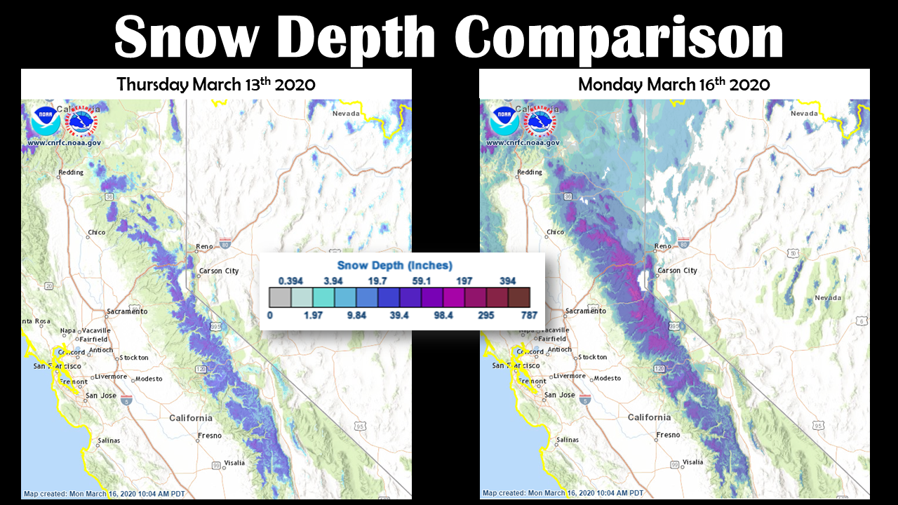 Snow depth comparison from March 13th to March 16th. From the National Weather Service Reno.
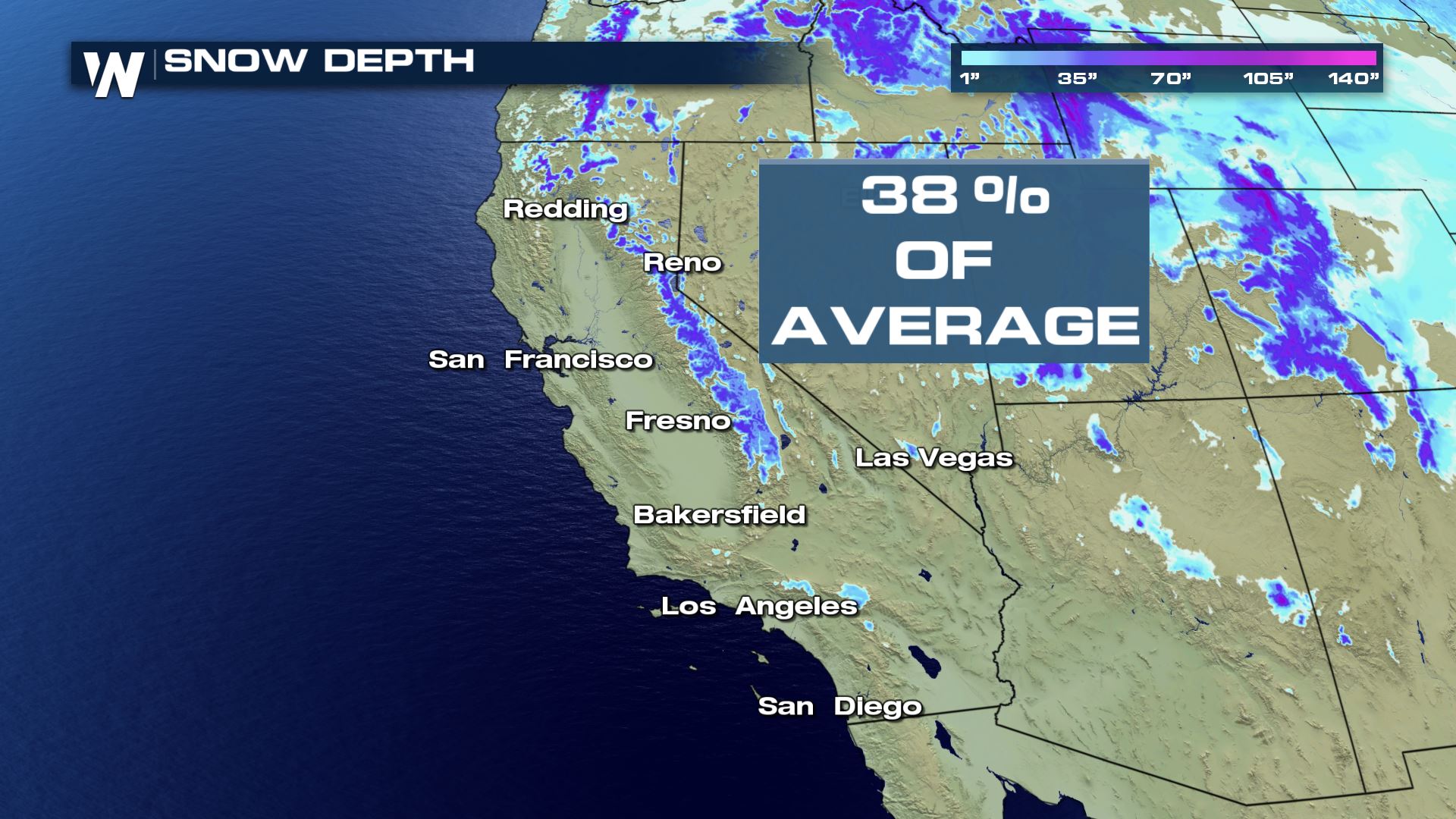 Snow depth as of Thursday, March 12, 2020 showing 35-40% to average for California.
If you're traveling by air through this region, be aware it will be bumpy with occasional turbulence. Meanwhile, driving will be tough at times across Interstate 80 between Sacramento, CA and Reno, NV. Make sure you have proper snow tires and equipment to make it over some of these higher passes!
Snow depth as of Thursday, March 12, 2020 showing 35-40% to average for California.
If you're traveling by air through this region, be aware it will be bumpy with occasional turbulence. Meanwhile, driving will be tough at times across Interstate 80 between Sacramento, CA and Reno, NV. Make sure you have proper snow tires and equipment to make it over some of these higher passes!
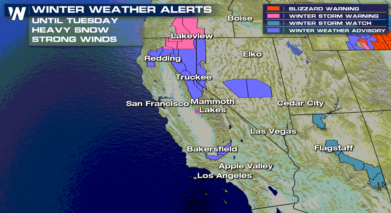
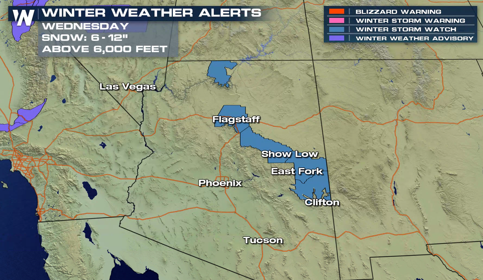 Winter weather alerts as of Tuesday morning, March 17.
Continue to stay with WeatherNation as we cover this story and our other top weather headlines this week!
Winter weather alerts as of Tuesday morning, March 17.
Continue to stay with WeatherNation as we cover this story and our other top weather headlines this week!
Forecast surface map with precipitation shown as rain in green/yellow and blue in snow. Valid Tuesday - Wednesday, March 16-17.
The precipitation is much needed in the region. As of mid-March (prior to this ongoing event), the Sierra Nevada mountains only had about 35-40 percent of its average snow depth. The melting snow is critical to the water supply throughout the year. This storm system will likely boost that number up closer to average by the time the week is over.
Snow depth comparison from March 13th to March 16th. From the National Weather Service Reno.
Snow depth as of Thursday, March 12, 2020 showing 35-40% to average for California.
If you're traveling by air through this region, be aware it will be bumpy with occasional turbulence. Meanwhile, driving will be tough at times across Interstate 80 between Sacramento, CA and Reno, NV. Make sure you have proper snow tires and equipment to make it over some of these higher passes!
Winter weather alerts as of Tuesday morning, March 17.
Continue to stay with WeatherNation as we cover this story and our other top weather headlines this week!All Weather News
More
More Storms for the East Through Monday
The threat for flooding rain continues across
3 Aug 2026 6:00 PM


After Reaching Category 5, Genevieve Weakens in the Pacific
PacificGenevieve formed last Friday south of
3 Aug 2026 12:30 AM

Flooding, Severe Storms Target the Midwest Again
After an active week of storms across the nor
1 Aug 2026 1:40 AM

Flooding Risk Increases as Heavy Rain Targets the Tri-State Area
Tuesday, heavy rainfall moved across the Nort
30 Jul 2026 12:25 AM