Northern Plains Severe Threat to Start This Week
Top Stories
6 Jul 2020 10:00 AM
The Northern Plains will remain active with chances for strong and severe thunderstorms to start this week. This weekend, severe storms brought large hail, strong winds, and even a few tornadoes, thanks to a nearly stationary low pressure system in Western Canada.
https://twitter.com/WeatherNation/status/1279052276791820288
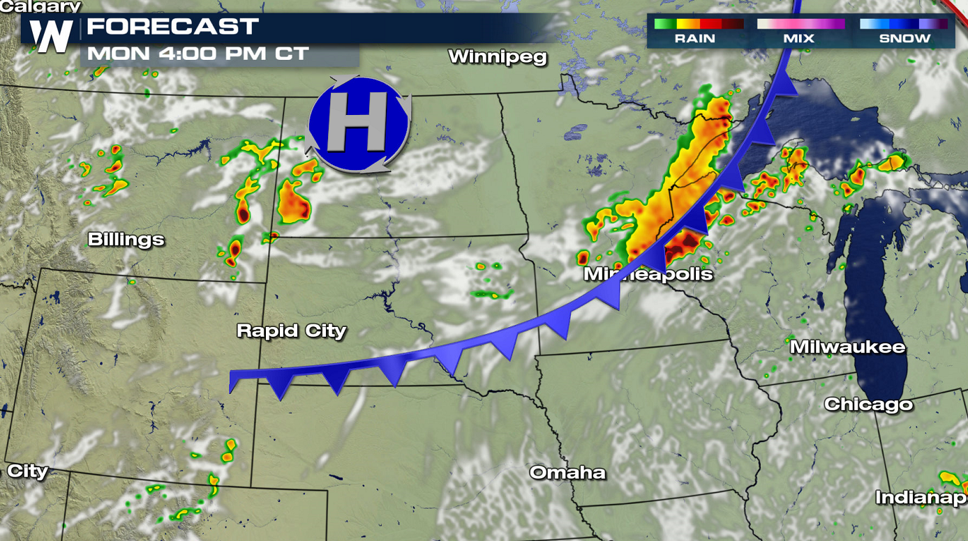
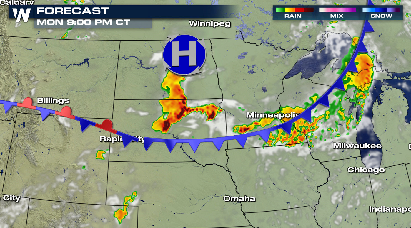
 Several waves of storms will cross the Upper Midwest and High Plains. One line of severe storms is likely to form this afternoon (Monday) along a cold front in the late afternoon in the western Great Lakes. More severe storms will develop in the High Plains in the evening, moving across the Dakotas overnight.
 Stay with WeatherNation for the latest on the severe weather this week. This article will continue to be updated as additional data becomes available.
Monday
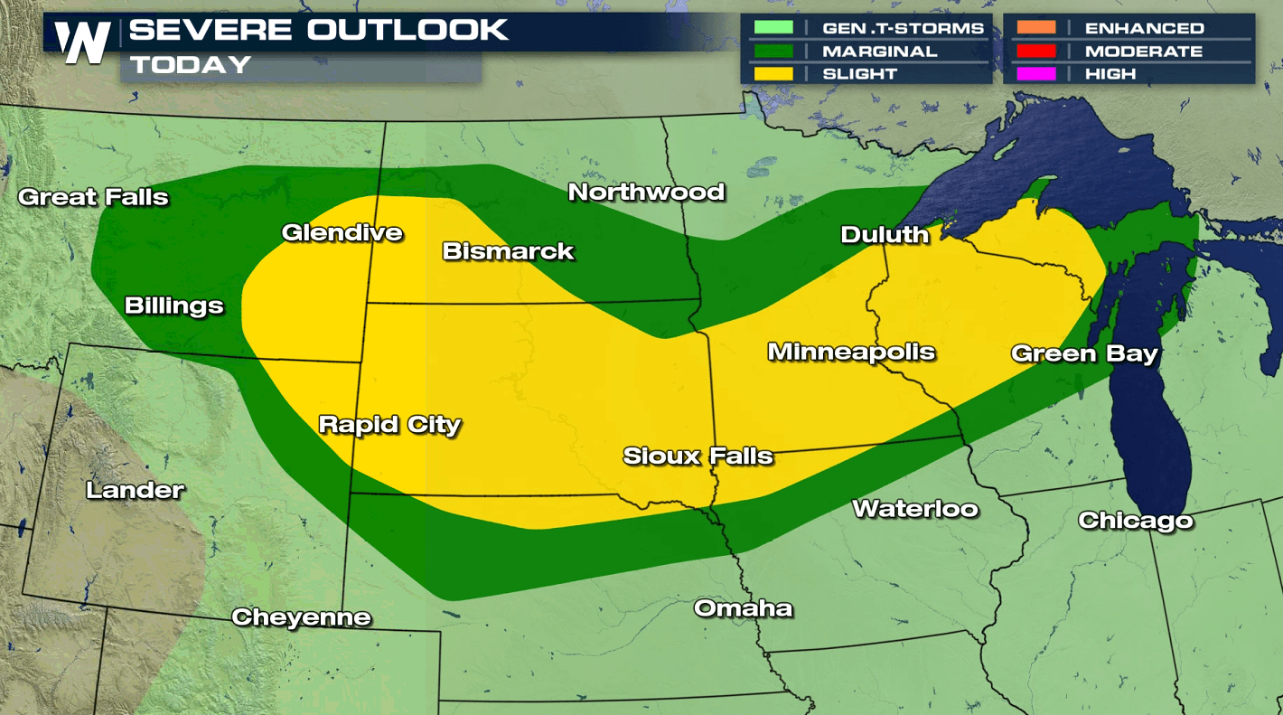
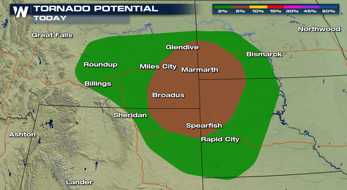
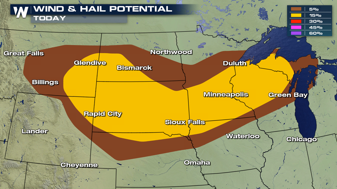
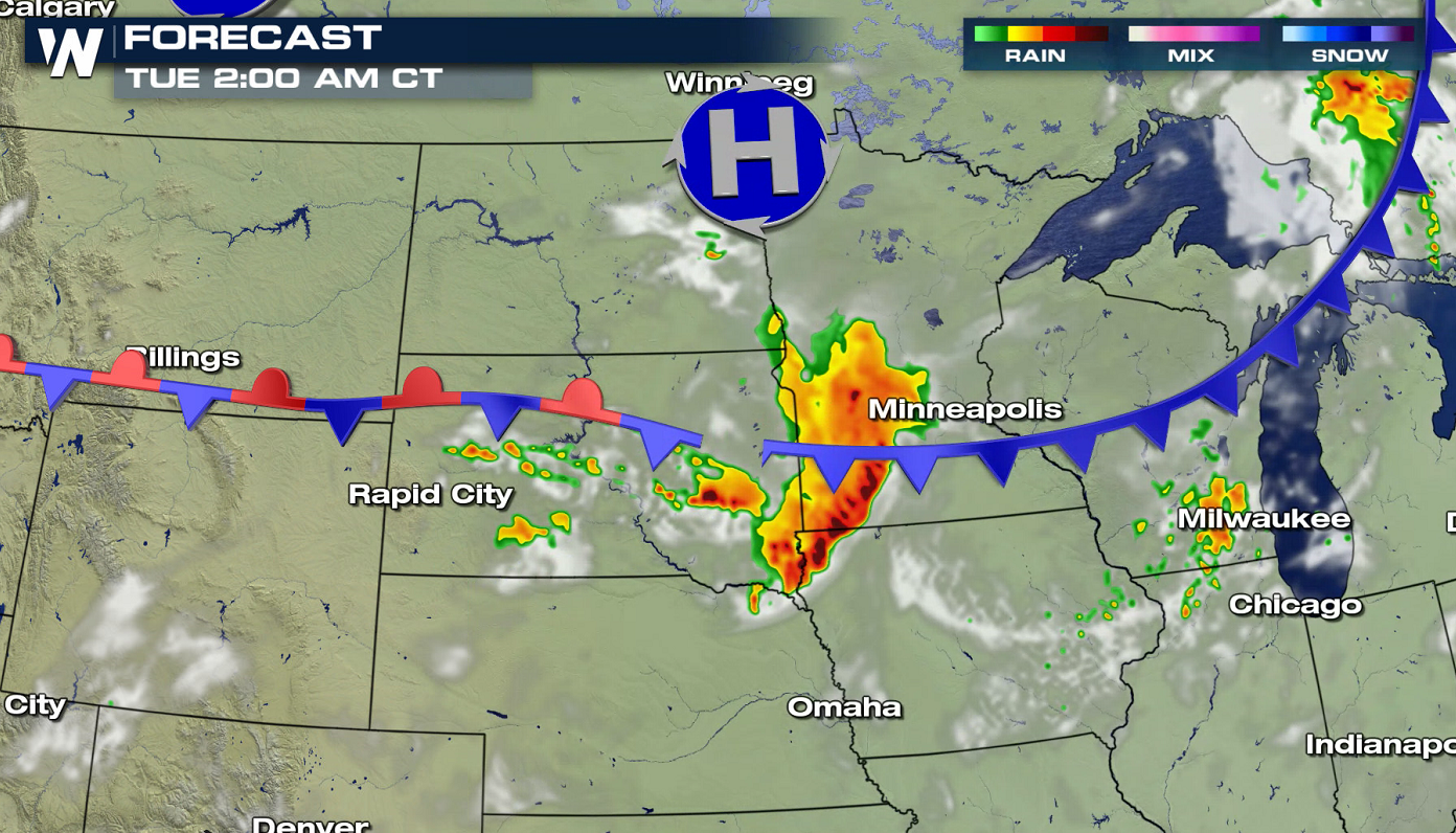
Additional energy from the persistent Canadian low pressure system will move through the Colorado Rockies up into the Upper Midwest with another chance for scattered severe storms. Strong winds and large hail will continue to be the primary hazards, but isolated tornadoes may also occur.
Several waves of storms will cross the Upper Midwest and High Plains. One line of severe storms is likely to form this afternoon (Monday) along a cold front in the late afternoon in the western Great Lakes. More severe storms will develop in the High Plains in the evening, moving across the Dakotas overnight.
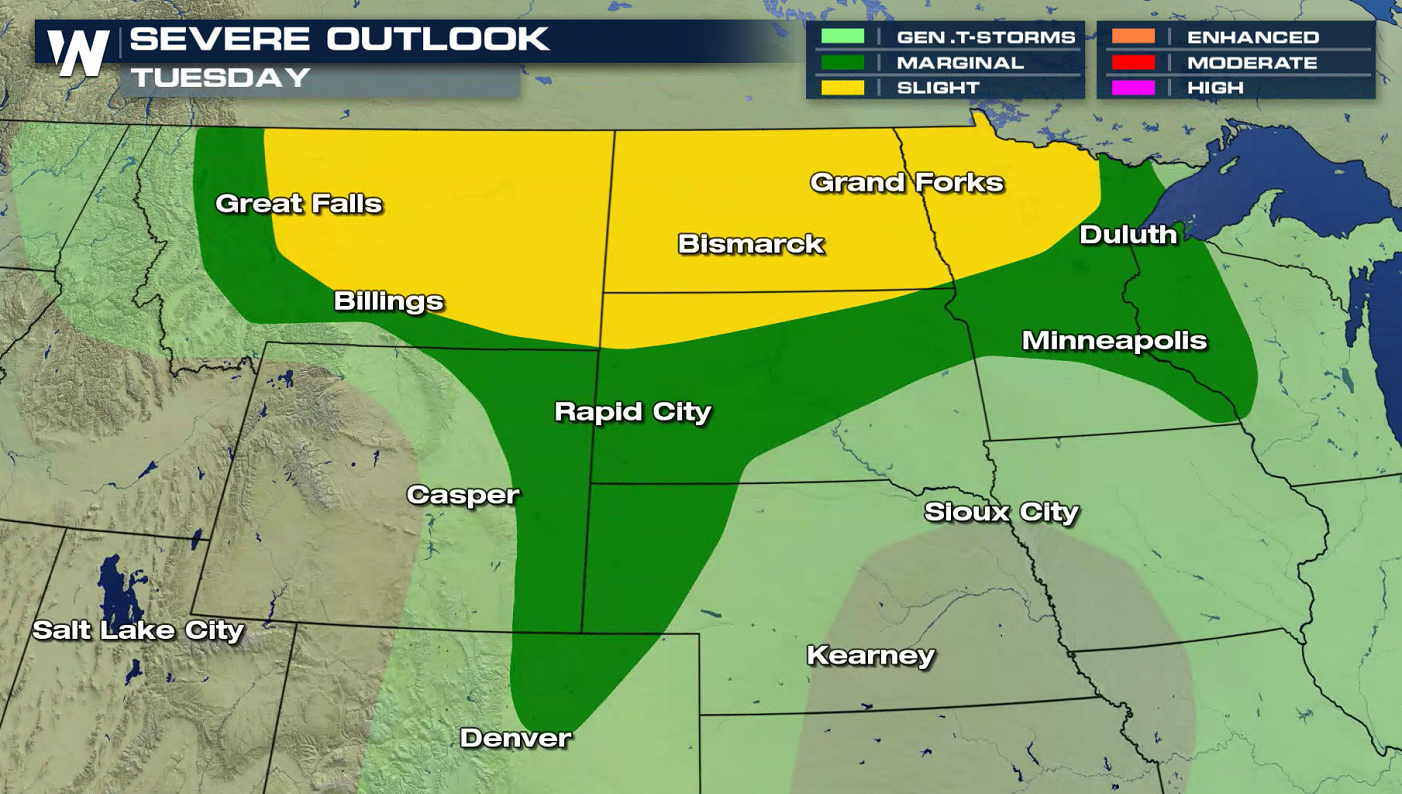
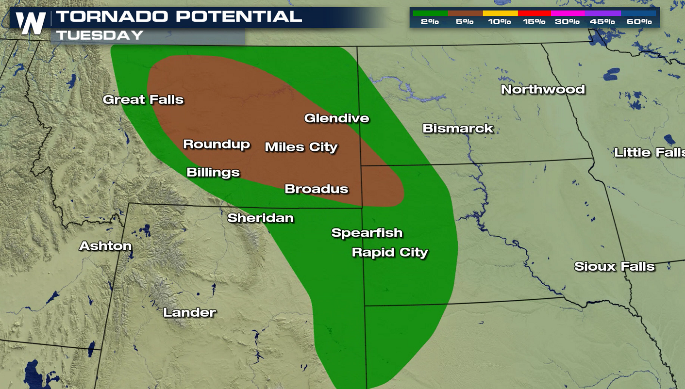
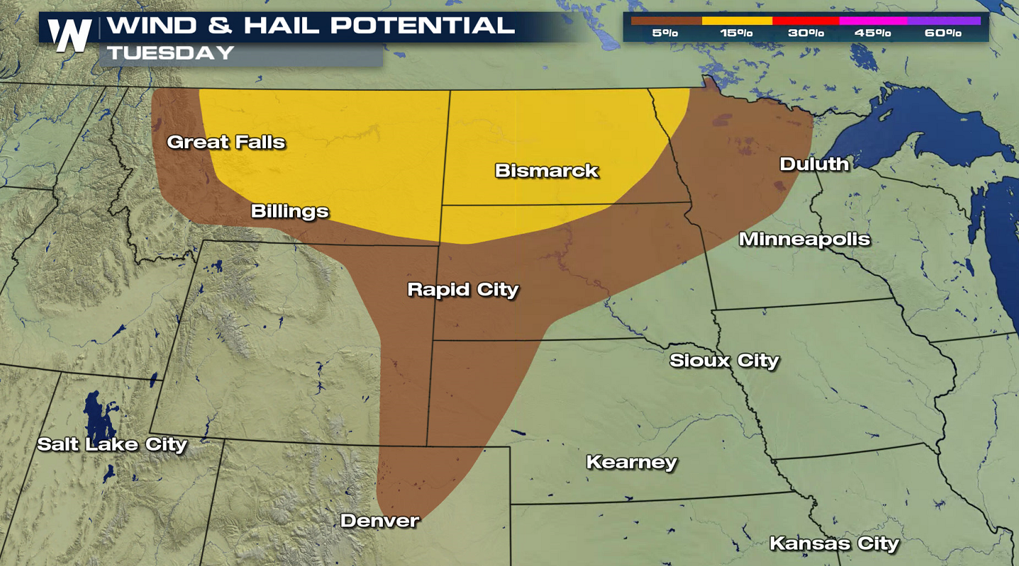
Tuesday
On Tuesday, energy from the trough will stretch out across the Northern Plains into the Upper Midwest. Severe storms will be possible from Montana through western Wisconsin.
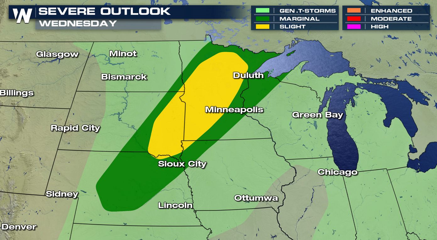
Wednesday
The severe weather threat continues on Wednesday, shifting to the east ahead of another cold front. Severe storms will be possible from Minnesota to Nebraska.
Stay with WeatherNation for the latest on the severe weather this week. This article will continue to be updated as additional data becomes available.All Weather News
More
Flooding Risk Increases as Heavy Rain Targets the Tri-State Area
Tuesday, heavy rainfall moved across the nort
29 Jul 2026 6:00 PM


Severe Weather: Energy From the Midwest Now in the Southeast
UPPER MIDWEST - Through Monday, dangerous tor
29 Jul 2026 5:30 PM

Tropics: Fausto Heads towards Hawaii; Genevieve a Major Hurricane
PacificTropical Depression Fausto continues t
29 Jul 2026 10:15 AM


Southeast Flood Risk Lingers Near Stalled Front
A stalled boundary over the Southeast will ke
25 Jul 2026 10:55 AM

Another Round of Storms Targets the Northeast
Tuesday brought severe weather again across p
23 Jul 2026 1:15 AM