High Plains Severe Weather Risk to Start The Week
Special Stories
16 Jul 2018 11:36 AM
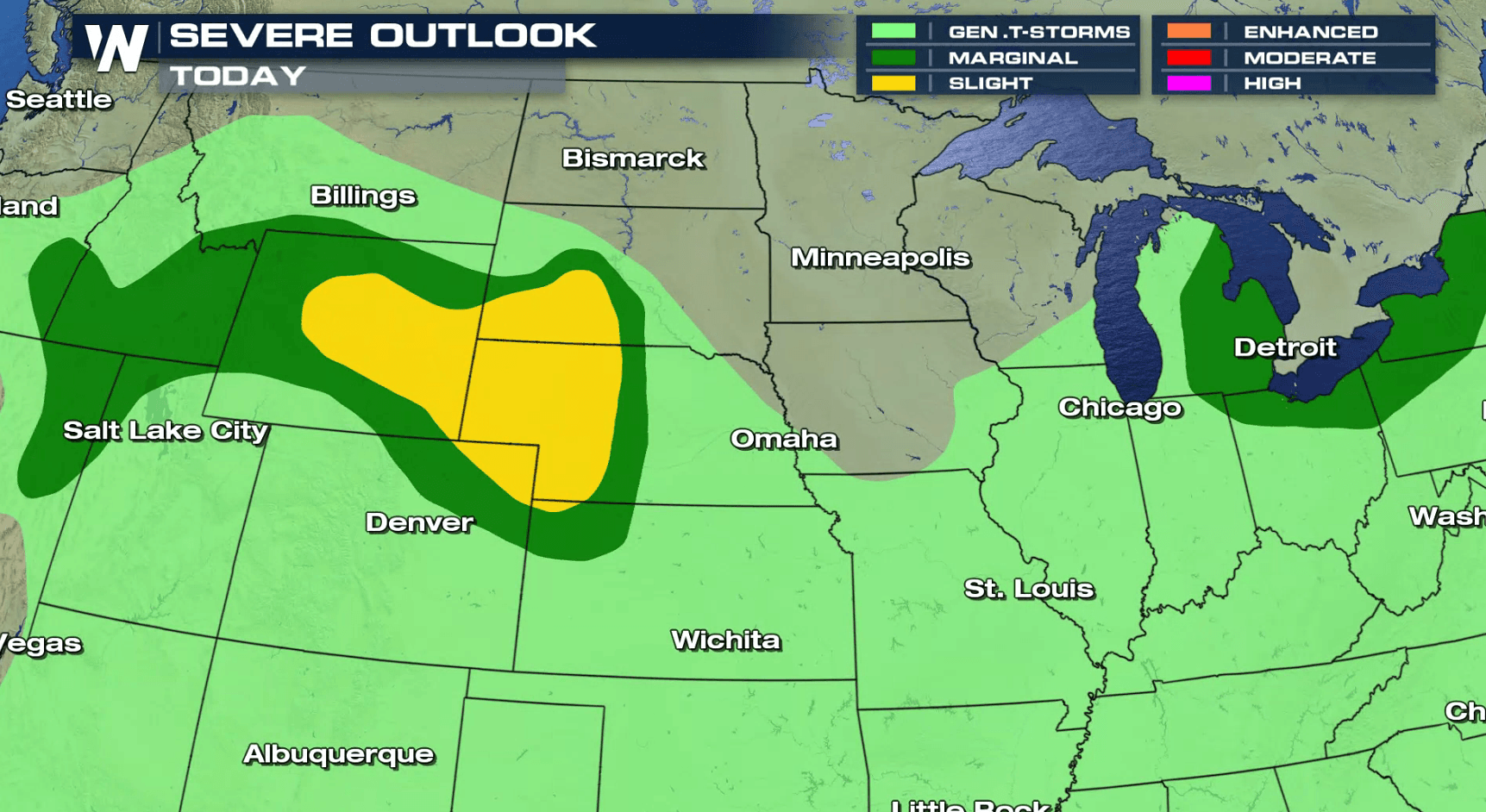
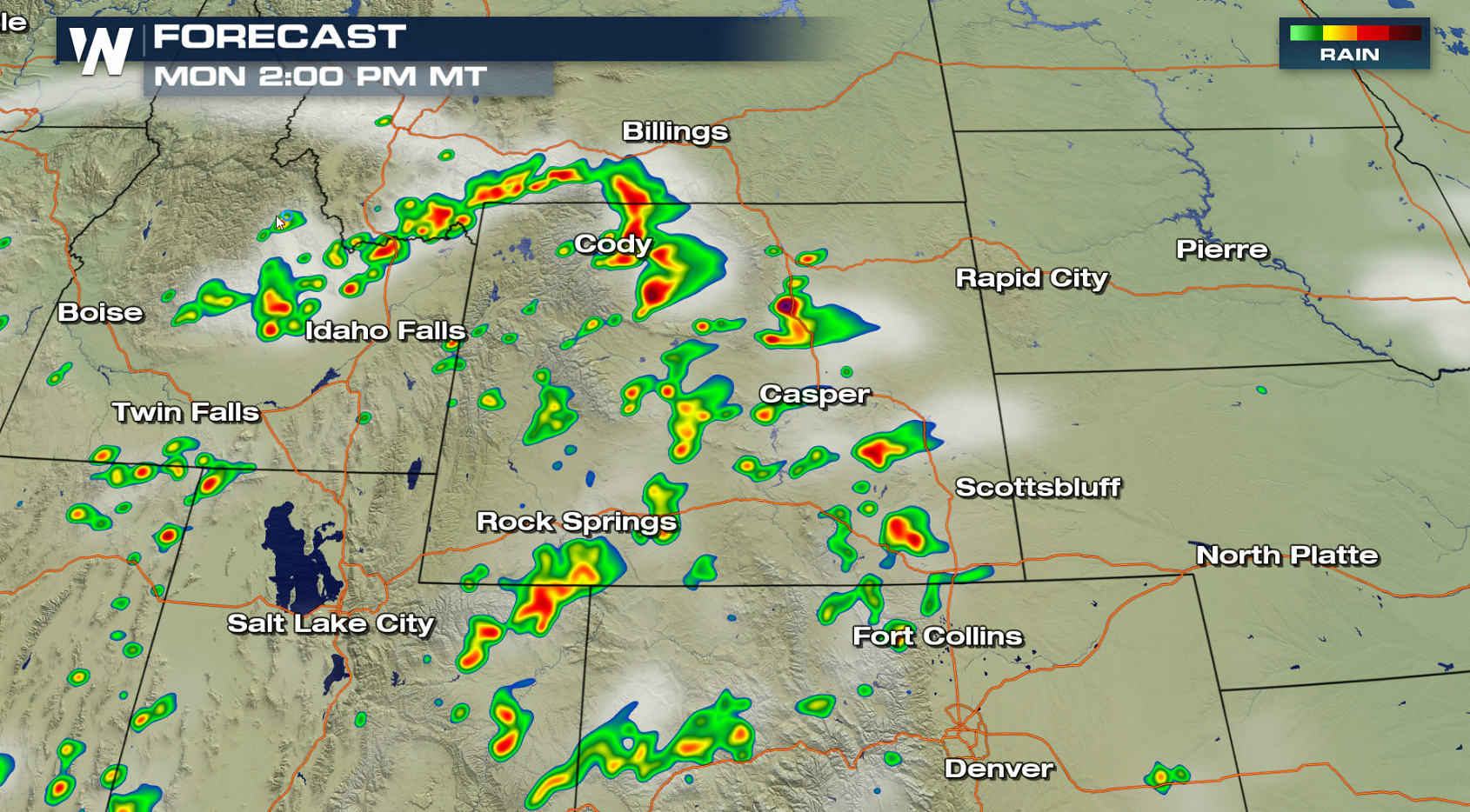
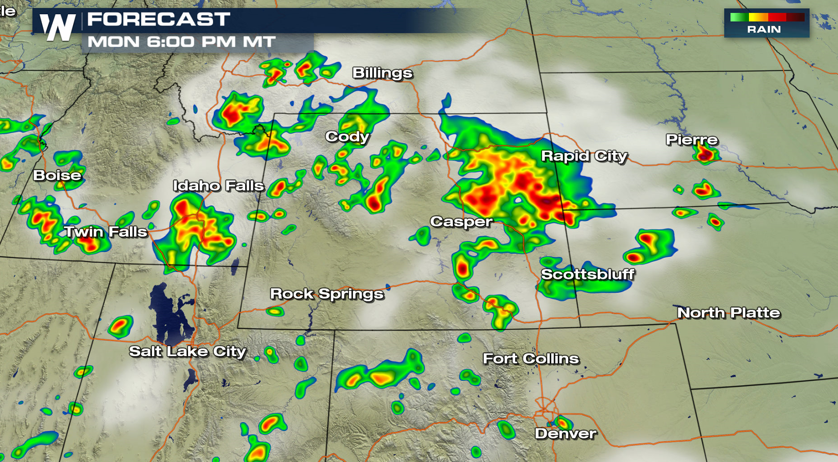
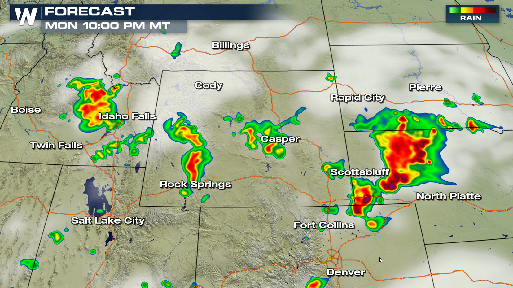
A storm system pushing out of the High Plains will bring a chance for severe thunderstorms later this afternoon and evening (Monday). A slight risk for severe thunderstorms extends from Wyoming to South Dakota and Kansas. Large hail and strong wind gusts are the biggest threats, with a low chance for a tornado.
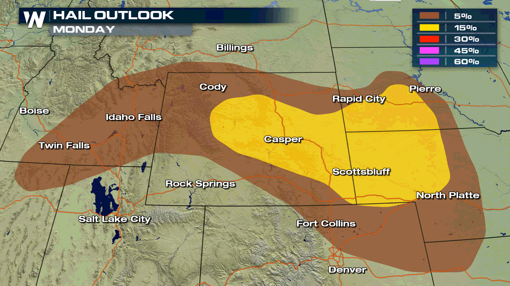
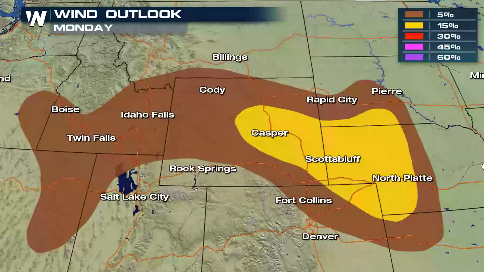
 A few storms will pop-up throughout the afternoon, with storm coverage becoming more widespread in the later afternoon and evening. Intensity will increase as well, as heat and humidity continues to build throughout the day.
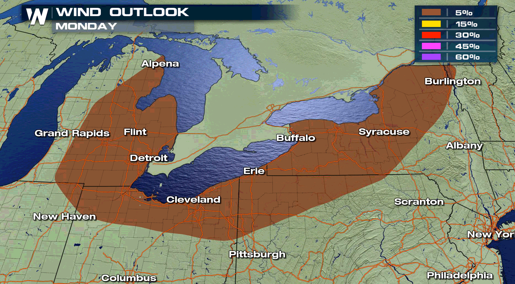
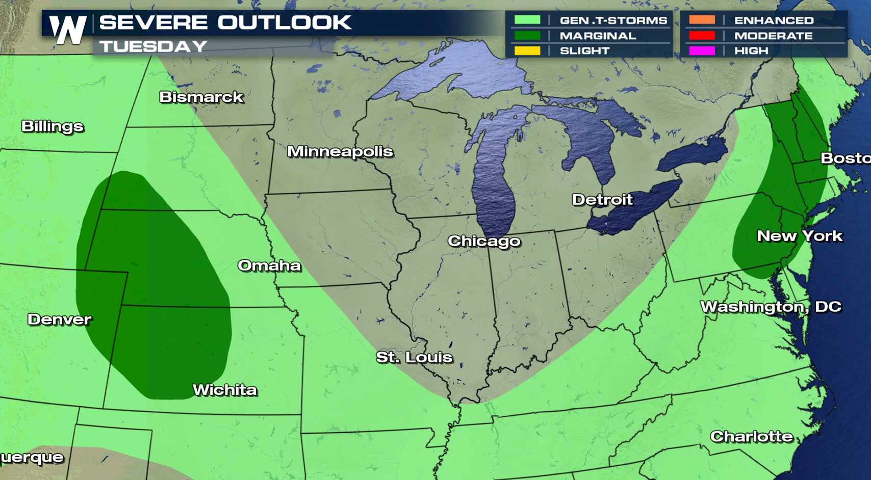
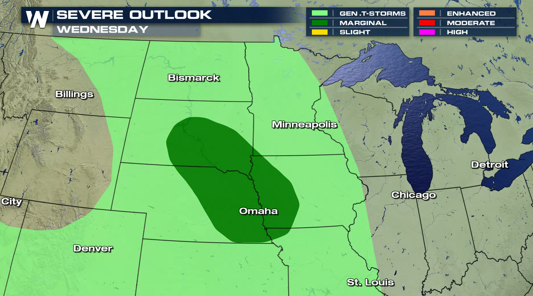
 The risk for severe thunderstorms diminishes for Tuesday and Wednesday, with a marginal risk posted both days from the Storm Prediction Center. The Northeast and Plains are the areas of concern.
 For WeatherNation: Meteorologist Mace Michaels
A few storms will pop-up throughout the afternoon, with storm coverage becoming more widespread in the later afternoon and evening. Intensity will increase as well, as heat and humidity continues to build throughout the day.
The risk for severe thunderstorms diminishes for Tuesday and Wednesday, with a marginal risk posted both days from the Storm Prediction Center. The Northeast and Plains are the areas of concern.
For WeatherNation: Meteorologist Mace Michaels
All Weather News
More
Fronts Continue To Spark Severe Weather Across the Plains
A cold front that brought record lows to the
18 Jul 2025 10:40 PM

Extreme Heat Impacts for the East Coast & South
Extreme heat continues to impact several area
18 Jul 2025 10:05 PM

Flooding Threat Remains Elevated in the East
A cold front pushing through the Eastern Seab
18 Jul 2025 9:10 PM

EF-2 Firenado from the Deer Creek Fire in Utah
A fire tornado was spotted near La Sal, Utah
18 Jul 2025 7:30 AM

Tropical System Brings Flood Risk to the Central Gulf
Time has run out for notable tropical develop
18 Jul 2025 3:05 AM

Heavy Rain, Flooding Threat Returns to Florida
Keep the rain boots handy in Florida - heavy
13 Jul 2025 12:50 PM

Severe Storm Risk Pushes into the Great Lakes, Ohio Valley
Friday was another busy day with severe weath
12 Jul 2025 8:00 PM