Holiday Winter Storm Takes Aim At California
Special Stories
21 Dec 2018 11:44 AM
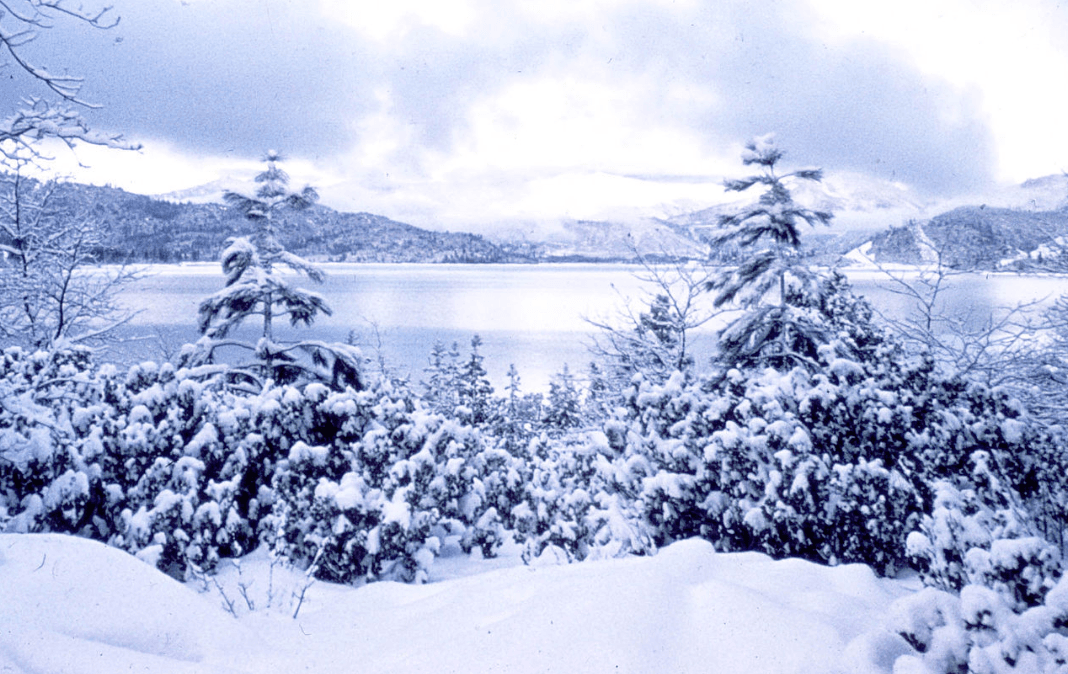
It looks like another big blast of winter is heading for portions of the Sierra Nevada mountains early next week. On the positive side, the snow will make many locations a winter wonderland just in time for Christmas. On the negative side, roads like Interstate 80 may become nightmarish, making travel to holiday destinations difficult, if not impossible.
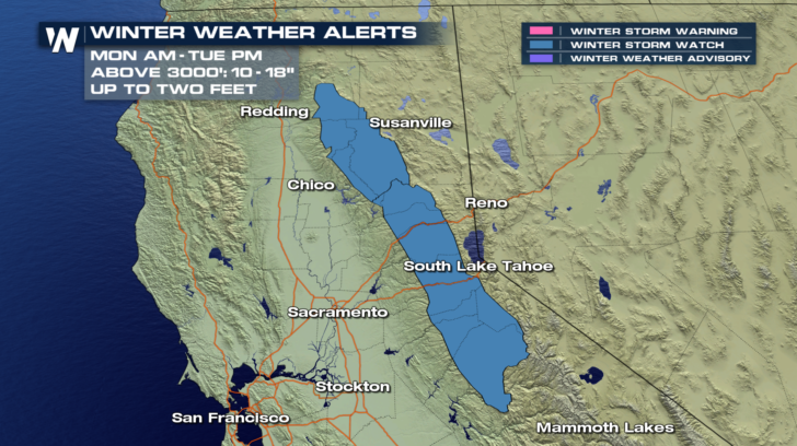
A Winter Storm Watch has already been issued for parts of northern California. This would include I-80 over Donner Pass, a very heavily traveled route. The storm is expected to begin Monday morning, Christmas Eve, and continue into Christmas afternoon. 10 to 18 inches of snow is expected over 3,000 feet. Some areas could see two feet of snow! The heaviest snow is expected to fall during Monday afternoon and evening.
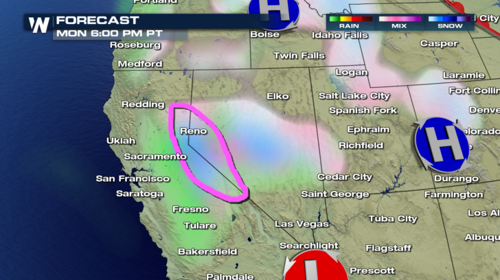
 Here's what future radar may look like at 6 pm on Monday. A heavy band of snow can be seen. The area is circled in pink.
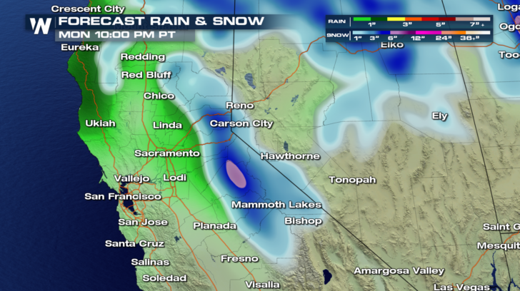
 By Monday at 10 pm, the blue and pink shaded areas indicate a heavy band of snow in the mountains, between Sacramento and Reno. This would include Donner Pass and Interstate 80. Snowfall is expected to continue into Tuesday afternoon.
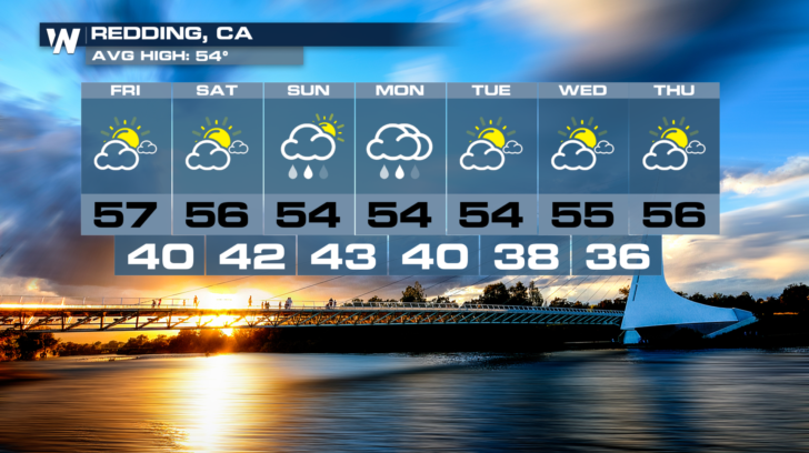
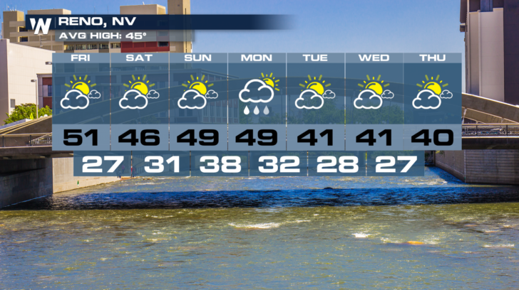
 On either side of the Sierra Nevada Mountains, it will be a little too warm for snow. The forecasts for Redding and Reno show rain, not snow, for Monday, Christmas Eve. And both cities will have sunshine on Christmas Tuesday.
 It's a storm that WeatherNation will be watching very closely. Stay tuned. You can watch on the Dish Network, Roku, Amazon Fire TV, and Apple TV.
For WeatherNation: Meteorologist Matt Monroe
It's a storm that WeatherNation will be watching very closely. Stay tuned. You can watch on the Dish Network, Roku, Amazon Fire TV, and Apple TV.
For WeatherNation: Meteorologist Matt Monroe
Here's what future radar may look like at 6 pm on Monday. A heavy band of snow can be seen. The area is circled in pink.
By Monday at 10 pm, the blue and pink shaded areas indicate a heavy band of snow in the mountains, between Sacramento and Reno. This would include Donner Pass and Interstate 80. Snowfall is expected to continue into Tuesday afternoon.
On either side of the Sierra Nevada Mountains, it will be a little too warm for snow. The forecasts for Redding and Reno show rain, not snow, for Monday, Christmas Eve. And both cities will have sunshine on Christmas Tuesday.
It's a storm that WeatherNation will be watching very closely. Stay tuned. You can watch on the Dish Network, Roku, Amazon Fire TV, and Apple TV.
For WeatherNation: Meteorologist Matt Monroe
All Weather News
More
More Storms for the East Through Monday
A low-pressure system that moved through the
2 Aug 2026 10:40 PM

Wildfire Outbreak in the Pacific Northwest
SPOKANE, WA - On Saturday, August 1st, the Ol
2 Aug 2026 10:35 PM


After Reaching Category 5, Genevieve Weakens in the Pacific
PacificGenevieve formed on last Friday south
2 Aug 2026 6:25 PM

Flooding, Severe Storms Target the Midwest Again
After an active week of storms across the nor
1 Aug 2026 1:40 AM

Flooding Risk Increases as Heavy Rain Targets the Tri-State Area
Tuesday, heavy rainfall moved across the Nort
30 Jul 2026 12:25 AM

Severe Weather: Energy From the Midwest Now in the Southeast
UPPER MIDWEST - Through Monday, dangerous tor
29 Jul 2026 10:30 PM