How Serious Does The Atlantic Tropical Wave Appear?

Special Stories
16 Aug 2018 10:02 PM
We're here to keep you updated regarding everything tropics! Right now, we're going to take a closer look at a tropical wave that is going to impact the Leeward and Windward Islands, then enter the Caribbean. It's called Invest 99L.
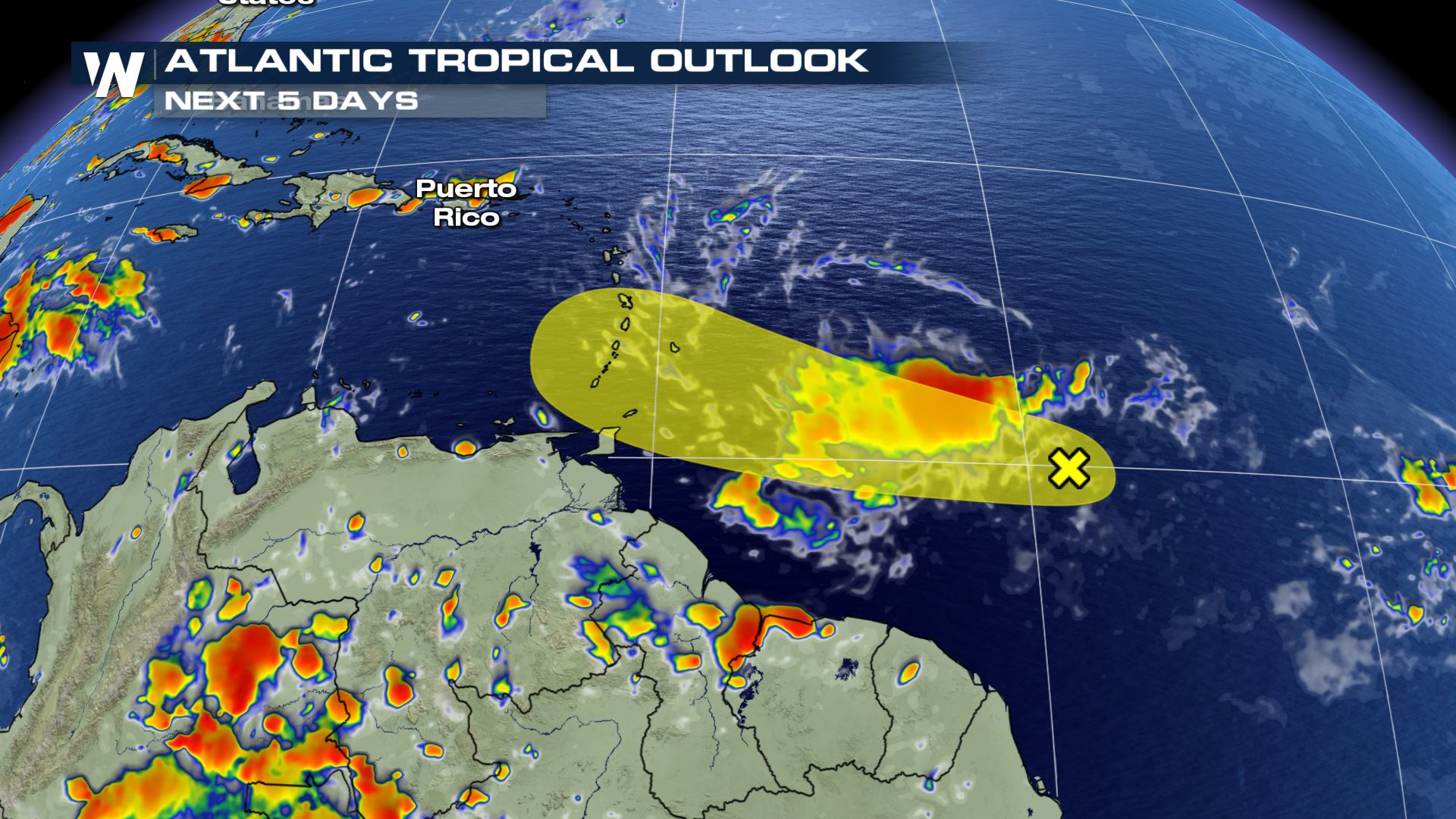 Invest 99L is the name of this tropical wave that is being investigated by the National Hurricane Center. The yellow area shows the tropical wave's projected path through this weekend (18th-19th).
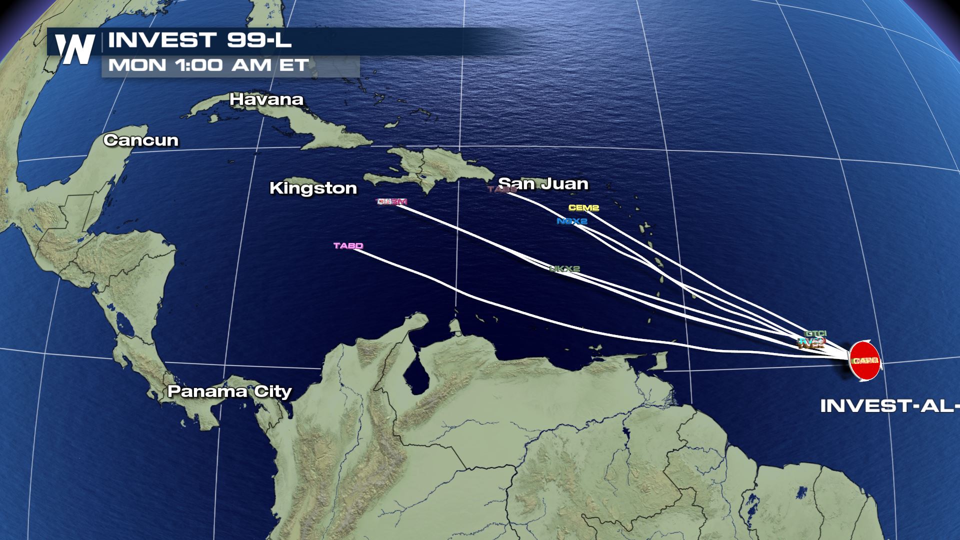 As of Thursday, there weren't a lot of hurricane models predicting this storm. The few that were showed a track through the Caribbean Sea.
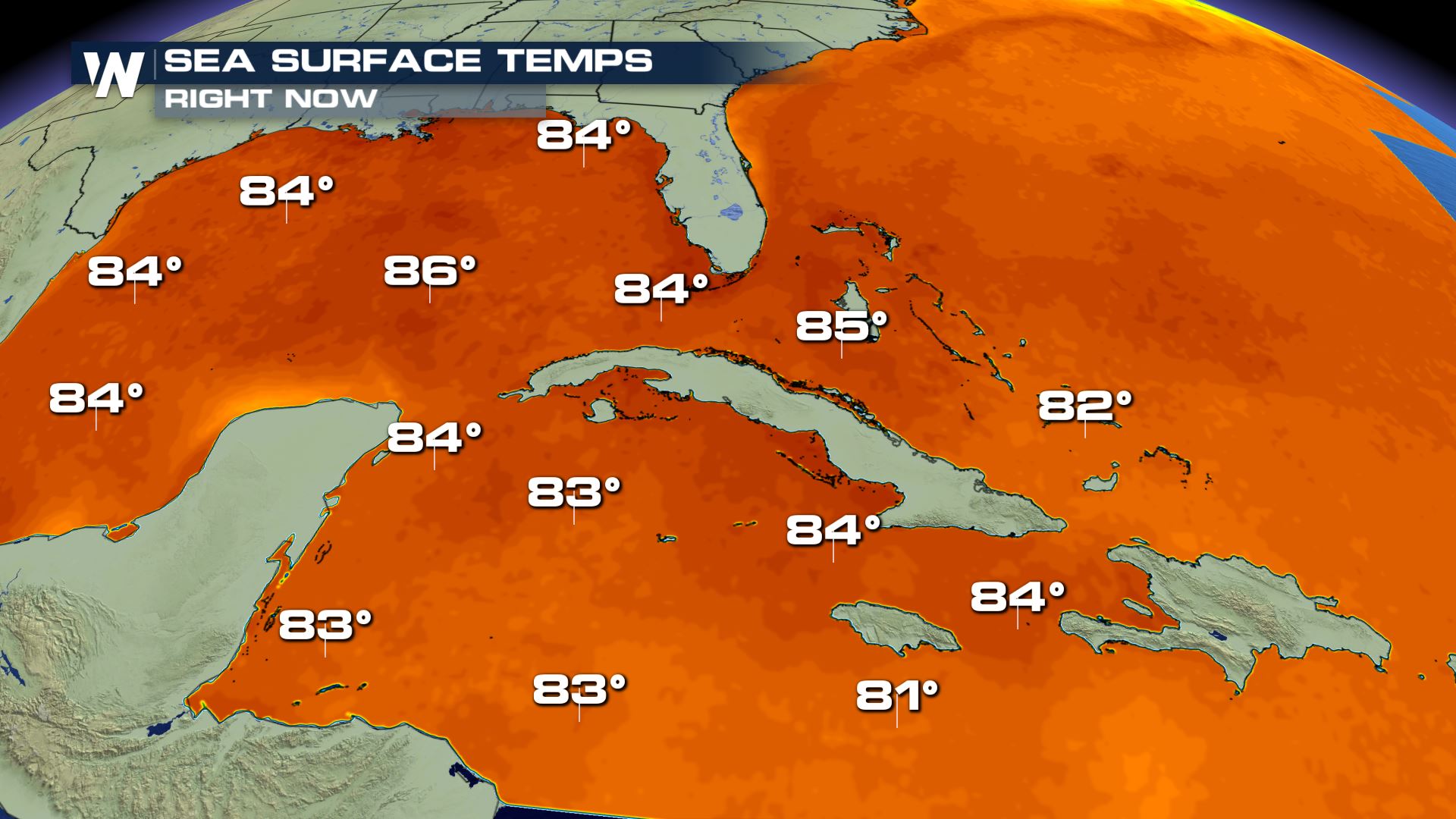 Sea surface temperatures in the Caribbean are warm enough for tropical cyclone development or strengthening, so that is a factor in favor of a tropical depression or storm forming. However...
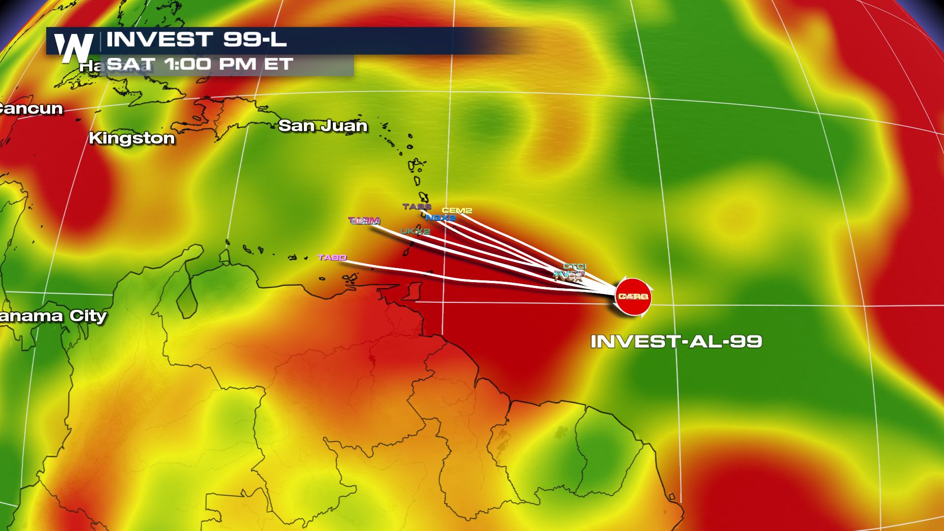 This weekend, the tropical wave is expected to encounter *less favorable conditions* for development, in regards to wind shear. Wind shear is plotted in red here. This is a factor *against* significant tropical development.
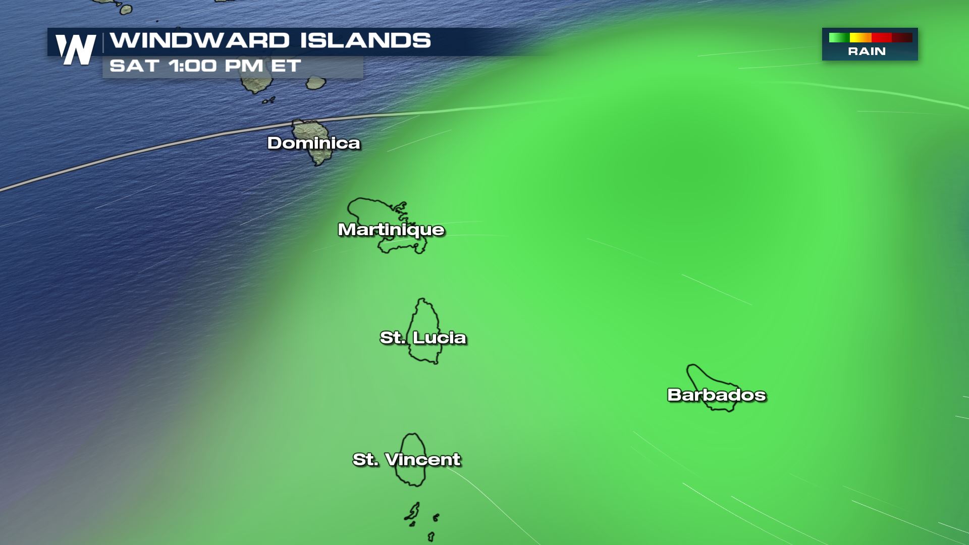
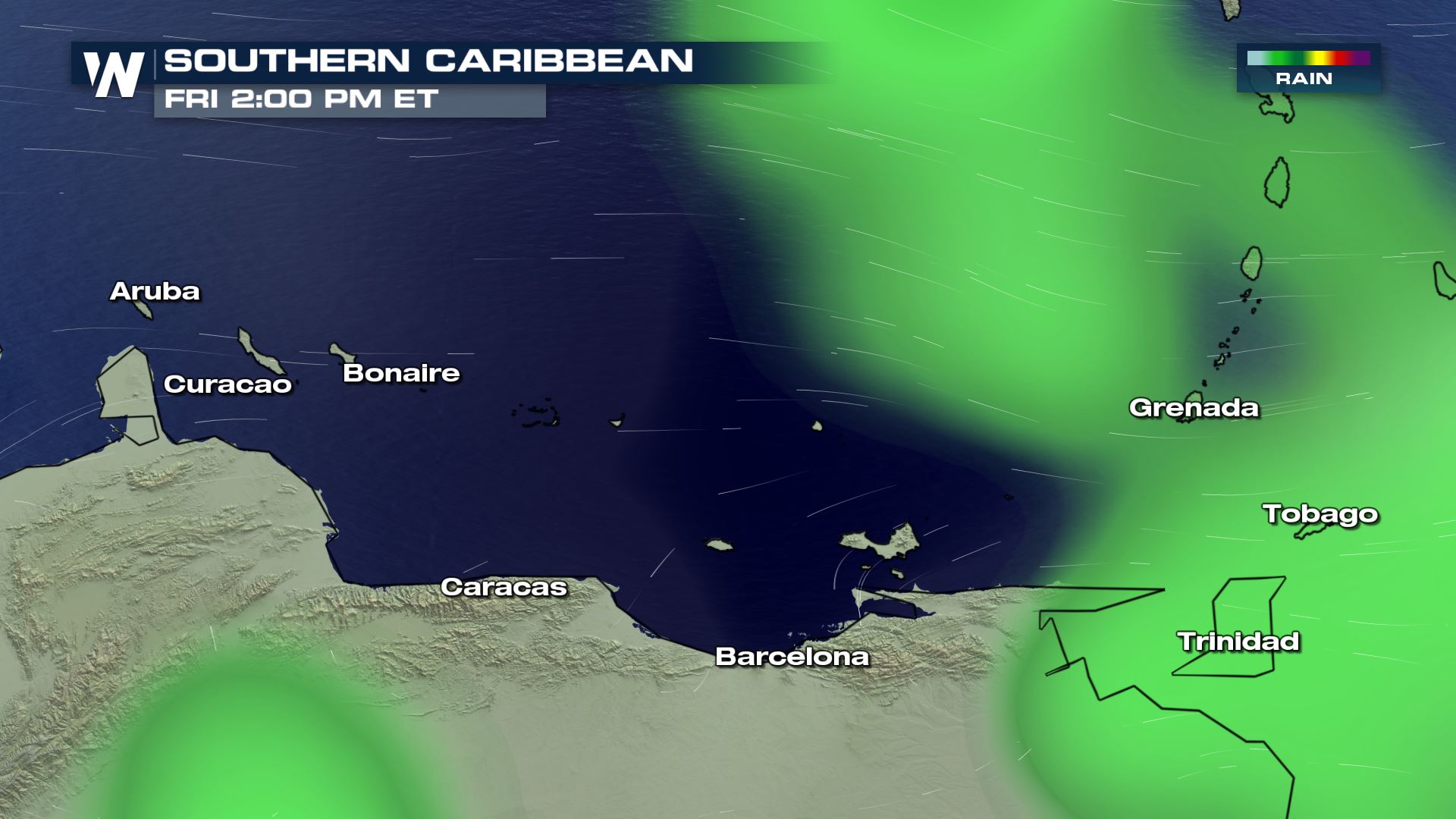 The tropical wave will bring pockets of heavy rain and gusty wind to the Windward and Leeward Islands Friday and Saturday.
 After the tropical wave moves into the Caribbean, we need to watch what happens! The good news is, there are not a lot of red flags (at the moment) for this tropical wave to rapidly intensify into a strong storm. However, we are approaching the peak of hurricane season (mid-September) when history tells us most storms form. It's always best to be hurricane ready, just in case. We will continue to update you regarding this story.
For WeatherNation, Meteorologist Steve Glazier
After the tropical wave moves into the Caribbean, we need to watch what happens! The good news is, there are not a lot of red flags (at the moment) for this tropical wave to rapidly intensify into a strong storm. However, we are approaching the peak of hurricane season (mid-September) when history tells us most storms form. It's always best to be hurricane ready, just in case. We will continue to update you regarding this story.
For WeatherNation, Meteorologist Steve Glazier
Invest 99L is the name of this tropical wave that is being investigated by the National Hurricane Center. The yellow area shows the tropical wave's projected path through this weekend (18th-19th).
As of Thursday, there weren't a lot of hurricane models predicting this storm. The few that were showed a track through the Caribbean Sea.
Sea surface temperatures in the Caribbean are warm enough for tropical cyclone development or strengthening, so that is a factor in favor of a tropical depression or storm forming. However...
This weekend, the tropical wave is expected to encounter *less favorable conditions* for development, in regards to wind shear. Wind shear is plotted in red here. This is a factor *against* significant tropical development.
The tropical wave will bring pockets of heavy rain and gusty wind to the Windward and Leeward Islands Friday and Saturday.
After the tropical wave moves into the Caribbean, we need to watch what happens! The good news is, there are not a lot of red flags (at the moment) for this tropical wave to rapidly intensify into a strong storm. However, we are approaching the peak of hurricane season (mid-September) when history tells us most storms form. It's always best to be hurricane ready, just in case. We will continue to update you regarding this story.
For WeatherNation, Meteorologist Steve GlazierAll Weather News
More
Severe Storm Threat Returns to the Midwest
After several tornadoes ripped through the Mi
31 Jul 2026 2:20 AM


After Reaching Category 5, Genevieve Weakens in the Pacific
PacificFausto is now a post-tropical cyclone.
31 Jul 2026 1:30 AM

Flooding Risk Increases as Heavy Rain Targets the Tri-State Area
Tuesday, heavy rainfall moved across the Nort
30 Jul 2026 12:25 AM

Severe Weather: Energy From the Midwest Now in the Southeast
UPPER MIDWEST - Through Monday, dangerous tor
29 Jul 2026 10:30 PM

Southeast Flood Risk Lingers Near Stalled Front
A stalled boundary over the Southeast will ke
25 Jul 2026 10:55 AM