Travel Forecasts into 2019: How Each Storm Could Impact You

Special Stories
28 Dec 2018 7:11 AM
Three storms systems are impacting the nation and this will create plenty of travel headaches into this weekend. Blizzard conditions are possible in the Southwest and Upper Midwest, with heavy rain from the Middle Atlantic to the Southeast. Give yourself plenty of extra travel time and consider rearranging your travel plans!
Friday December 28:
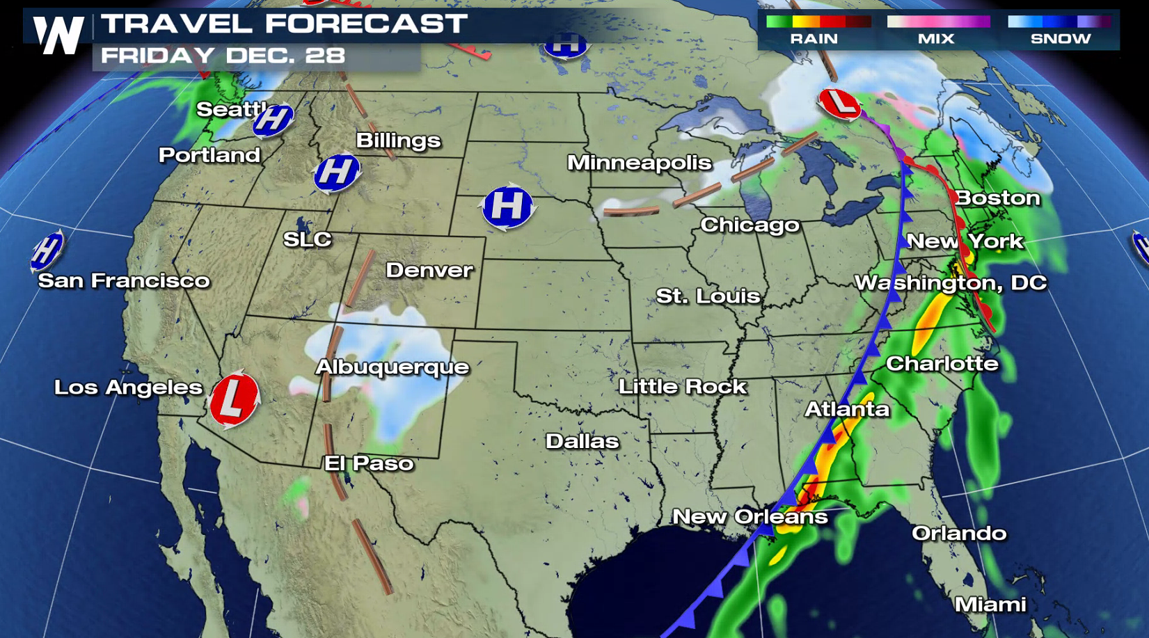
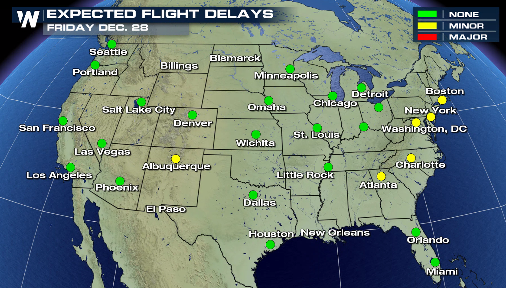 A winter storm will exit the northern Great Lakes today (Friday) but still produce snow back through the Upper Midwest. The snow from the previous day will still be left on the ground and blowing around places such as North and South Dakota, Nebraska and Minnesota! Heavy rain will stream from the Middle Atlantic to the Southeast with flooding possible. Heavy snow is possible in the Southwest, especially in New Mexico.
Here's how it looks on Saturday, the 29th of December:
A winter storm will exit the northern Great Lakes today (Friday) but still produce snow back through the Upper Midwest. The snow from the previous day will still be left on the ground and blowing around places such as North and South Dakota, Nebraska and Minnesota! Heavy rain will stream from the Middle Atlantic to the Southeast with flooding possible. Heavy snow is possible in the Southwest, especially in New Mexico.
Here's how it looks on Saturday, the 29th of December:
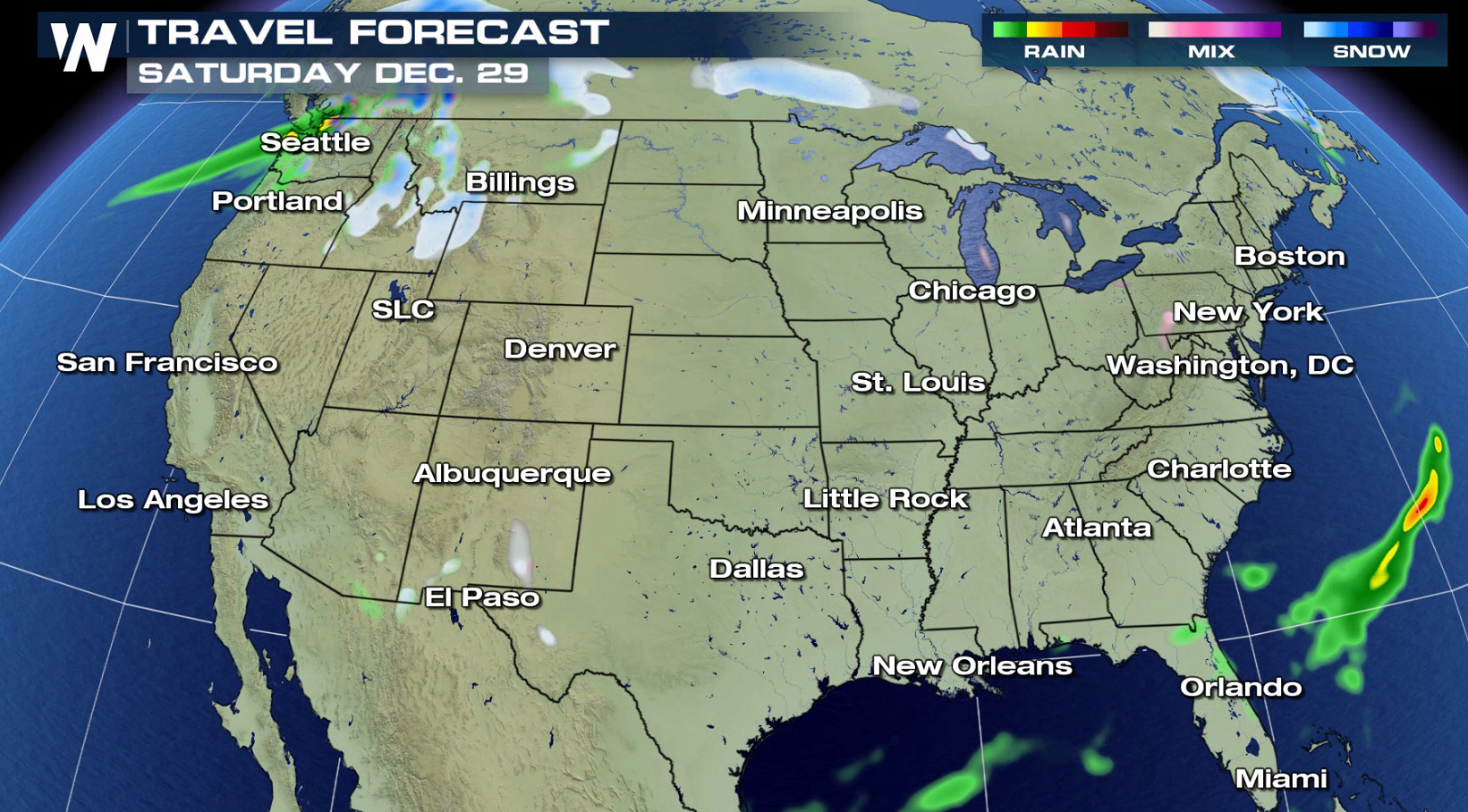
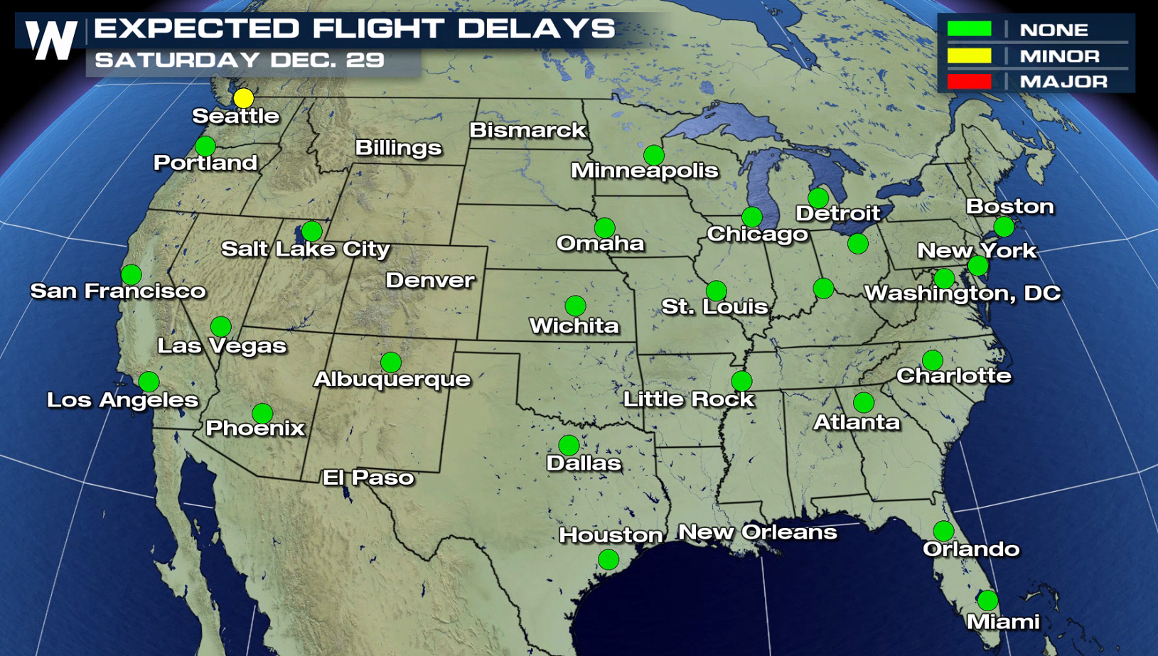 On Saturday, the weather should calm quite a bit. We'll have some cold air sticking around to ensure the fresh snow doesn't melt. Overall compared to Wednesday, Thursday and Friday...Saturday looks pretty decent.
Sunday, December 30:
On Saturday, the weather should calm quite a bit. We'll have some cold air sticking around to ensure the fresh snow doesn't melt. Overall compared to Wednesday, Thursday and Friday...Saturday looks pretty decent.
Sunday, December 30:
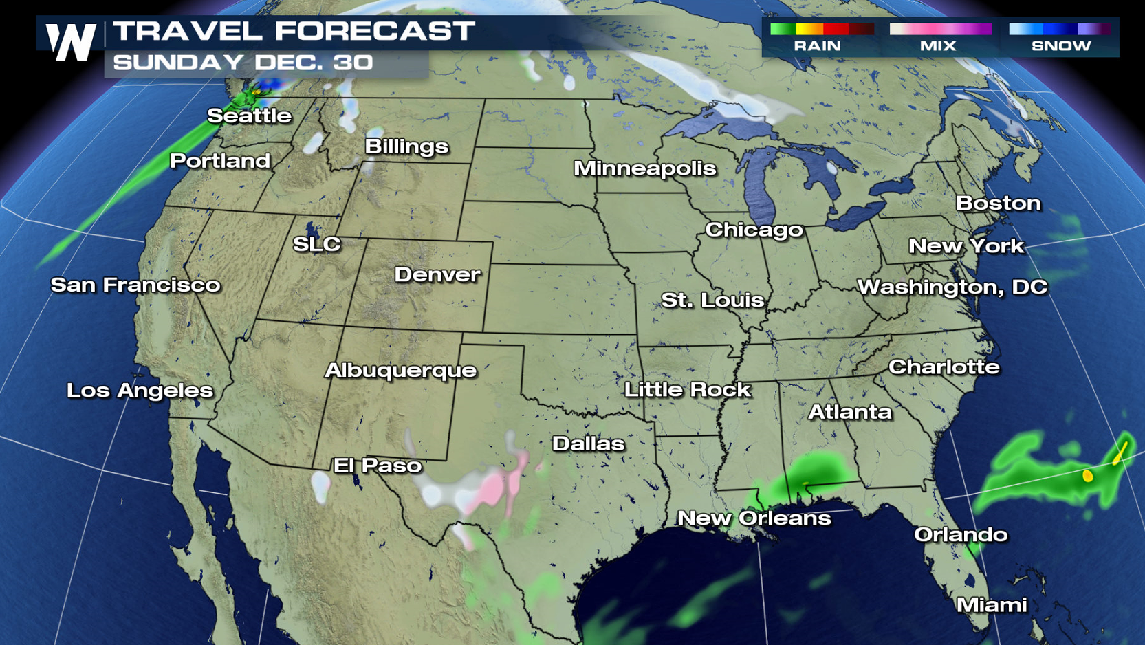
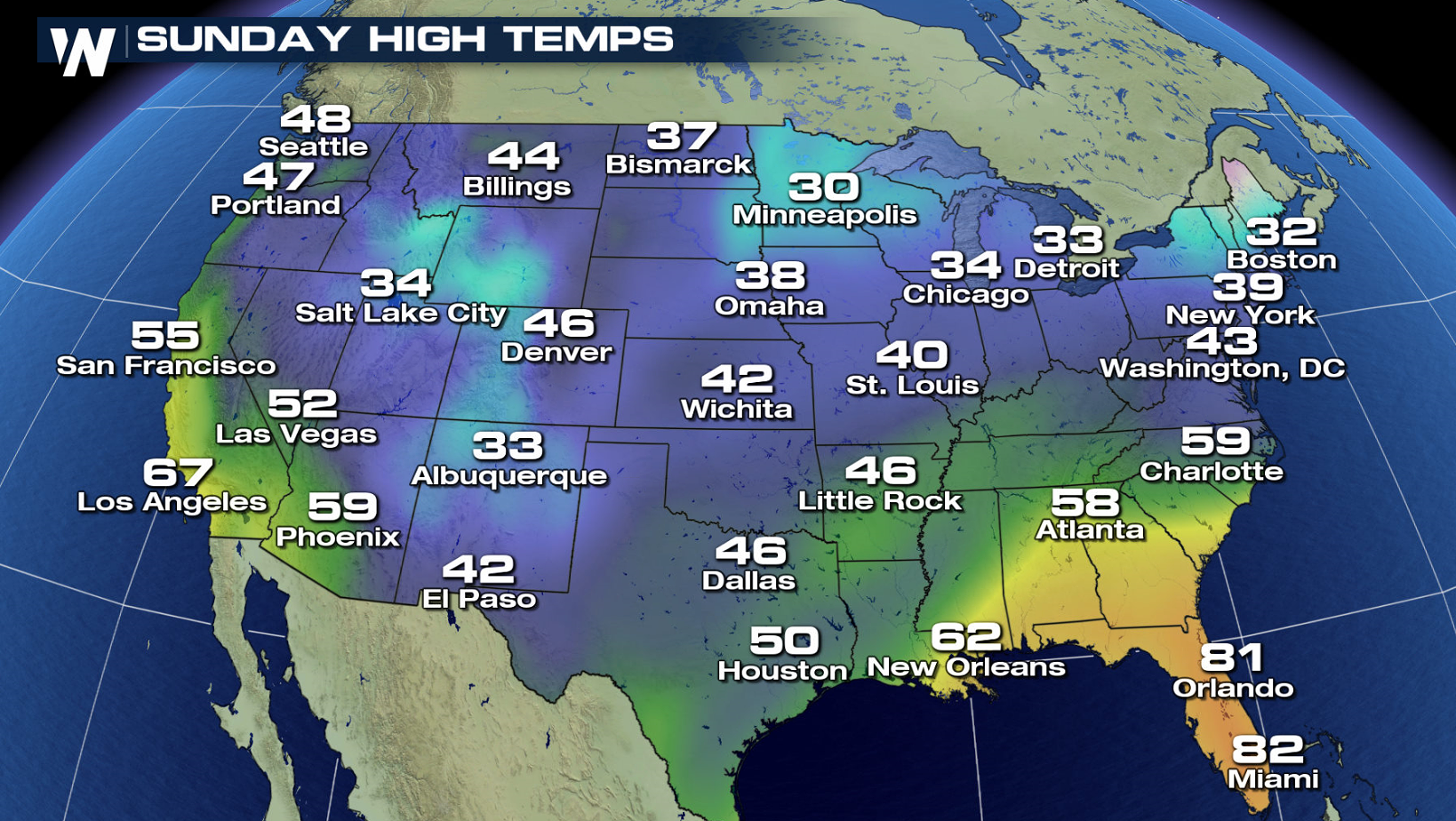 Much quieter weather is expected again over most of the nation Sunday and temperatures will start to rebound.
Monday, December 31st
Much quieter weather is expected again over most of the nation Sunday and temperatures will start to rebound.
Monday, December 31st
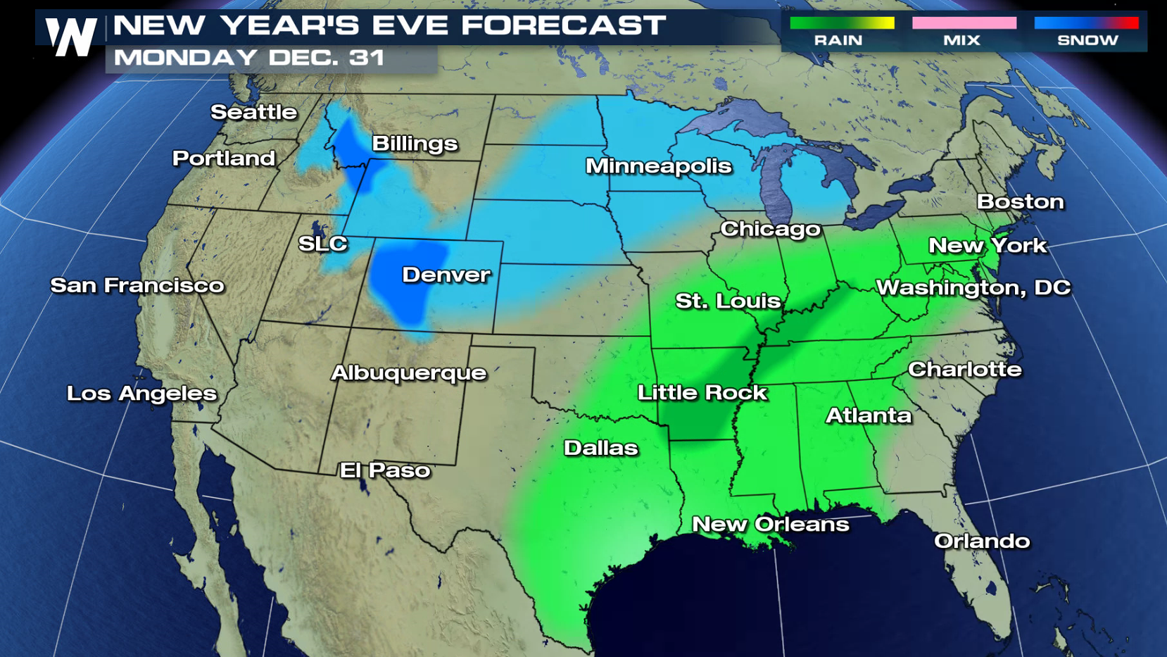
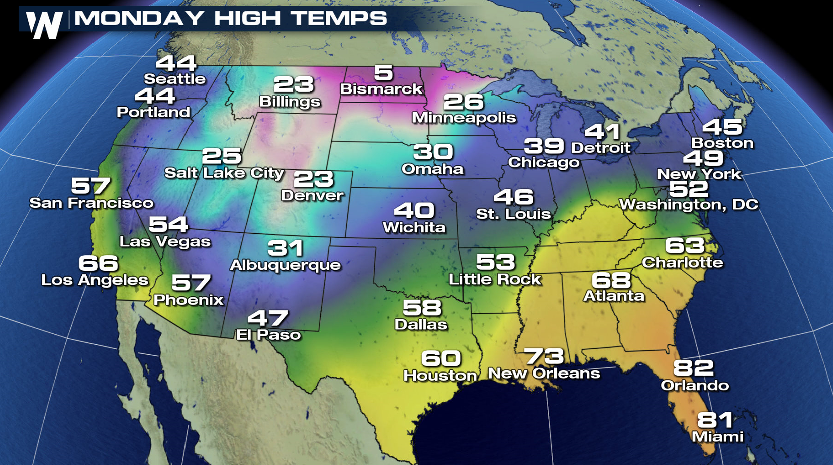 A low pressure center moving through the southern Plains will bring a good chance for showers and thunderstorms to the middle of the nation. Colder readings will begin to filter across the North and West with areas of snow.
Tuesday, January 1st:
A low pressure center moving through the southern Plains will bring a good chance for showers and thunderstorms to the middle of the nation. Colder readings will begin to filter across the North and West with areas of snow.
Tuesday, January 1st:
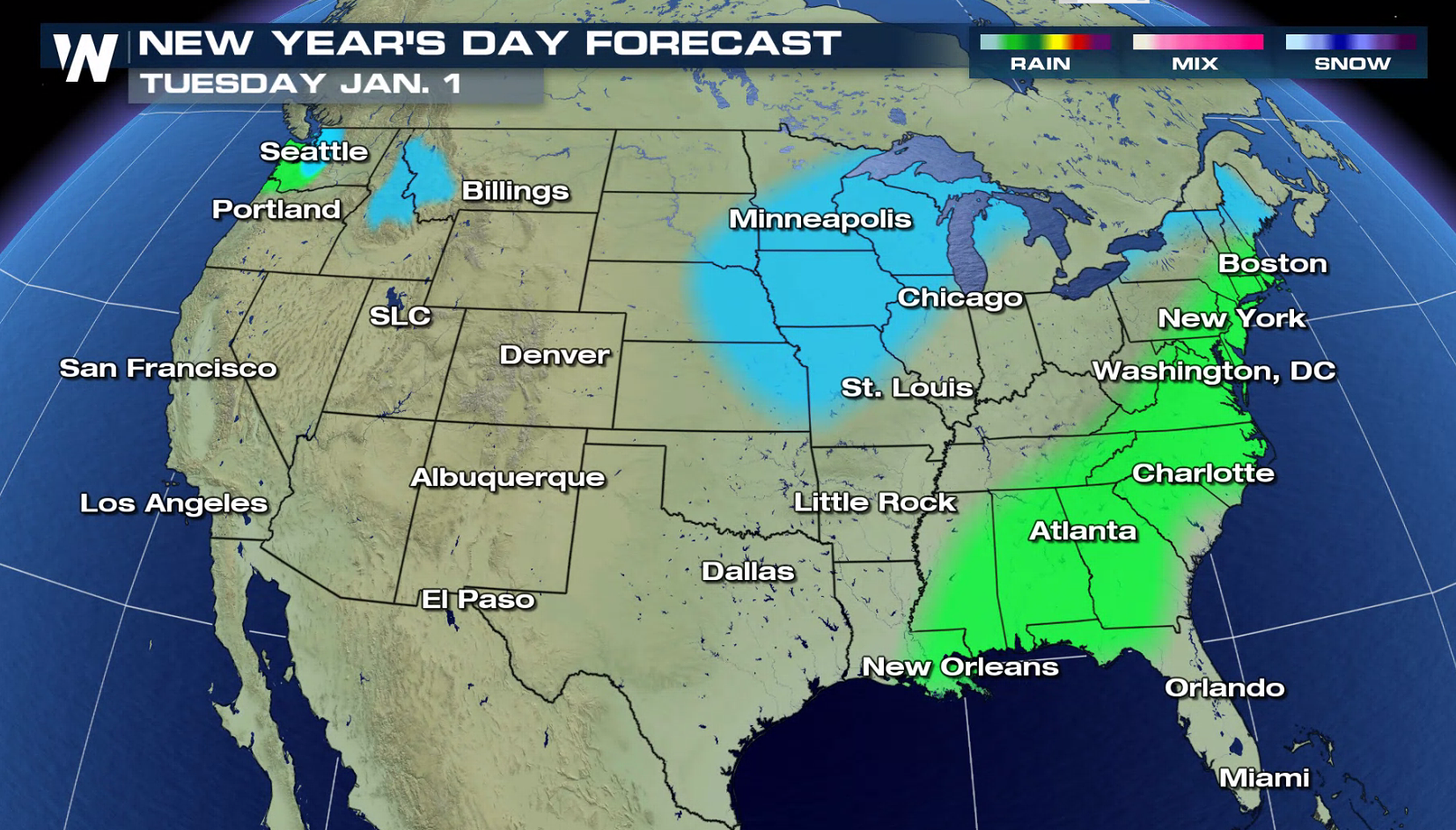
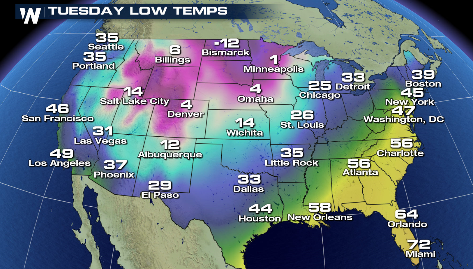 As we look into the New Year, snow will move across the Great Lakes with rain from the Middle Atlantic into the Southeast. Much colder temperatures will be felt from the northern Plains into the West.
Stay with WeatherNation for developments and details regarding the upcoming forecast.
For WeatherNation, Meteorologist Steve Glazier
As we look into the New Year, snow will move across the Great Lakes with rain from the Middle Atlantic into the Southeast. Much colder temperatures will be felt from the northern Plains into the West.
Stay with WeatherNation for developments and details regarding the upcoming forecast.
For WeatherNation, Meteorologist Steve Glazier
A winter storm will exit the northern Great Lakes today (Friday) but still produce snow back through the Upper Midwest. The snow from the previous day will still be left on the ground and blowing around places such as North and South Dakota, Nebraska and Minnesota! Heavy rain will stream from the Middle Atlantic to the Southeast with flooding possible. Heavy snow is possible in the Southwest, especially in New Mexico.
Here's how it looks on Saturday, the 29th of December:
On Saturday, the weather should calm quite a bit. We'll have some cold air sticking around to ensure the fresh snow doesn't melt. Overall compared to Wednesday, Thursday and Friday...Saturday looks pretty decent.
Sunday, December 30:
Much quieter weather is expected again over most of the nation Sunday and temperatures will start to rebound.
Monday, December 31st
A low pressure center moving through the southern Plains will bring a good chance for showers and thunderstorms to the middle of the nation. Colder readings will begin to filter across the North and West with areas of snow.
Tuesday, January 1st:
As we look into the New Year, snow will move across the Great Lakes with rain from the Middle Atlantic into the Southeast. Much colder temperatures will be felt from the northern Plains into the West.
Stay with WeatherNation for developments and details regarding the upcoming forecast.
For WeatherNation, Meteorologist Steve GlazierAll Weather News
More
Fronts Continue To Spark Severe Weather Across the Plains
A cold front that brought record lows to the
18 Jul 2025 10:40 PM

Extreme Heat Impacts for the East Coast & South
Extreme heat continues to impact several area
18 Jul 2025 10:05 PM

Flooding Threat Remains Elevated in the East
A cold front pushing through the Eastern Seab
18 Jul 2025 9:10 PM

EF-2 Firenado from the Deer Creek Fire in Utah
A fire tornado was spotted near La Sal, Utah
18 Jul 2025 7:30 AM

Tropical System Brings Flood Risk to the Central Gulf
Time has run out for notable tropical develop
18 Jul 2025 3:05 AM

Heavy Rain, Flooding Threat Returns to Florida
Keep the rain boots handy in Florida - heavy
13 Jul 2025 12:50 PM

Severe Storm Risk Pushes into the Great Lakes, Ohio Valley
Friday was another busy day with severe weath
12 Jul 2025 8:00 PM