Hurricane-Force Storm In North Pacific Ocean

Special Stories
31 Dec 2021 6:21 AM
An incredibly-strong storm system in the Northern Pacific Ocean is making history as one of the strongest to plow through this part of the world in modern records!
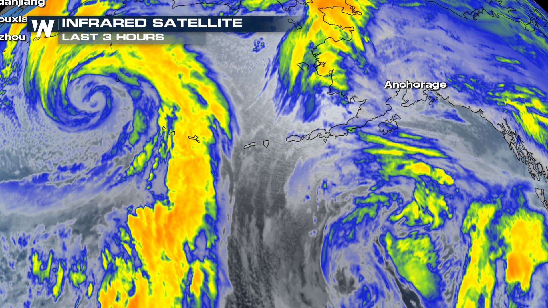 The infrared satellite picture on Thursday morning, December 31st showed the intense swirl (left) of the strong Pacific storm.
The storm, pictured left in the image above, had an intense swirl as seen by infrared satellite on Thursday morning, New Year's Eve. The wrapped up "comma shape" indicated this storm was in its mature stage, with a falling low pressure.
https://twitter.com/NWSOPC/status/1344676414805606401
As of Thursday morning, the central pressure had dropped to 921 millibars. For reference, Hurricane Eta dropped to a pressure of 927 millibars on November 2nd while the storm was about 50 miles east of Nicaragua. At that time, Eta had maximum sustained winds of 150 miles per hour! While this current storm system in the North Pacific Ocean is completely different, it is still producing hurricane-force wind across the open sea.
https://twitter.com/NWSOPC/status/1344674595769466883
According to the Ocean Prediction Center, the storm had reached a maximum (estimated) intensity of 95 knots. Converting that to miles per hour, that means the storm peaked with winds around 105-110 mph! Fortunately, the storm is over the open North Pacific Ocean and will mainly affect the Aleutian Islands of Alaska.
https://twitter.com/NWSAnchorage/status/1344082444354428928
According to the National Weather Service office in Anchorage, Alaska this storm is the strongest area of low pressure to hit the Bering Sea since 2014! The National Weather Service office in Fairbanks, Alaska says this storm may even be the strongest to ever hit the area!
https://twitter.com/NWSFairbanks/status/1344559032997089280
If this storm system becomes stronger and the central pressure drops further, we'll let you know! What a way to end 2020!
The infrared satellite picture on Thursday morning, December 31st showed the intense swirl (left) of the strong Pacific storm.
The storm, pictured left in the image above, had an intense swirl as seen by infrared satellite on Thursday morning, New Year's Eve. The wrapped up "comma shape" indicated this storm was in its mature stage, with a falling low pressure.
https://twitter.com/NWSOPC/status/1344676414805606401
As of Thursday morning, the central pressure had dropped to 921 millibars. For reference, Hurricane Eta dropped to a pressure of 927 millibars on November 2nd while the storm was about 50 miles east of Nicaragua. At that time, Eta had maximum sustained winds of 150 miles per hour! While this current storm system in the North Pacific Ocean is completely different, it is still producing hurricane-force wind across the open sea.
https://twitter.com/NWSOPC/status/1344674595769466883
According to the Ocean Prediction Center, the storm had reached a maximum (estimated) intensity of 95 knots. Converting that to miles per hour, that means the storm peaked with winds around 105-110 mph! Fortunately, the storm is over the open North Pacific Ocean and will mainly affect the Aleutian Islands of Alaska.
https://twitter.com/NWSAnchorage/status/1344082444354428928
According to the National Weather Service office in Anchorage, Alaska this storm is the strongest area of low pressure to hit the Bering Sea since 2014! The National Weather Service office in Fairbanks, Alaska says this storm may even be the strongest to ever hit the area!
https://twitter.com/NWSFairbanks/status/1344559032997089280
If this storm system becomes stronger and the central pressure drops further, we'll let you know! What a way to end 2020!All Weather News
More
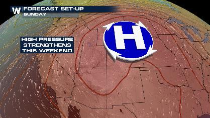
Stormy Pattern Ahead for the Plains and Midwest
Severe weather is in the forecast across the
9 Jul 2026 1:15 AM

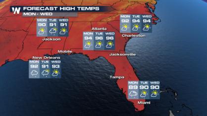
Saharan Dust, Excessive Heat Impact the Southeast
Hazy skies will be hovering over portions of
9 Jul 2026 1:15 AM
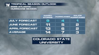
Colorado State University Scales Back 2026 Atlantic Hurricane Season Forecast
Colorado State University researchers have lo
9 Jul 2026 1:10 AM

Babylon Fire in UT Surpasses 100,000 Acres, CO Fires Continue to Grow
The Aspen Acres fire continues to burn in Sou
8 Jul 2026 2:10 PM

After Flooding in the NE, Strong Storms Stick Around
NEW JERSEY - Heavy rainfall rates of around 2
8 Jul 2026 2:05 PM