Hurricane Hector to Pass South of Hawaii Wednesday
Special Stories
8 Aug 2018 7:01 AM
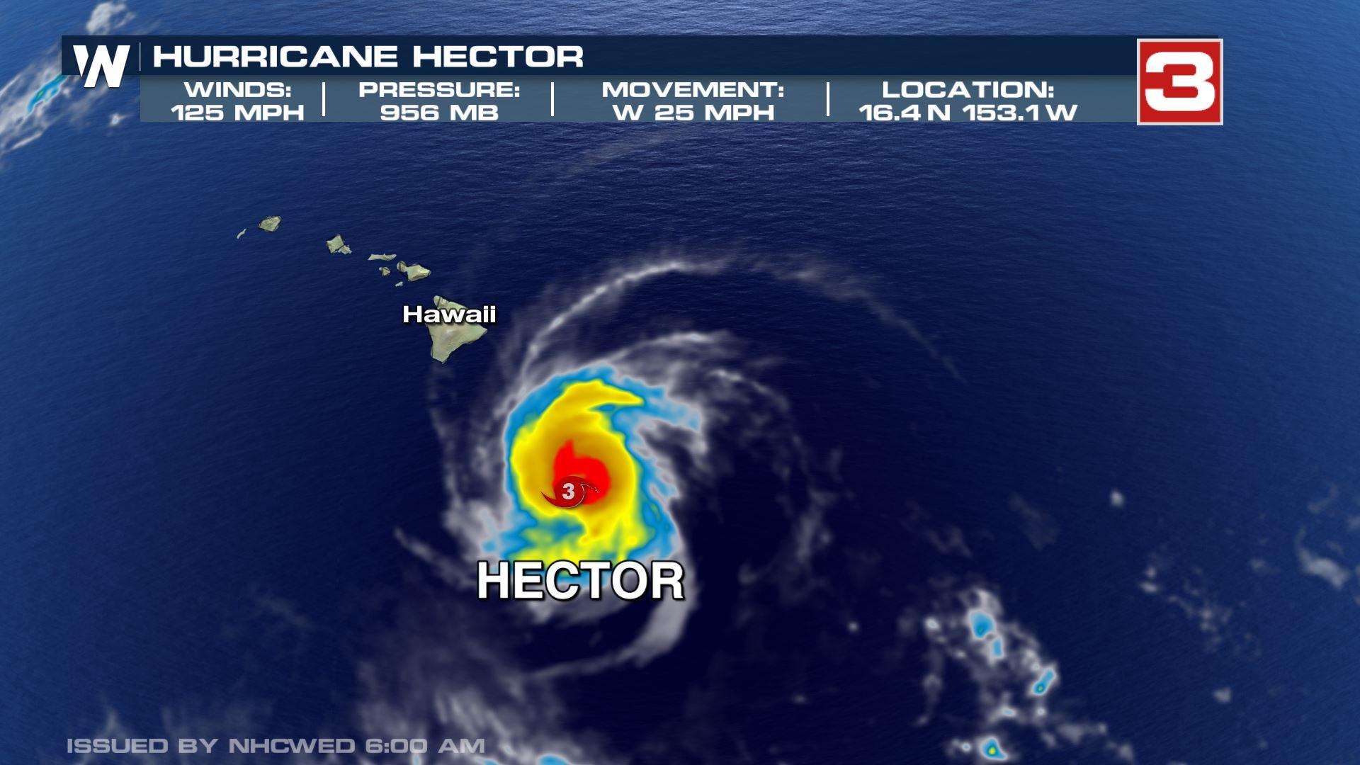
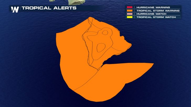
Hurricane Hector, a Cat-3 hurricane as of 6:45 AM Wednesday, is forecasted to track south of Hawaii's Big Island Wednesday. As of 6:45 AM winds were sustained at 125 MPH and it was moving west at 25 mph. The storm is forecasted to remain a Cat-3 hurricane and move south of the big island, bringing strong wind and storm surge to the southern portion of the island.
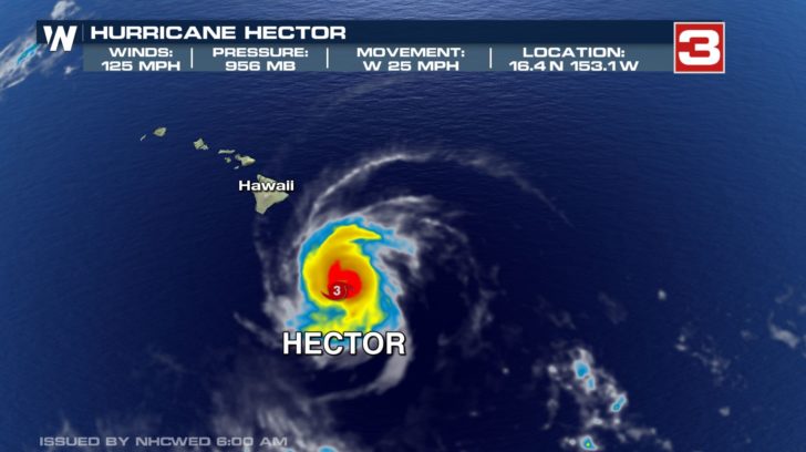
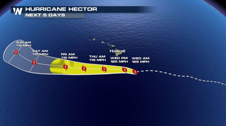
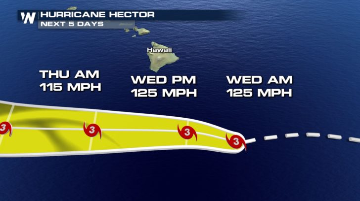 While Hector won't make a direct hit, the Big Island will still feel an impact from the storm Wednesday. Tropical storm warnings are out through the day. Tropical storm force winds, 39 to 73 mph, will impact the island Wednesday into Thursday with calmer conditions returning Friday.
 For Weather Nation: Meteorologist Emily Roehler
While Hector won't make a direct hit, the Big Island will still feel an impact from the storm Wednesday. Tropical storm warnings are out through the day. Tropical storm force winds, 39 to 73 mph, will impact the island Wednesday into Thursday with calmer conditions returning Friday.
For Weather Nation: Meteorologist Emily RoehlerAll Weather News
More
Fronts Continue To Spark Severe Weather Across the Plains
A cold front that brought record lows to the
18 Jul 2025 10:40 PM

Extreme Heat Impacts for the East Coast & South
Extreme heat continues to impact several area
18 Jul 2025 10:05 PM

Flooding Threat Remains Elevated in the East
A cold front pushing through the Eastern Seab
18 Jul 2025 9:10 PM

EF-2 Firenado from the Deer Creek Fire in Utah
A fire tornado was spotted near La Sal, Utah
18 Jul 2025 7:30 AM

Tropical System Brings Flood Risk to the Central Gulf
Time has run out for notable tropical develop
18 Jul 2025 3:05 AM

Heavy Rain, Flooding Threat Returns to Florida
Keep the rain boots handy in Florida - heavy
13 Jul 2025 12:50 PM

Severe Storm Risk Pushes into the Great Lakes, Ohio Valley
Friday was another busy day with severe weath
12 Jul 2025 8:00 PM