Hurricane Michael Upgraded to a Category 5 at Time of Landfall
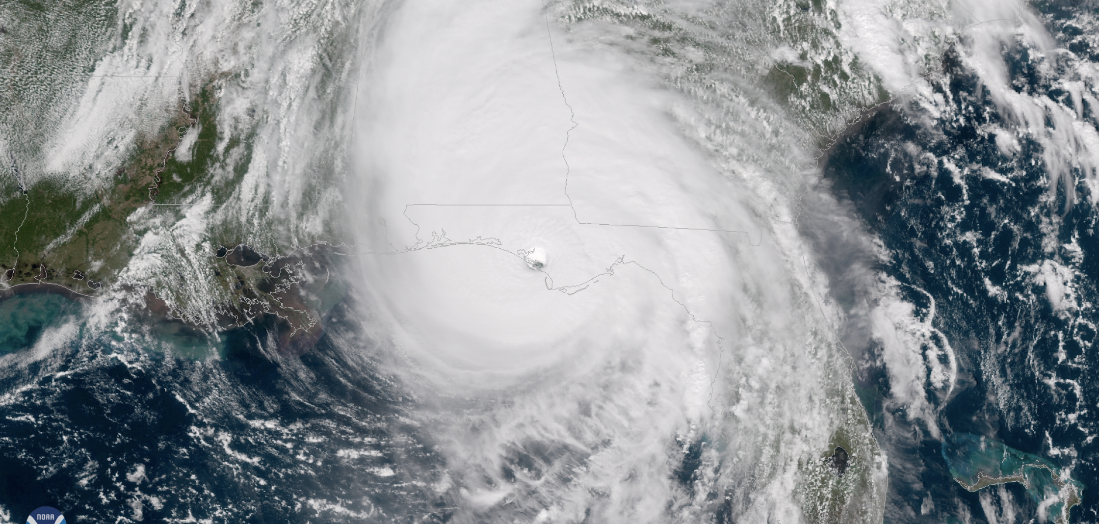
Michael is the first hurricane to make landfall in the United States as a category 5 since Hurricane Andrew in 1992, and only the fourth on record. The others are the Labor Day Hurricane in 1935 and Hurricane Camille in 1969. Michael is also the strongest hurricane landfall on record in the Florida Panhandle and only the second known category 5 landfall on the northern Gulf Coast.

[GOES-East captured this image of Hurricane Michael as it came ashore near Mexico Beach, Florida on Oct. 10, 2018. According to the National Hurricane Center, Michael intensified before landfall with maximum sustained winds of 160 mph, heavy rainfall, and deadly storm surge. From NOAA.]
The real-time operational intensity estimate was 135 knots (155 mph). The final best track intensity estimate of 140 knots (160 mph) was determined by a review of the available aircraft winds, surface winds, surface pressures, satellite intensity estimates and Doppler radar velocities – including data and analyses that were not available in real time. The 5 knot (5 mph) increase in the estimated maximum sustained wind speed from the operational estimate is small and well within the normal range of uncertainty.
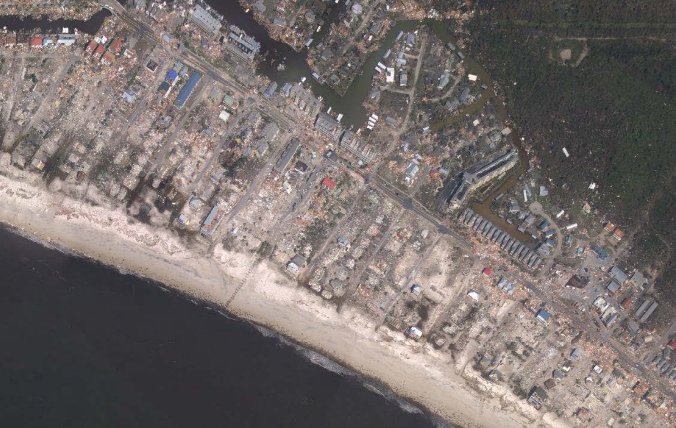
Category 5 winds were likely experienced over a very small area at and near the coast, and the change in estimated wind speeds is of little practical significance in terms of the impacts associated with the storm. Michael produced devastating winds and storm surge and was directly responsible for 16 deaths and about $25 billion in damage in the United States. Before hitting the United States, the cyclone brought hurricane-force winds to the western tip of Cuba when it was a category 2 Hurricane. [Aerial image of the devastation caused by Michael in Mexico Beach, Florida. Image courtesy of the NOAA National Geodetic Survey and the NWS Weather Forecast Office in Tallahassee, Florida.]
Along with wind speed, atmospheric pressure is a measure of storm intensity. In general, the lower a storm’s central pressure, the higher the winds. Michael’s central pressure of 919 millibars (mb) at landfall is the third lowest on record for a landfalling U. S. hurricane since reliable records began in 1900, trailing only the Labor Day Hurricane of 1935 (892 mb) and Hurricane Camille of 1969 (900 mb).
Edited for WeatherNation by Meteorologist Mace Michaels