Hurricane Season Around the Corner: Eyes on the Atlantic
Atlantic Hurricane Season officially begins on June 1st, but there is an area of interest that the National Hurricane Center [NHC] is already monitoring. This has a low chance for development in the next 7 days but there is still the potential for showers and thunderstorms in the western Atlantic. Minor development is possible through the weekend as this low-pressure system forms.
Forecasts for the 2024 Atlantic Hurricane Season call for an above-average number of storms thanks to warmer-than-average sea surface temperatures and a transition to La Nina conditions just in time for the peak of the season in September. The first name on the list is "Alberto" if this area of low pressure manages to strengthen to tropical storm force (sustained winds greater than 39 mph).
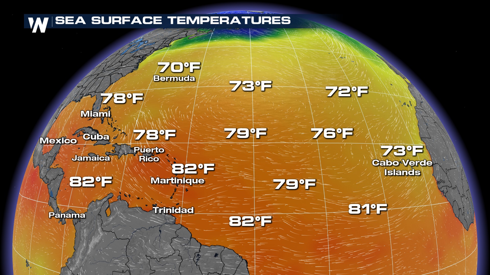
As mentioned above, warmer-than-average sea surface temperatures will aid in storm development. We are roughly two months ahead of schedule according to experts when it comes to sea surface temperatures.
Sea surface temperatures are in the 70s near Bermuda and in the low 80s in the Caribbean. This is already feeling like bathwater in many locations in the tropical Atlantic.
 Stay with WeatherNation for the latest in the Tropical Season!