Ice likely across parts of the Southeast and Mid-Atlantic
Special Stories
16 Dec 2020 9:31 AM
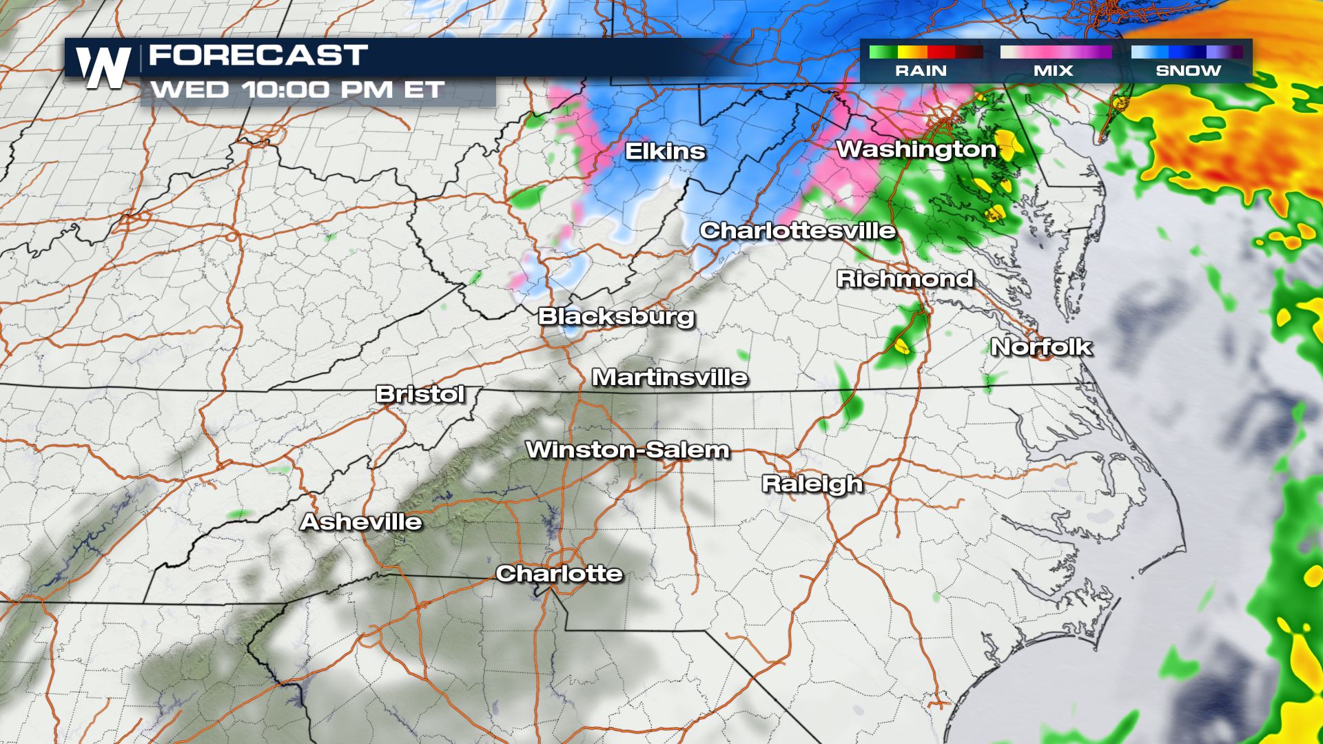
Light ice accumulations are expected across parts of the Southeast and Mid-Atlantic Wednesday as a low pressure system strengthens and moves into the Northeast.
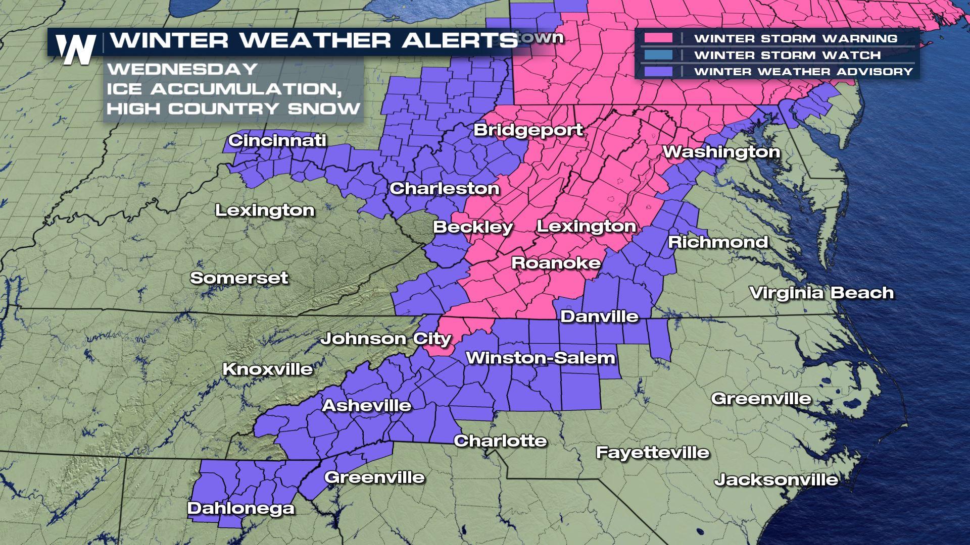
Winter weather alerts are in place from north Georgia through Virginia and Maryland and west into parts of Indiana, Kentucky and Ohio.
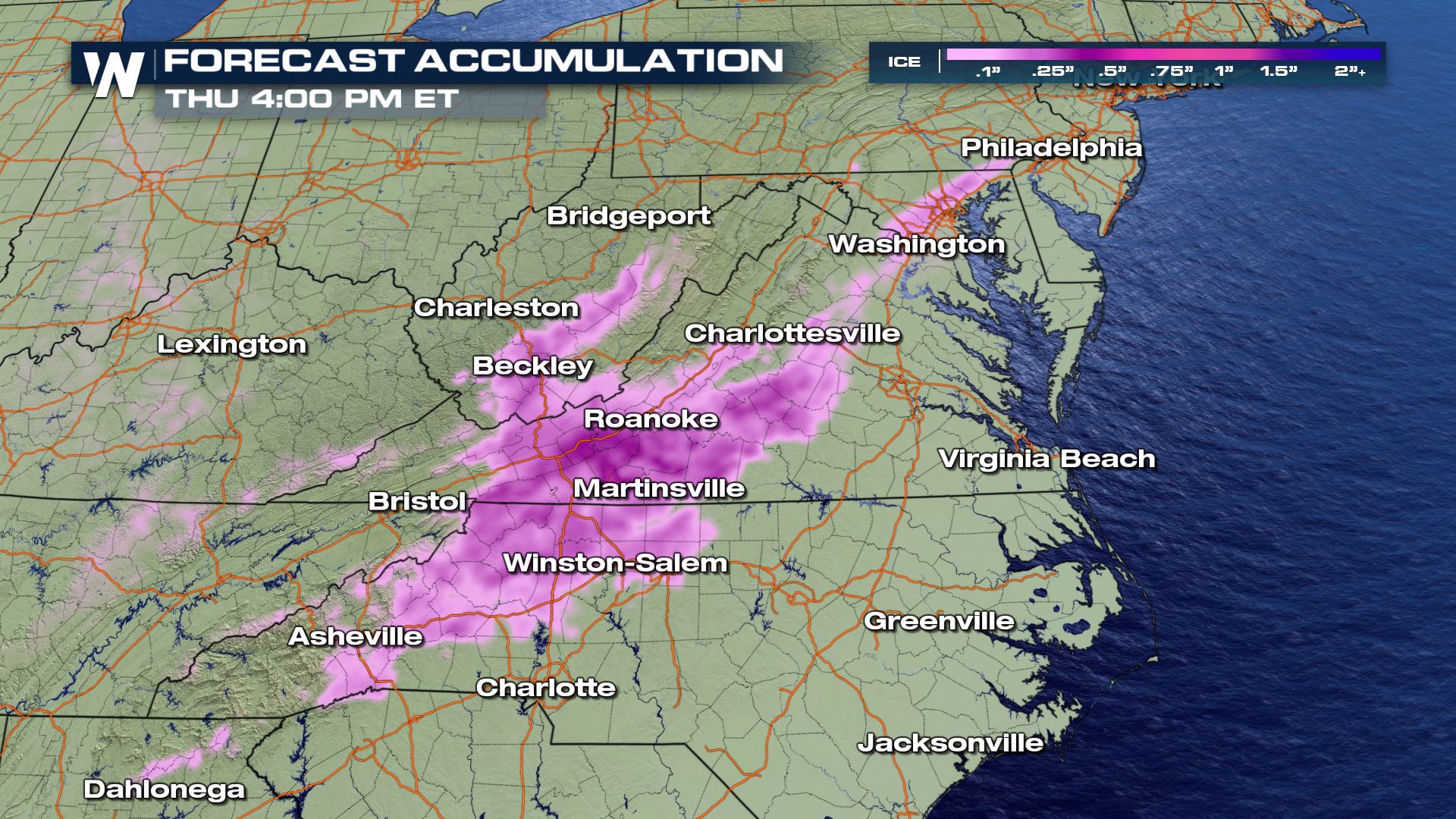
 Ice accumulations are expected to be around 0.1" from Georgia through the mountains of North Carolina. This comes from a mix of freezing rain and sleet. A glaze of ice building up on bridges, overpasses and secondary roads could make for dangerous driving conditions through the rest of the day. Snow could mix in as well with totals in areas above 2000 feet around 1-2".
Ice is expected to be the thickest in the mountains of North Carolina, Virginia and West Virginia where Winter Storm Warnings are in place. These spots could pick up more than 0.25" of ice and 2-4" of snow. Thick ice glazing could bring down trees and power lines in addition to sticking on the road and making driving very dangerous.
Ice accumulations are expected to be around 0.1" from Georgia through the mountains of North Carolina. This comes from a mix of freezing rain and sleet. A glaze of ice building up on bridges, overpasses and secondary roads could make for dangerous driving conditions through the rest of the day. Snow could mix in as well with totals in areas above 2000 feet around 1-2".
Ice is expected to be the thickest in the mountains of North Carolina, Virginia and West Virginia where Winter Storm Warnings are in place. These spots could pick up more than 0.25" of ice and 2-4" of snow. Thick ice glazing could bring down trees and power lines in addition to sticking on the road and making driving very dangerous.
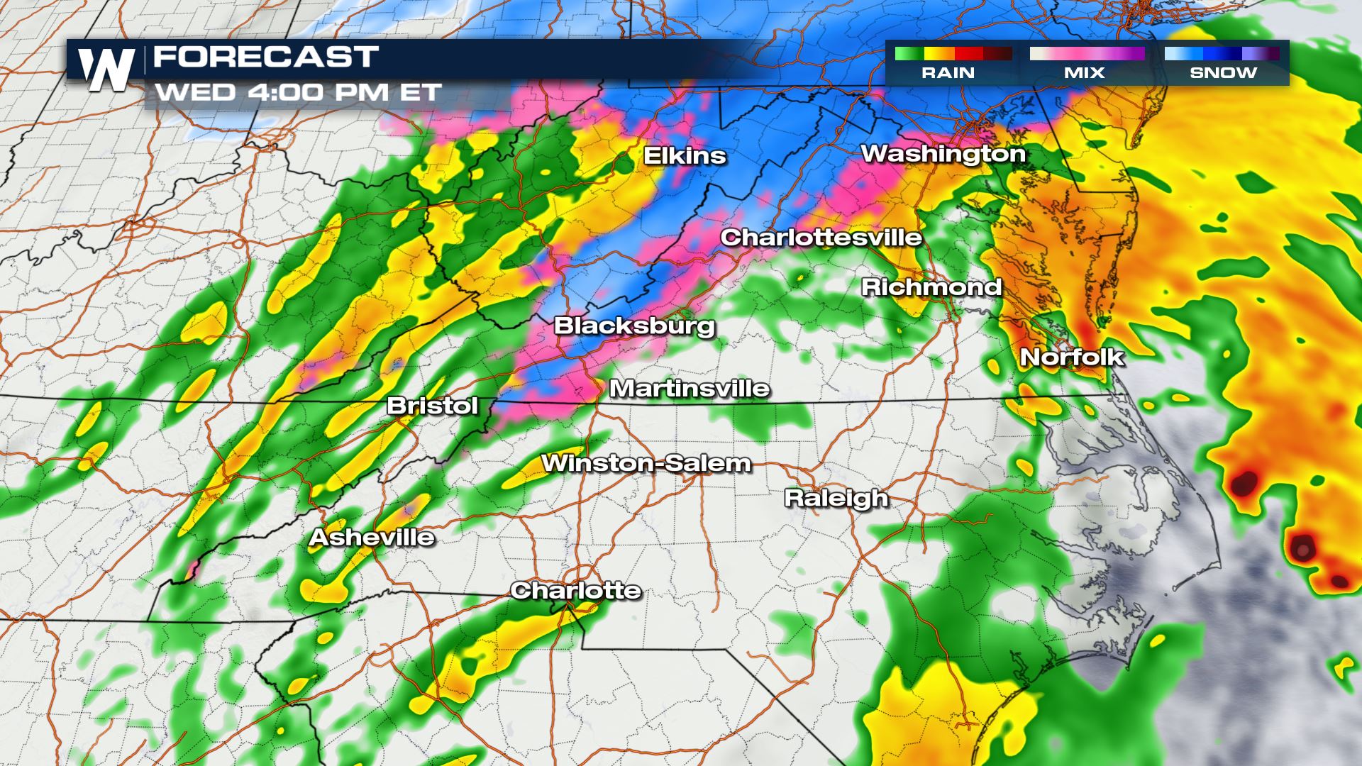
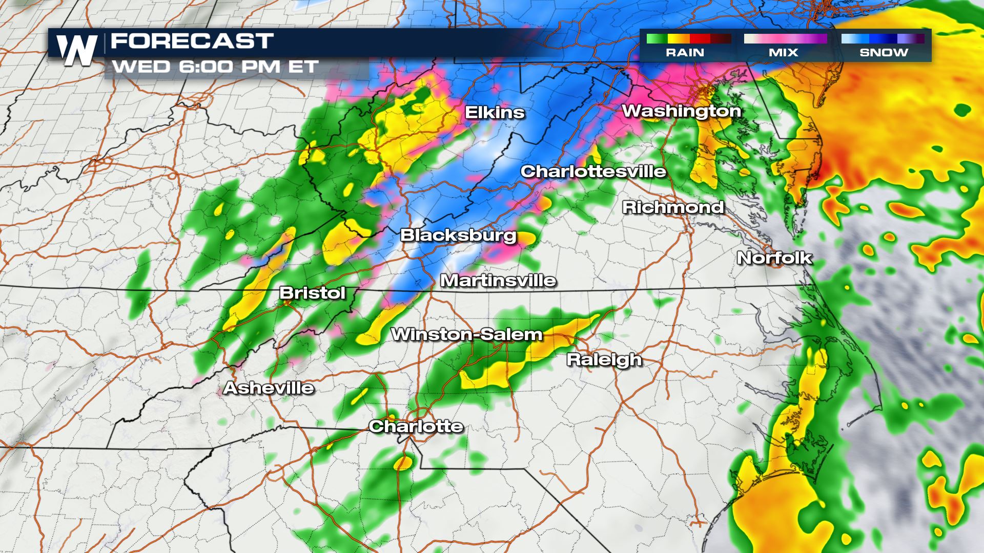
 Any sleet or freezing rain should be wrapping up across Georgia and South Carolina by early afternoon. Freezing rain, sleet and snow will continue through parts of North Carolina, Virginia and West Virginia throughout the afternoon and evening. While most of the moisture will clear out by midnight, some wrap around moisture on the back side of the low will bring occasional snow showers to the mountains of West Virginia overnight. Snow totals there could top
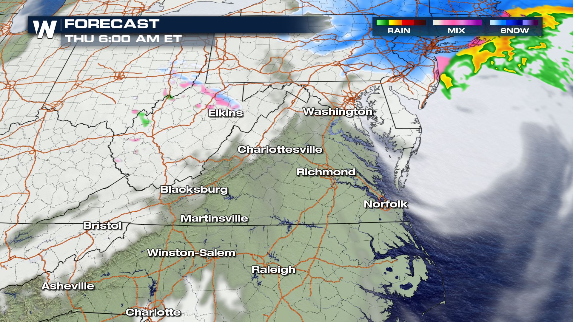 Stay with WeatherNation for all the updates on this system, including the timing for heavy snow totals in the Northeast.
Ice accumulations are expected to be around 0.1" from Georgia through the mountains of North Carolina. This comes from a mix of freezing rain and sleet. A glaze of ice building up on bridges, overpasses and secondary roads could make for dangerous driving conditions through the rest of the day. Snow could mix in as well with totals in areas above 2000 feet around 1-2".
Ice is expected to be the thickest in the mountains of North Carolina, Virginia and West Virginia where Winter Storm Warnings are in place. These spots could pick up more than 0.25" of ice and 2-4" of snow. Thick ice glazing could bring down trees and power lines in addition to sticking on the road and making driving very dangerous.
Any sleet or freezing rain should be wrapping up across Georgia and South Carolina by early afternoon. Freezing rain, sleet and snow will continue through parts of North Carolina, Virginia and West Virginia throughout the afternoon and evening. While most of the moisture will clear out by midnight, some wrap around moisture on the back side of the low will bring occasional snow showers to the mountains of West Virginia overnight. Snow totals there could top
Stay with WeatherNation for all the updates on this system, including the timing for heavy snow totals in the Northeast.All Weather News
More
Fronts Continue To Spark Severe Weather Across the Plains
A cold front that brought record lows to the
18 Jul 2025 10:40 PM

Extreme Heat Impacts for the East Coast & South
Extreme heat continues to impact several area
18 Jul 2025 10:05 PM

Flooding Threat Remains Elevated in the East
A cold front pushing through the Eastern Seab
18 Jul 2025 9:10 PM

EF-2 Firenado from the Deer Creek Fire in Utah
A fire tornado was spotted near La Sal, Utah
18 Jul 2025 7:30 AM

Tropical System Brings Flood Risk to the Central Gulf
Time has run out for notable tropical develop
18 Jul 2025 3:05 AM

Heavy Rain, Flooding Threat Returns to Florida
Keep the rain boots handy in Florida - heavy
13 Jul 2025 12:50 PM

Severe Storm Risk Pushes into the Great Lakes, Ohio Valley
Friday was another busy day with severe weath
12 Jul 2025 8:00 PM