Imelda's Flood Threat Now Moves North

Special Stories
21 Sep 2019 4:50 AM
After Imelda dropped torrential rainfall across Texas and Louisiana, the flood threat now moves north to the Midwest United States.
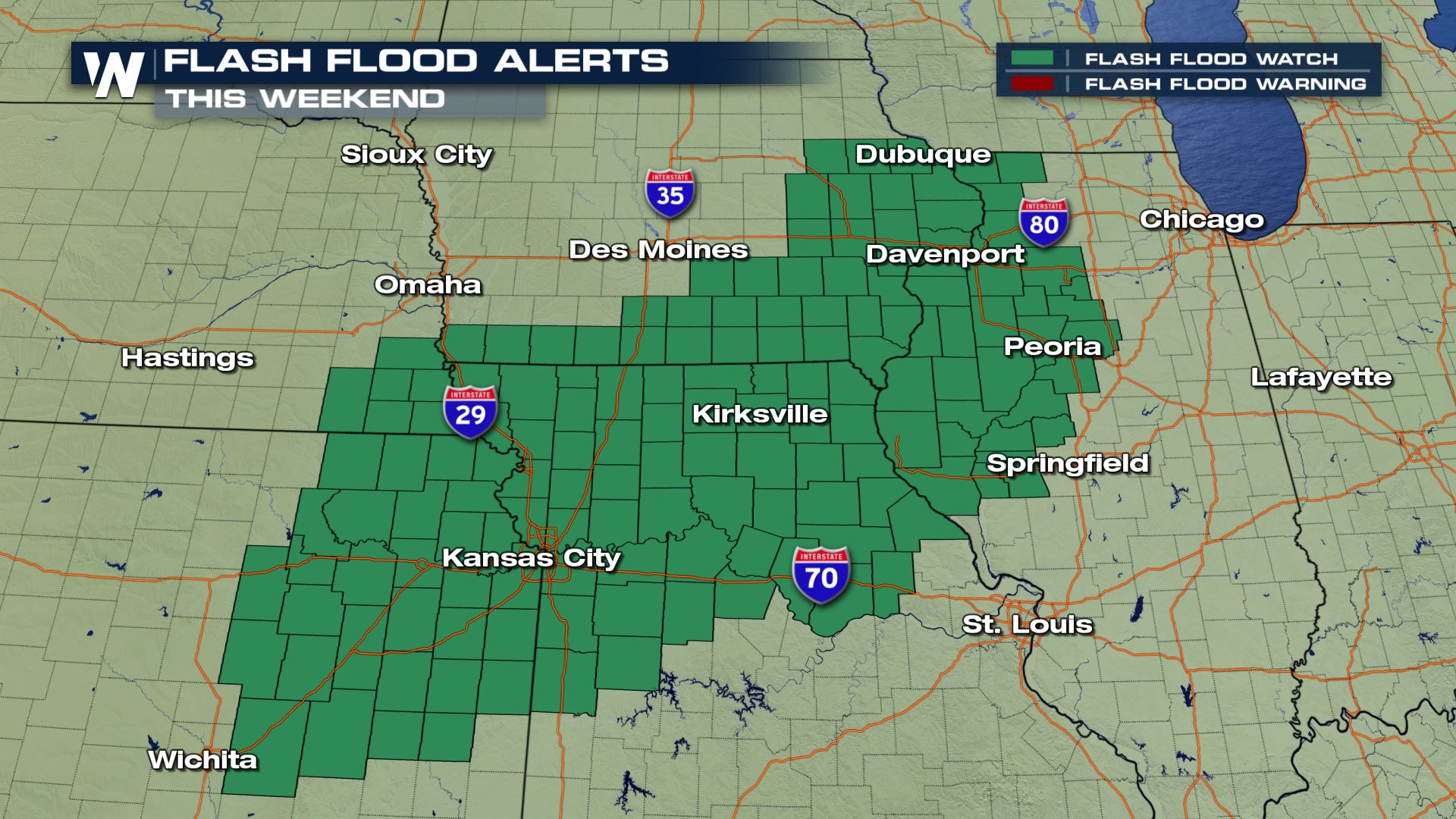
 Flash flood watches have been issued for parts of Kansas, Missouri, Nebraska, Illinois and Iowa in anticipation of the heavy weekend rain. A flash flood watch means there is a heightened potential for flash flooding in the near future and you should be prepared to take action, if needed. On the other hand, a flash flood warning means that high water has already occurred or will shortly and you need to take action now.
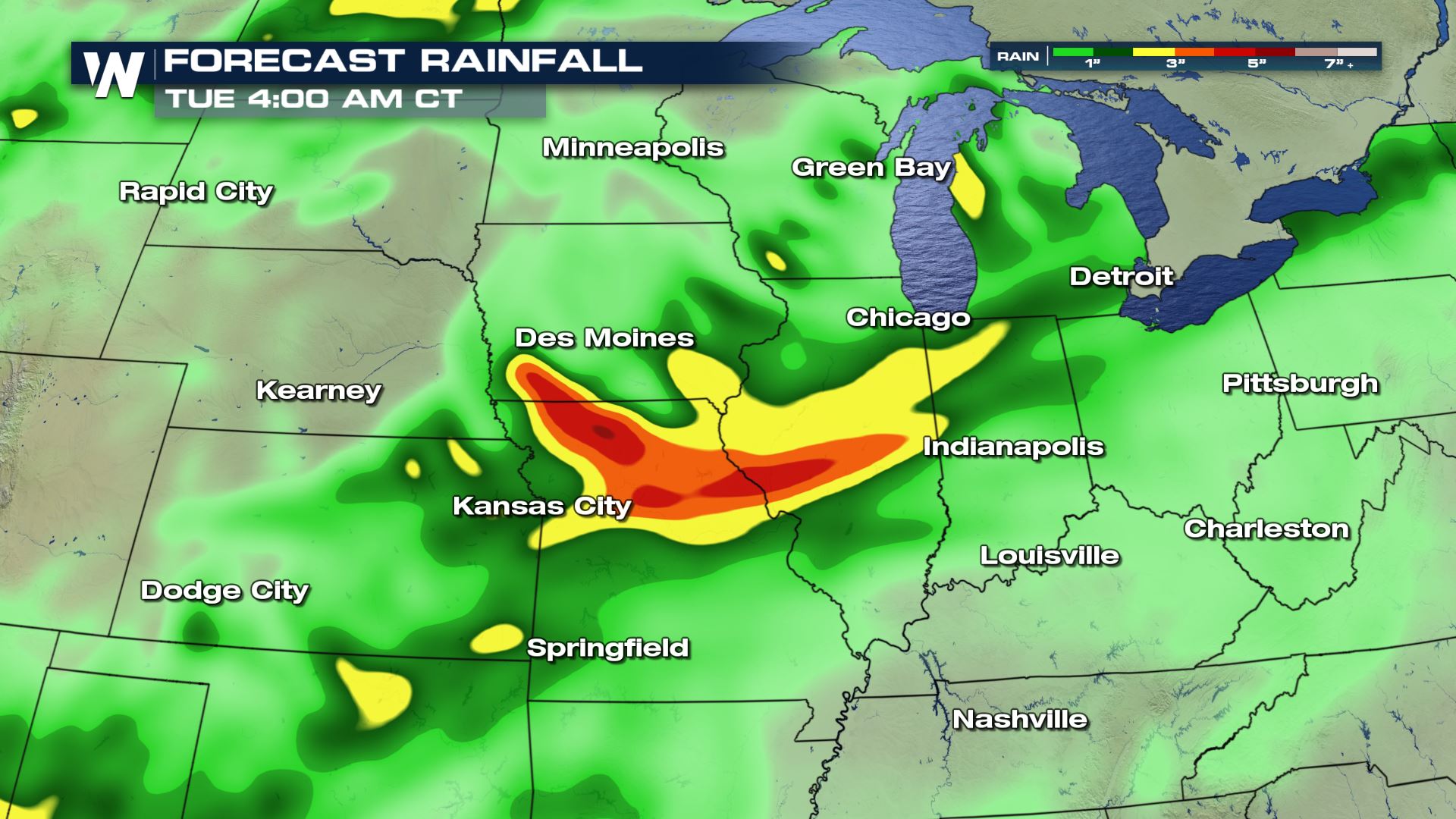
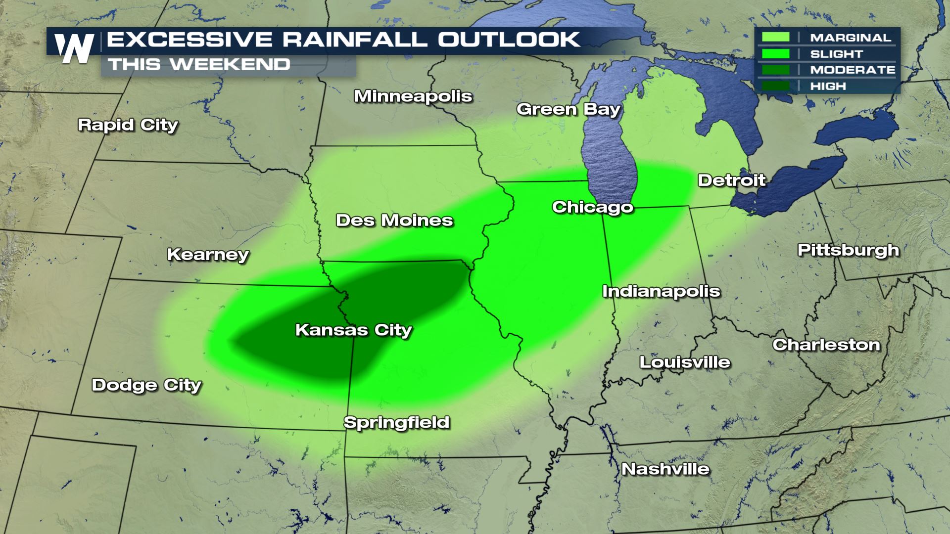
 The heaviest rain will occur between Saturday night and through the day Sunday. Total rainfall will be in the 3 to 6 inch range, however it's not just about the overall amounts. This is tropical moisture that will come down very heavily during a short amount of time. We're more concerned about rainfall rates, of which will reach 1-2 inches per hour at times this weekend. That's when the fastest flooding occurs (flash flooding).
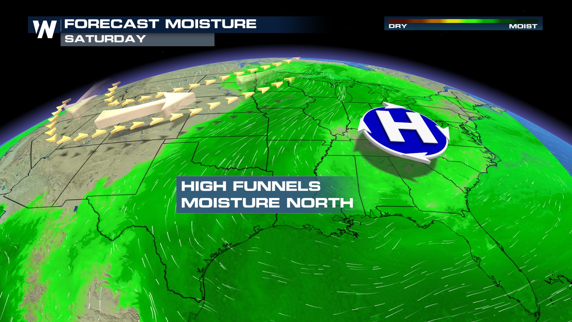
 This weekend's rainfall will be associated with the remnant moisture from Tropical Storm Imelda. The storm is no longer a tropical entity and has dissipated, but the moisture it carried inland is still hanging around. The moisture will meet up with a slow-moving cold front and dump out of the sky via downpours this weekend.
 The conditions should start to clear Monday, but not before areas see high water. Stay weather aware and weather ready this weekend!
Flash flood watches have been issued for parts of Kansas, Missouri, Nebraska, Illinois and Iowa in anticipation of the heavy weekend rain. A flash flood watch means there is a heightened potential for flash flooding in the near future and you should be prepared to take action, if needed. On the other hand, a flash flood warning means that high water has already occurred or will shortly and you need to take action now.
The heaviest rain will occur between Saturday night and through the day Sunday. Total rainfall will be in the 3 to 6 inch range, however it's not just about the overall amounts. This is tropical moisture that will come down very heavily during a short amount of time. We're more concerned about rainfall rates, of which will reach 1-2 inches per hour at times this weekend. That's when the fastest flooding occurs (flash flooding).
This weekend's rainfall will be associated with the remnant moisture from Tropical Storm Imelda. The storm is no longer a tropical entity and has dissipated, but the moisture it carried inland is still hanging around. The moisture will meet up with a slow-moving cold front and dump out of the sky via downpours this weekend.
The conditions should start to clear Monday, but not before areas see high water. Stay weather aware and weather ready this weekend!
All Weather News
More
Severe Storms Target the Midwest to the Northeast This Week
Extreme heat will be a big story this week ac
26 Jul 2026 2:30 PM

Tropics: Fausto Heads to Hawaii; Genevieve Rapidly Intensifying
Atlantic BasinBertha has dissipated after mov
26 Jul 2026 2:30 PM

Fire Weather Continues This Weekend
Conditions have been really dry out west. We'
26 Jul 2026 10:40 AM

Heat Wave Grips Central, Western U.S.
Are you over the summer heat yet? The heat al
26 Jul 2026 10:35 AM

Southeast Flood Risk Lingers Near Stalled Front
A stalled boundary over the Southeast will ke
25 Jul 2026 10:55 AM

Another Round of Storms Targets the Northeast
Tuesday brought severe weather again across p
23 Jul 2026 1:15 AM

Another Round of Severe Weather for the Upper Midwest and Great Lakes
The upper-level low train continues to keep t
21 Jul 2026 1:45 AM