Improving Computer Model Forecasts for Hurricanes in the Gulf and Caribbean
Special Stories
22 May 2018 7:37 AM
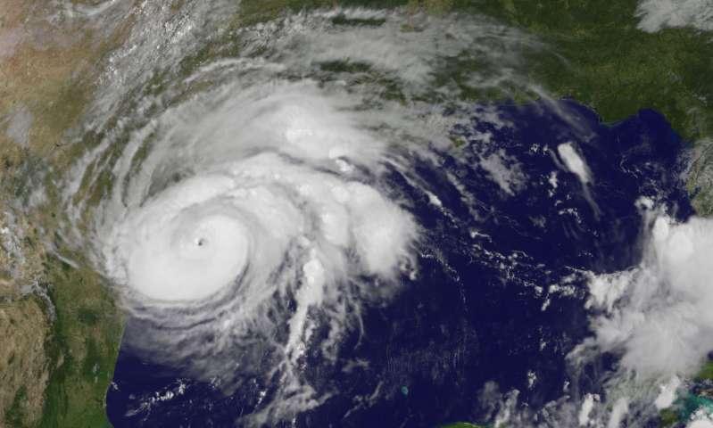
[Hurricane Harvey approaching the Texas coastline on August 25, 2017]
From NOAA
Tropical cyclones that form over the Gulf of Mexico have a high probability of making landfall at the surrounding coastal regions, causing severe property damage and loss of life. Skillful sub-seasonal prediction of tropical cyclone activity is critical for early preparation and reducing damage in this region. In order to have skillful prediction of sub-seasonal tropical cyclone activity, it is important for dynamical models to faithfully capture thunderstorm activity across the tropics and near the equator. This is known as the Intraseasonal Oscillation (ISO, or the Madden-Julian Oscillation). Observing its impact on tropical cyclone activity, such as the frequency of tropical cyclone formation and landfall, can assist in improved model forecasts. It has been established that ISO modulates tropical cyclone activity in the Gulf of Mexico region by affecting the large-scale environment, increasing the likelihood of tropical cyclone genesis when it is in a convectively (thunderstorm influenced) enhanced phase.
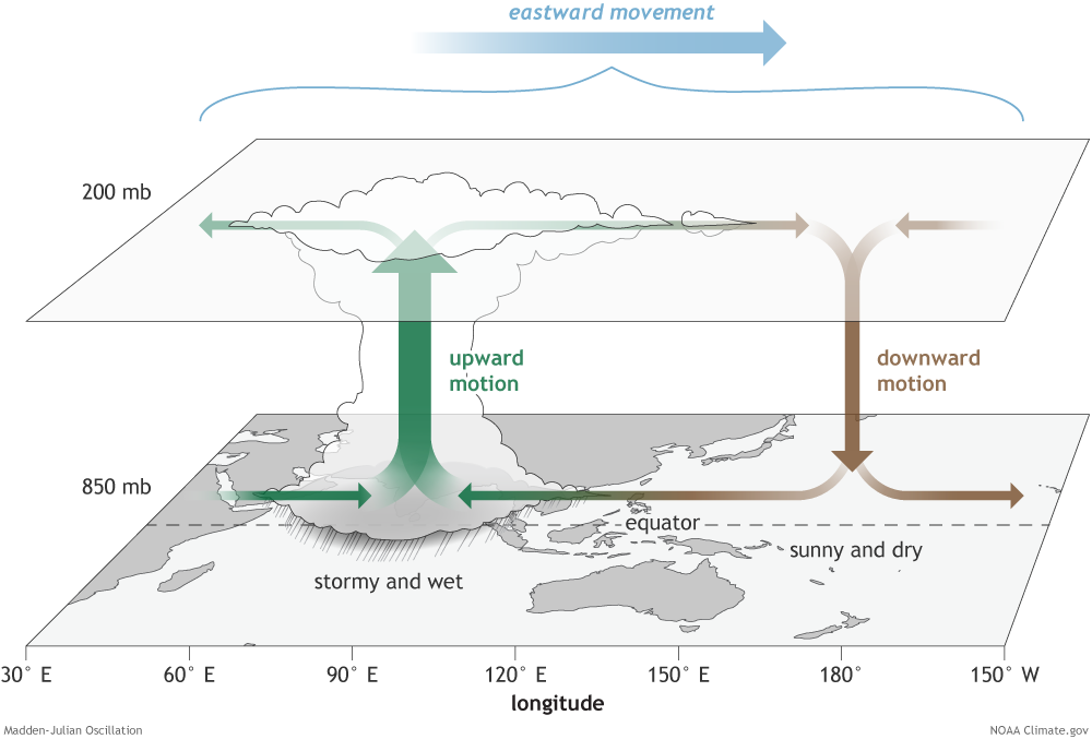 [The surface and upper-atmosphere structure of the MJO for a period when the enhanced convective phase (thunderstorm cloud) is centered across the Indian Ocean and the suppressed convective phase is centered over the west-central Pacific Ocean. Horizontal arrows pointing left represent wind departures from average that are easterly, and arrows pointing right represent wind departures from average that are westerly. The entire system shifts eastward over time, eventually circling the globe and returning to its point of origin. NOAA drawing by Fiona Martin.]
Previous studies have suggested that global models generally have deficiencies in simulating the climatology and the variability of tropical cyclone activity over the Gulf of Mexico region. A new study in the Journal of Geophysical Research, evaluates the performance of Geophysical Fluid Dynamics Labratory's (GFDL) global High Resolution Atmospheric Model (HiRAM) in simulating the modulation of tropical cyclone activity in the Gulf of Mexico and western Caribbean Sea by ISO, based on multi-year retrospective seasonal predictions. The authors demonstrate for the first time that HiRAM faithfully captures the observed influence of ISO on tropical cyclone activity over the region of interest, including the formation of tropical storms and (major) hurricanes, as well as landfalling storms. This is likely because of the realistic representation of the large-scale anomalies associated with boreal summer ISO over the Northeast Pacific in HiRAM, especially the enhanced (reduced) moisture throughout the troposphere during the convectively enhanced (suppressed) phase of ISO.
[The surface and upper-atmosphere structure of the MJO for a period when the enhanced convective phase (thunderstorm cloud) is centered across the Indian Ocean and the suppressed convective phase is centered over the west-central Pacific Ocean. Horizontal arrows pointing left represent wind departures from average that are easterly, and arrows pointing right represent wind departures from average that are westerly. The entire system shifts eastward over time, eventually circling the globe and returning to its point of origin. NOAA drawing by Fiona Martin.]
Previous studies have suggested that global models generally have deficiencies in simulating the climatology and the variability of tropical cyclone activity over the Gulf of Mexico region. A new study in the Journal of Geophysical Research, evaluates the performance of Geophysical Fluid Dynamics Labratory's (GFDL) global High Resolution Atmospheric Model (HiRAM) in simulating the modulation of tropical cyclone activity in the Gulf of Mexico and western Caribbean Sea by ISO, based on multi-year retrospective seasonal predictions. The authors demonstrate for the first time that HiRAM faithfully captures the observed influence of ISO on tropical cyclone activity over the region of interest, including the formation of tropical storms and (major) hurricanes, as well as landfalling storms. This is likely because of the realistic representation of the large-scale anomalies associated with boreal summer ISO over the Northeast Pacific in HiRAM, especially the enhanced (reduced) moisture throughout the troposphere during the convectively enhanced (suppressed) phase of ISO.
 [Tracks of the TCs formed over Gulf of Mexico during the convectively enhanced (a, b) and suppressed (c, d) ISO phases, respectively. Observed tracks are shown in (a, c) and model tracks are shown in (b, d). Blue represents tropical storm intensity and red represents hurricane intensity.]
The successful performance of HiRAM over this region likely results from a combination of the use of relatively high horizontal resolution (~25 km), advanced non-hydrostatic dynamical core (FV3) and upgraded convection parameterizations. This work strongly suggests the potential of HiRAM for the subseasonal prediction of regional tropical cyclone risk.
Edited for WeatherNation by Meteorologist Mace Michaels
[Tracks of the TCs formed over Gulf of Mexico during the convectively enhanced (a, b) and suppressed (c, d) ISO phases, respectively. Observed tracks are shown in (a, c) and model tracks are shown in (b, d). Blue represents tropical storm intensity and red represents hurricane intensity.]
The successful performance of HiRAM over this region likely results from a combination of the use of relatively high horizontal resolution (~25 km), advanced non-hydrostatic dynamical core (FV3) and upgraded convection parameterizations. This work strongly suggests the potential of HiRAM for the subseasonal prediction of regional tropical cyclone risk.
Edited for WeatherNation by Meteorologist Mace Michaels
[The surface and upper-atmosphere structure of the MJO for a period when the enhanced convective phase (thunderstorm cloud) is centered across the Indian Ocean and the suppressed convective phase is centered over the west-central Pacific Ocean. Horizontal arrows pointing left represent wind departures from average that are easterly, and arrows pointing right represent wind departures from average that are westerly. The entire system shifts eastward over time, eventually circling the globe and returning to its point of origin. NOAA drawing by Fiona Martin.]
Previous studies have suggested that global models generally have deficiencies in simulating the climatology and the variability of tropical cyclone activity over the Gulf of Mexico region. A new study in the Journal of Geophysical Research, evaluates the performance of Geophysical Fluid Dynamics Labratory's (GFDL) global High Resolution Atmospheric Model (HiRAM) in simulating the modulation of tropical cyclone activity in the Gulf of Mexico and western Caribbean Sea by ISO, based on multi-year retrospective seasonal predictions. The authors demonstrate for the first time that HiRAM faithfully captures the observed influence of ISO on tropical cyclone activity over the region of interest, including the formation of tropical storms and (major) hurricanes, as well as landfalling storms. This is likely because of the realistic representation of the large-scale anomalies associated with boreal summer ISO over the Northeast Pacific in HiRAM, especially the enhanced (reduced) moisture throughout the troposphere during the convectively enhanced (suppressed) phase of ISO.
[Tracks of the TCs formed over Gulf of Mexico during the convectively enhanced (a, b) and suppressed (c, d) ISO phases, respectively. Observed tracks are shown in (a, c) and model tracks are shown in (b, d). Blue represents tropical storm intensity and red represents hurricane intensity.]
The successful performance of HiRAM over this region likely results from a combination of the use of relatively high horizontal resolution (~25 km), advanced non-hydrostatic dynamical core (FV3) and upgraded convection parameterizations. This work strongly suggests the potential of HiRAM for the subseasonal prediction of regional tropical cyclone risk.
Edited for WeatherNation by Meteorologist Mace MichaelsAll Weather News
More
Wildfire Outbreak in the Pacific Northwest
SPOKANE, WA - On Saturday, August 1st, the Ol
3 Aug 2026 1:55 AM

More Storms for the East Through Monday
A low-pressure system that moved through the
3 Aug 2026 1:50 AM


After Reaching Category 5, Genevieve Weakens in the Pacific
PacificGenevieve formed last Friday south of
3 Aug 2026 12:30 AM

Flooding, Severe Storms Target the Midwest Again
After an active week of storms across the nor
1 Aug 2026 1:40 AM

Flooding Risk Increases as Heavy Rain Targets the Tri-State Area
Tuesday, heavy rainfall moved across the Nort
30 Jul 2026 12:25 AM

Severe Weather: Energy From the Midwest Now in the Southeast
UPPER MIDWEST - Through Monday, dangerous tor
29 Jul 2026 10:30 PM