Severe Storms Possible in the South and Southeast into Friday
Top Stories
13 Dec 2018 10:01 AM
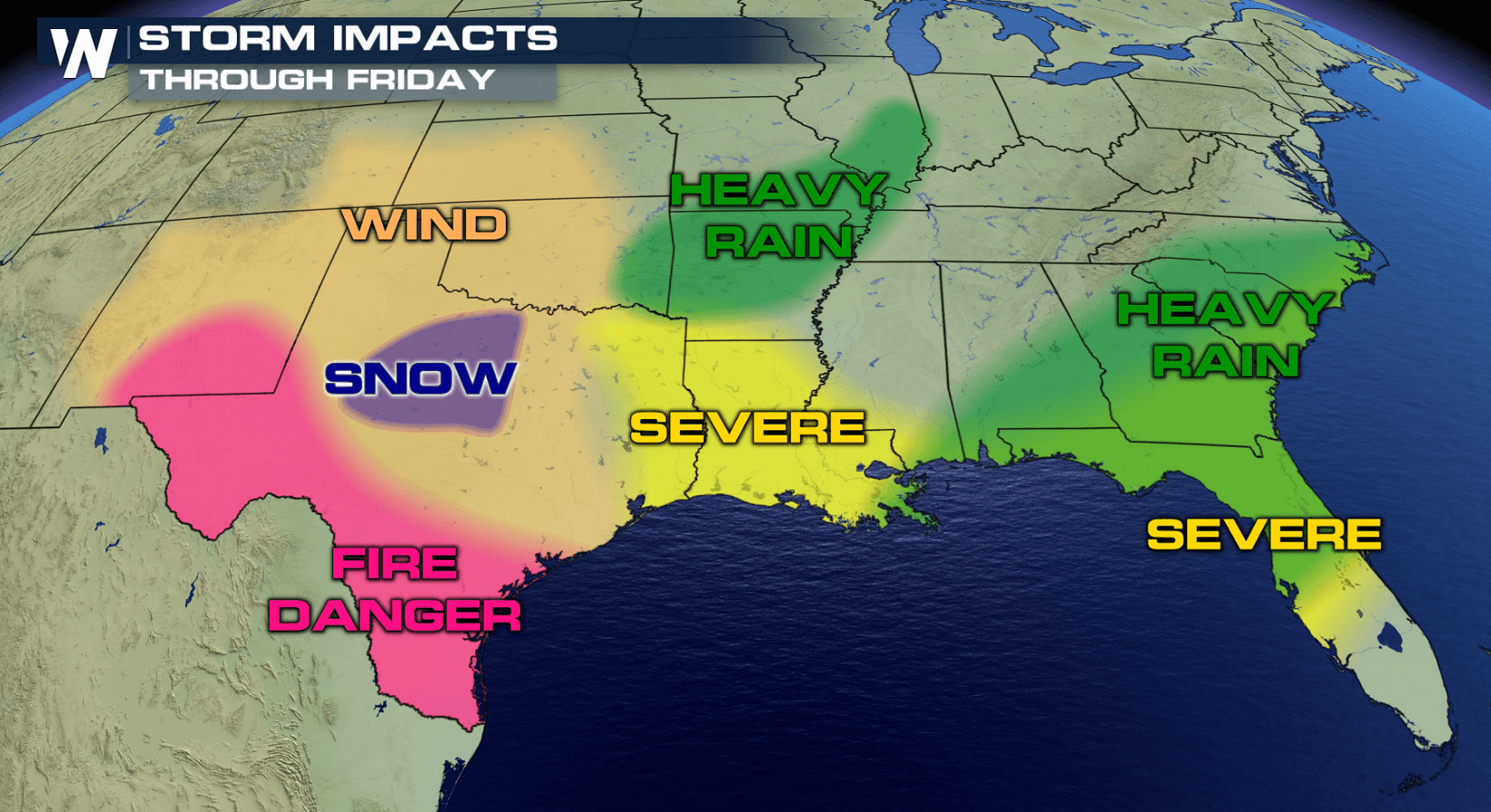
Energy out ahead our the next big weather system to impact the South and Southeast will bring increasing shower and thunderstorm chances from Texas to Florida today (Thursday). Here is the latest:
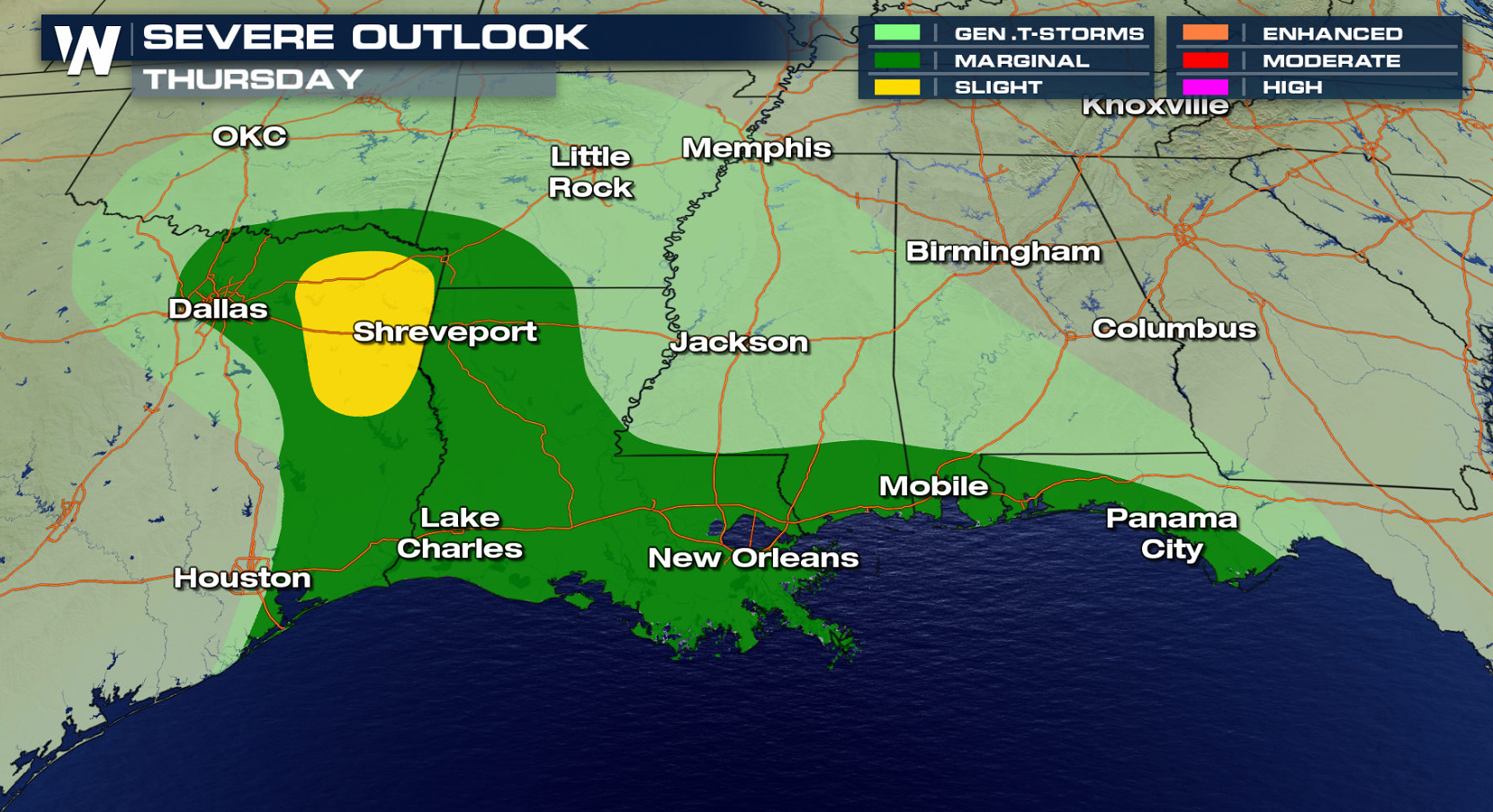
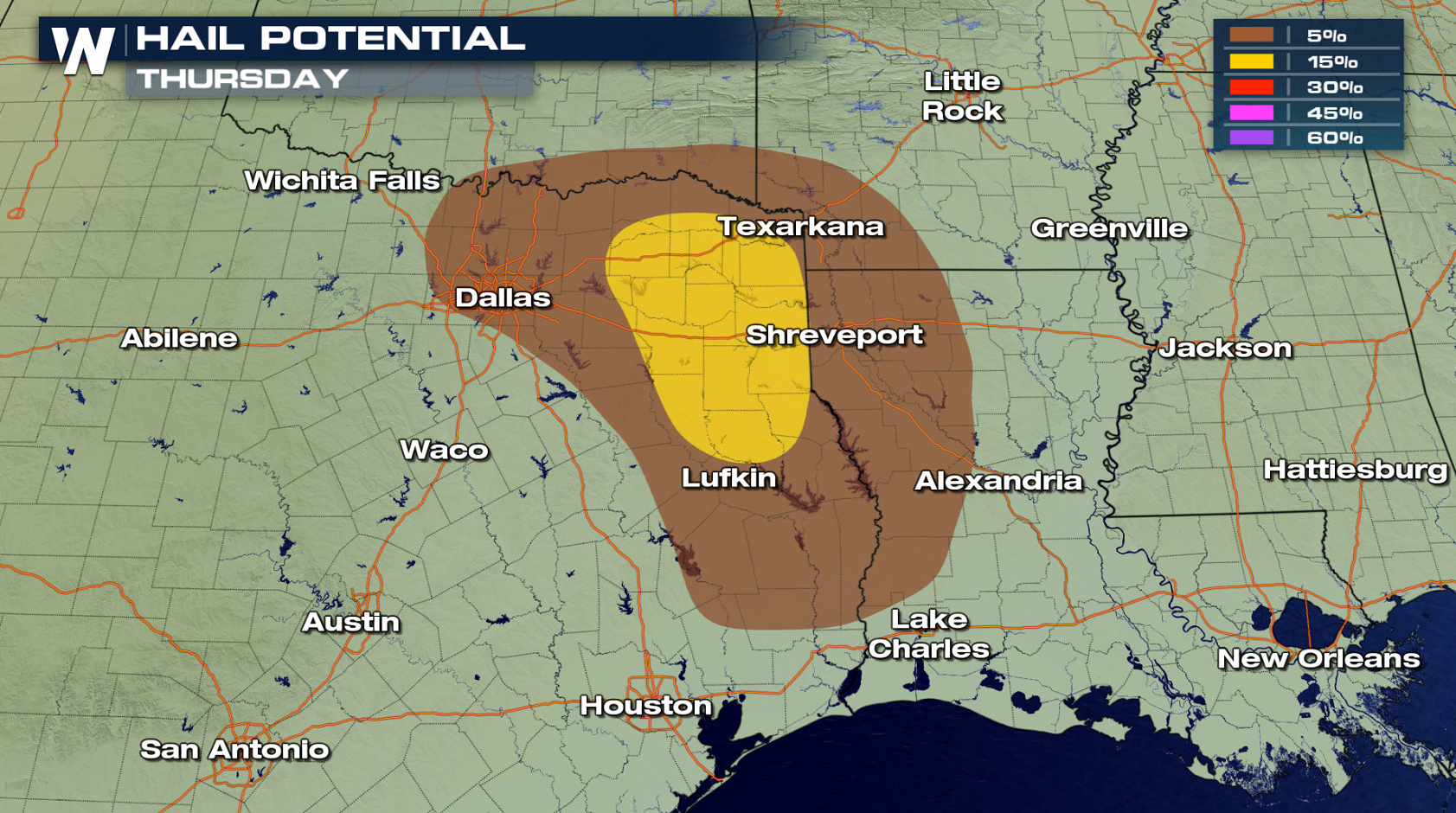
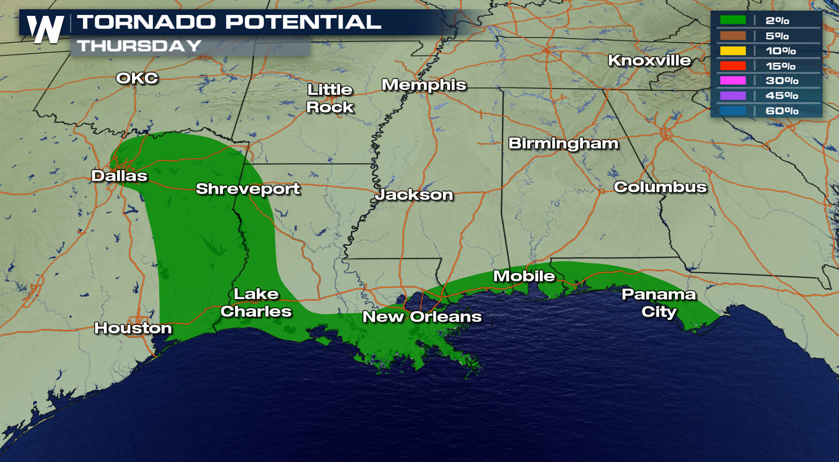 The risk of severe storms is slight. Storms will be around throughout the afternoon and evening for cities like Houston, Dallas, New Orleans and Mobile. Large hail and isolated tornadoes are the biggest threats. Be alert for low visibility and ponding on the roads if you get caught under one of the heavier storms.
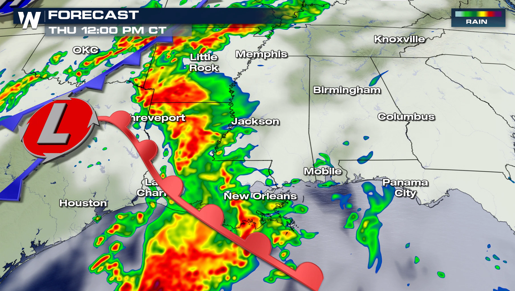
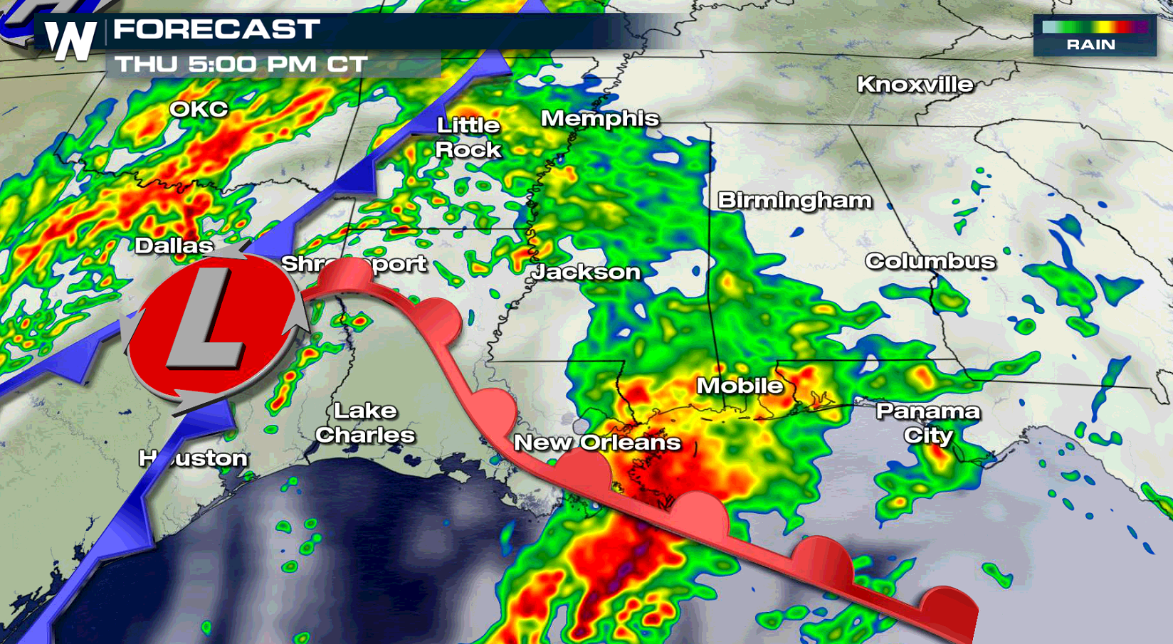
 The timing for the storms will be more for the afternoon and evening than it will be in the early morning. As this system moves east, it will move into a more favorable environment for severe storms. That will be the big story into Friday for the Gulf Coast states.
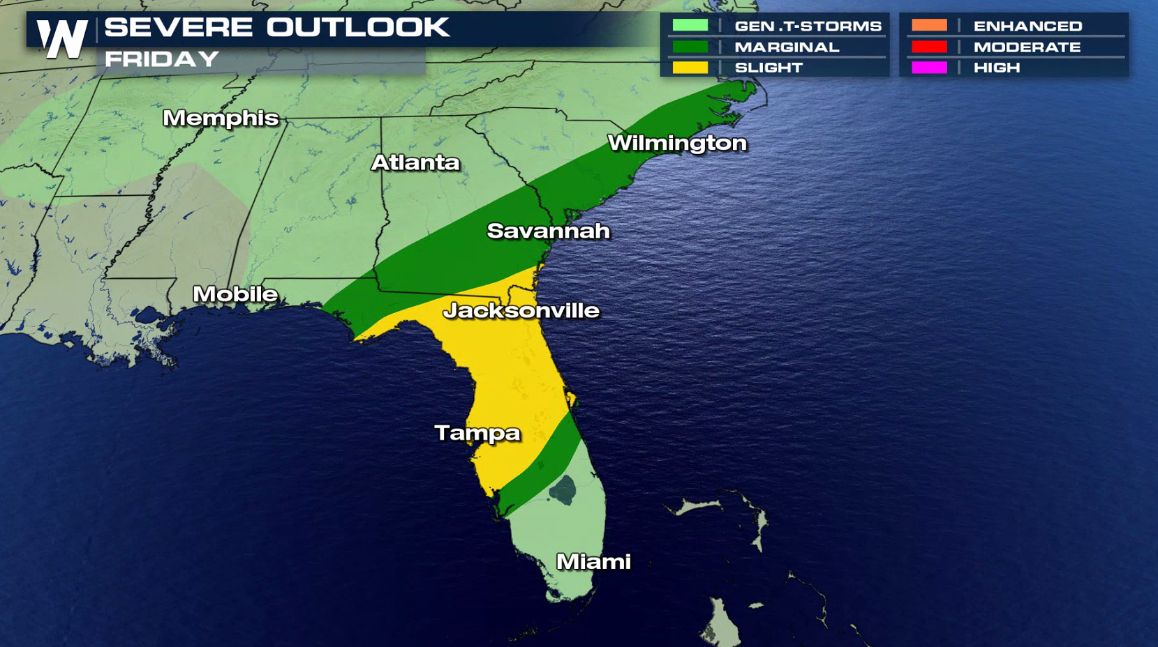
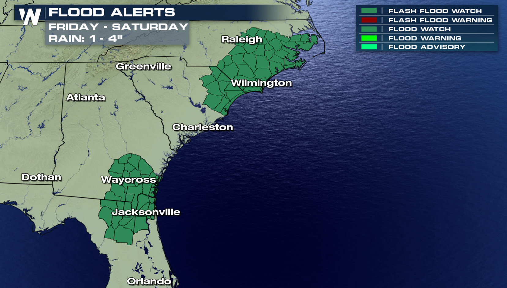
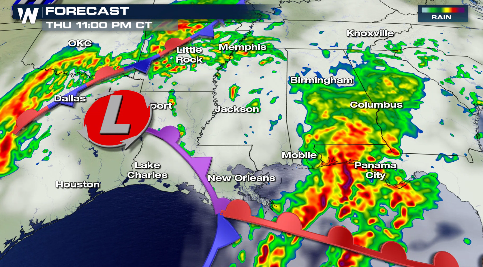
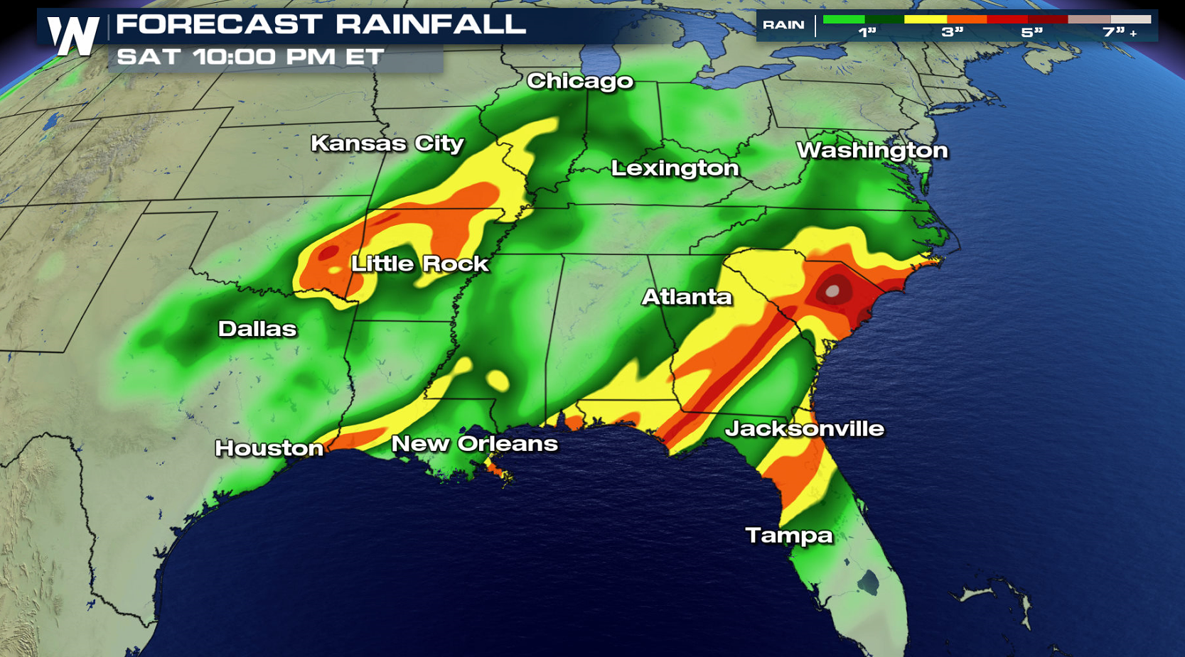 The storm system will slide further eastward for Friday, bringing a threat for severe storms and flooding from Florida's West Coast to the Outer Banks of North Carolina.
More updates are on the way from WeatherNation on-air and online.
The storm system will slide further eastward for Friday, bringing a threat for severe storms and flooding from Florida's West Coast to the Outer Banks of North Carolina.
More updates are on the way from WeatherNation on-air and online.
Severe Outlook Thursday
The risk of severe storms is slight. Storms will be around throughout the afternoon and evening for cities like Houston, Dallas, New Orleans and Mobile. Large hail and isolated tornadoes are the biggest threats. Be alert for low visibility and ponding on the roads if you get caught under one of the heavier storms.
Forecast
The timing for the storms will be more for the afternoon and evening than it will be in the early morning. As this system moves east, it will move into a more favorable environment for severe storms. That will be the big story into Friday for the Gulf Coast states.
Severe Outlook Friday
The storm system will slide further eastward for Friday, bringing a threat for severe storms and flooding from Florida's West Coast to the Outer Banks of North Carolina.
More updates are on the way from WeatherNation on-air and online.All Weather News
More

Flooding, Severe Storms Target the Midwest Again
After an active week of storms across the nor
1 Aug 2026 1:40 AM


After Reaching Category 5, Genevieve Weakens in the Pacific
PacificFausto is now a post-tropical cyclone.
31 Jul 2026 1:30 AM

Flooding Risk Increases as Heavy Rain Targets the Tri-State Area
Tuesday, heavy rainfall moved across the Nort
30 Jul 2026 12:25 AM

Severe Weather: Energy From the Midwest Now in the Southeast
UPPER MIDWEST - Through Monday, dangerous tor
29 Jul 2026 10:30 PM