Isolated Severe Storm Chances for Southeast New Mexico and West Texas Friday
Special Stories
27 Dec 2019 5:07 AM
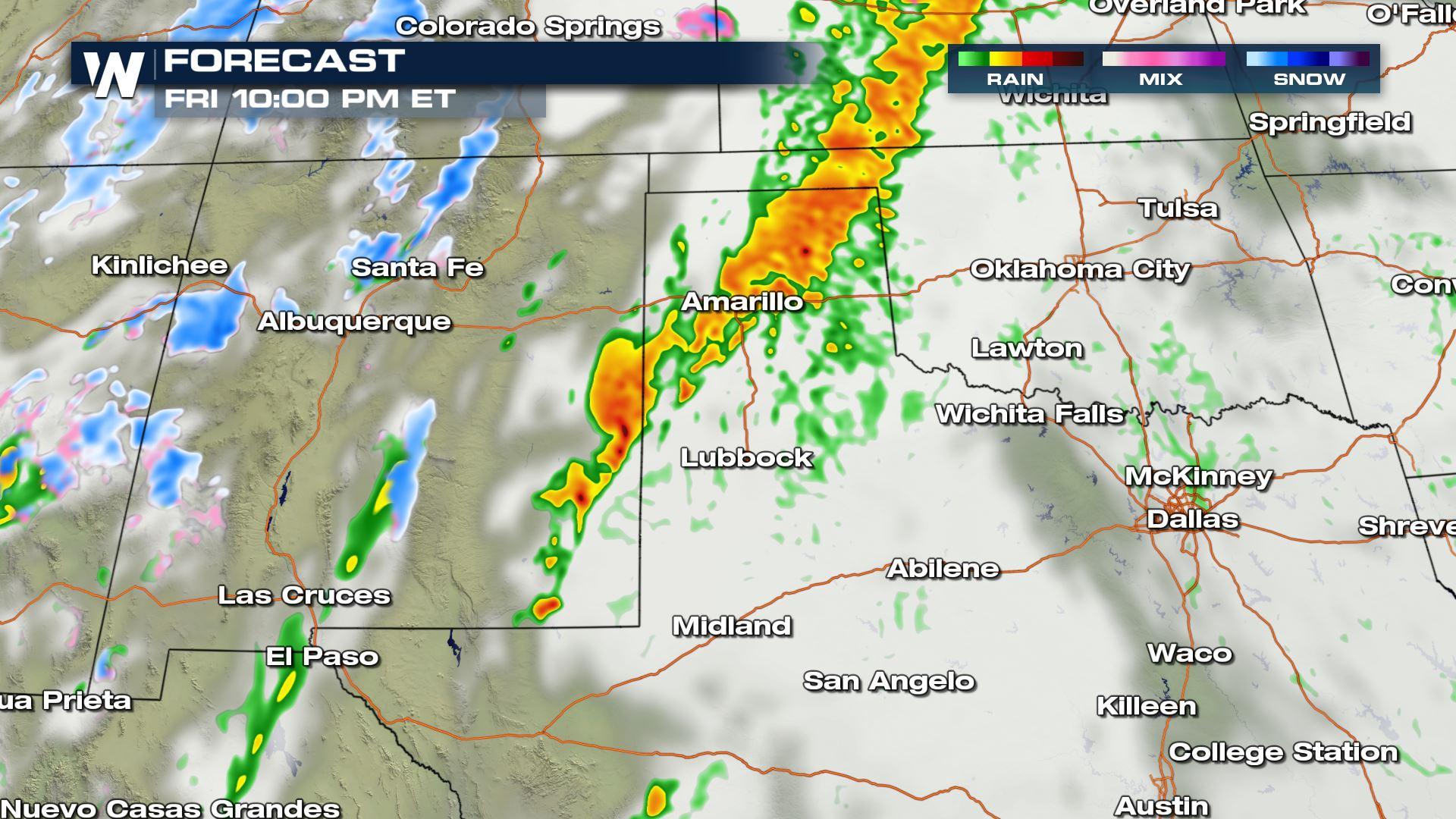
A strong upper-level trough moving across the the Southwest will impact areas of New Mexico and western Texas. Isolated tornadoes and hail up to 1" in diameter will be possible. Here is the very latest.
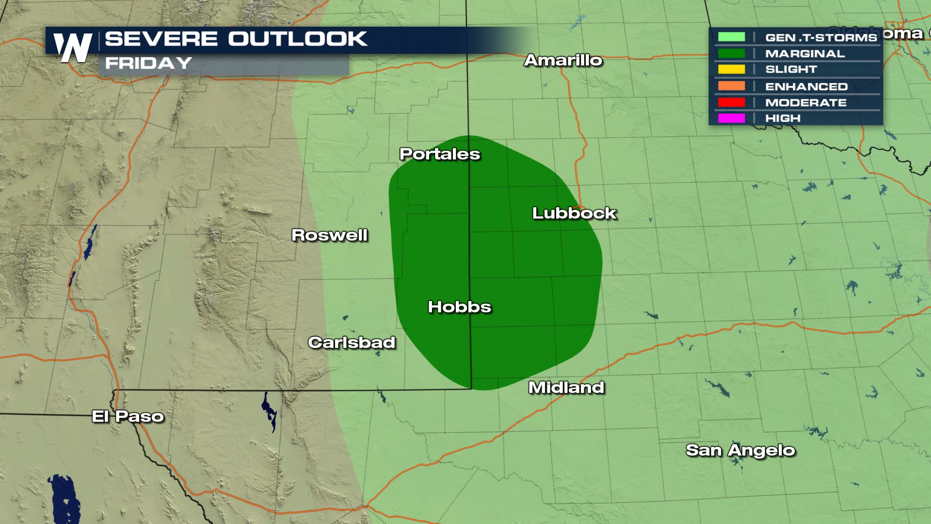 A Marginal risk of severe weather has been issued for areas of New Mexico and Texas. This includes the city of Lubbock. A marginal risk means isolated severe storms will be possible. A marginal risk is on the lower end when it comes to severe weather, but it is a risk nonetheless so you will need to be prepared in these areas.
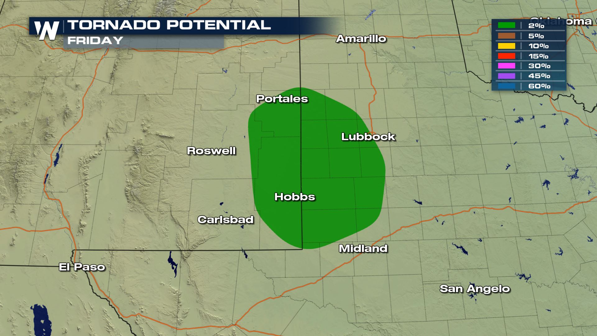
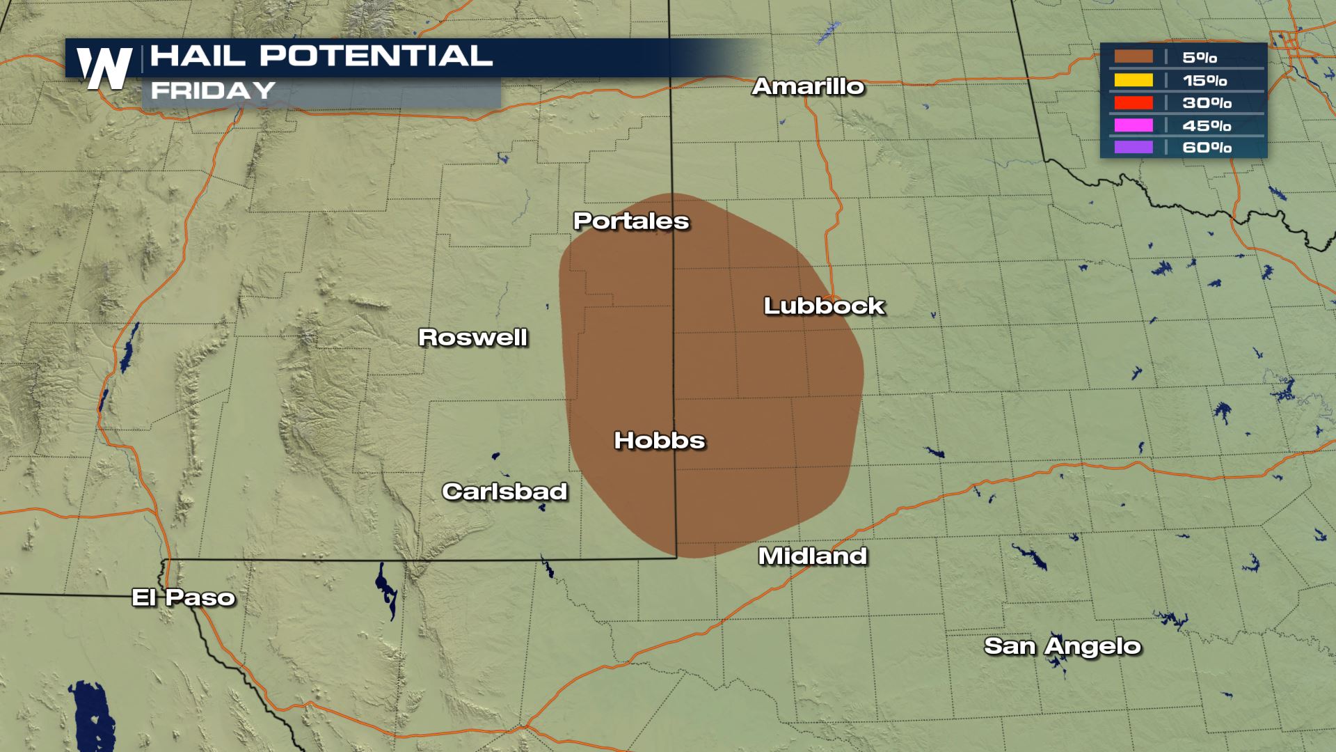 The damaging wind risk will be low with today's storms, but the hail and tornado risk will be high enough to monitor closely. You will want to have a way to receive alerts in case you have to take cover due to a tornado or severe t'storm warning.
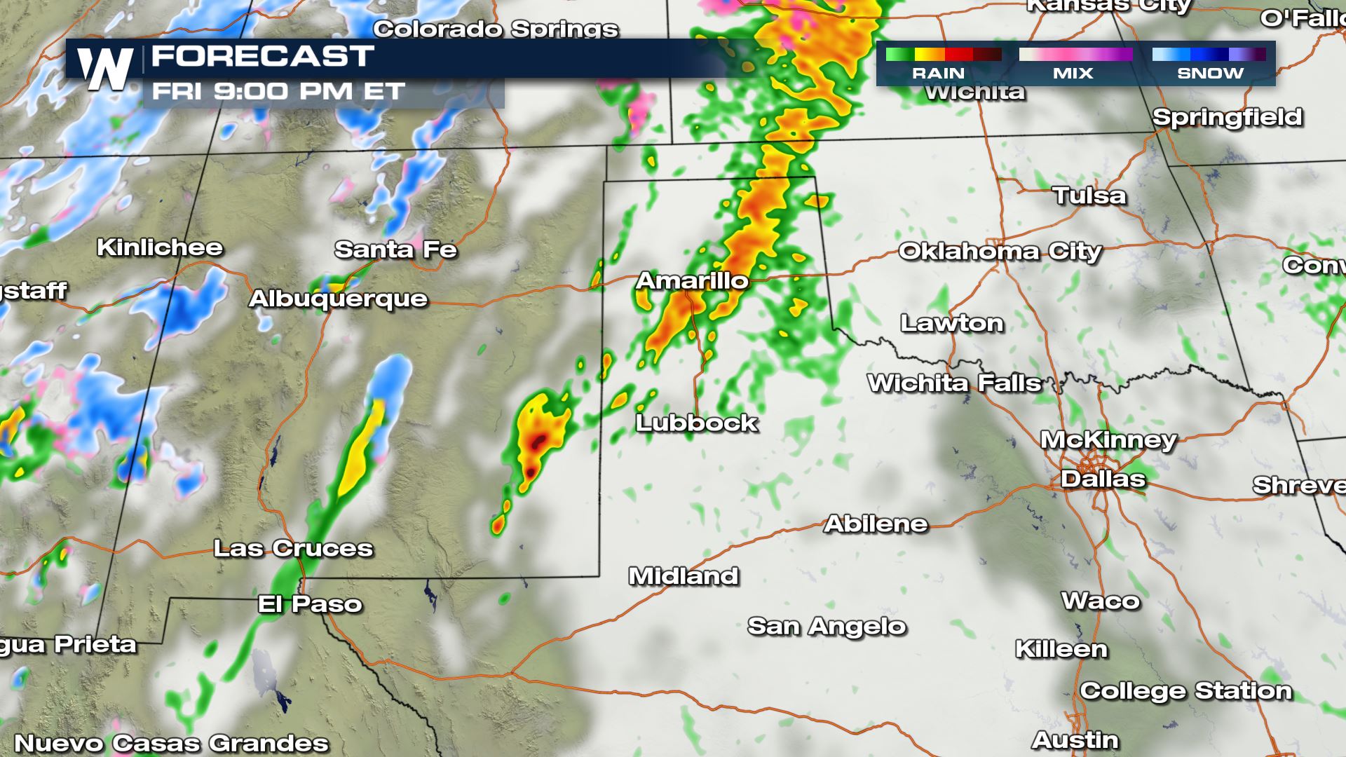
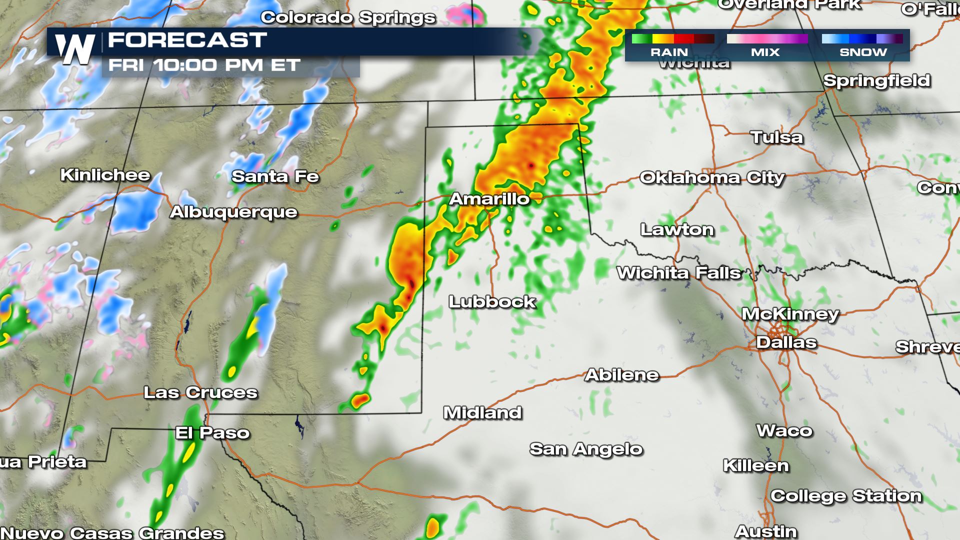
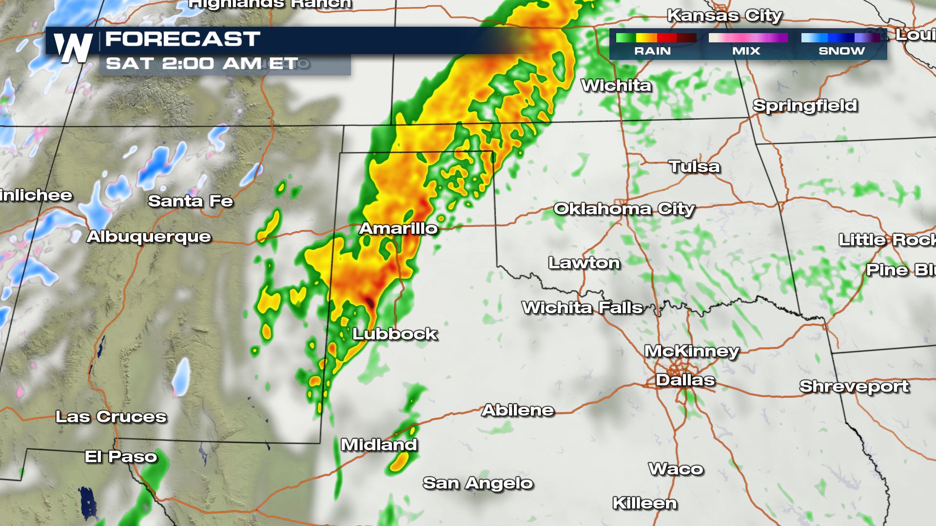 The timing for today's severe storms will be from the afternoon and evening all the way into early Saturday morning. Keep checking with WeatherNation for the very latest updates on Friday's severe weather risk.
Severe Outlook
A Marginal risk of severe weather has been issued for areas of New Mexico and Texas. This includes the city of Lubbock. A marginal risk means isolated severe storms will be possible. A marginal risk is on the lower end when it comes to severe weather, but it is a risk nonetheless so you will need to be prepared in these areas.
Severe Risks
The damaging wind risk will be low with today's storms, but the hail and tornado risk will be high enough to monitor closely. You will want to have a way to receive alerts in case you have to take cover due to a tornado or severe t'storm warning.
Forecast
The timing for today's severe storms will be from the afternoon and evening all the way into early Saturday morning. Keep checking with WeatherNation for the very latest updates on Friday's severe weather risk.All Weather News
More
Severe Storms Target the Midwest to the Northeast
UPPER MIDWEST - Dangerous tornadoes have alre
28 Jul 2026 1:45 AM

Tropics: Fausto Heads towards Hawaii; Genevieve Cat 4 Hurricane
PacificHurricane Fausto continues to track we
28 Jul 2026 1:45 AM


Southeast Flood Risk Lingers Near Stalled Front
A stalled boundary over the Southeast will ke
25 Jul 2026 10:55 AM

Another Round of Storms Targets the Northeast
Tuesday brought severe weather again across p
23 Jul 2026 1:15 AM

Another Round of Severe Weather for the Upper Midwest and Great Lakes
The upper-level low train continues to keep t
21 Jul 2026 1:45 AM