Isolated Severe Storm Chances Monday for the Southeast
Top Stories
23 Mar 2020 4:58 AM
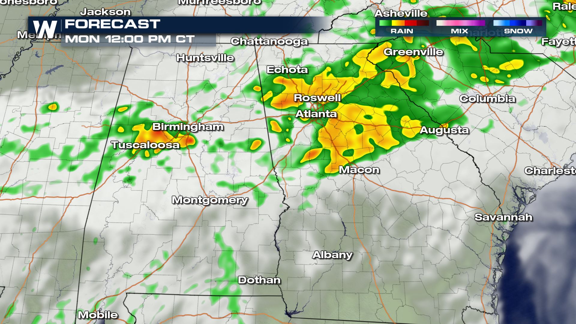
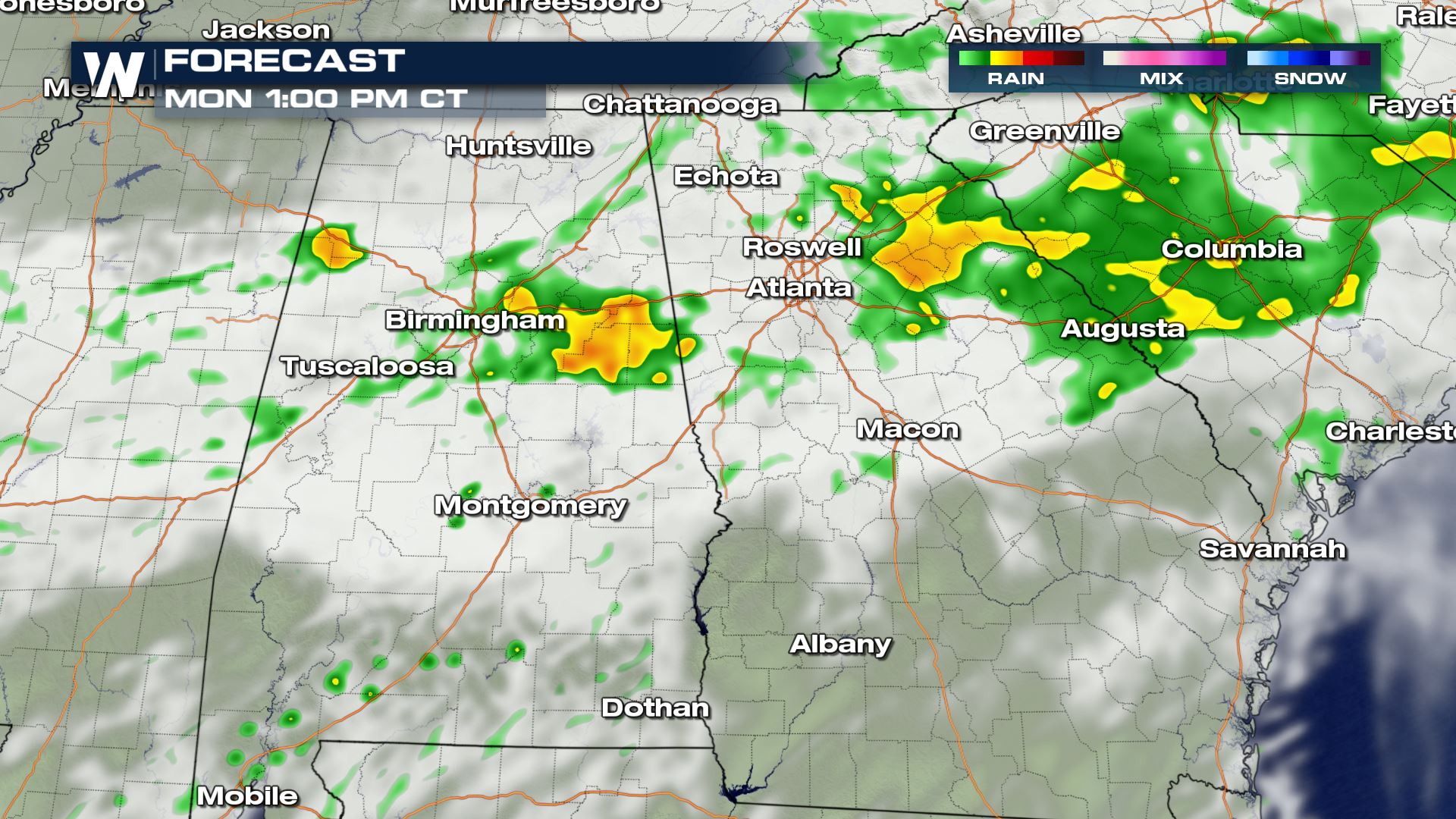
A stalled front will allow for strong showers and storms to develop all morning across parts of Mississippi, Alabama and Georgia. This risk will be isolated for the threat of large hail and damaging winds. Here is the latest severe forecast.
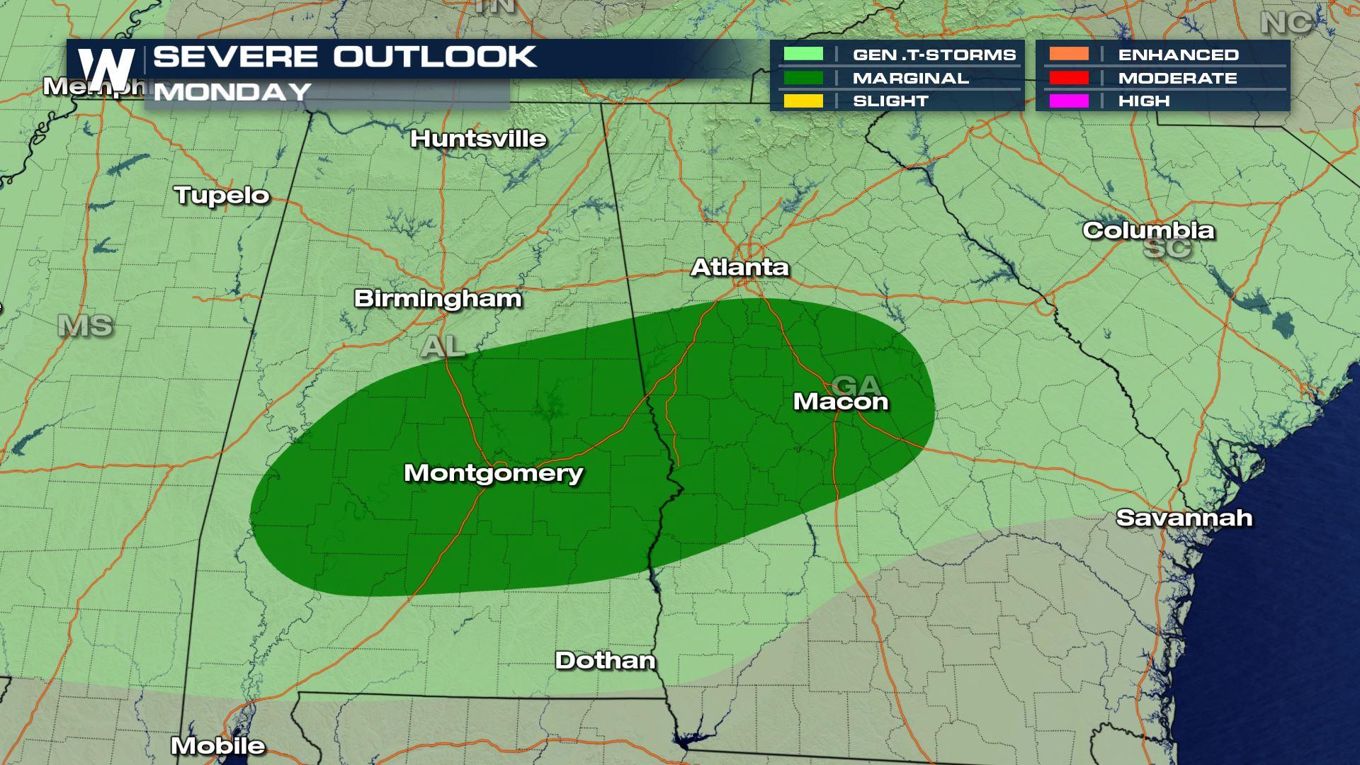
 Cities like Montgomery and Macon will be right in the path of today's severe storms. If you are in these areas you will want to be weather aware.
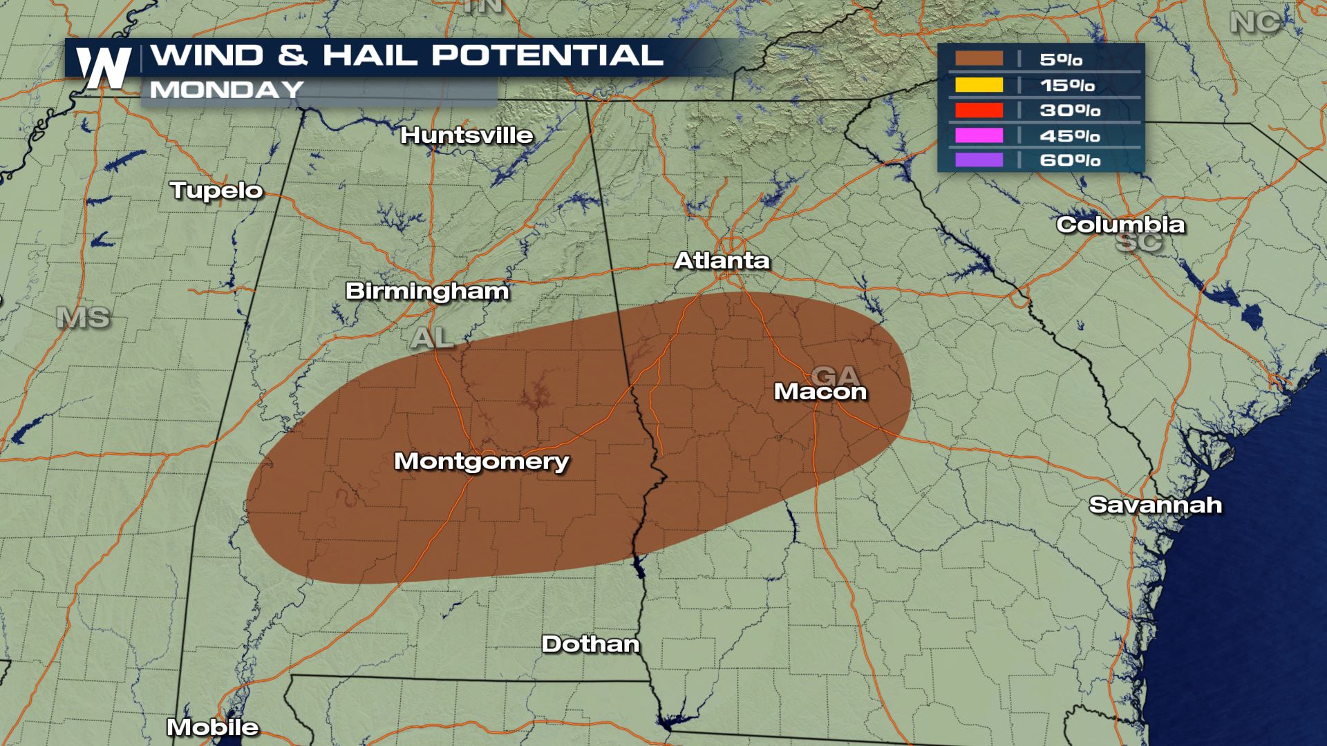 The main weather risks will be hail and wind, but a very isolated tornado can't be ruled out of the forecast.
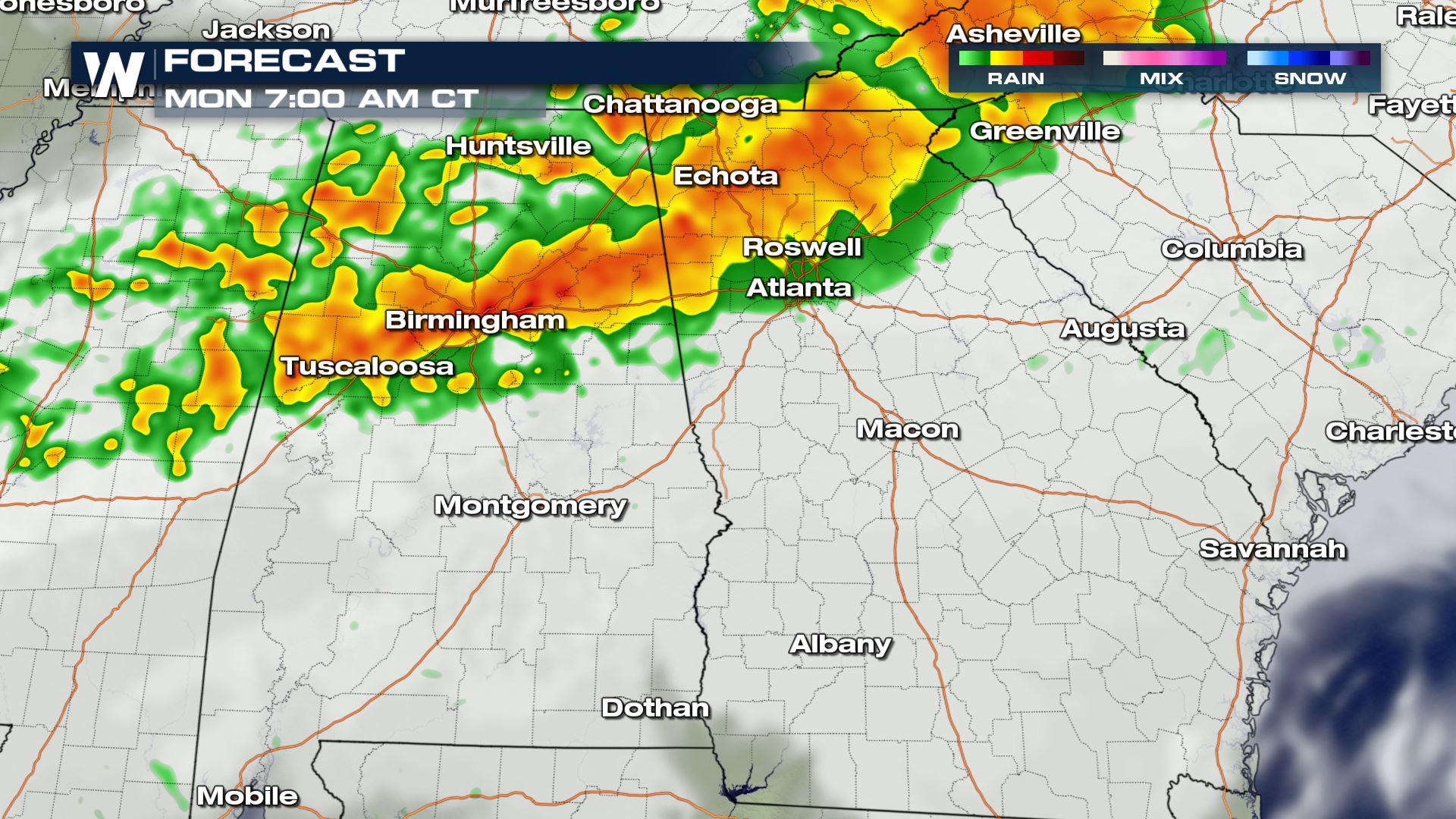
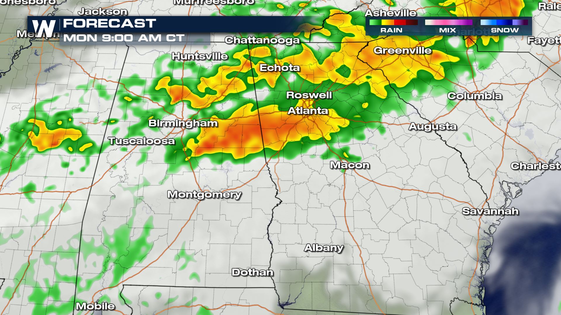
 The timing for today's storms will be during the morning and early afternoon hours. We will also have to watch out for some flash flooding from some of the high rainfall rates. Keep checking with WeatherNation for more updates.
Severe Outlook
Cities like Montgomery and Macon will be right in the path of today's severe storms. If you are in these areas you will want to be weather aware.
Severe Risks
The main weather risks will be hail and wind, but a very isolated tornado can't be ruled out of the forecast.
Forecast
The timing for today's storms will be during the morning and early afternoon hours. We will also have to watch out for some flash flooding from some of the high rainfall rates. Keep checking with WeatherNation for more updates.All Weather News
More

Flooding, Severe Storms Target the Midwest Again
After an active week of storms across the nor
1 Aug 2026 1:40 AM


After Reaching Category 5, Genevieve Weakens in the Pacific
PacificFausto is now a post-tropical cyclone.
31 Jul 2026 1:30 AM

Flooding Risk Increases as Heavy Rain Targets the Tri-State Area
Tuesday, heavy rainfall moved across the Nort
30 Jul 2026 12:25 AM

Severe Weather: Energy From the Midwest Now in the Southeast
UPPER MIDWEST - Through Monday, dangerous tor
29 Jul 2026 10:30 PM