Isolated Severe Storms for the Lower Mississippi Valley On Monday

Special Stories
18 Oct 2020 1:00 PM
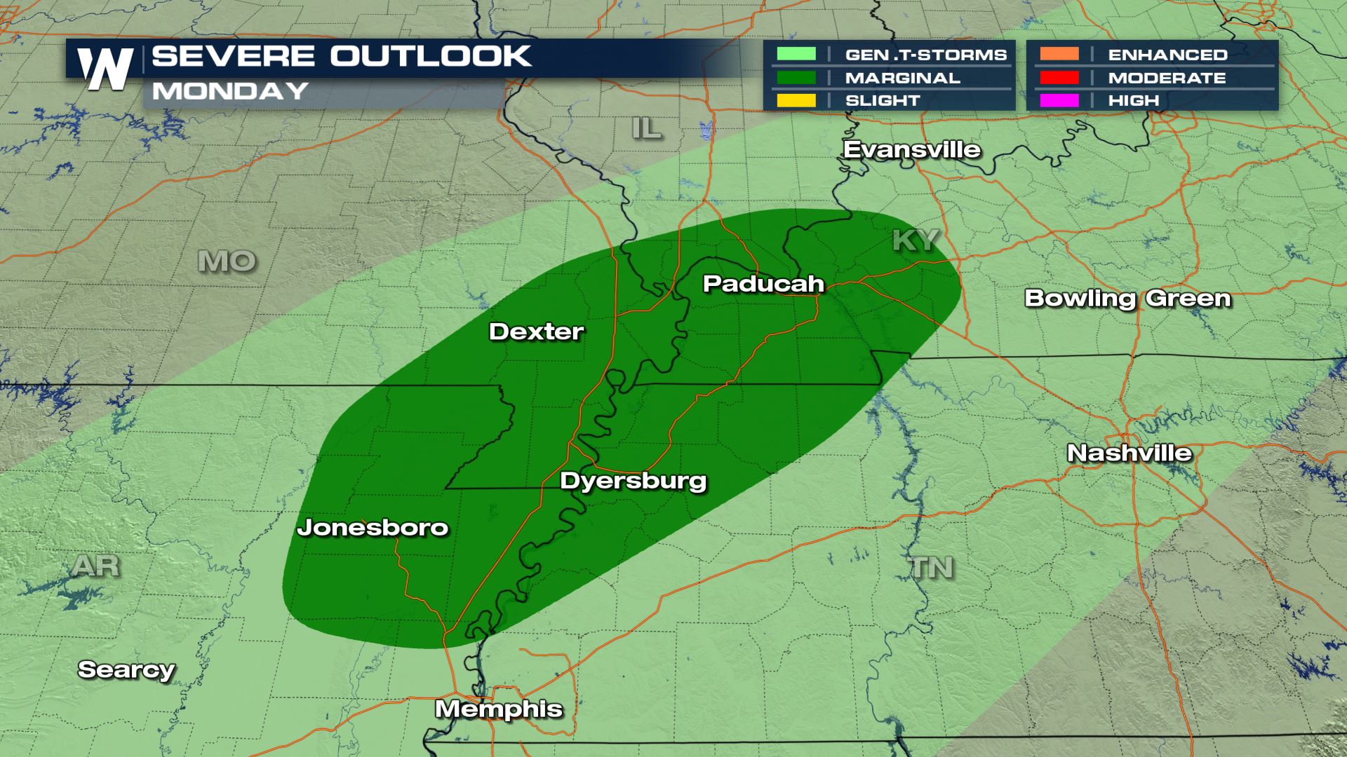
A Fall cold front will spark up a few thunderstorms to kick off the new week. Some of these thunderstorms may reach severe limits, bringing the threat for damaging wind gusts, sizeable hail, and heavy downpours. A dip in the jet stream will help provide energy for the potential of some thunderstorms on Sunday, but mostly into early Monday morning from northeast Arkansas to western Kentucky.
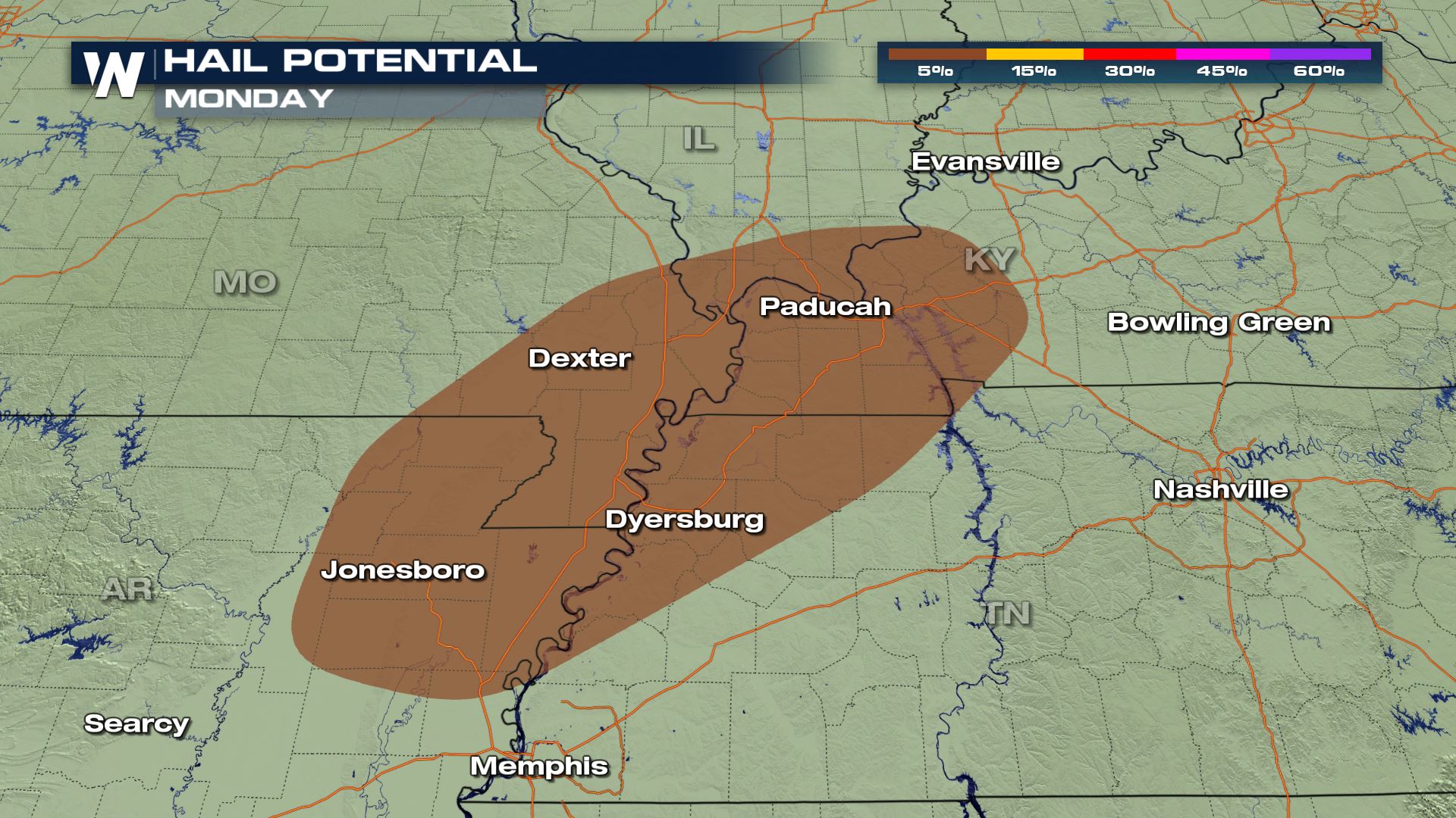
These thunderstorms will likely bring some isolated gusty winds and frequent lightning, and some elevated instability which could suggest some marginally severe hail. The severe threat will be focused across northeastern Arkansas, Missouri, Tennessee, Kentucky and far southern Illinois.
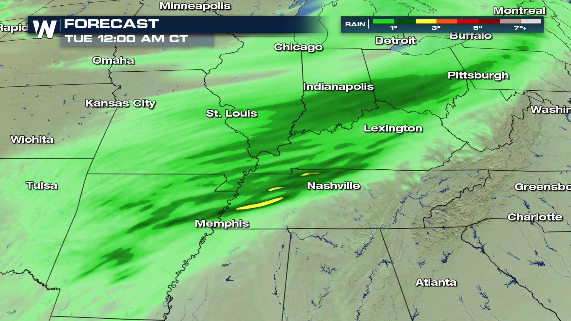
 The cold front will push east and eventually become stationary, setting the stage for flooding rainfall.
 Heavy rain is expected to continue in the region into Tuesday, extending the risk for flooding. Southeastern Missouri, western and northern Kentucky, southern Illinois, southern Indiana, and southwestern Ohio could potentially accumulate 3 to 5 inches of rain.
 Keep it tuned to WeatherNation in the days ahead for more forecast information.
Monday Severe Outlook
The cold front will push east and eventually become stationary, setting the stage for flooding rainfall.
Severe Storm Risks
Heavy rain is expected to continue in the region into Tuesday, extending the risk for flooding. Southeastern Missouri, western and northern Kentucky, southern Illinois, southern Indiana, and southwestern Ohio could potentially accumulate 3 to 5 inches of rain.
Keep it tuned to WeatherNation in the days ahead for more forecast information.All Weather News
More
Flooding Risk Increases as Heavy Rain Targets the Tri-State Area
TRI-STATE AREA - Along with the threat of sev
28 Jul 2026 10:00 PM

Severe Threat Marches East This Afternoon
UPPER MIDWEST - Through Monday, dangerous tor
28 Jul 2026 8:20 PM

Tropics: Fausto Heads towards Hawaii; Genevieve a Major Hurricane
PacificTropical Storm Fausto continues to tra
28 Jul 2026 8:20 PM


Southeast Flood Risk Lingers Near Stalled Front
A stalled boundary over the Southeast will ke
25 Jul 2026 10:55 AM

Another Round of Storms Targets the Northeast
Tuesday brought severe weather again across p
23 Jul 2026 1:15 AM