Isolated Severe Storms Today for Oklahoma, Arkansas and Missouri
Top Stories
9 Mar 2020 4:13 AM
A cold front sweeping through the Mississippi Valley will bring a chance for showers and storms to areas of Ozark Plateau Monday afternoon and evening. Here is the latest severe weather forecast.
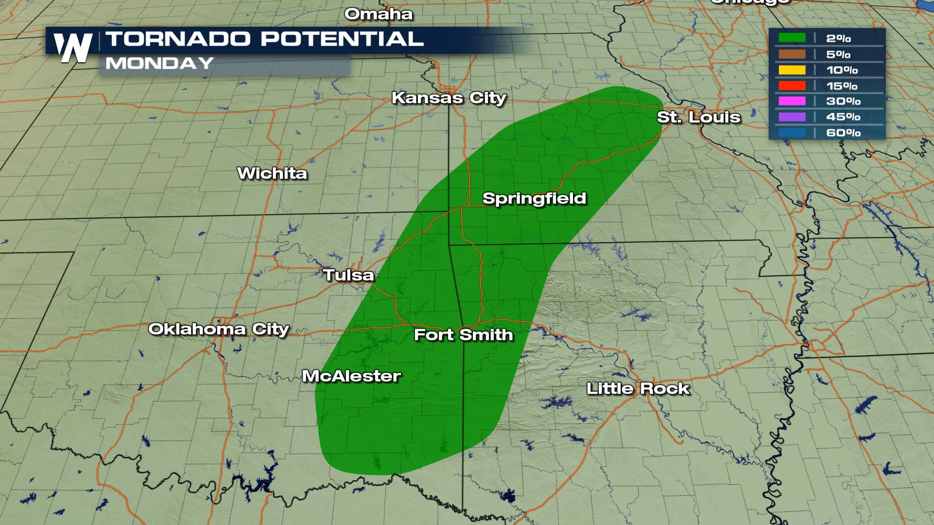
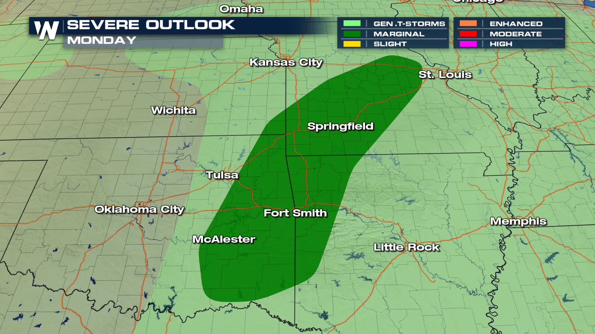 A marginal risk for severe storms has been added from the Storm Prediction Center for areas of Oklahoma, Arkansas and Missouri. This means an isolated severe threat for large hail and damaging winds. There will also be a chance for some rotation within today's storms, so an isolated tornado can't be ruled out.
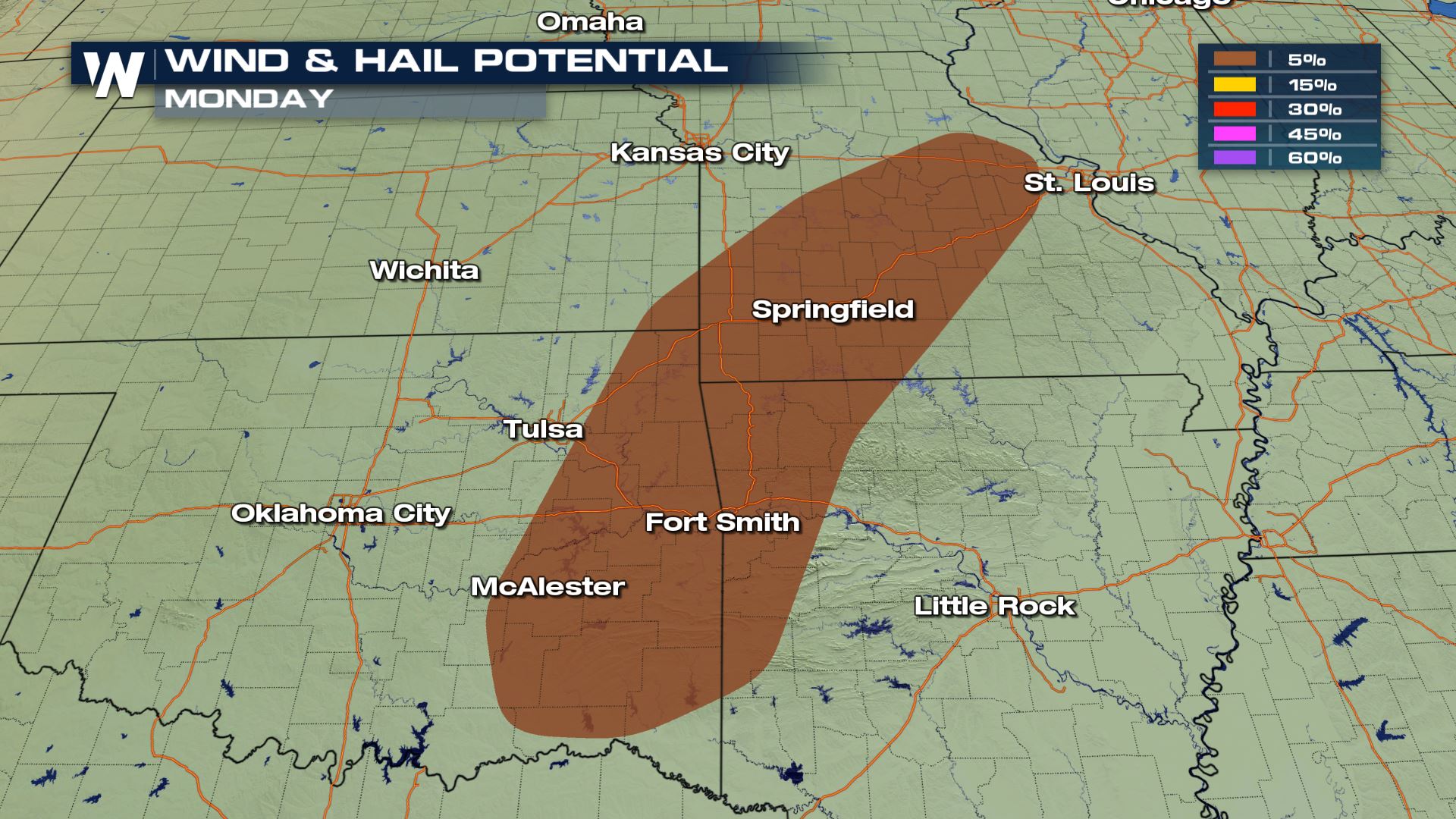 Damaging winds up to 58 mph will be possible with any storms that fire up this afternoon and evening. This will likely be a quick moving line of storms so thankfully the severe risk will only be during a very small window.
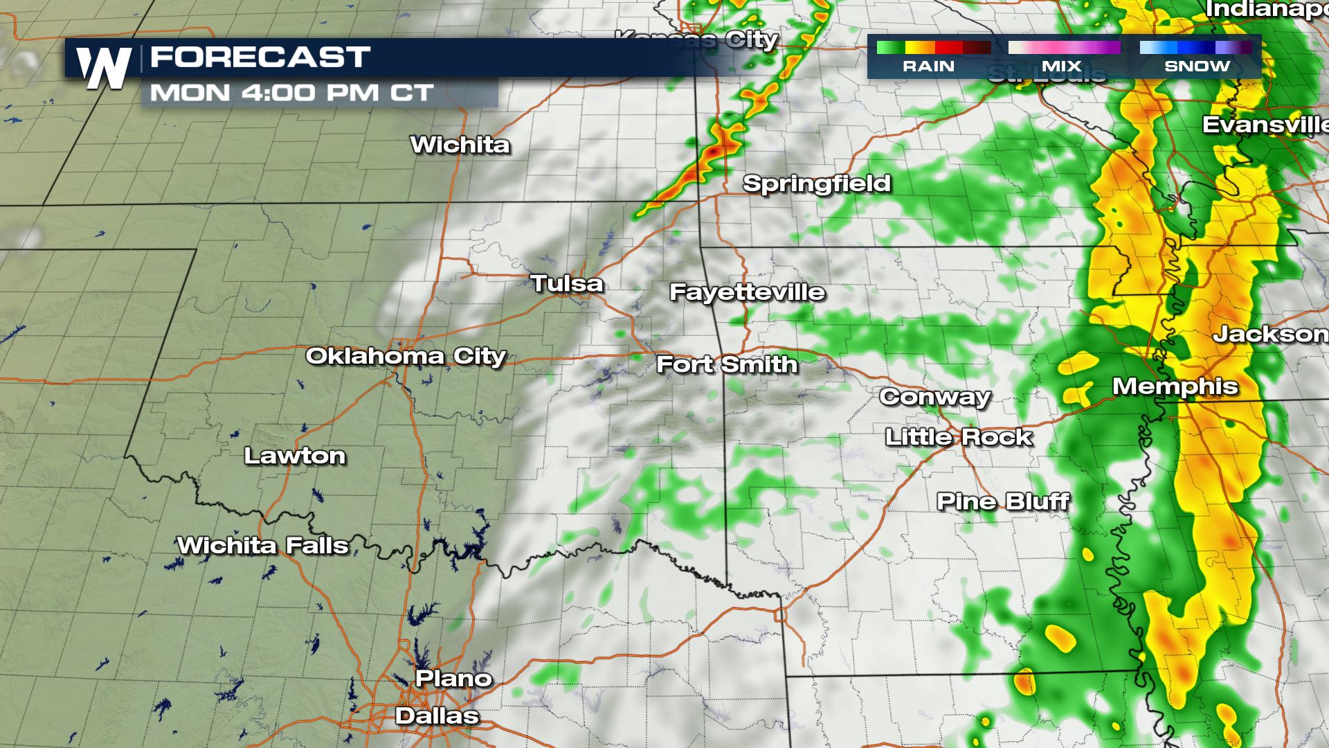
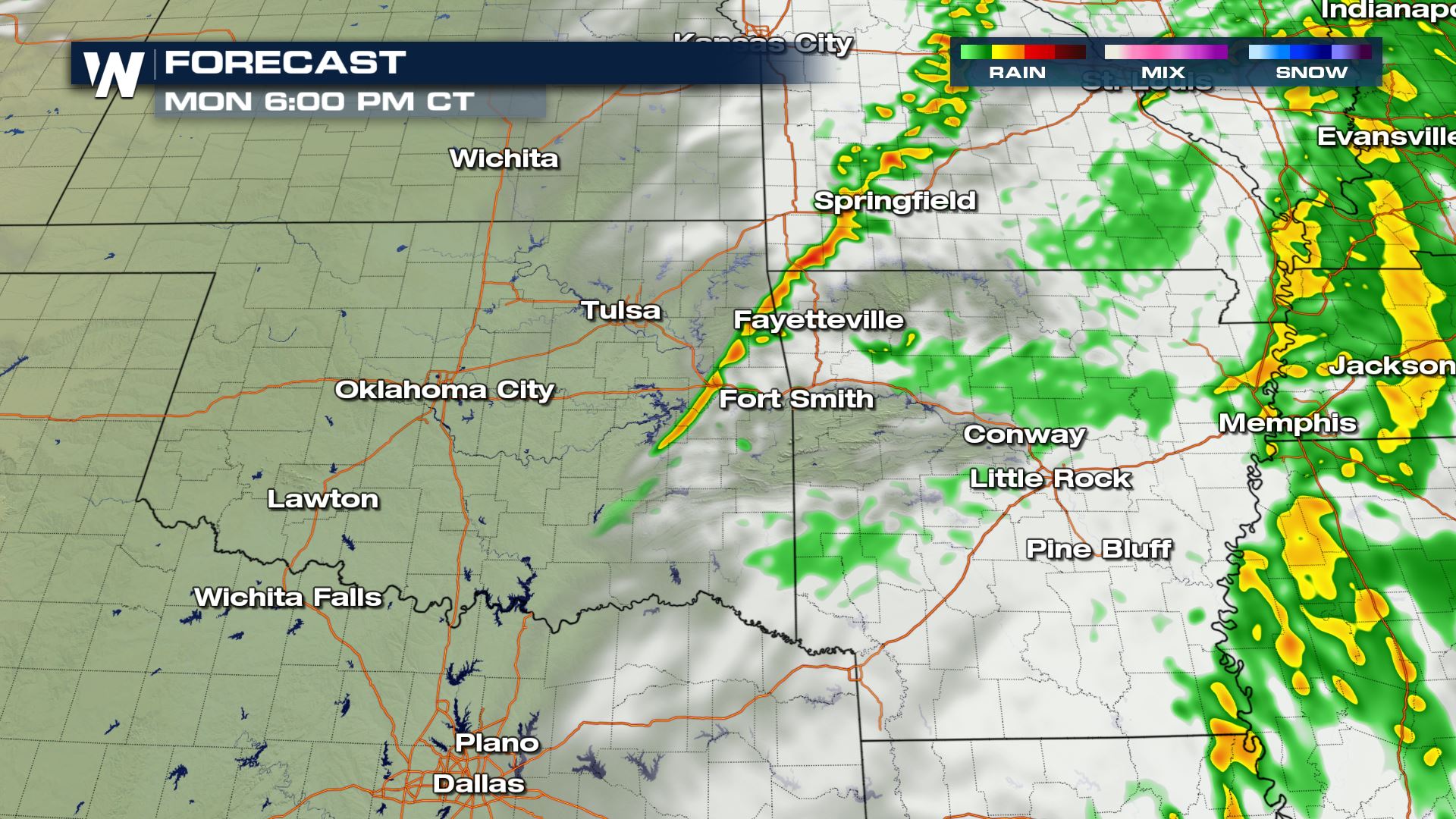
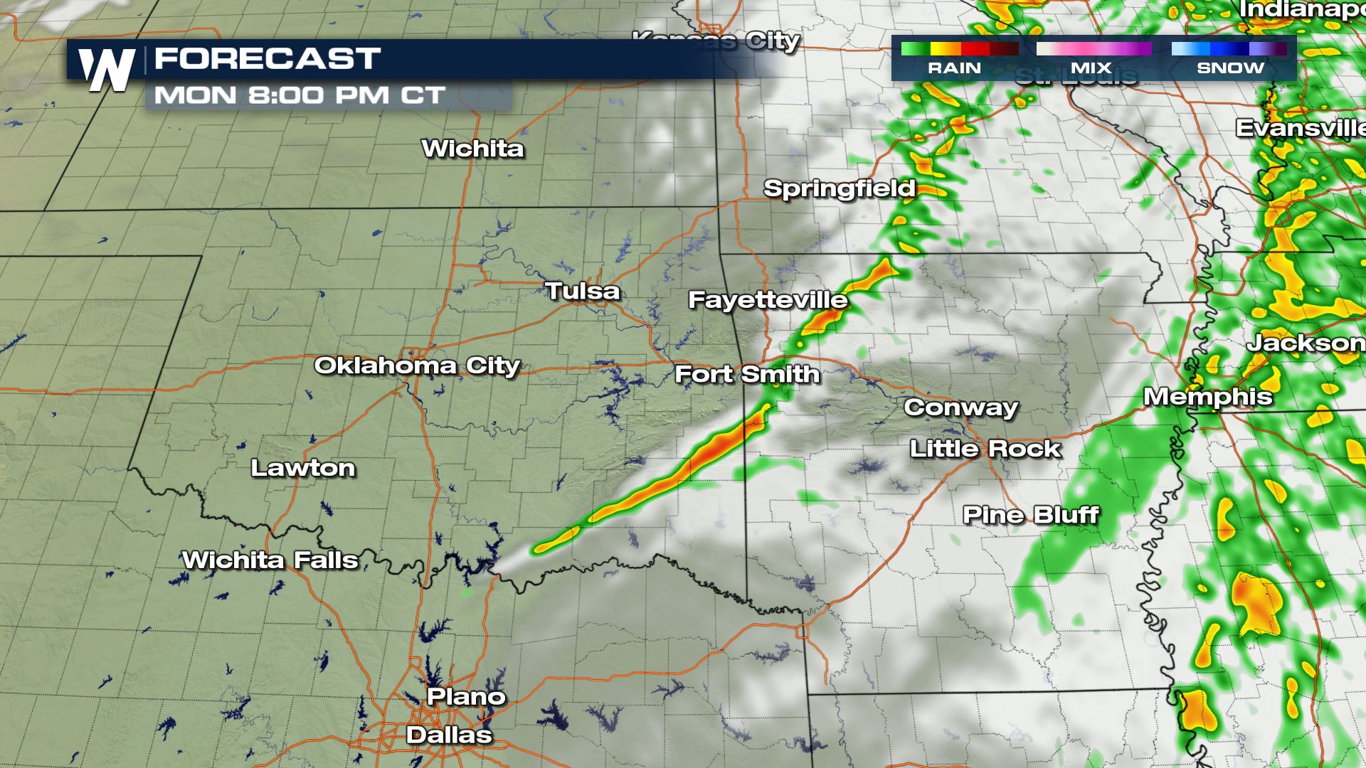 Here is the latest timing with today's storms. Today's severe risk will arrive during the afternoon and evening hours. Once the sun sets, the severe risk will diminish. Keep checking with WeatherNation for more updates on today's severe weather risk.
Severe Outlook
 A marginal risk for severe storms has been added from the Storm Prediction Center for areas of Oklahoma, Arkansas and Missouri. This means an isolated severe threat for large hail and damaging winds. There will also be a chance for some rotation within today's storms, so an isolated tornado can't be ruled out.
Severe Risks

 Damaging winds up to 58 mph will be possible with any storms that fire up this afternoon and evening. This will likely be a quick moving line of storms so thankfully the severe risk will only be during a very small window.
Forecast


 Here is the latest timing with today's storms. Today's severe risk will arrive during the afternoon and evening hours. Once the sun sets, the severe risk will diminish. Keep checking with WeatherNation for more updates on today's severe weather risk.
All Weather News
More