Keeping Our Eye on an Active Pacific!
Special Stories
16 Jul 2018 11:02 AM
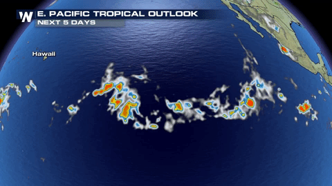
The eastern Pacific is showing us, once again, that it likes to be active!
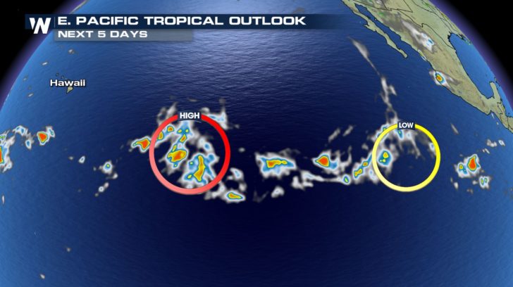 We now have two lows that we are keeping our eye on.
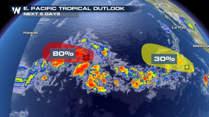 The storm closer to Hawaii has an 80 percent chance of developing into our next named storm! This one will need to be closely monitored due to the fact that it could make landfall with Hawaii! The storm trailing right behind it could possible be another named storm by the end of the week or weekend!
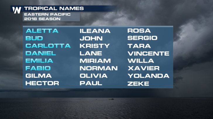 If both of these storms see favorable conditions in the Pacific, we could see Gilma and Hector soon!
For WeatherNation -Meteorologist Shelly Lindblade
If both of these storms see favorable conditions in the Pacific, we could see Gilma and Hector soon!
For WeatherNation -Meteorologist Shelly Lindblade
We now have two lows that we are keeping our eye on.
The storm closer to Hawaii has an 80 percent chance of developing into our next named storm! This one will need to be closely monitored due to the fact that it could make landfall with Hawaii! The storm trailing right behind it could possible be another named storm by the end of the week or weekend!
If both of these storms see favorable conditions in the Pacific, we could see Gilma and Hector soon!
For WeatherNation -Meteorologist Shelly LindbladeAll Weather News
More
Fronts Continue To Spark Severe Weather Across the Plains
A cold front that brought record lows to the
18 Jul 2025 10:40 PM

Extreme Heat Impacts for the East Coast & South
Extreme heat continues to impact several area
18 Jul 2025 10:05 PM

Flooding Threat Remains Elevated in the East
A cold front pushing through the Eastern Seab
18 Jul 2025 9:10 PM

EF-2 Firenado from the Deer Creek Fire in Utah
A fire tornado was spotted near La Sal, Utah
18 Jul 2025 7:30 AM

Tropical System Brings Flood Risk to the Central Gulf
Time has run out for notable tropical develop
18 Jul 2025 3:05 AM

Heavy Rain, Flooding Threat Returns to Florida
Keep the rain boots handy in Florida - heavy
13 Jul 2025 12:50 PM

Severe Storm Risk Pushes into the Great Lakes, Ohio Valley
Friday was another busy day with severe weath
12 Jul 2025 8:00 PM