La Niña a Big Factor in Hurricane Season Forecast
Special Stories
7 Aug 2020 8:00 PM
In Early 2020, an El Nino pattern dominated in the tropical Pacific Ocean.
This is associated with very warm Pacific waters, heat transport, and increased wind shear that spreads into the Caribbean. This traditionally suppresses tropical development.
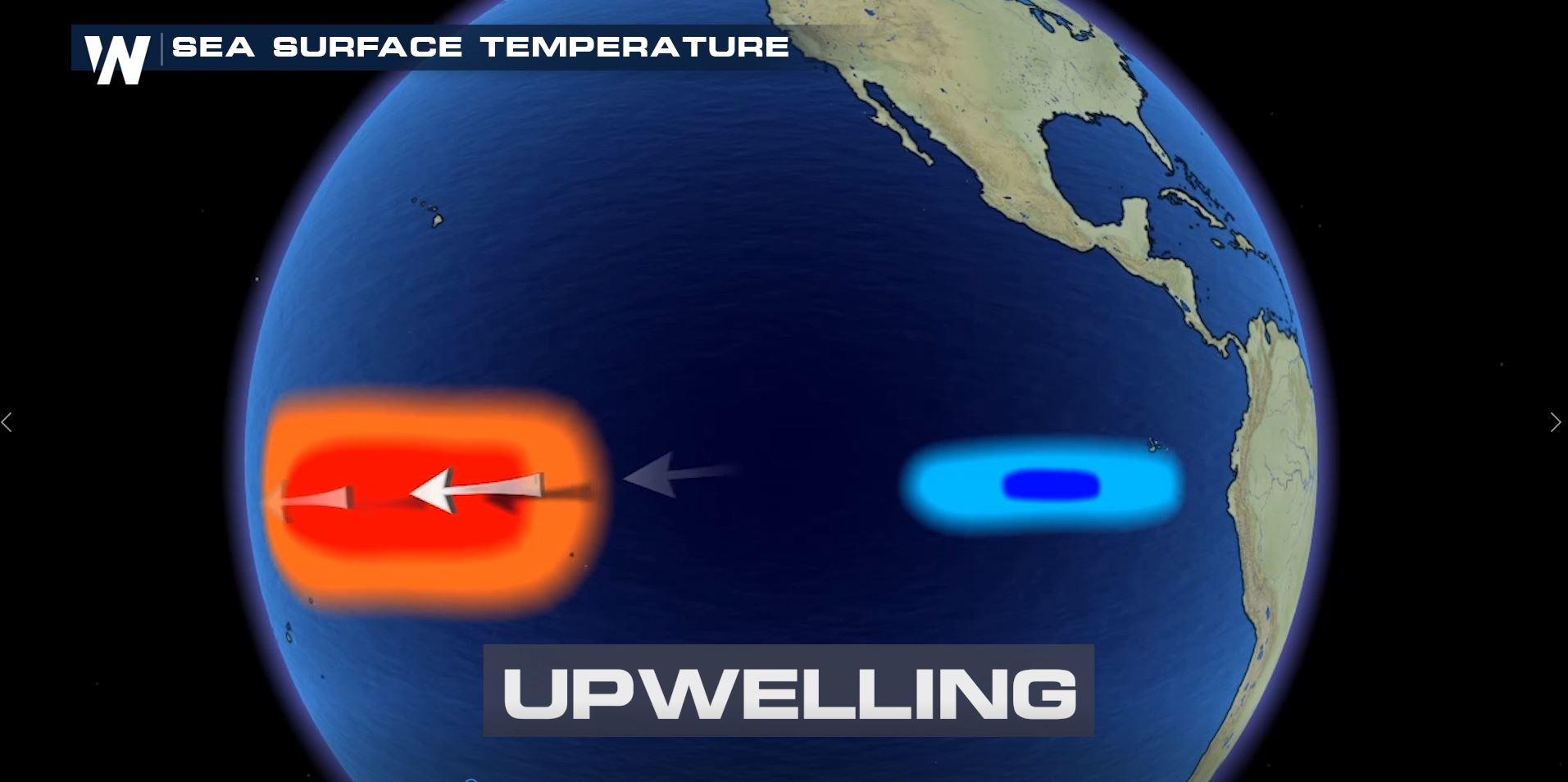
 But since March, strong easterly winds, called Trade Winds have pushed the warm ocean waters to the west. The result? Much colder water coming to the surface, in a process called upwelling.
With this area of cold water continuing to expand, NOAA has issued a “La Nina Watch.”
But since March, strong easterly winds, called Trade Winds have pushed the warm ocean waters to the west. The result? Much colder water coming to the surface, in a process called upwelling.
With this area of cold water continuing to expand, NOAA has issued a “La Nina Watch.”
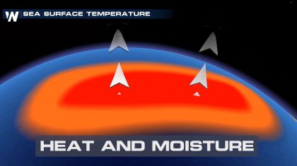
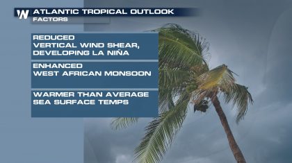
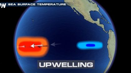 The cool Pacific waters reduce the amount of heat and moisture that rise into the atmosphere…a pattern that typically favors increased tropical development in the Atlantic basin.
La Nina further acts to weaken the wind shear over the Atlantic Ocean and the Caribbean, which promotes healthy tropical systems.
Dr. Gerry Bell, NOAA lead hurricane forecaster, says “When you have this combination of La Nina and the favorable conditions already over the Atlantic basin, that’s when the potential for an extremely active season goes way up.”
The potential La Nina was one of the main factors that went into NOAA’s updated hurricane season forecast.
The cool Pacific waters reduce the amount of heat and moisture that rise into the atmosphere…a pattern that typically favors increased tropical development in the Atlantic basin.
La Nina further acts to weaken the wind shear over the Atlantic Ocean and the Caribbean, which promotes healthy tropical systems.
Dr. Gerry Bell, NOAA lead hurricane forecaster, says “When you have this combination of La Nina and the favorable conditions already over the Atlantic basin, that’s when the potential for an extremely active season goes way up.”
The potential La Nina was one of the main factors that went into NOAA’s updated hurricane season forecast.
 Dr. Bell says that conditions are truly ripe now to produce a lot of activity this season.
Stick with us here at WeatherNation as we continue to track every system throughout the rest of the season.
https://www.youtube.com/watch?v=pOV4KjEmQyY
Dr. Bell says that conditions are truly ripe now to produce a lot of activity this season.
Stick with us here at WeatherNation as we continue to track every system throughout the rest of the season.
https://www.youtube.com/watch?v=pOV4KjEmQyY
But since March, strong easterly winds, called Trade Winds have pushed the warm ocean waters to the west. The result? Much colder water coming to the surface, in a process called upwelling.
With this area of cold water continuing to expand, NOAA has issued a “La Nina Watch.”
The cool Pacific waters reduce the amount of heat and moisture that rise into the atmosphere…a pattern that typically favors increased tropical development in the Atlantic basin.
La Nina further acts to weaken the wind shear over the Atlantic Ocean and the Caribbean, which promotes healthy tropical systems.
Dr. Gerry Bell, NOAA lead hurricane forecaster, says “When you have this combination of La Nina and the favorable conditions already over the Atlantic basin, that’s when the potential for an extremely active season goes way up.”
The potential La Nina was one of the main factors that went into NOAA’s updated hurricane season forecast.
Dr. Bell says that conditions are truly ripe now to produce a lot of activity this season.
Stick with us here at WeatherNation as we continue to track every system throughout the rest of the season.
https://www.youtube.com/watch?v=pOV4KjEmQyYAll Weather News
More

More Storms for the East Through Monday
A low-pressure system that moved through the
3 Aug 2026 12:20 PM


After Reaching Category 5, Genevieve Weakens in the Pacific
PacificGenevieve formed last Friday south of
3 Aug 2026 12:30 AM

Flooding, Severe Storms Target the Midwest Again
After an active week of storms across the nor
1 Aug 2026 1:40 AM

Flooding Risk Increases as Heavy Rain Targets the Tri-State Area
Tuesday, heavy rainfall moved across the Nort
30 Jul 2026 12:25 AM