La Niña Favors Increased Severe Weather
Special Stories
7 Mar 2021 7:28 AM
A moderate La Niña, ongoing since late last summer, was a significant driver in 2020’s Record breaking Atlantic Hurricane Season.
Now, signs point to it having a similar effect on the spring severe weather season.
Dr. John Allen, a meteorologist, and professor at Central Michigan University said: “La Niña tends to increase the likelihood of us seeing tornadoes and severe weather across the Continental united states. Generally speaking, La Niñas can result in anywhere from 125% of normal to even 200% of normal.”
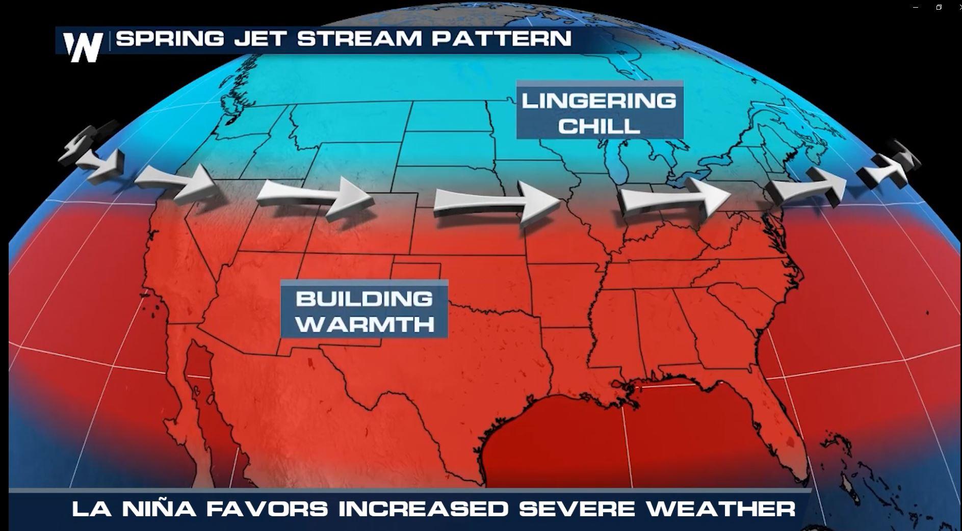
This pool of unusually cold water in the tropical Pacific Ocean can influence weather patterns all around the globe. When a La Niña is present in the spring, the jet stream tends to migrate farther north. This sets up a large temperature contrast in the US. It separates warm, humid air across the south from winter’s lingering chill in the north.
This persistent clash of air masses can fuel an active storm track from the Rockies to the interior southeast: a recipe for severe weather.
Allen said, “For thunderstorms, we need instability. La Niña increases the amount of instability we see in the continent… particularly early in the season. So, La Niña’s tend to have tornado frequency peak 1-2 weeks ahead of normal.”
Severe weather typically reaches its peak in mid-May. This year’s pattern projects the height of the season as early as late April.
La Niña years also favor intensity over frequency. So while may see fewer severe weather days overall, there is a tendency for blockbuster events.
According to Dr. Allen, “We tend to see outbreaks boom and bust. We have big days, but then we may have relatively quiet periods for a week or two.”
The current La Niña has been similar in strength to other big La Niña years, such as 2011. While a La Niña weights the dice for enhanced severe weather activity, it does not necessarily mean that we will set any records.
In 2011, we saw record-level outbreaks. April was the highest level we’ve ever seen in tornado history, with 800 tornadoes in a month. We won’t necessarily see that again, but we will likely see enhanced activity compared to normal.
This is why it is even more important for you to stay tuned to WeatherNation, as we help you weather every storm.
http://www.youtube.com/watch?v=t5mn8yt6pWA
All Weather News
More
Fronts Continue To Spark Severe Weather Across the Plains
A cold front that brought record lows to the
18 Jul 2025 10:40 PM

Extreme Heat Impacts for the East Coast & South
Extreme heat continues to impact several area
18 Jul 2025 10:05 PM

Flooding Threat Remains Elevated in the East
A cold front pushing through the Eastern Seab
18 Jul 2025 9:10 PM

EF-2 Firenado from the Deer Creek Fire in Utah
A fire tornado was spotted near La Sal, Utah
18 Jul 2025 7:30 AM

Tropical System Brings Flood Risk to the Central Gulf
Time has run out for notable tropical develop
18 Jul 2025 3:05 AM

Heavy Rain, Flooding Threat Returns to Florida
Keep the rain boots handy in Florida - heavy
13 Jul 2025 12:50 PM

Severe Storm Risk Pushes into the Great Lakes, Ohio Valley
Friday was another busy day with severe weath
12 Jul 2025 8:00 PM