More Lake Effect Snow Ahead for the Great Lakes
Special Stories
1 Feb 2018 9:55 AM
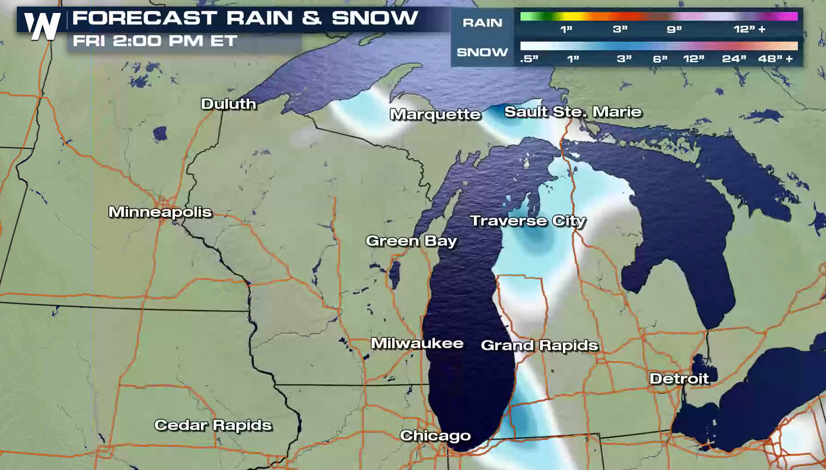
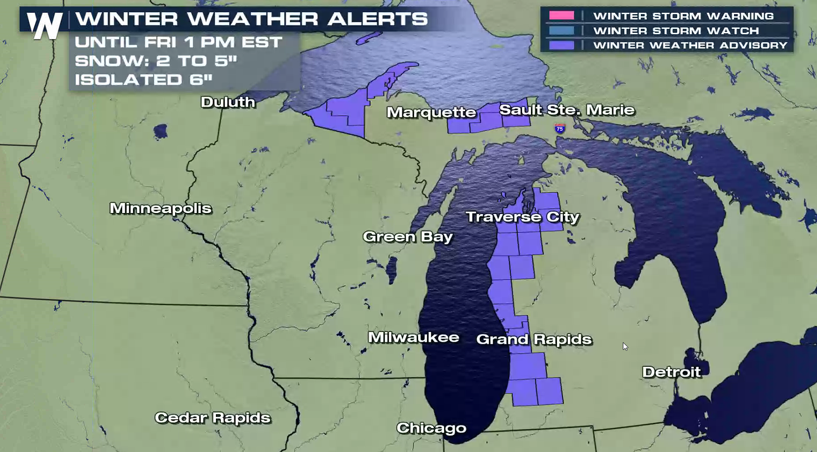
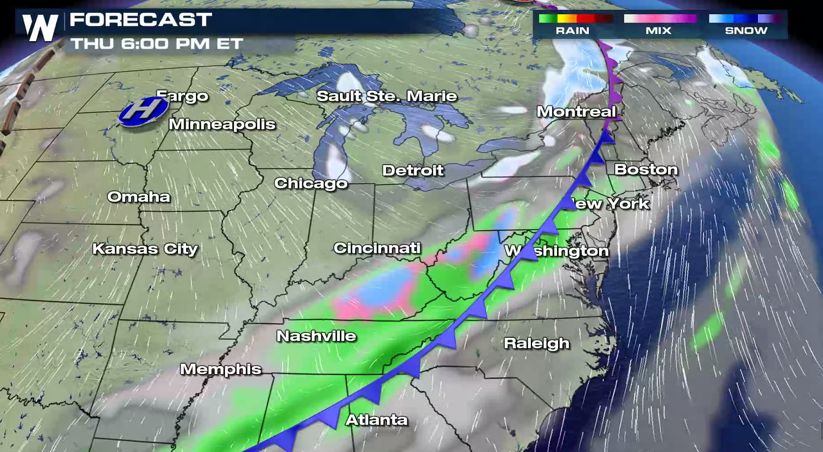
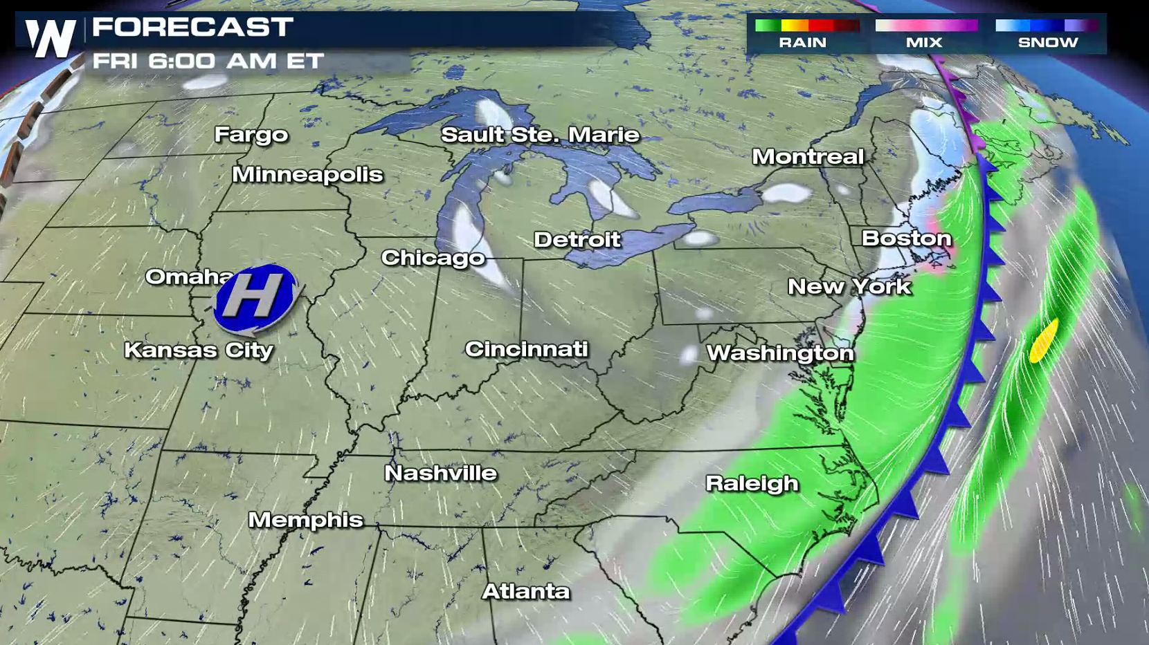
Lake effect snow showers moving across Michigan will produce up to 6" of new snowfall accumulation by Friday. The heaviest bands will be found in eastern Upper Michigan and northern Lower Michigan. Winter Weather Advisories remain in effect for the area.
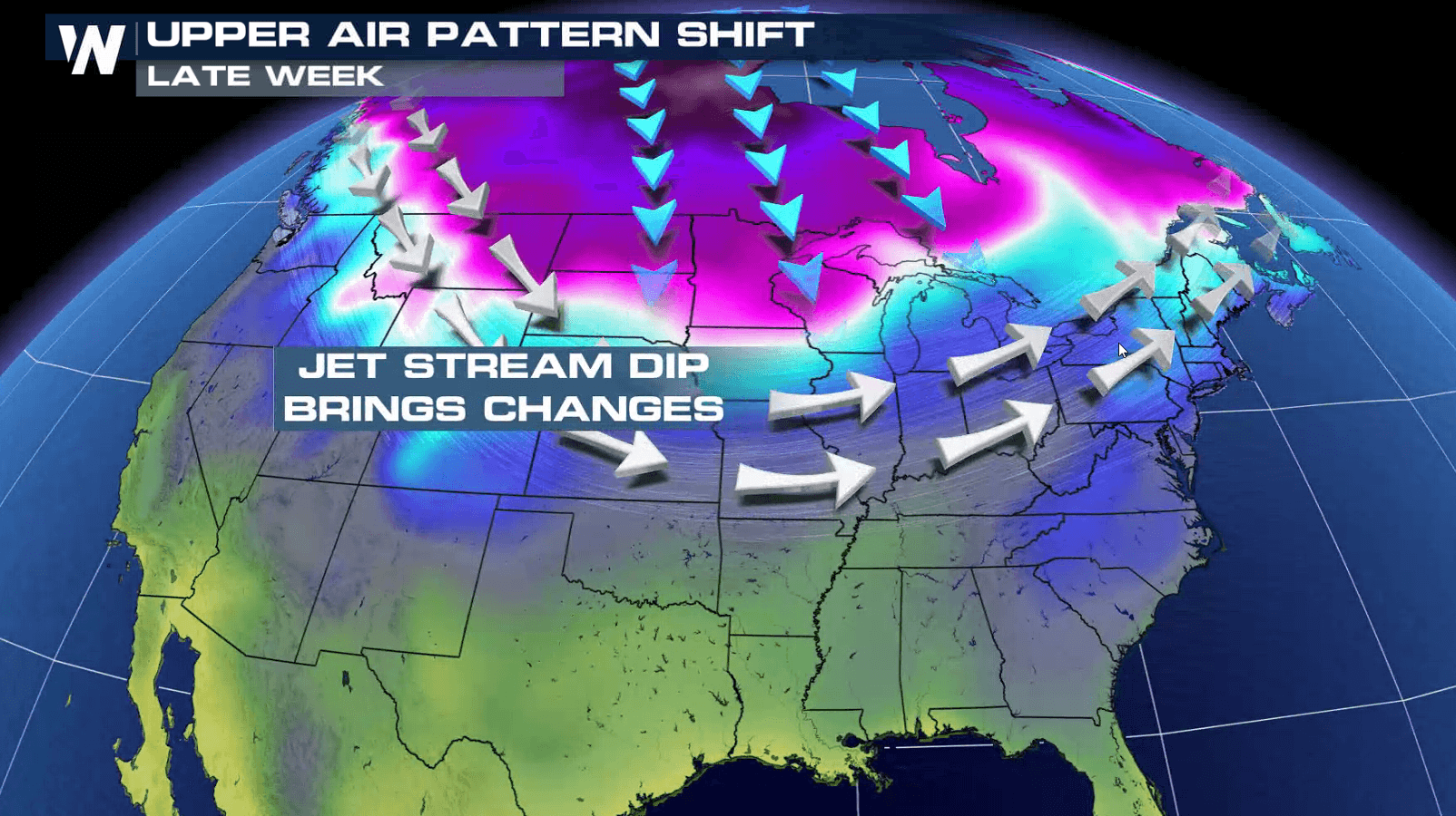
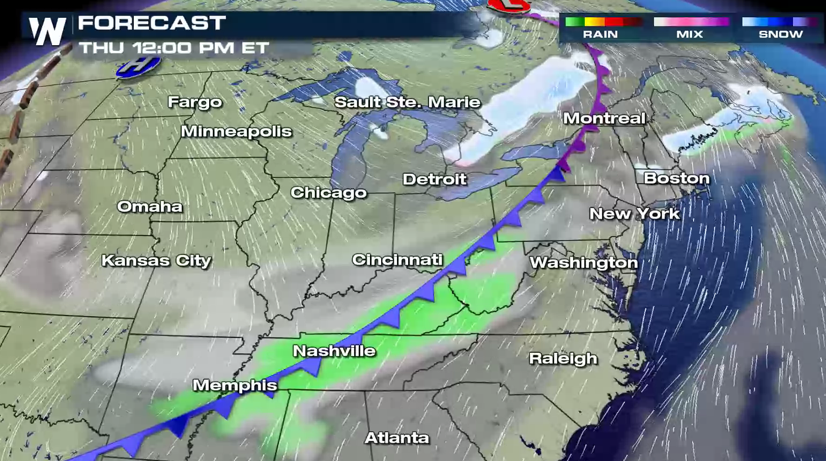
 As a fast moving low pressure center moves east of the Great Lakes, a cold front dropping southward will funnel in cold air throughout the region. This will fuel the lake effect snow as a strong high pressure center in the Upper Midwest pushes cold northwest winds over the lakes. The snow showers will diminish this weekend with a wind shift.
 For WeatherNation: Meteorologist Mace Michaels
As a fast moving low pressure center moves east of the Great Lakes, a cold front dropping southward will funnel in cold air throughout the region. This will fuel the lake effect snow as a strong high pressure center in the Upper Midwest pushes cold northwest winds over the lakes. The snow showers will diminish this weekend with a wind shift.
For WeatherNation: Meteorologist Mace MichaelsAll Weather News
More

Flooding, Severe Storms Target the Midwest Again
After an active week of storms across the nor
1 Aug 2026 1:40 AM


After Reaching Category 5, Genevieve Weakens in the Pacific
PacificFausto is now a post-tropical cyclone.
31 Jul 2026 1:30 AM

Flooding Risk Increases as Heavy Rain Targets the Tri-State Area
Tuesday, heavy rainfall moved across the Nort
30 Jul 2026 12:25 AM

Severe Weather: Energy From the Midwest Now in the Southeast
UPPER MIDWEST - Through Monday, dangerous tor
29 Jul 2026 10:30 PM