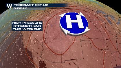
Lake Effect Snow Ramps Up
Special Stories
13 Nov 2019 6:00 AM
In the wake of a vigorous winter storm, cold temperatures and a brisk breeze will usher in another round of lake effect snow for the Great Lakes. Some areas have already seen well over a foot of snow.
https://twitter.com/NWSGrandRapids/status/1194266205902667776
WeatherNation meteorologist Joe Astolfi explains how the process of lake effect snow works.
https://youtu.be/iPAwyoSDYh8
.
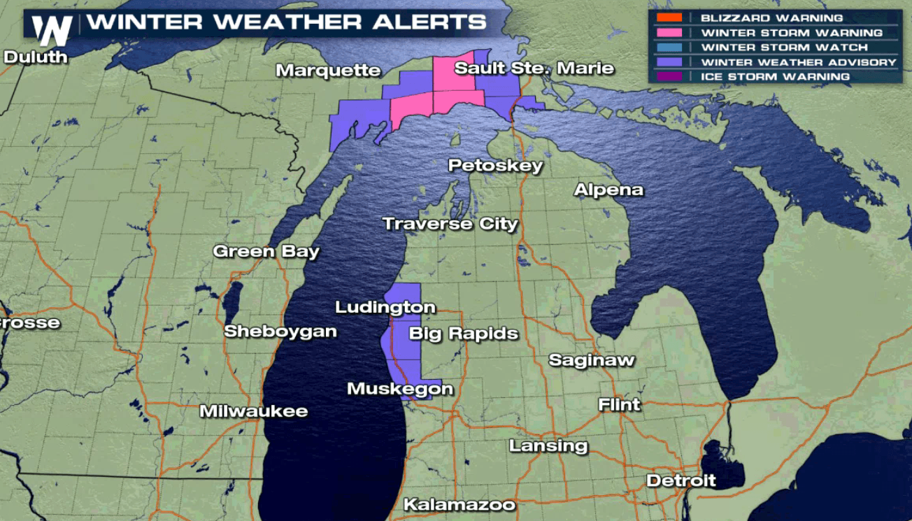
Favored locations downwind of Lake Superior and Lake Michigan---known as the snowbelt---can expect localized bands of persistent snowfall into this evening. Squalls will be narrow but intense at times. Expect quick changes in visibility and road conditions if you need to travel in the alert areas.
https://twitter.com/NWSMarquette/status/1194584919697018880
https://twitter.com/NWSGaylord/status/1194632090047762432
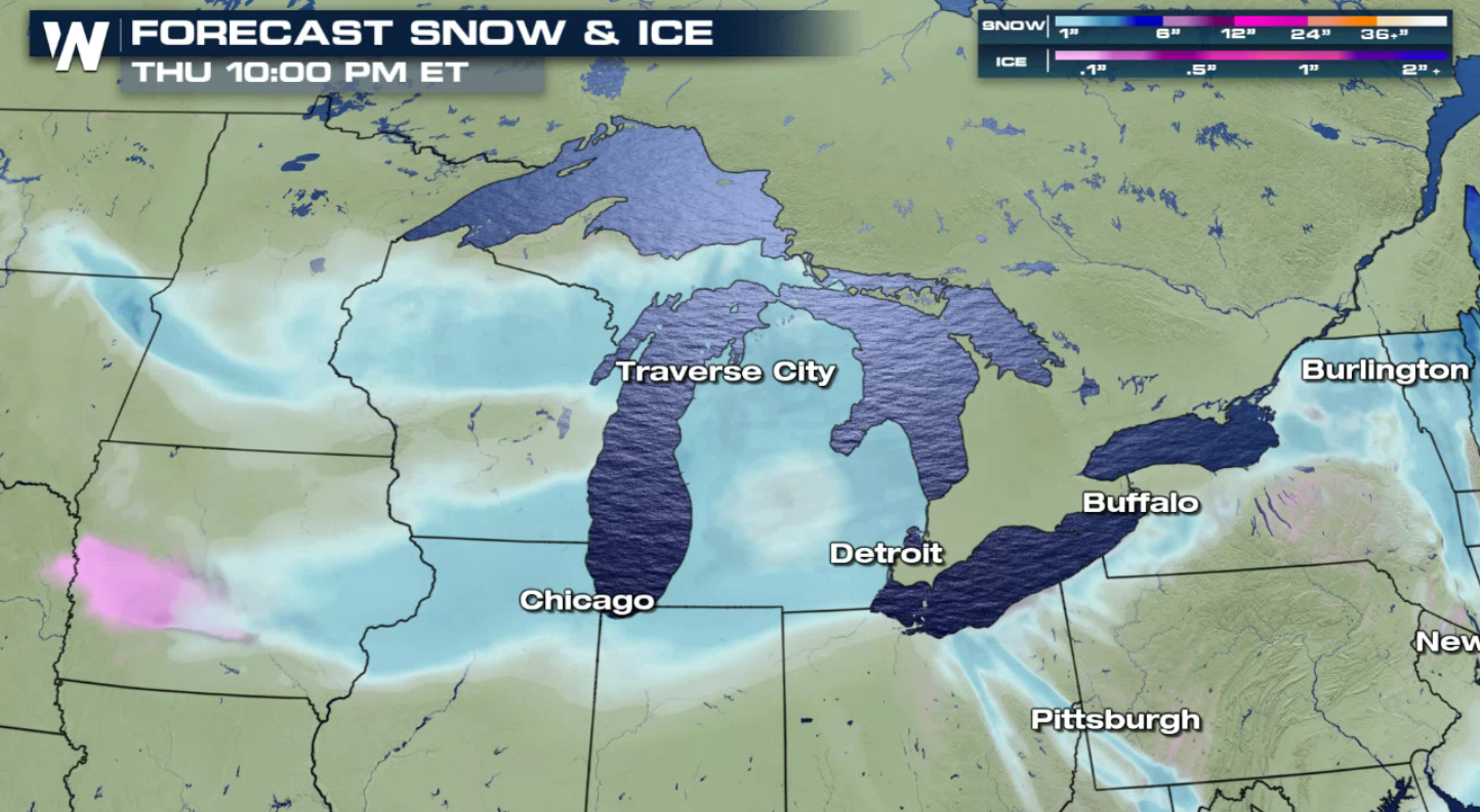
Some communities in Michigan's Upper Peninsula may pick up another 6" to 12" of snow! In west Michigan, another 3" to 6" is possible. A storm system moving in from the west coupled with lake interaction will enhance snowfall Thursday into Friday morning. Travel may be hazardous for the morning commute.
https://twitter.com/NWSGrandRapids/status/1194565509217423360
 If you're joining us from cities in the Great Lakes region, make sure to stay up to date with WeatherNation for the latest forecast. Looking ahead, warmer weather will return by the end of the week and bring an end to the lake effect snow.
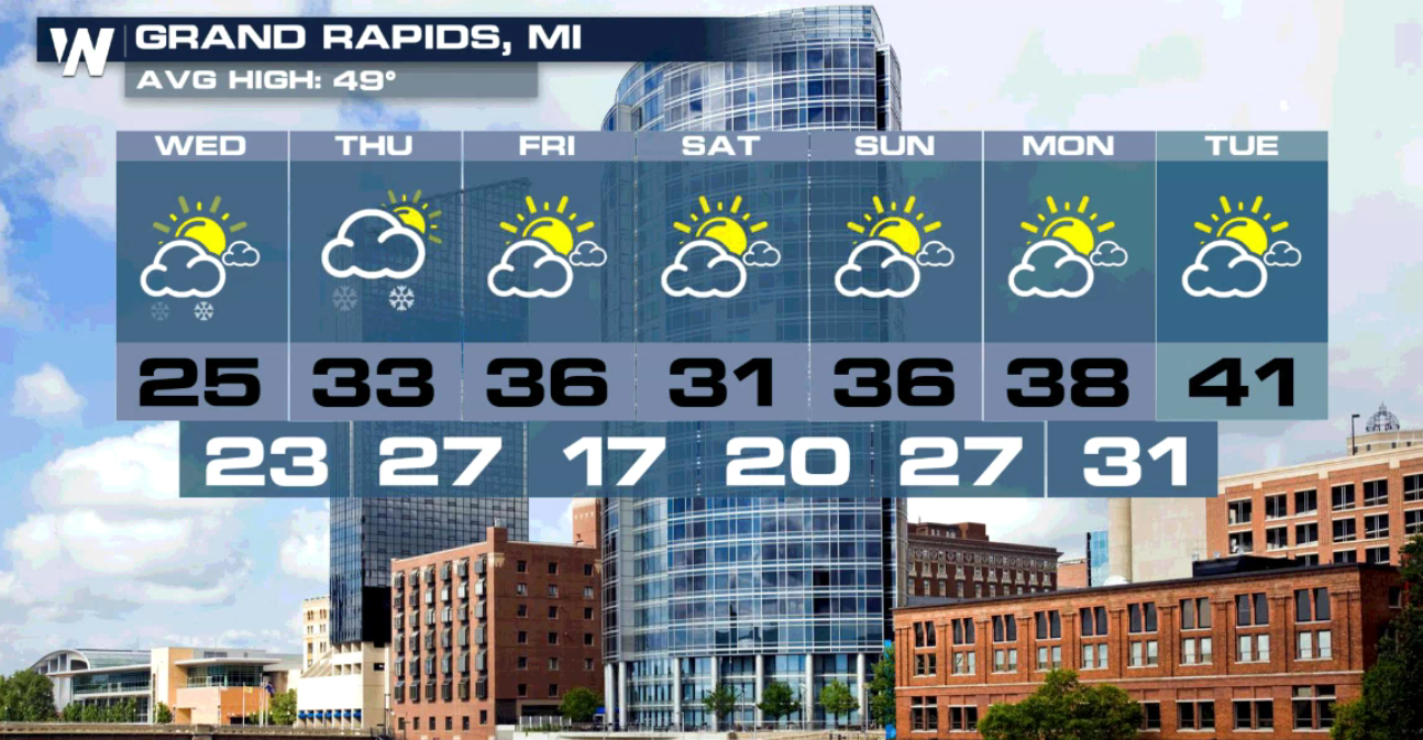
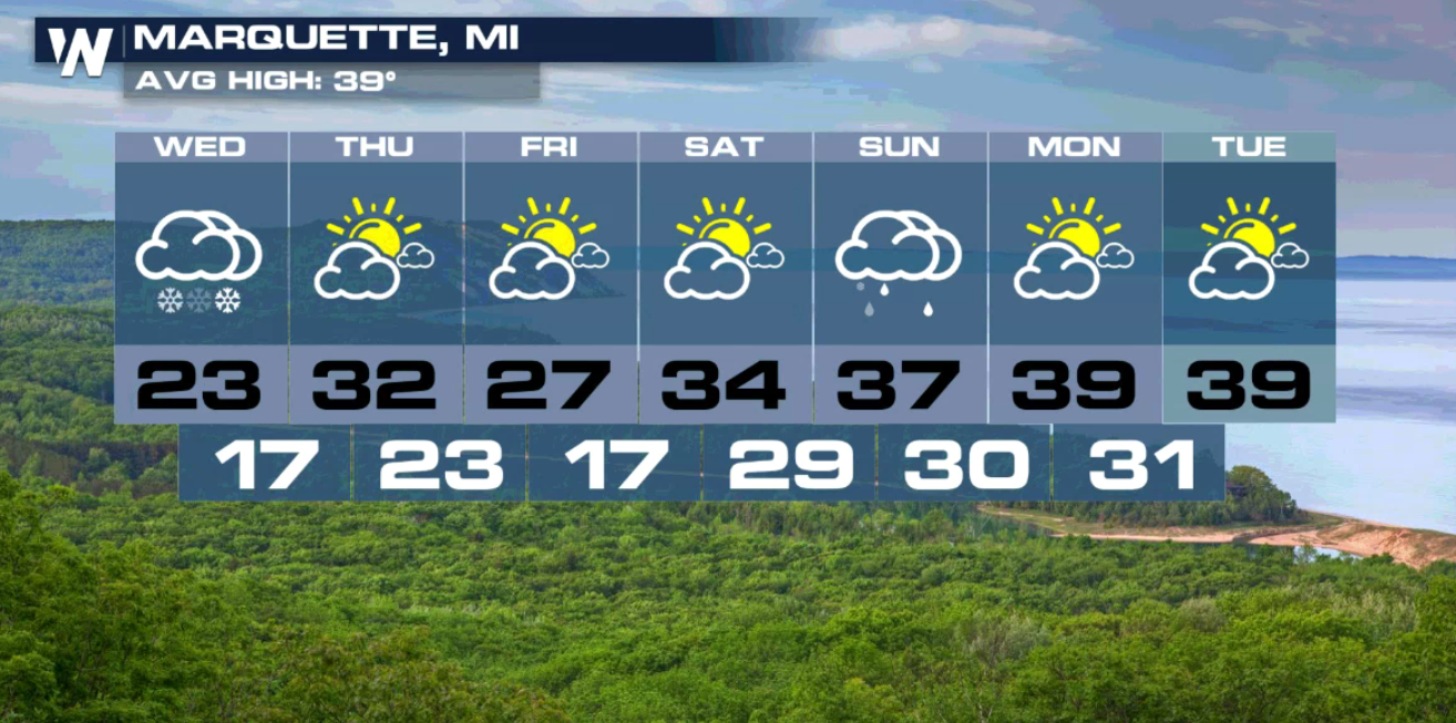 Stay warm and stay safe! For WeatherNation, I'm Meteorologist Joe Astolfi.
If you're joining us from cities in the Great Lakes region, make sure to stay up to date with WeatherNation for the latest forecast. Looking ahead, warmer weather will return by the end of the week and bring an end to the lake effect snow.
Stay warm and stay safe! For WeatherNation, I'm Meteorologist Joe Astolfi.All Weather News
More
Stalled Boundary Increases Flood Threat into the Weekend
The last couple of days we have been tracking
10 Jul 2026 2:12 AM

Saharan Dust, Excessive Heat Impact the Southeast
Hazy skies will be hovering over portions of
10 Jul 2026 2:00 AM

Babylon Fire in UT Surpasses 100,000 Acres, CO Fires Continue to Grow
The Aspen Acres fire continues to burn in Sou
10 Jul 2026 1:40 AM
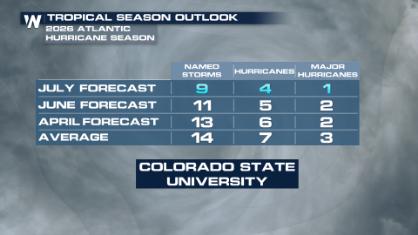
Colorado State University Scales Back 2026 Atlantic Hurricane Season Forecast
Colorado State University researchers have lo
10 Jul 2026 12:20 AM

Stormy Pattern Ahead for the Plains and Midwest
Severe weather is in the forecast across the
9 Jul 2026 12:15 PM

After Flooding in the NE, Strong Storms Stick Around
NEW JERSEY - Heavy rainfall rates of around 2
8 Jul 2026 2:05 PM