Last Day of Heat in the Northwest
Top Stories
31 Jul 2021 11:55 AM
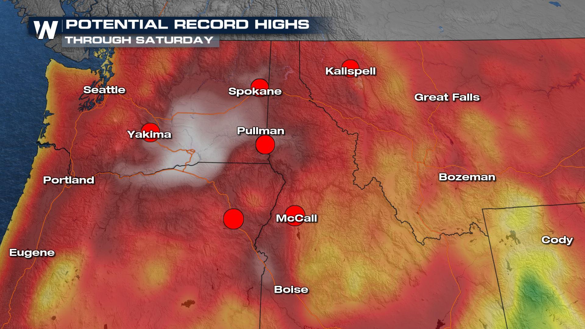
Another round of intense heat is coming to an end across portions of the Northwest. Heat alerts are still in effect on Saturday but a surge of monsoonal moisture, followed by a trough of low pressure later in the week, will help to keep temperatures out of record breaking territory for some time to come.
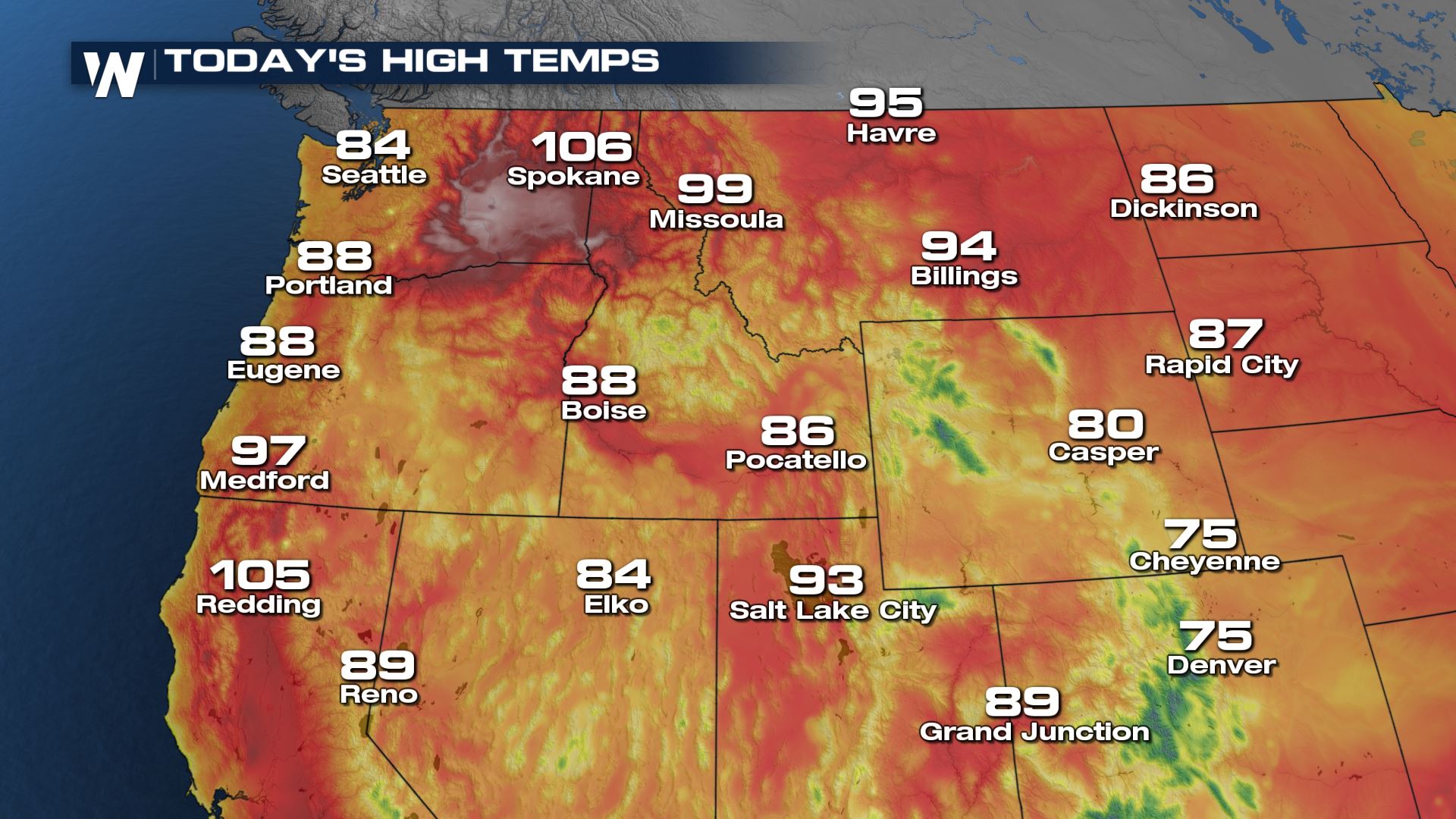
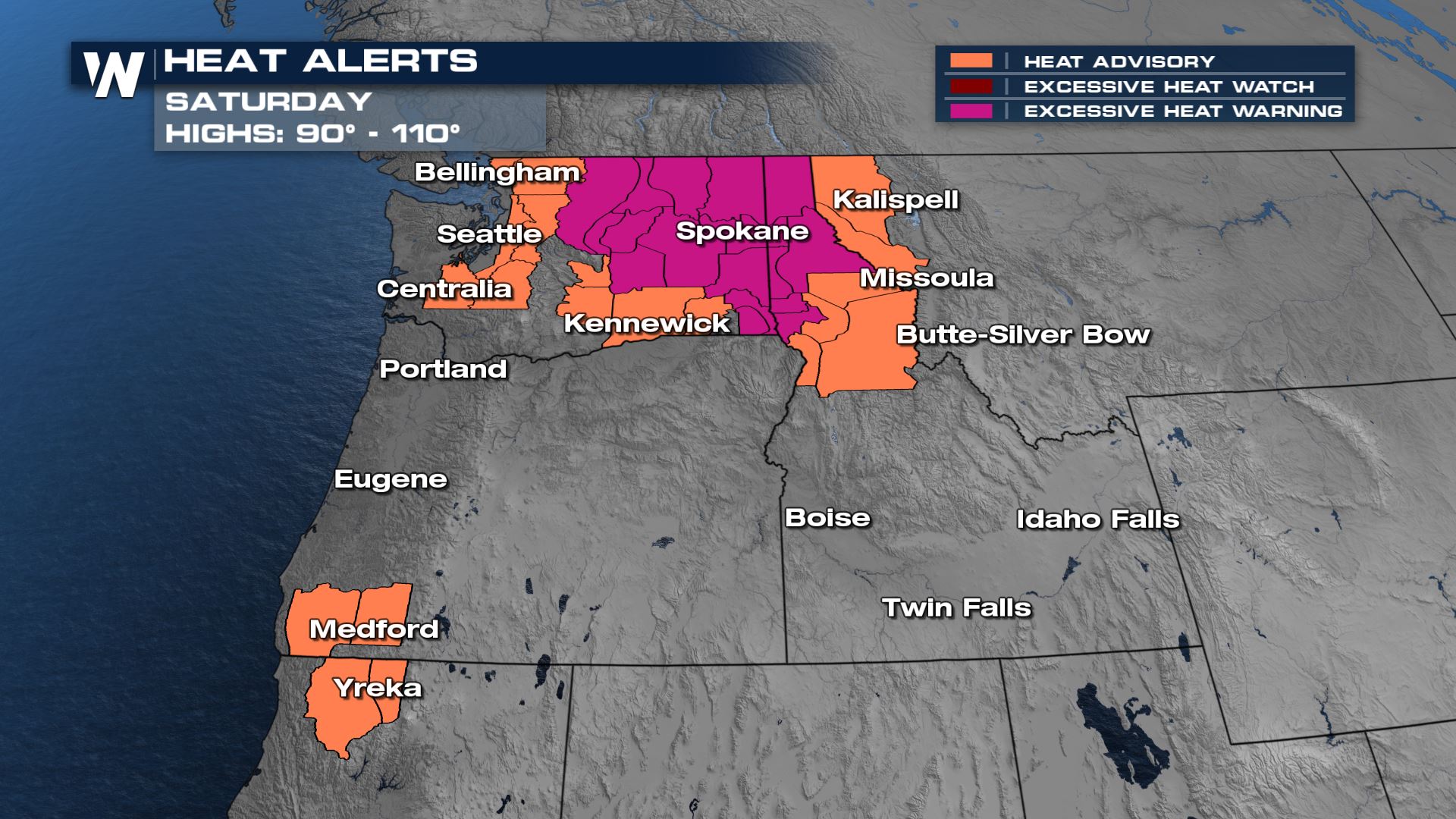 This is due to a large ridge of high pressure that is drawing hot and humid air up from the south. This will be in place through Saturday before breaking down a bit. This is nothing like the heat wave from earlier this summer, but it will be very hot through Saturday.
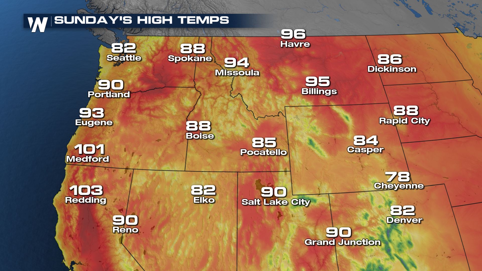 Some cooler air will move in to the I-5 corridor by Sunday as the high pressure weakens. Monsoonal moisture will surge into the Northwest Sunday too. This will increase cloud cover, chances for rain, and help hold temperatures down.
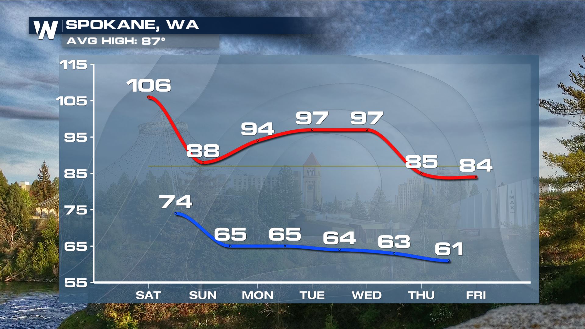 The overall trend for spots like Spokane is a cooldown through the weekend as rain and thunderstorms increase. As moisture moves away temperatures will return to above average numbers through the first half of the week before an upper-level low helps to usher in below average temperatures.
For more on the heat, join WeatherNation :50 past for the western U.S. regional forecast.
The overall trend for spots like Spokane is a cooldown through the weekend as rain and thunderstorms increase. As moisture moves away temperatures will return to above average numbers through the first half of the week before an upper-level low helps to usher in below average temperatures.
For more on the heat, join WeatherNation :50 past for the western U.S. regional forecast.
This is due to a large ridge of high pressure that is drawing hot and humid air up from the south. This will be in place through Saturday before breaking down a bit. This is nothing like the heat wave from earlier this summer, but it will be very hot through Saturday.
Some cooler air will move in to the I-5 corridor by Sunday as the high pressure weakens. Monsoonal moisture will surge into the Northwest Sunday too. This will increase cloud cover, chances for rain, and help hold temperatures down.
The overall trend for spots like Spokane is a cooldown through the weekend as rain and thunderstorms increase. As moisture moves away temperatures will return to above average numbers through the first half of the week before an upper-level low helps to usher in below average temperatures.
For more on the heat, join WeatherNation :50 past for the western U.S. regional forecast.All Weather News
More

More Storms for the East Through Monday
A low-pressure system that moved through the
3 Aug 2026 12:20 PM


After Reaching Category 5, Genevieve Weakens in the Pacific
PacificGenevieve formed last Friday south of
3 Aug 2026 12:30 AM

Flooding, Severe Storms Target the Midwest Again
After an active week of storms across the nor
1 Aug 2026 1:40 AM

Flooding Risk Increases as Heavy Rain Targets the Tri-State Area
Tuesday, heavy rainfall moved across the Nort
30 Jul 2026 12:25 AM