Last of Ida's Rain Moving Away From The Northeast
Top Stories
2 Sep 2021 4:00 AM
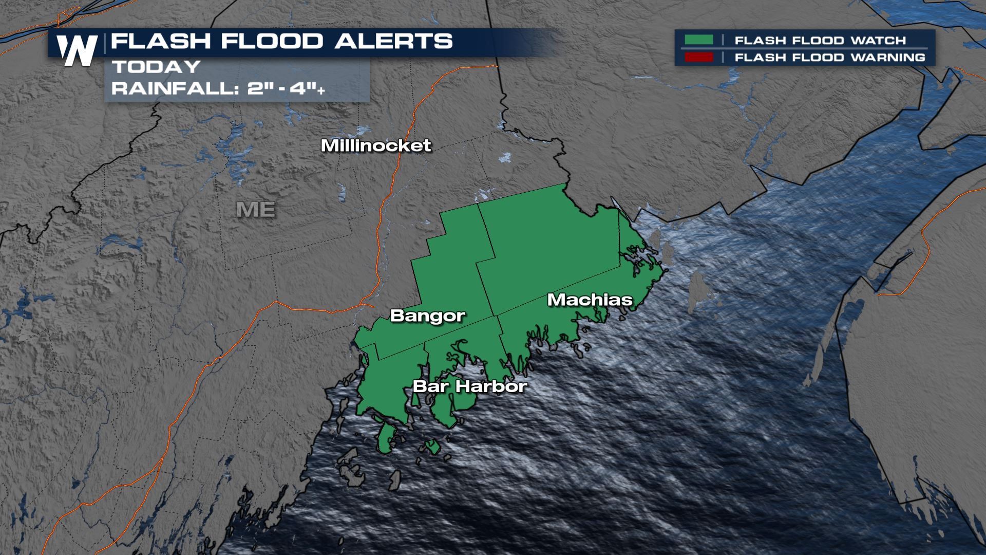
Life-threatening flash flooding and severe weather from the remnants of Ida inundate the northeast Wednesday. The last rain bands from Ida are moving through the Northeast coast today and will soon be into maritime Canada. However, flooding will still be possible in a few spots for the next several hours mainly for coastal Maine.
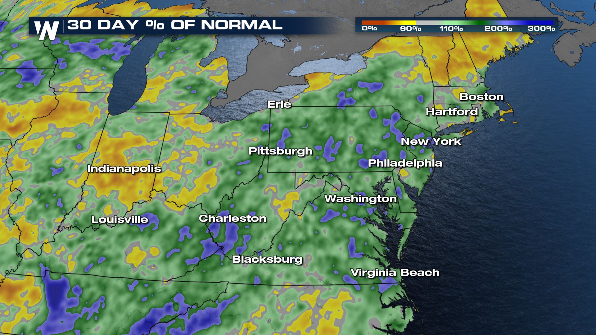
 For perspective, this area has seen well above average rainfall in the last month. Anything shaded in green or blue is 2-3 times the normal amount of precipitation for the period. The WPC outlook takes forecasted rainfall into account, but it also takes past rainfall and saturation into account. Many area waterways are already running high and susceptible to additional flooding. Over the last month Fred and Henri also brought very heavy rain
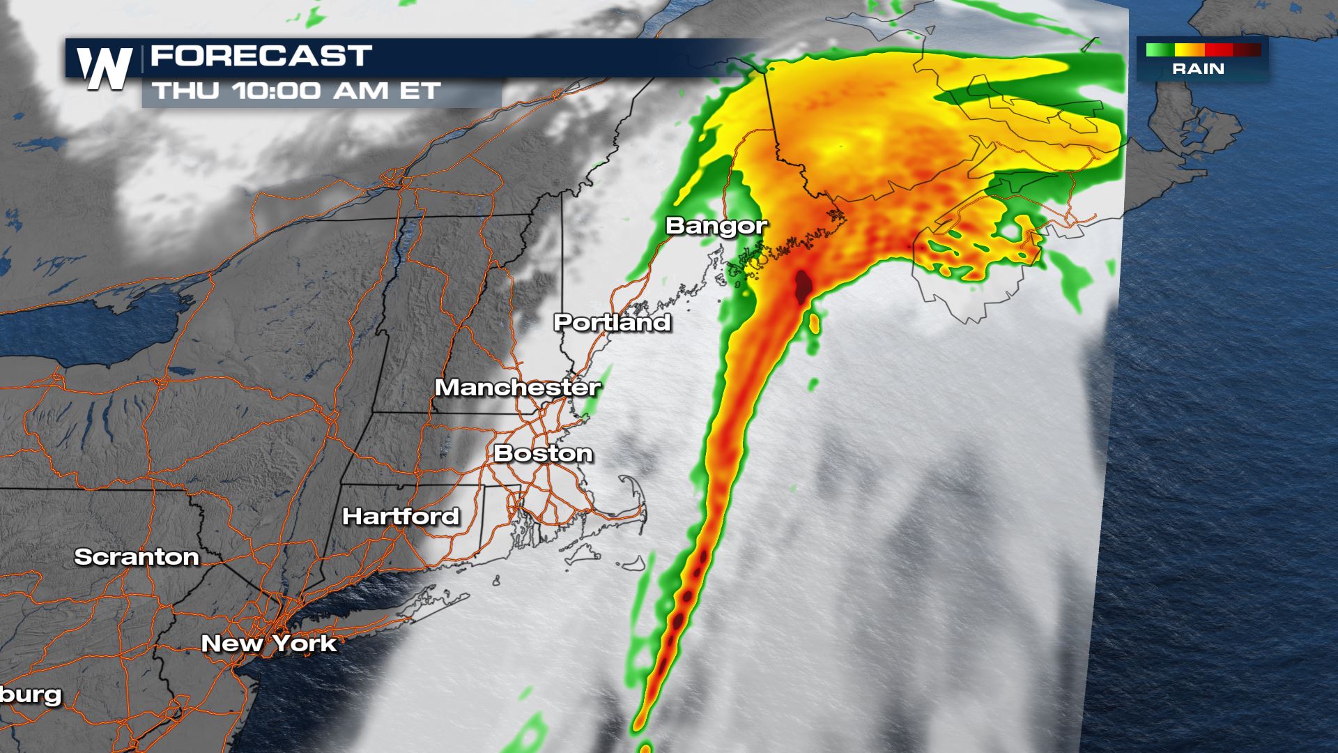
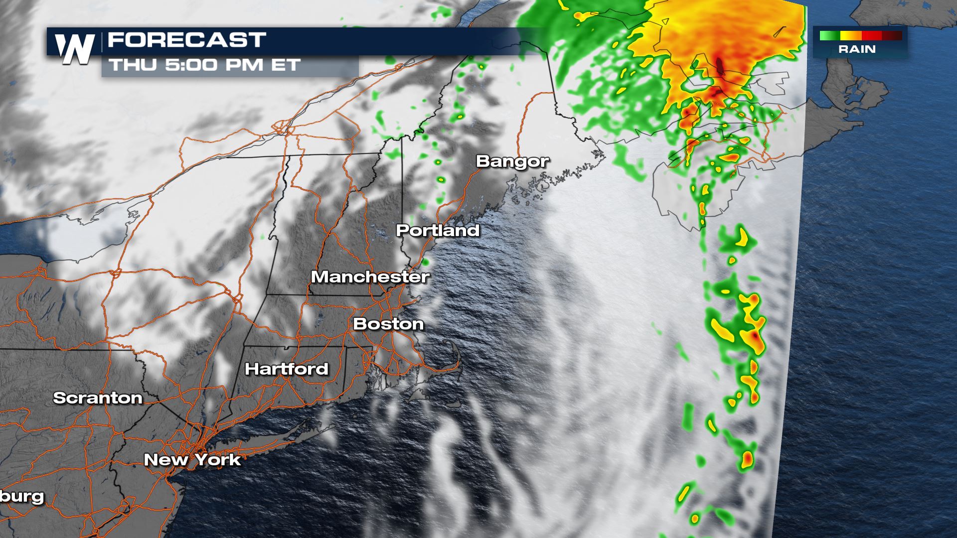
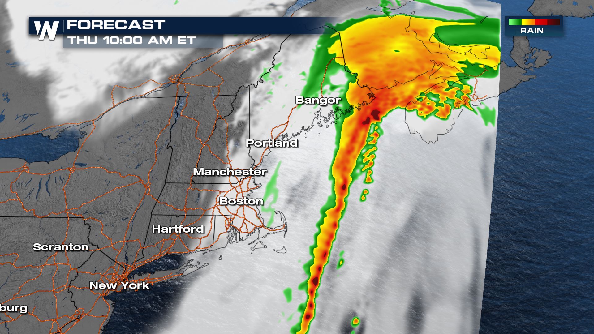 By the early afternoon most of the rain will be in Canada, but a few wrap around showers in western Maine could persist into the evening.
 Stay with WeatherNation for all the details on the aftermath of Ida from Louisiana to the Northeast.
Flood Alerts
Flash flood alerts are in place for northeast Maine as the remnants of Ida continue moving that direction.
Flood Outlooks
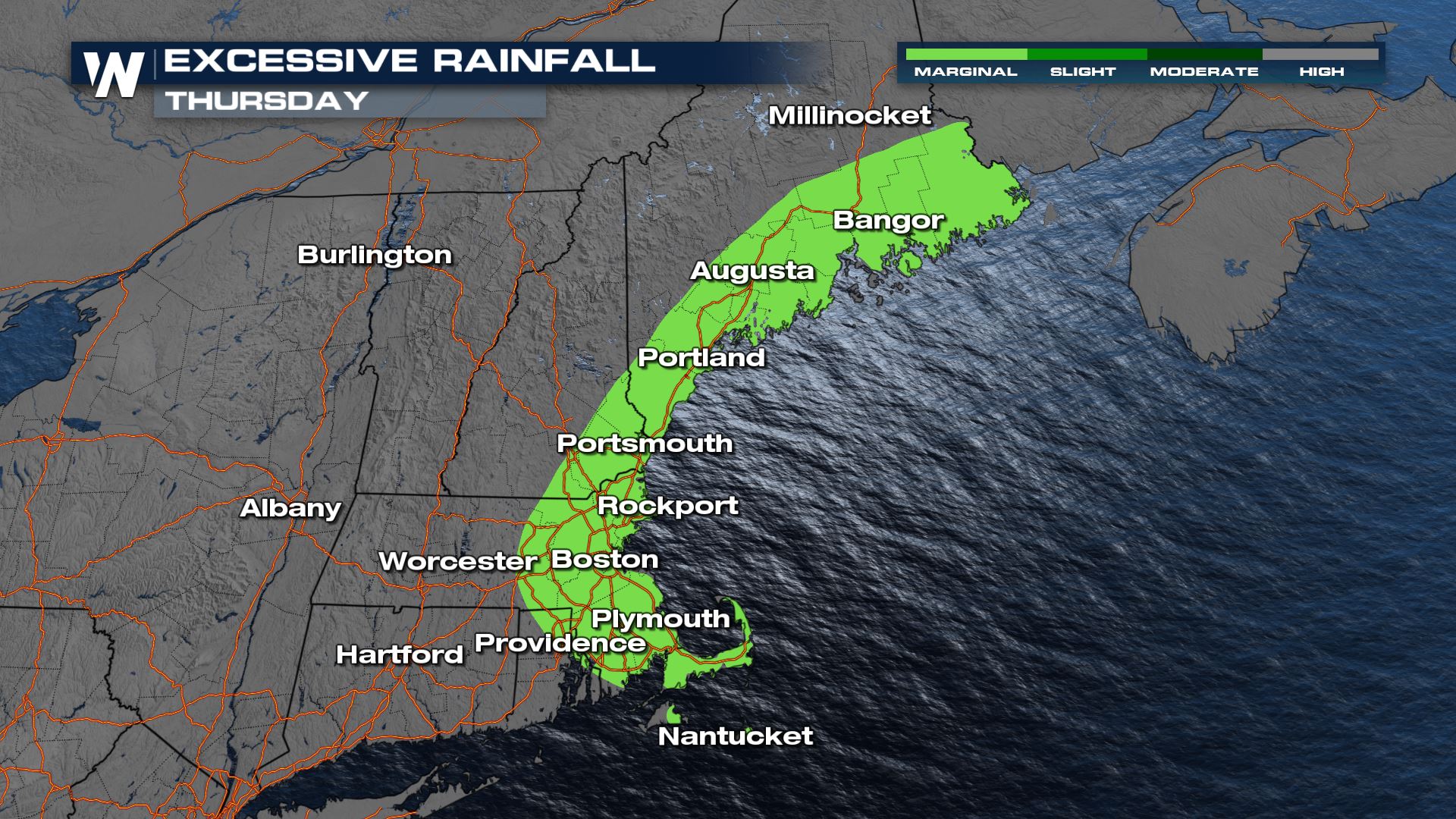
The Excessive Rain outlook for this area is Marginal today, the lowest category. That doesn't mean that flooding won't happen, rather that it will be much more isolated in reports. For perspective, this area has seen well above average rainfall in the last month. Anything shaded in green or blue is 2-3 times the normal amount of precipitation for the period. The WPC outlook takes forecasted rainfall into account, but it also takes past rainfall and saturation into account. Many area waterways are already running high and susceptible to additional flooding. Over the last month Fred and Henri also brought very heavy rain

Forecast Rainfall
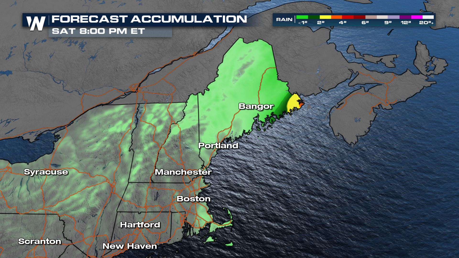
Heavy rain totals will be limited today but additional totals of 2-4" of rain in coastal Maine will be possible.
Forecast Timing
The remnants of Ida are moving quickly away from the United States but contain heavy rain.
 By the early afternoon most of the rain will be in Canada, but a few wrap around showers in western Maine could persist into the evening.
 Stay with WeatherNation for all the details on the aftermath of Ida from Louisiana to the Northeast.
All Weather News
More