Severe Storms Target the Plains and Midwest Through Early Sunday

LOWER MO VALLEY— A developing frontal boundary is dramatically dropping temperatures in the Plains and Midwest tonight, tapping into rich gulf moisture as it drops farther south. Storms have been developing and look to continue into early Sunday morning.
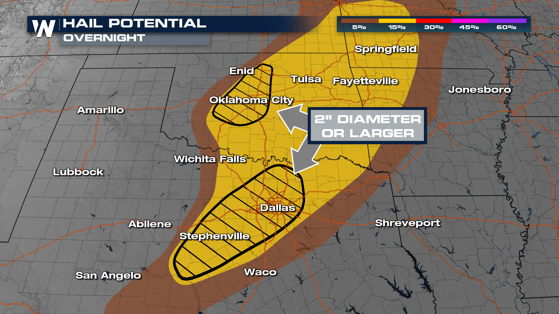
Hail is the primary threat overnight, with significant hail (bigger than golf balls) possible for the hatched region below in central Oklahoma and north Texas.
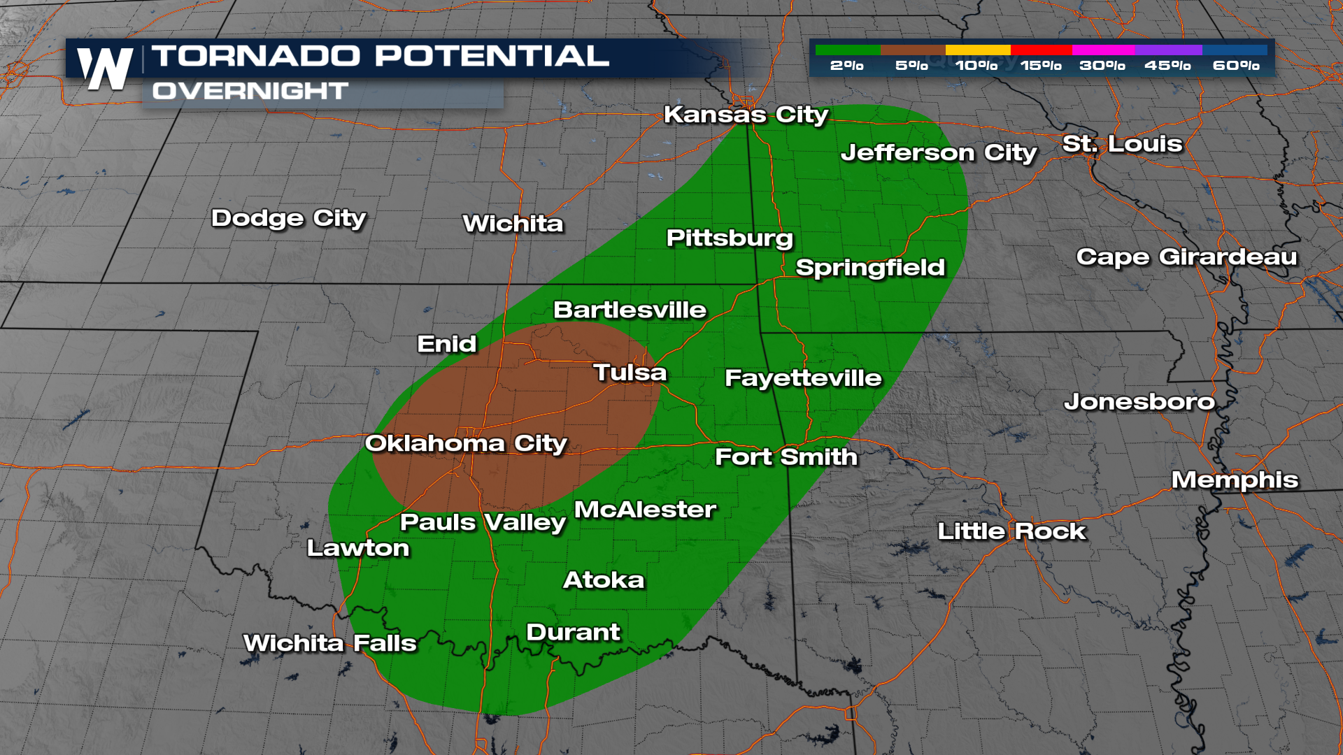
Tornadoes are also possible from the Red River into southwestern Missouri. This includes a 5% chance for Central Oklahoma.
As the upper waves and associated surface fronts move through, severe thunderstorm development will be possible over the coming days. Here's our in-house model's prediction of the future radar:
Hail events can be extremely costly, so be sure to protect your property today to ensure you don't receive any damage this week's end. For more on hail damage by the numbers, here's more:


