Late Week Lake Effect Snow
Special Stories
25 Jan 2019 8:22 AM
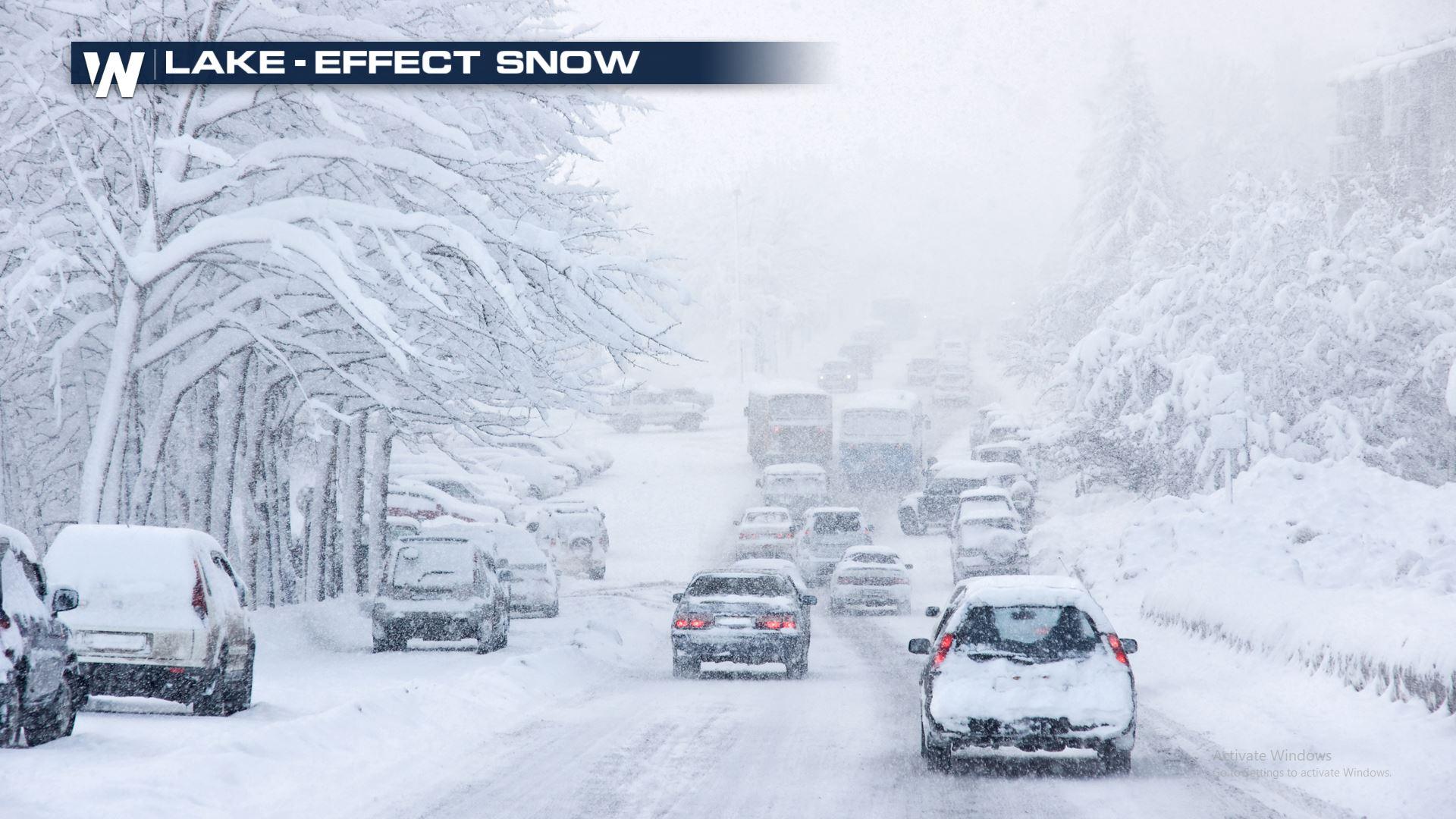
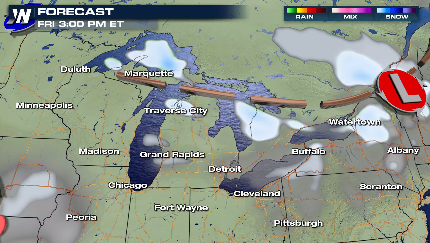
Another arctic blast will set the stage for lake-effect snow in the Great Lakes into the weekend. Thanks to less-than-average ice cover, all of the Great Lakes still have areas of open water which allows for lake-effect snow to form. Several snowbelt locations have winter weather alerts already in place in anticipation of the snow. From Michigan to New York, residents should brace for heavy bands of snow to end the week.
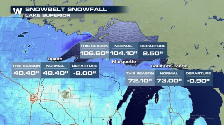
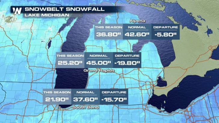
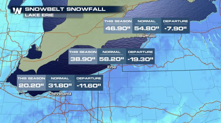
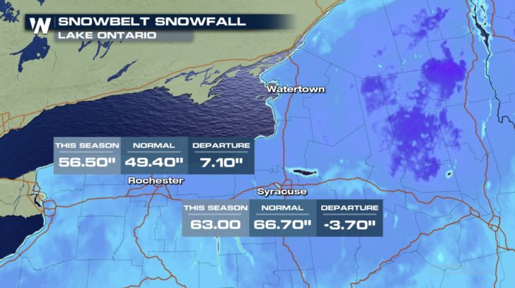
 In many lake-effect snowbelt locations, seasonal snowfall is below normal by as much as ten to twenty inches! There are a few exceptions, however. Both Marquette, Michigan and Rochester, New York have had above normal snowfall so far this winter.
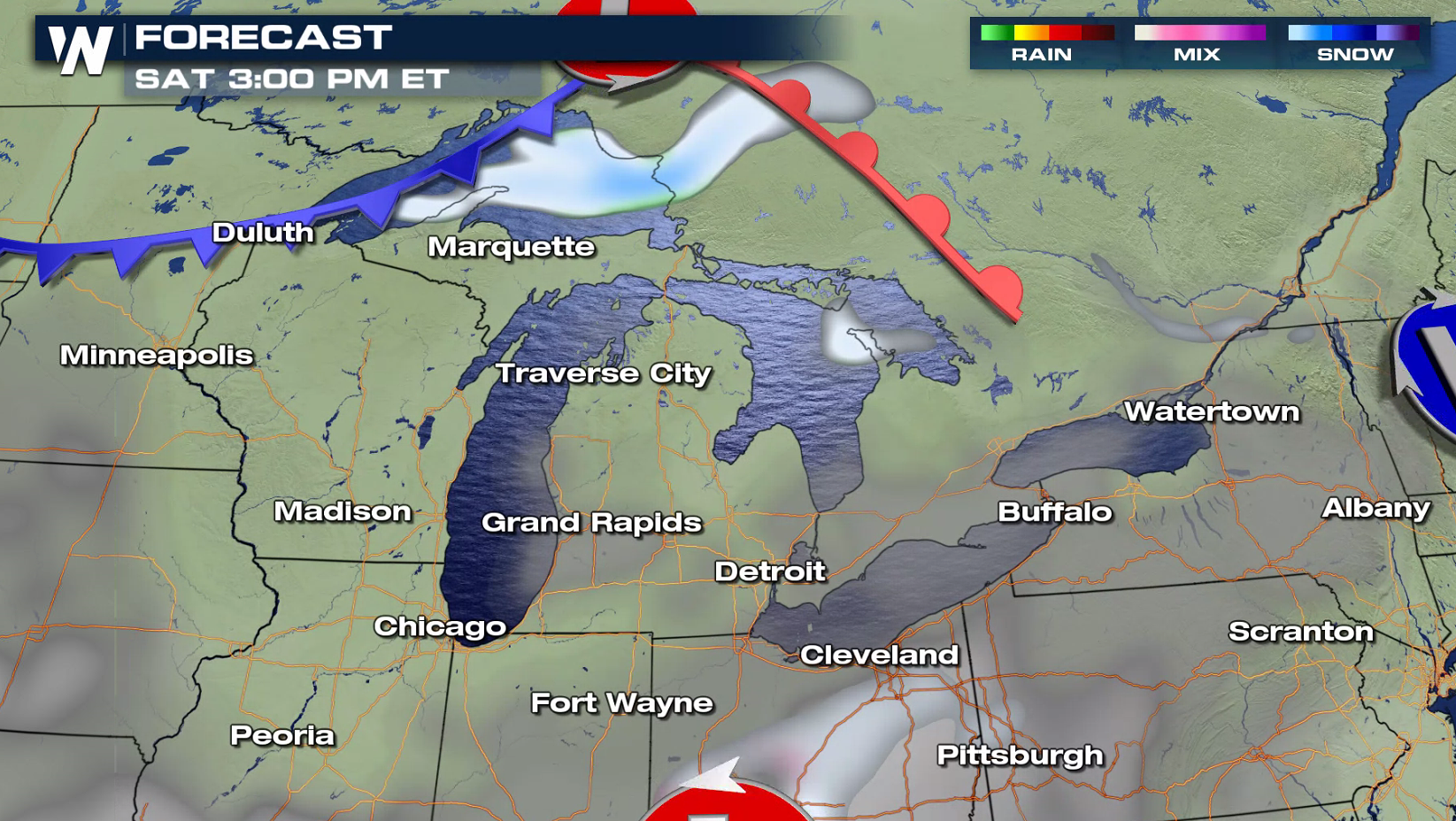
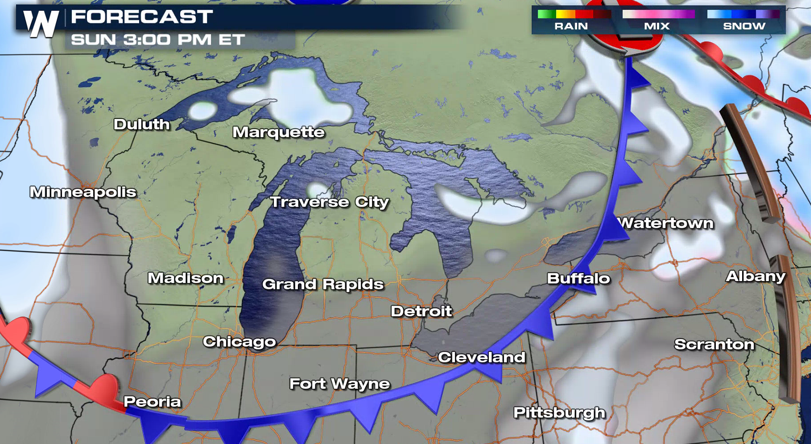
 A cold front passed through the Great Lakes region on Thursday and the winds began to howl out of the west-northwest. This overall pattern will continue into the weekend, as a reinforcing trough Saturday and another cold front Sunday will keep the winds flowing over the lakes.
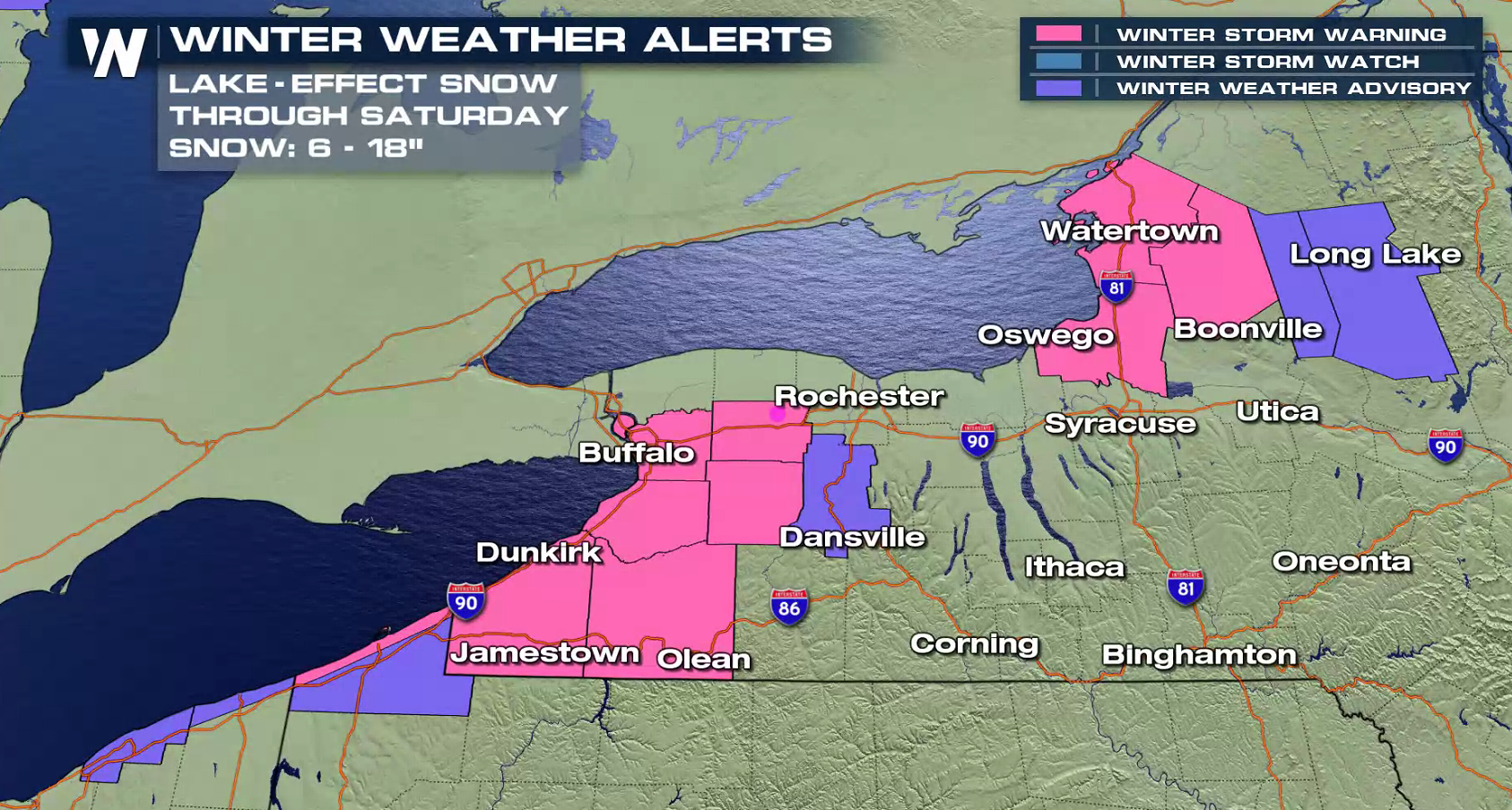
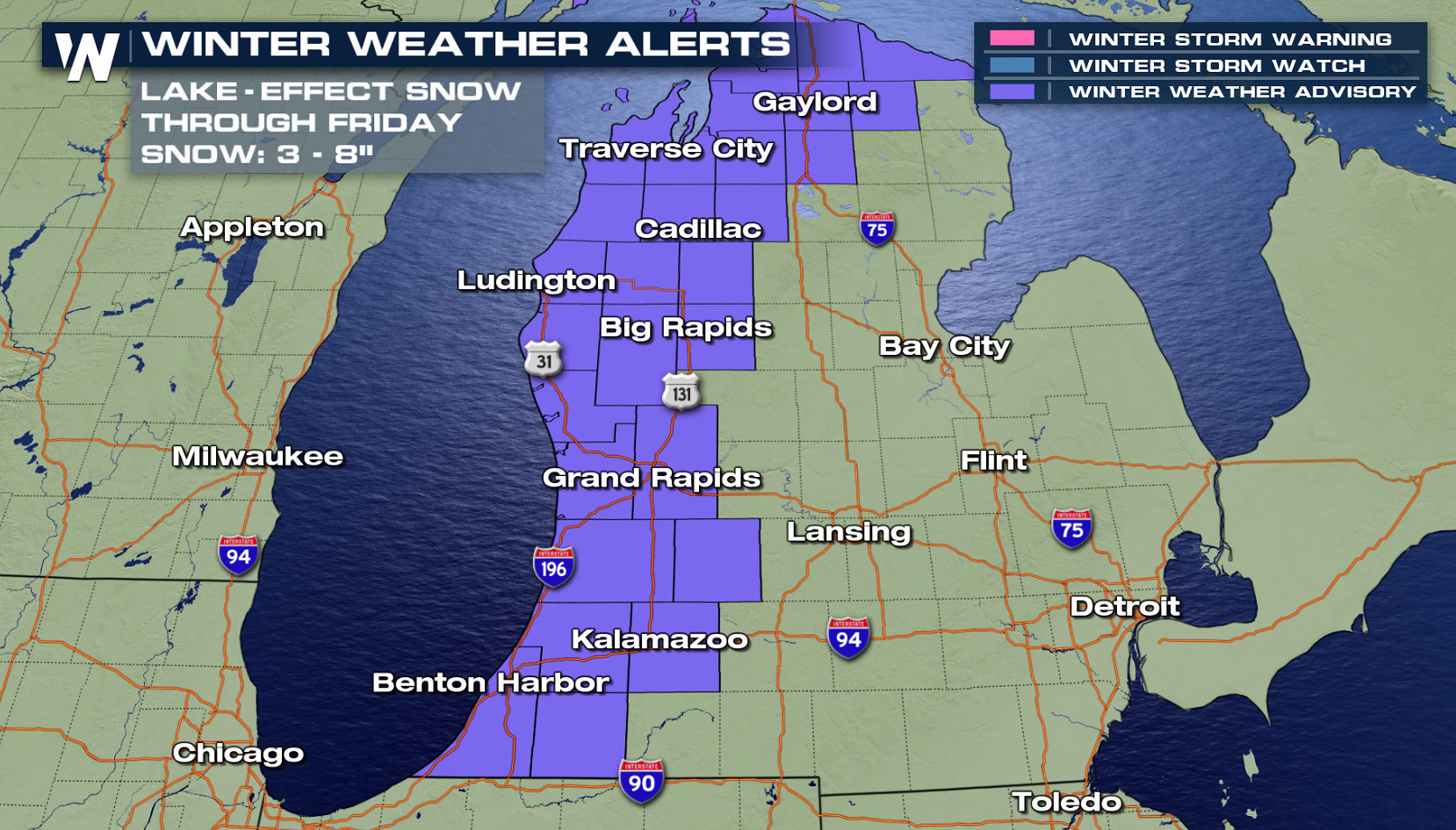
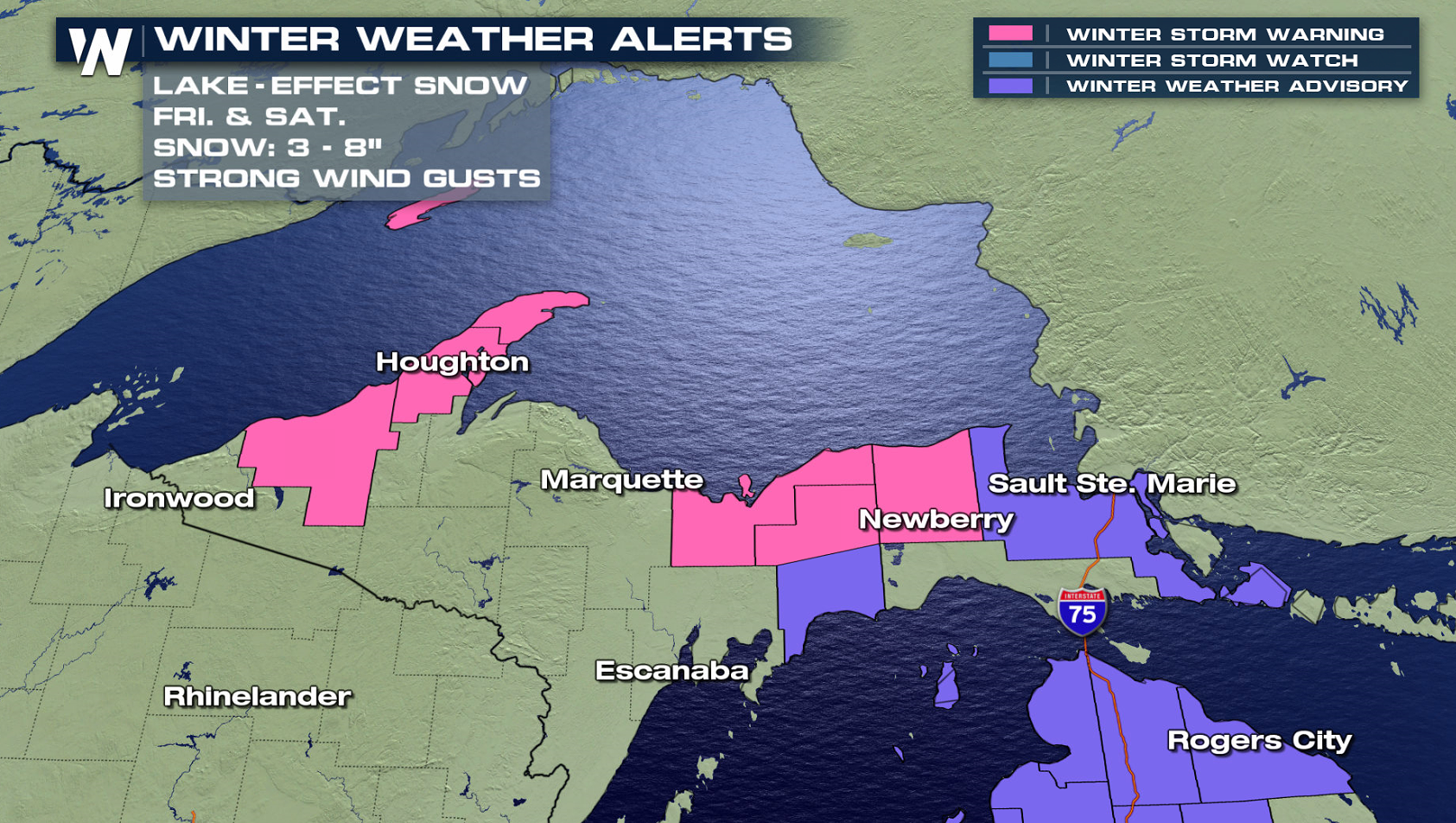
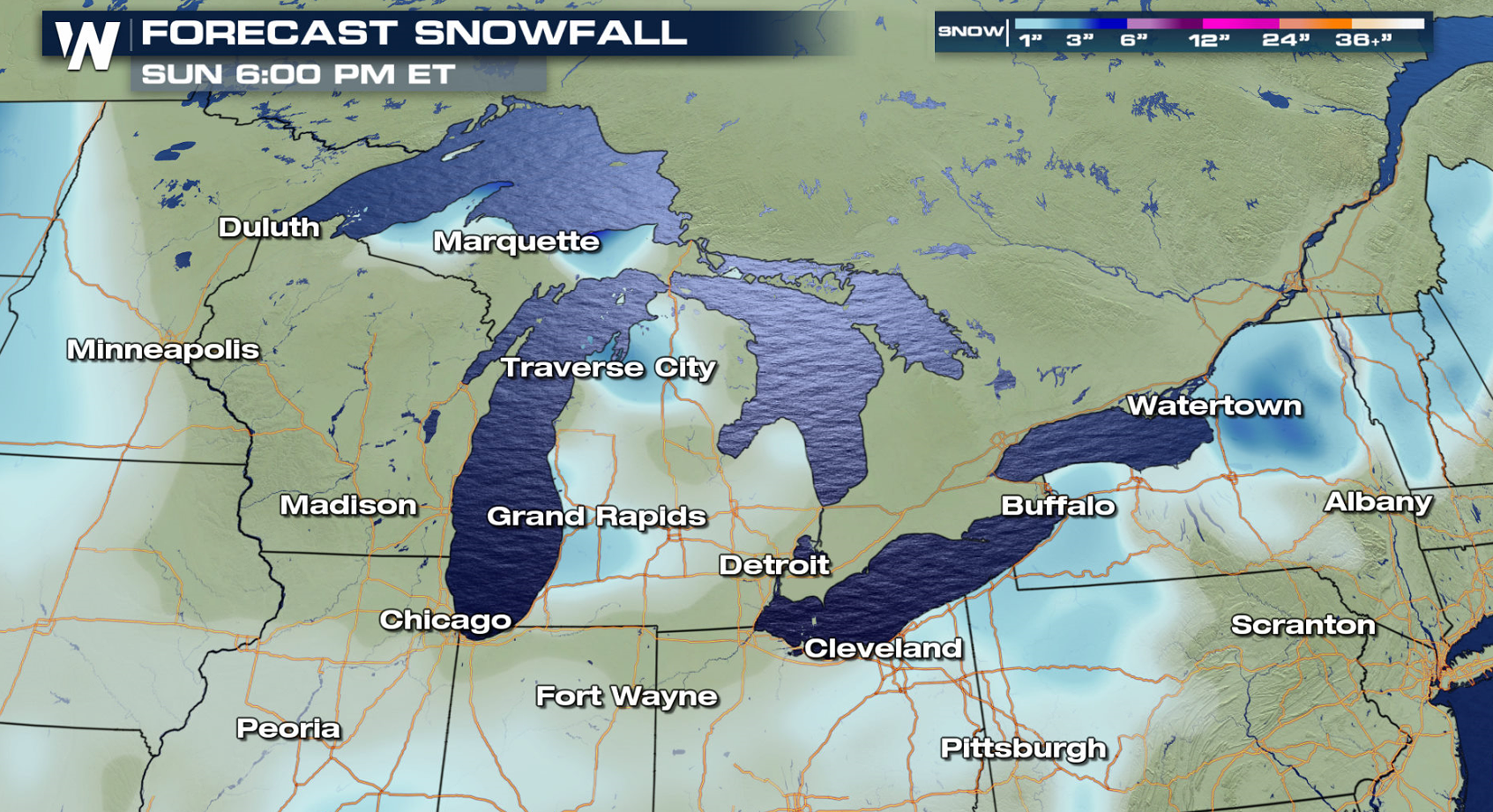
 The potential exists for one to two feet of snow in western New York, where the most persistent lake-effect snow bands will likely set up. Still, many areas of Michigan and other lake-effect prone areas could accumulate six or more inches of new snow by the end of the week.
 Stay safe. Stay warm. And stay tuned to WeatherNation for the latest forecast.
- Meteorologist Joe Astolfi
Stay safe. Stay warm. And stay tuned to WeatherNation for the latest forecast.
- Meteorologist Joe Astolfi
In many lake-effect snowbelt locations, seasonal snowfall is below normal by as much as ten to twenty inches! There are a few exceptions, however. Both Marquette, Michigan and Rochester, New York have had above normal snowfall so far this winter.
A cold front passed through the Great Lakes region on Thursday and the winds began to howl out of the west-northwest. This overall pattern will continue into the weekend, as a reinforcing trough Saturday and another cold front Sunday will keep the winds flowing over the lakes.
The potential exists for one to two feet of snow in western New York, where the most persistent lake-effect snow bands will likely set up. Still, many areas of Michigan and other lake-effect prone areas could accumulate six or more inches of new snow by the end of the week.
Stay safe. Stay warm. And stay tuned to WeatherNation for the latest forecast.
- Meteorologist Joe AstolfiAll Weather News
More
Severe Storms Target the Midwest to the Northeast
UPPER MIDWEST - Dangerous tornadoes have alre
27 Jul 2026 10:20 PM


Tropics: Fausto Heads towards Hawaii; Genevieve Cat 4 Hurricane
Atlantic BasinBertha has dissipated after mov
27 Jul 2026 3:00 PM

Southeast Flood Risk Lingers Near Stalled Front
A stalled boundary over the Southeast will ke
25 Jul 2026 10:55 AM

Another Round of Storms Targets the Northeast
Tuesday brought severe weather again across p
23 Jul 2026 1:15 AM

Another Round of Severe Weather for the Upper Midwest and Great Lakes
The upper-level low train continues to keep t
21 Jul 2026 1:45 AM