Severe Storms in the Upper Midwest Monday
Special Stories
15 Jun 2020 9:00 AM
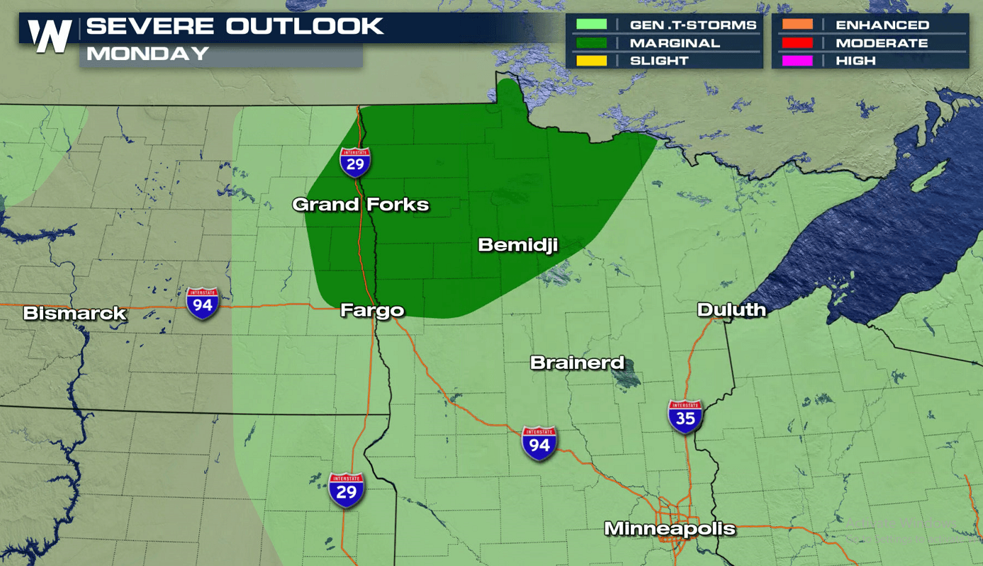
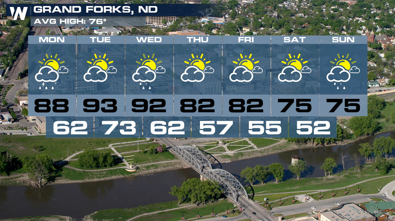
More unsettled weather is expected in the northern tier of the nation today (Monday). The threat will be once again in the Upper Midwest of North Dakota and Minnesota, where temperatures will be able to warm up and instability is able to build.
 The forecast snapshots below show where and when storms could form and move today (Monday). Storms will form and be most active ahead of a low pressure center and warm front.
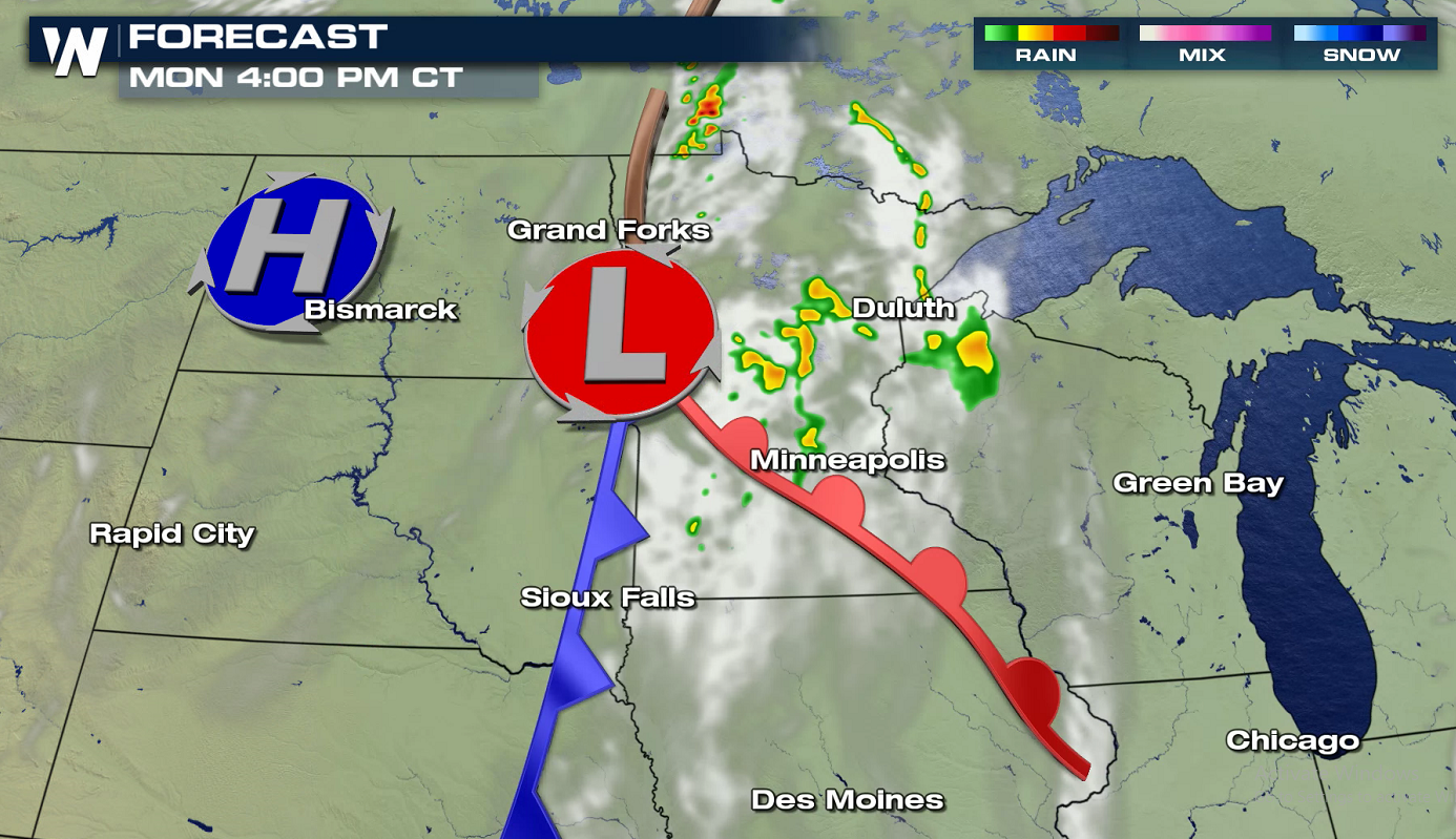
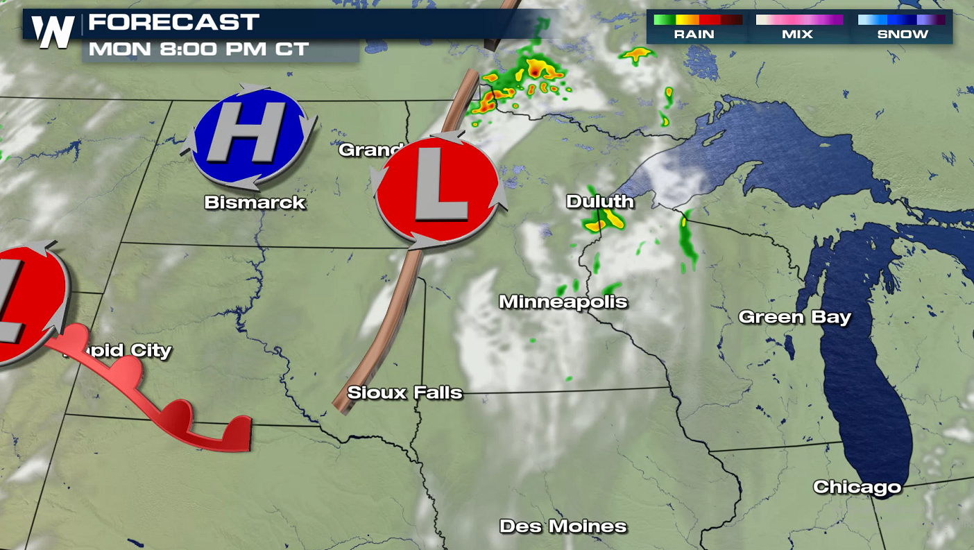
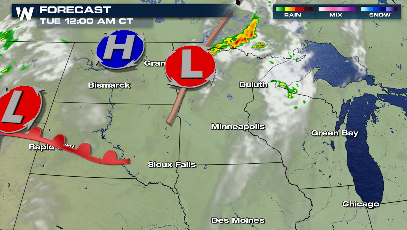 The moderate to heavy precipitation in thunderstorms could help the dry conditions found across most of the region. Severe will again be possible Tuesday and Wednesday.
 Keep it tuned to WeatherNation for the latest forecast.
Severe Risks
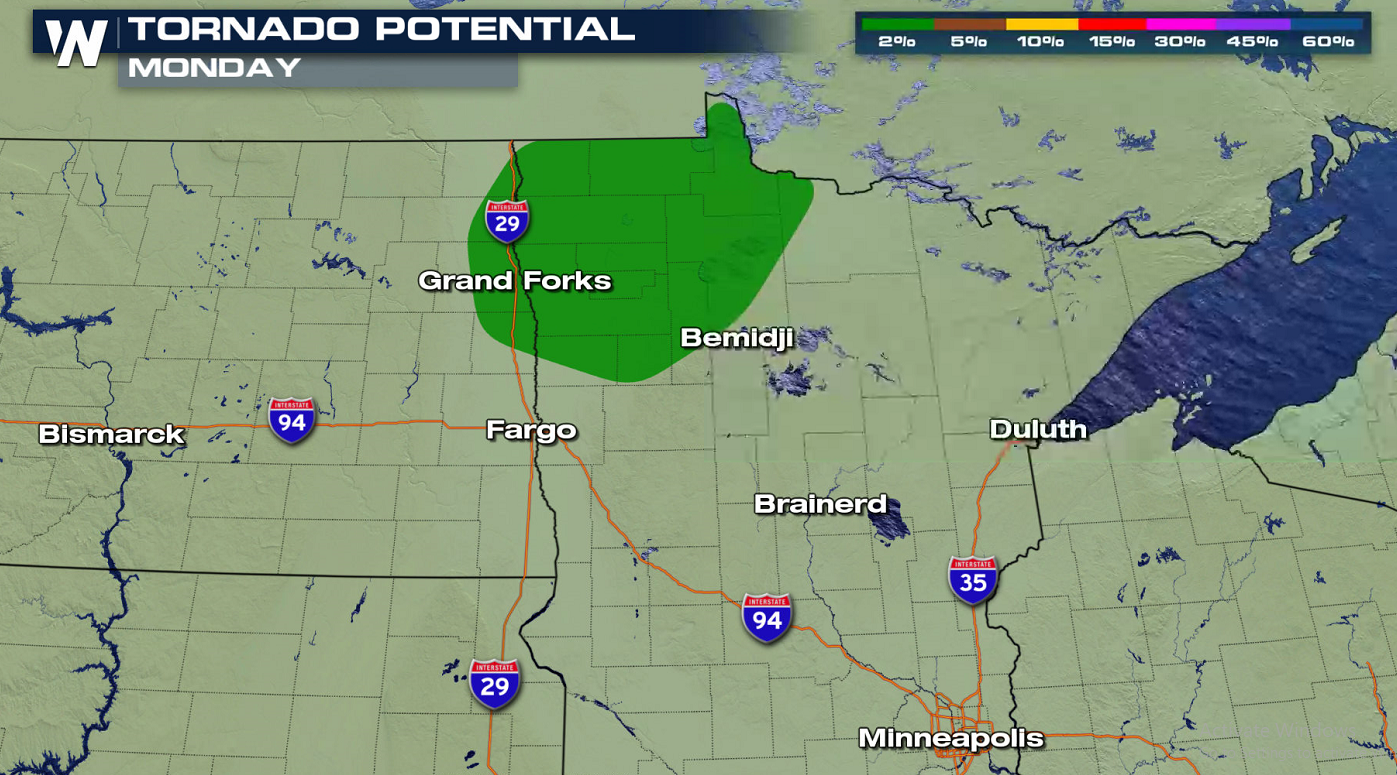
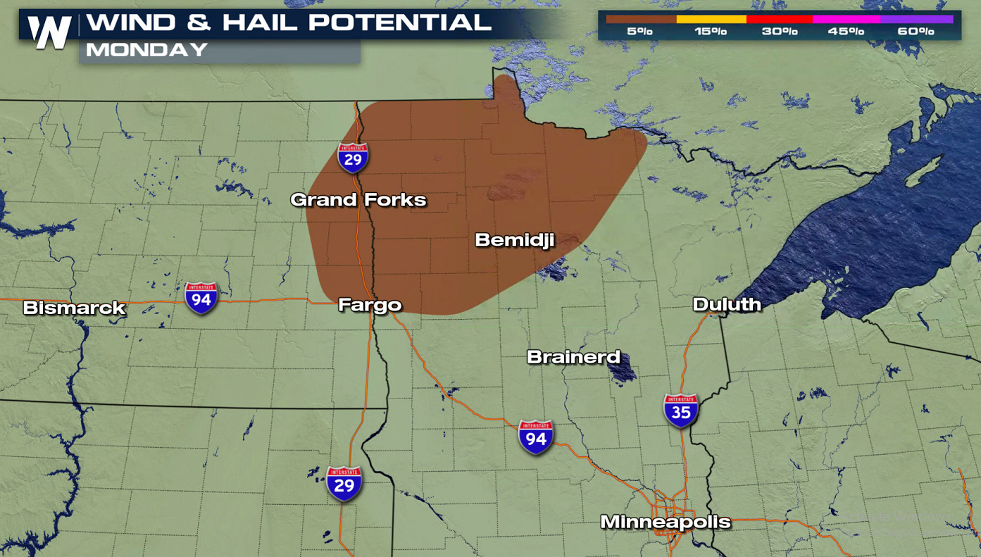
All modes of severe weather will be in today's forecast with damaging winds and large hail as the primary weather threats. An isolated tornado is possible, mainly in the northern Red River Valley into Northwest Minnesota.
The forecast snapshots below show where and when storms could form and move today (Monday). Storms will form and be most active ahead of a low pressure center and warm front.
The moderate to heavy precipitation in thunderstorms could help the dry conditions found across most of the region. Severe will again be possible Tuesday and Wednesday.
Keep it tuned to WeatherNation for the latest forecast.All Weather News
More
Severe Storm Threat Returns to the Midwest
After several tornadoes ripped through the Mi
31 Jul 2026 2:20 AM


After Reaching Category 5, Genevieve Weakens in the Pacific
PacificFausto is now a post-tropical cyclone.
31 Jul 2026 1:30 AM

Flooding Risk Increases as Heavy Rain Targets the Tri-State Area
Tuesday, heavy rainfall moved across the Nort
30 Jul 2026 12:25 AM

Severe Weather: Energy From the Midwest Now in the Southeast
UPPER MIDWEST - Through Monday, dangerous tor
29 Jul 2026 10:30 PM

Southeast Flood Risk Lingers Near Stalled Front
A stalled boundary over the Southeast will ke
25 Jul 2026 10:55 AM