Weekend Snow for the Sierra Nevada Mountains
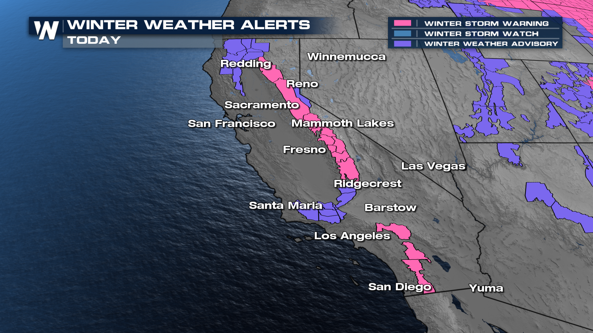
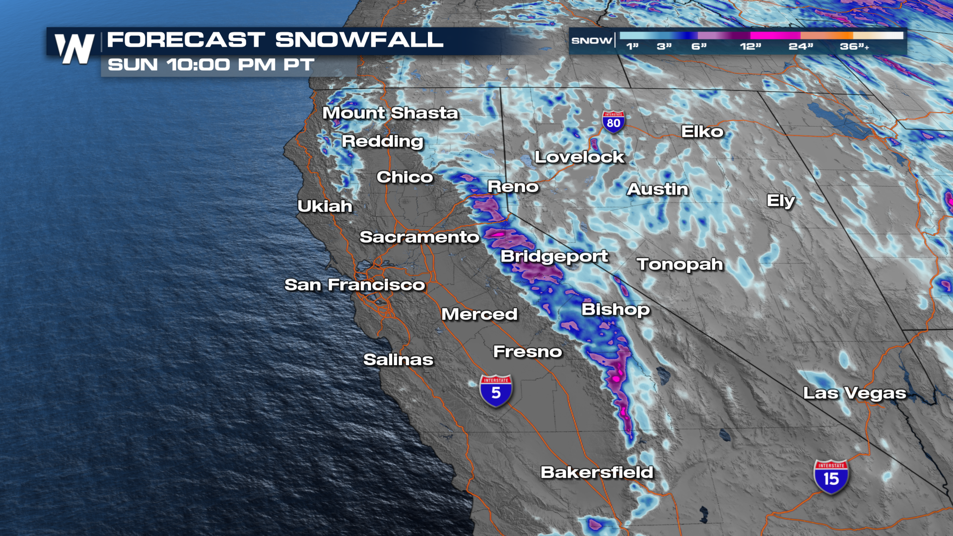
The Southwest is still seeing rain, snow, and wind on this first weekend of spring. With this ongoing system, heavy snow is expected for the Sierra and the Rockies. Winter alerts have already been issued for parts of the Sierra for up to two feet of snow by the time the weekend is over.

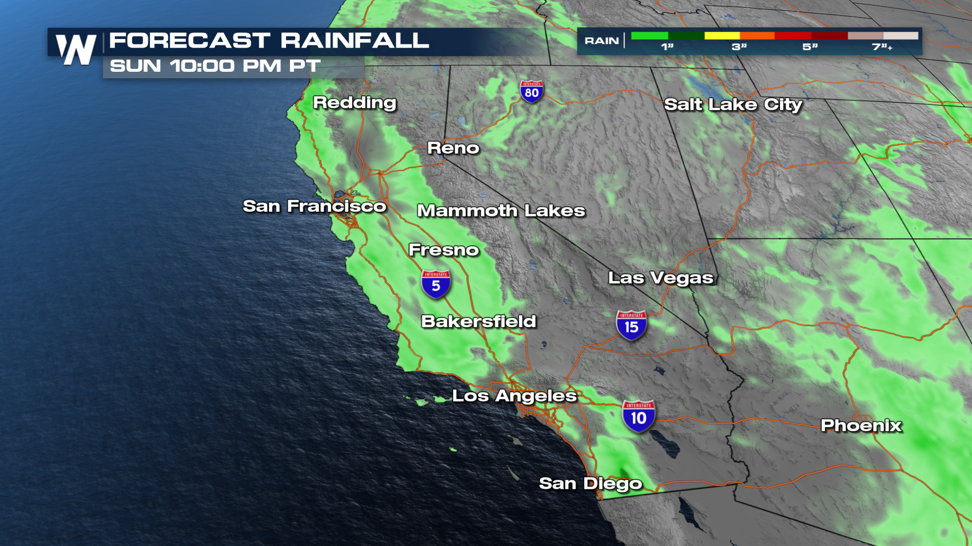
Rain and snow showers will be on and off throughout Sunday, finally ending Sunday evening as the main low and energy spread into the Four Corners. A few thundershowers will be possible in the Sacramento and San Joaquin Valleys, as well as coastal areas from San Francisco down to San Diego. Heavy mountain snowfall will be likely on the mountain passes, so plan accordingly for travel purposes!
Rain will be heaviest along the immediate coastline of northern California and southern Oregon with 1-3" of rain already on the ground. Southern California has the possibility of seeing a little over an inch of rain by late Sunday.

At the top of this article, we show the snow reports coming out the Sierra Nevada in the last 24 hours. In addition to what has already fallen, some lucky peaks could see another foot of snow. This will be excellent late-season snowfall before the climatological peak of snow depth around April 1.

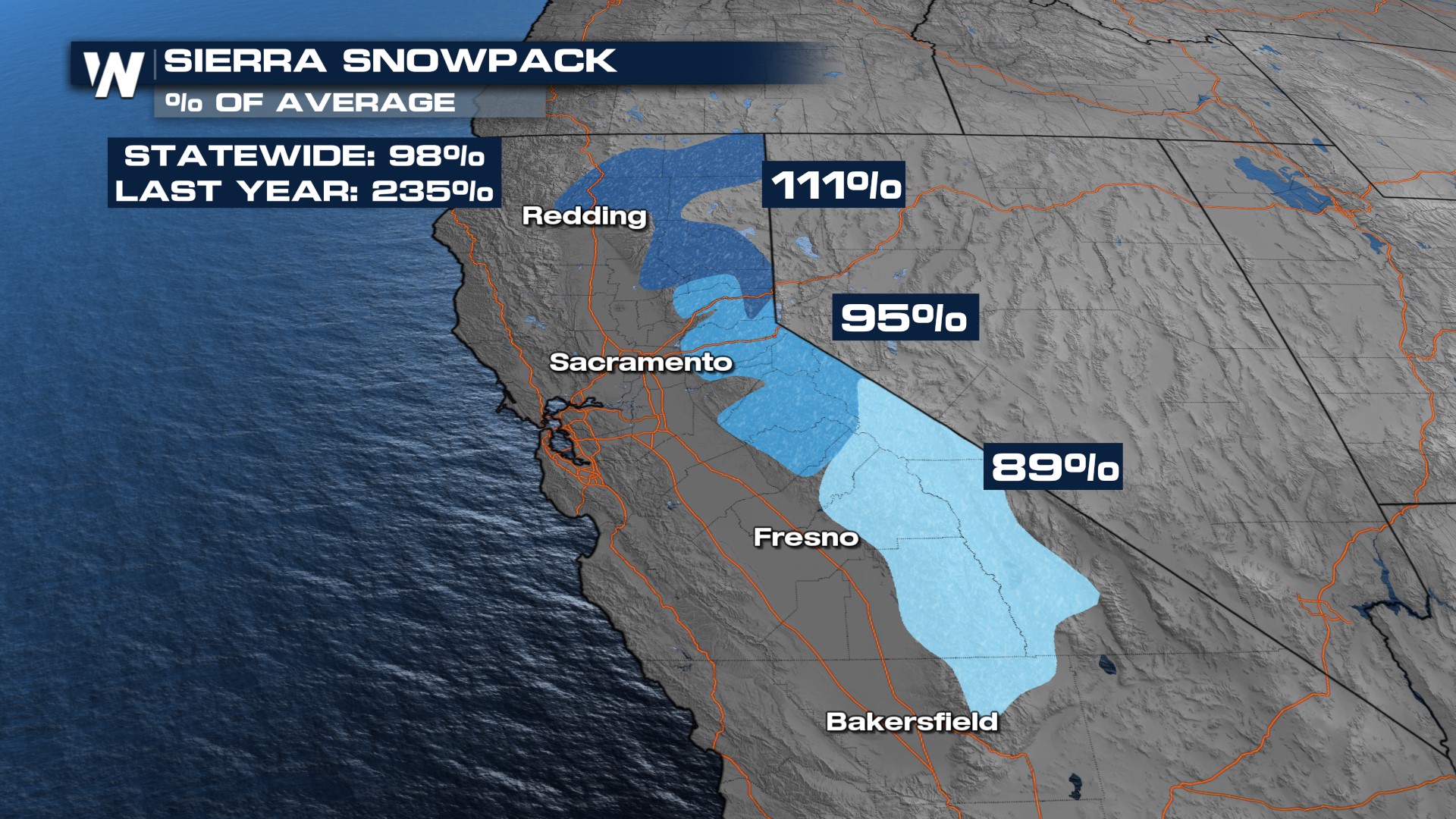
As we head into Spring, the snowpack levels are important in California (and much of the west). The northern Sierra is sitting at 111% of the average with the central and southern Sierra trailing slightly below normal. April 1st marks the climatological peak of snowfall in the Sierra Nevada, so hopefully our late March snow system can help to boost those numbers!
