Light Ice Potential in the Northeast Late Tonight
Special Stories
10 Jan 2018 9:45 AM
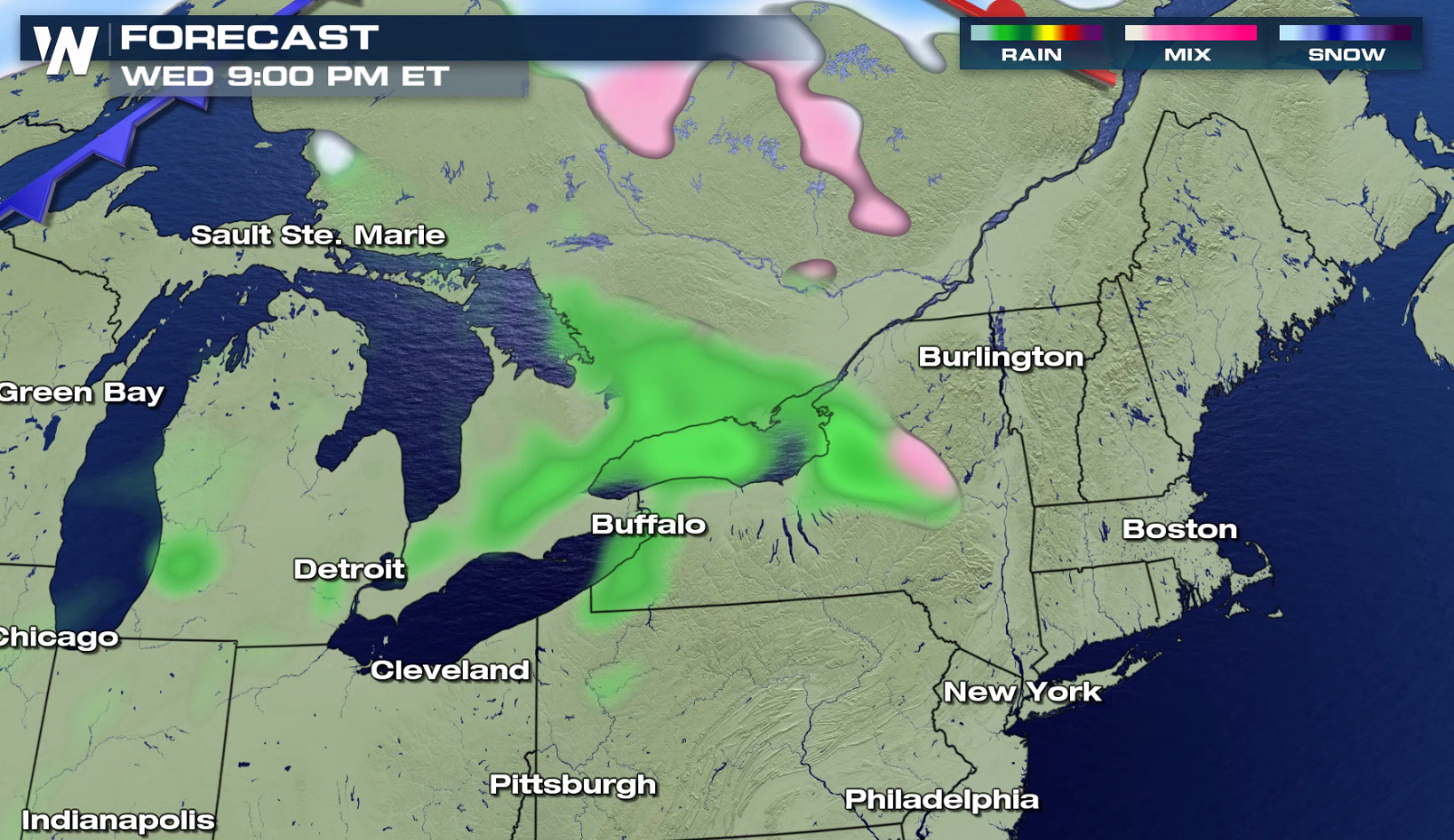
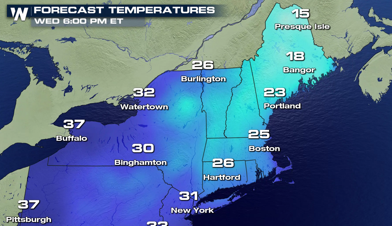
Sunshine but cold temperatures will be found in the Northeast today, but that will change tonight. On the leading edge of warmer air that will push into the region Thursday, a weak upper level disturbance will bring a light area of mixed precipitation. This will move into parts of Upstate New York and northern New England this evening through Thursday morning.
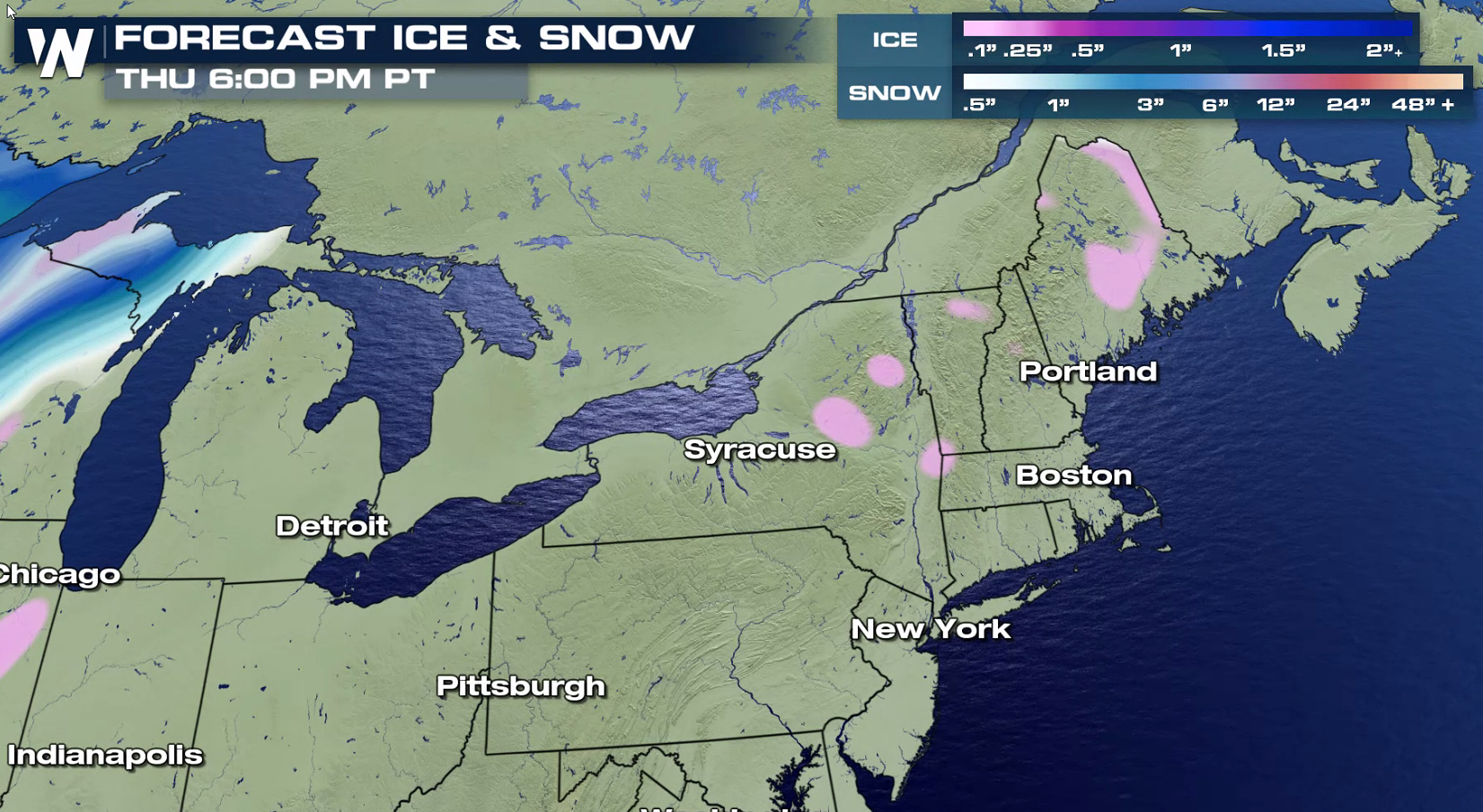
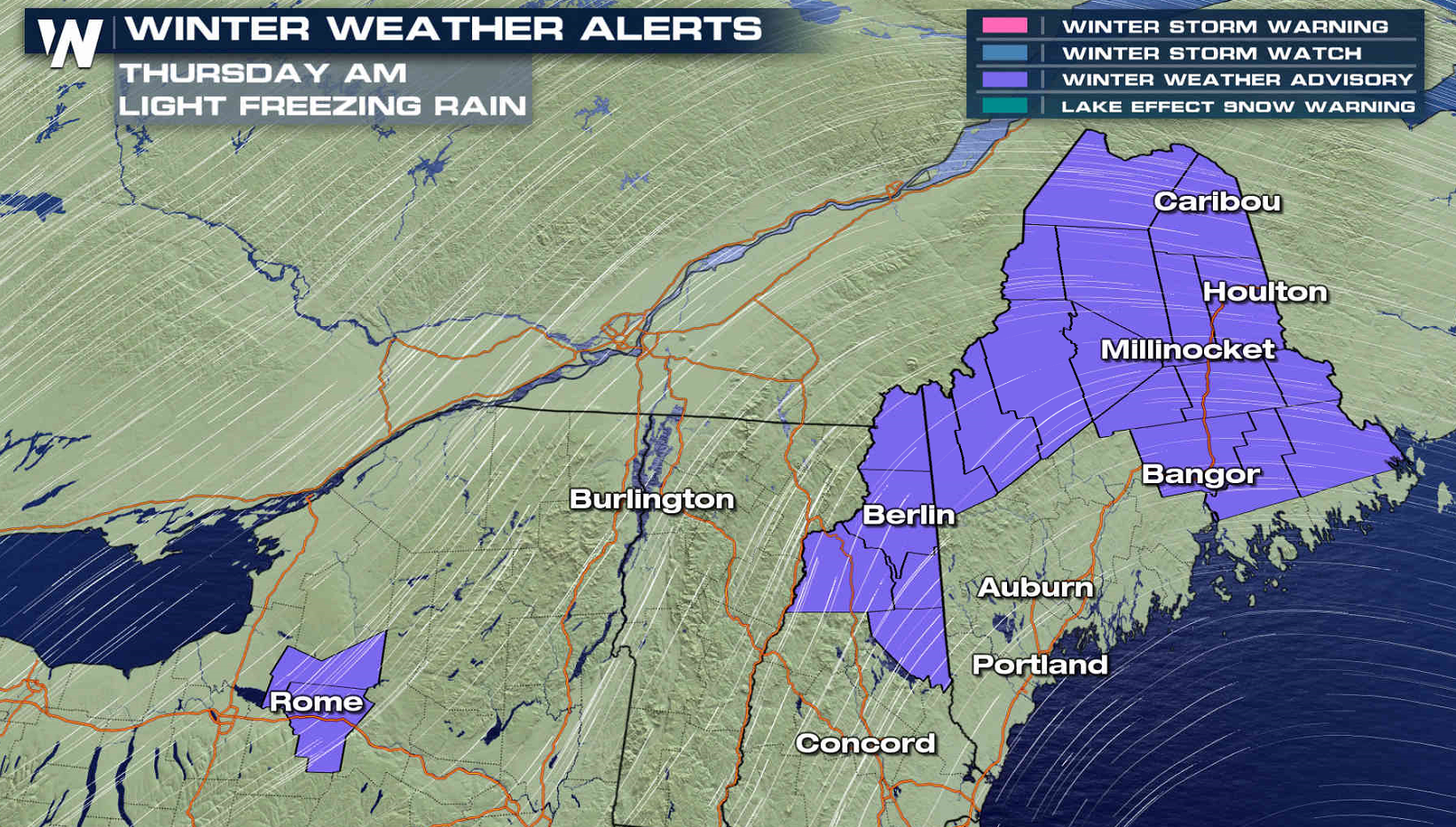 Winter Weather Advisories have been issued around Rome and Utica, NY and for Northern Maine and New Hampshire. The light freezing rain will likely only accumulate to a few hundredths, but with temperatures below freezing, a glaze of ice will create slippery travel conditions this evening into Thursday morning.
https://twitter.com/NWSAlbany/status/951040968928780288
https://twitter.com/NWSGray/status/951026368866930688
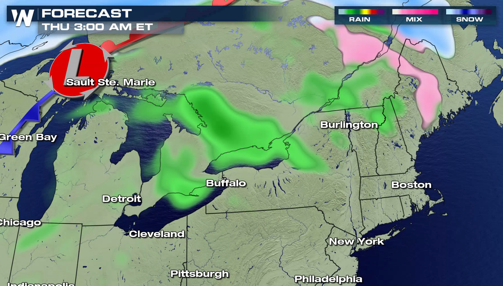
The leading edge of the precipitation will move into New York after sunset, and then push across New England overnight into early Thursday morning. The precipitation won't be heavy or widespread, but light icing is possible with cold temperatures.
Winter Weather Advisories have been issued around Rome and Utica, NY and for Northern Maine and New Hampshire. The light freezing rain will likely only accumulate to a few hundredths, but with temperatures below freezing, a glaze of ice will create slippery travel conditions this evening into Thursday morning.
https://twitter.com/NWSAlbany/status/951040968928780288
https://twitter.com/NWSGray/status/951026368866930688
The leading edge of the precipitation will move into New York after sunset, and then push across New England overnight into early Thursday morning. The precipitation won't be heavy or widespread, but light icing is possible with cold temperatures.
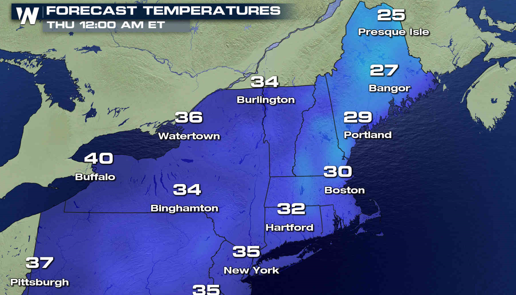
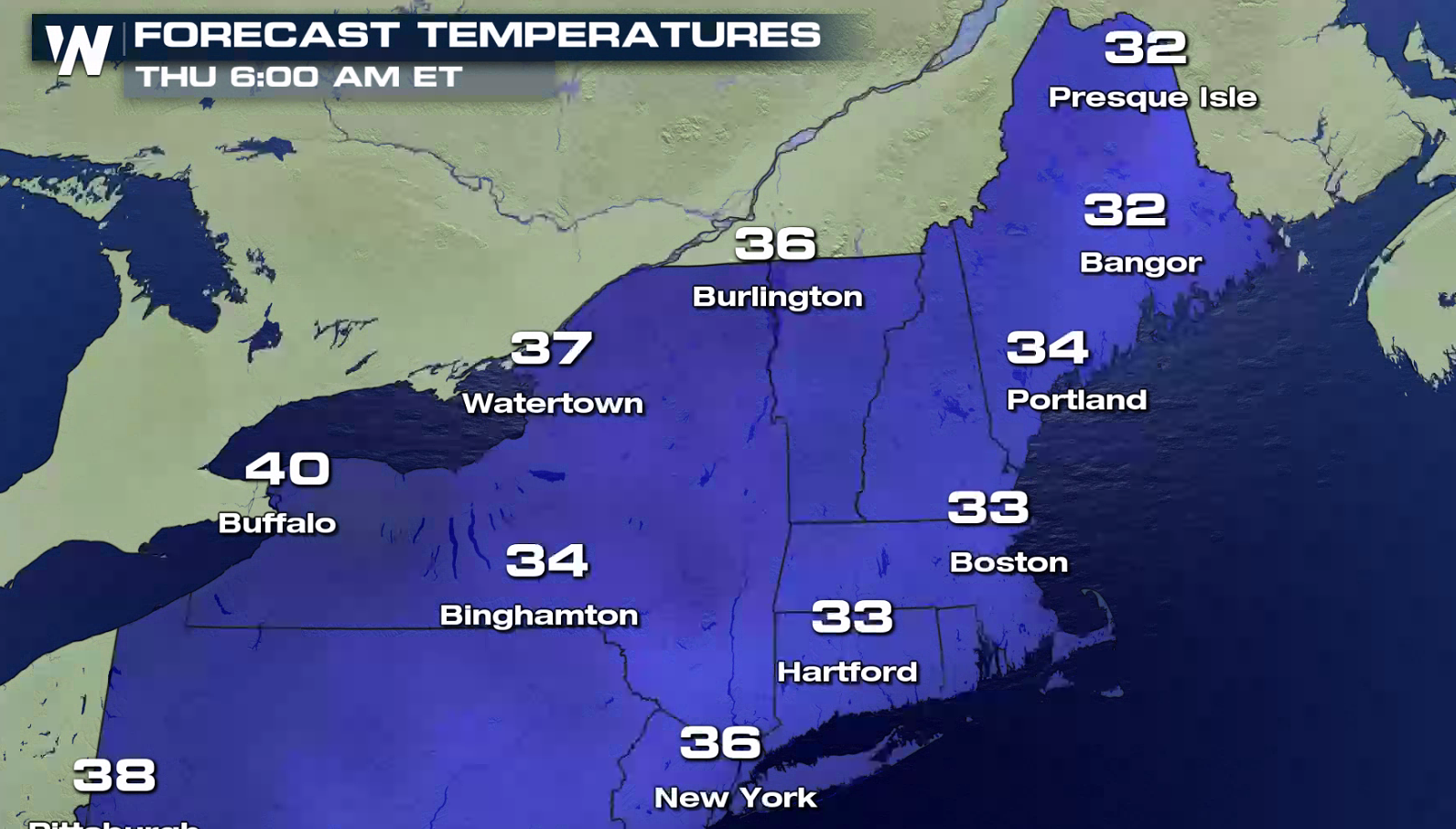
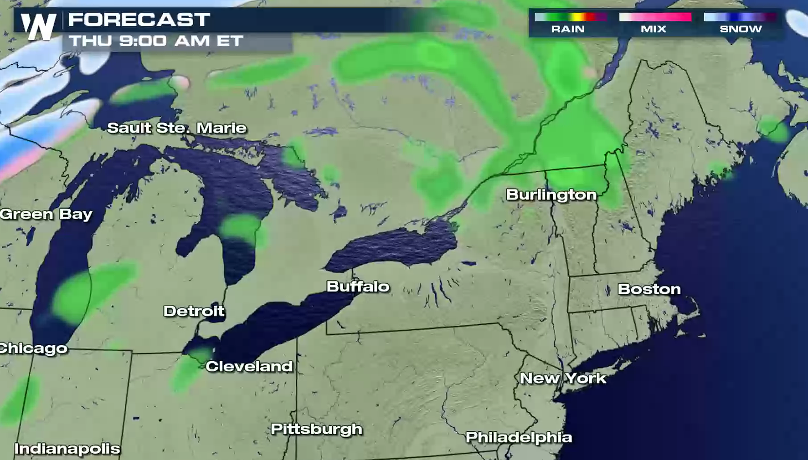 Temperatures will be well below freezing this evening. Warming is expected overnight, but in the mountains and valleys, temperatures may not climb above freezing until after sunrise.
 For WeatherNation: Meteorologist Mace Michaels
Winter Weather Advisories have been issued around Rome and Utica, NY and for Northern Maine and New Hampshire. The light freezing rain will likely only accumulate to a few hundredths, but with temperatures below freezing, a glaze of ice will create slippery travel conditions this evening into Thursday morning.
https://twitter.com/NWSAlbany/status/951040968928780288
https://twitter.com/NWSGray/status/951026368866930688
The leading edge of the precipitation will move into New York after sunset, and then push across New England overnight into early Thursday morning. The precipitation won't be heavy or widespread, but light icing is possible with cold temperatures.
Temperatures will be well below freezing this evening. Warming is expected overnight, but in the mountains and valleys, temperatures may not climb above freezing until after sunrise.
For WeatherNation: Meteorologist Mace MichaelsAll Weather News
More
Tropics: Tropical Storm Bertha Forms In the Atlantic, Eastern Pacific Active
In the Atlantic basin, we are keeping a very
21 Jul 2026 10:55 PM

Flash Flooding and Severe Weather for the Carolinas This Week
Another stalled front in the Carolinas is for
21 Jul 2026 10:50 PM

Another Round of Storms Targets the Northeast
Another cold front is dropping east and will
21 Jul 2026 10:00 PM

Pacific Northwest Fires Bringing Down the Air Quality
Conditions have been real dry out west. We've
21 Jul 2026 5:05 PM

Another Round of Severe Weather for the Upper Midwest and Great Lakes
The upper-level low train continues to keep t
21 Jul 2026 1:45 AM

Air Quality Improvements in the Forecast
Wildfires burning in Northwestern Ontario, Ca
20 Jul 2026 7:20 PM

Monsoon Moisture Brings Weekend Flood Threat
The monsoon has returned to the southwestern
19 Jul 2026 1:30 AM