Heavy Rain & Snow in the Northwest

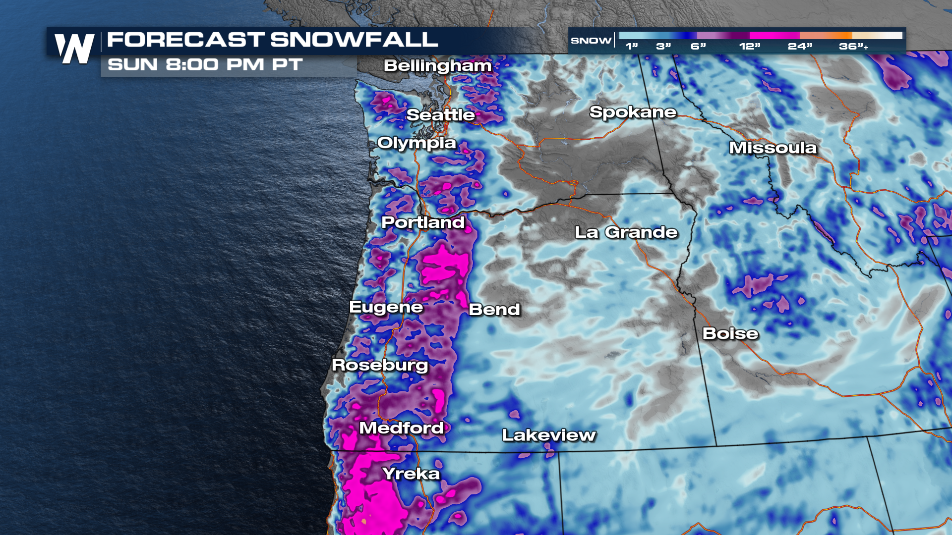
Multiple low-pressure systems have been hitting the Pacific Northwest, heightening the dangerous travel risk in mountain communities. This latest disturbance is part of the same system bringing extreme weather to California. Snow totals will be upwards of 2-5 feet for the southern Cascades of Oregon and over 2 feet for the ranges in Washington before the system winds down early into the upcoming week.
Related Article - Blizzard in California
Extreme impacts are anticipated - Traveling in mountainous areas will be treacherous and nearly impossible. This includes I-5, I-90, I-84, and many other state routes into the mountains. Winter alerts remain in effect through Sunday for many areas.
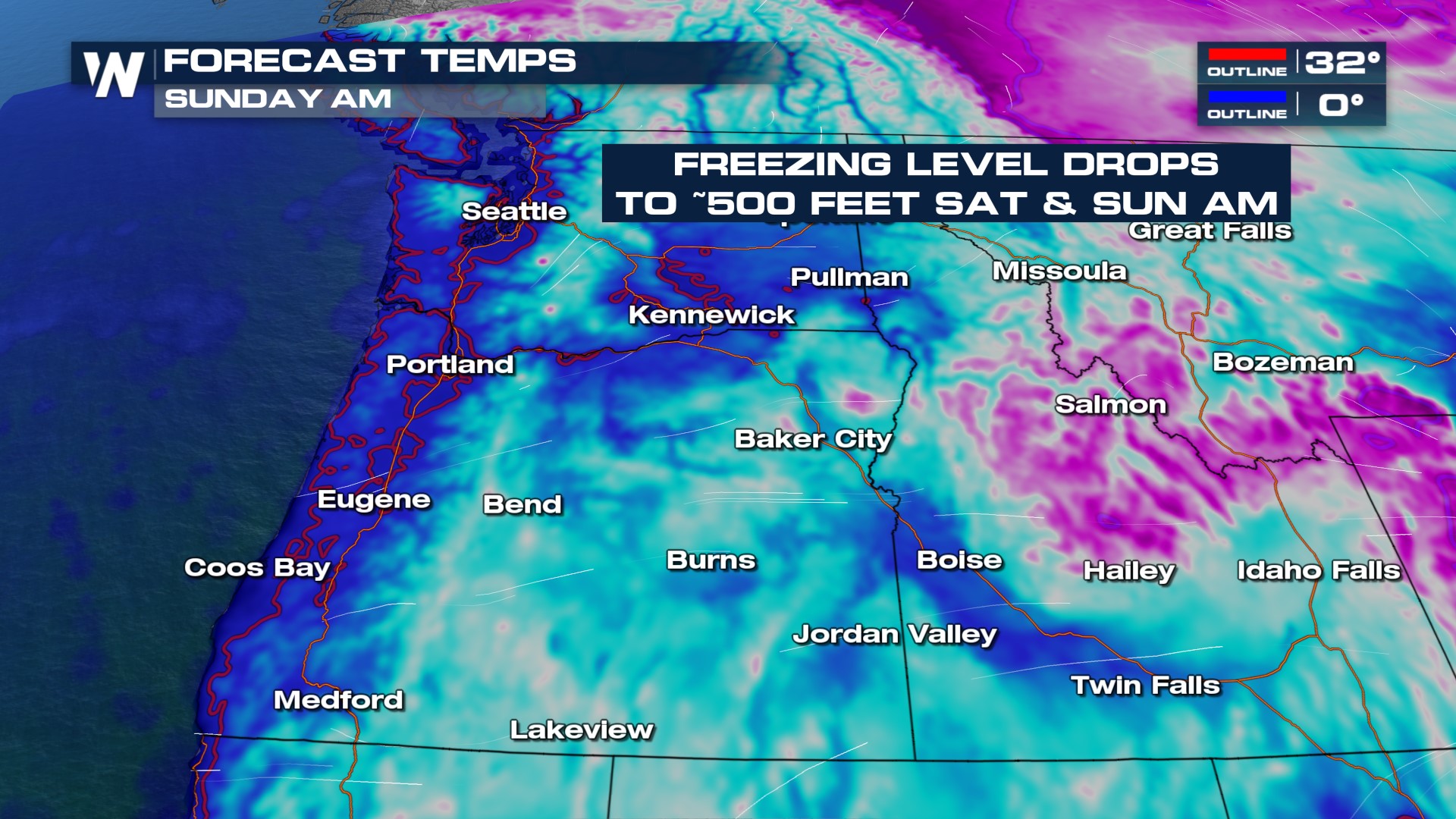
 Temperatures have been dropping and will continue to bottom out through Sunday morning, possibly as low as 500 feet at times. This could lead to light to moderate snow accumulations around the I-5 corridor, including the Willamette Valley and areas around the Puget Sound.
 Some of the heaviest rain and snow will fall through Saturday evening with hardly any breaks in the activity for those along the I-5 corridor. Snow showers continue into Sunday.
Heavy rainfall will be more likely along the coastline of Washington and Oregon and towards the foothills of the mountains. Along the coast, 1-2" of rain is possible, with locally higher totals through Saturday. Rain isn't expected to cause many issues, but snow in lower elevation could make things slick both weekend mornings, with black ice possibly lingering into Monday.