Major Cooldown in Store for the Upper-Midwest

While we finish our Thanksgiving food and head back home, loads of people in the upper-Midwest are in store for a MAJOR cool down going into next week. The Climate Prediction Center has great confidence of seeing some well below average temperatures going into early December.
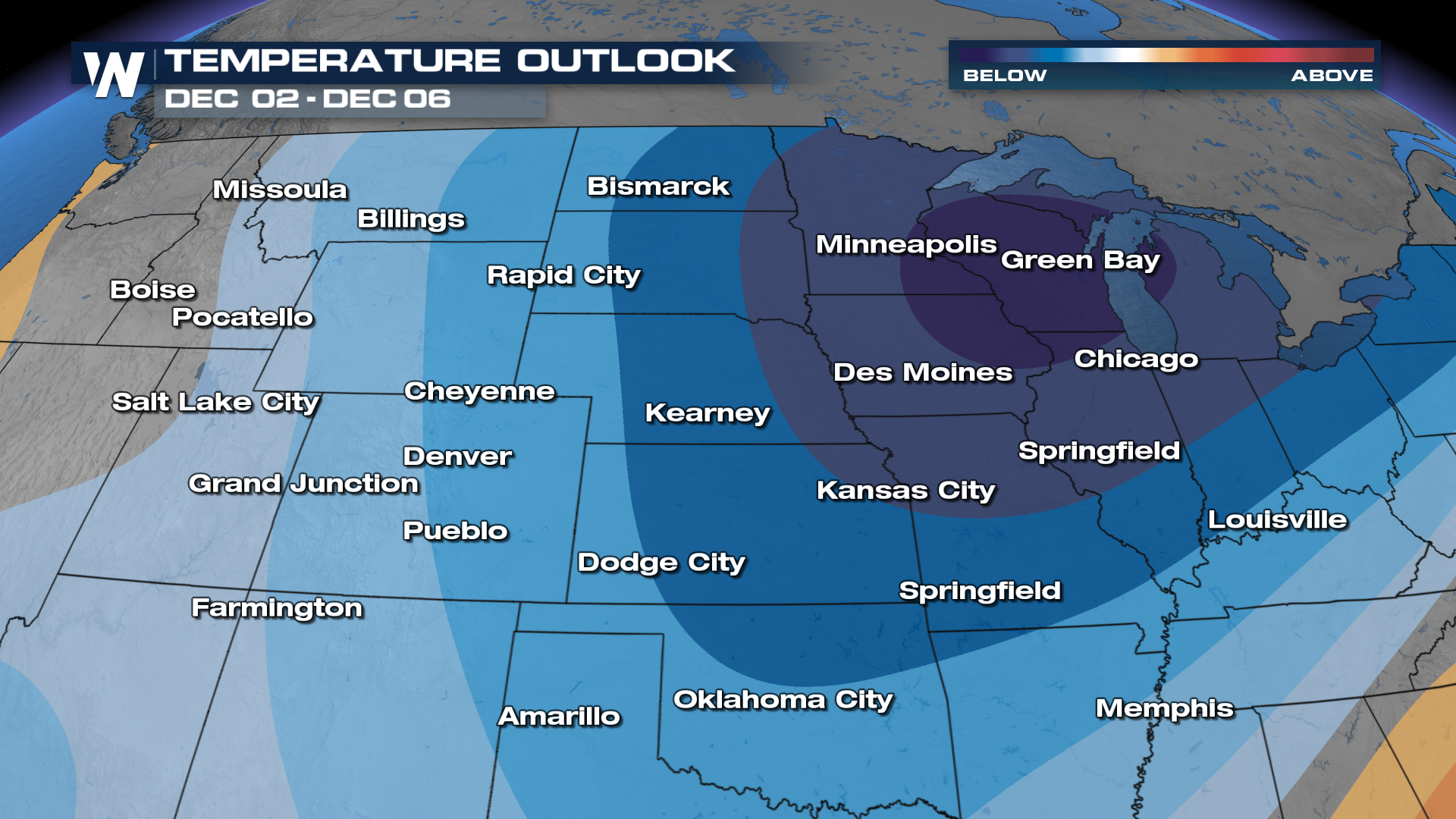
But what's going on? Well it all starts at the Polar Vortex, which typically traps arctic air where it belongs, at the North Pole. However, it's expected to weaken into the next week. As a result, frigid polar air descends south, through Canada, impacting northern areas of the U.S.
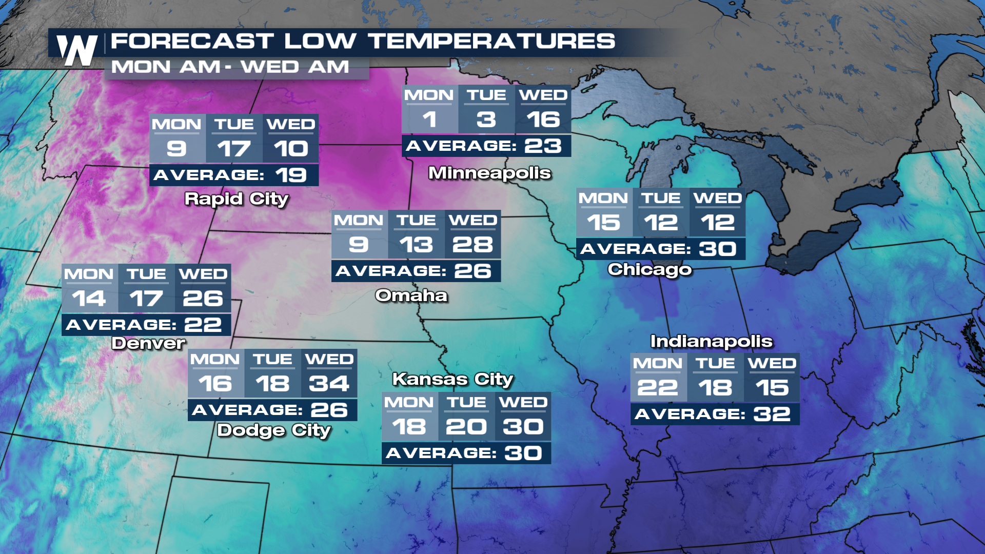
Now let's have a look at some of the impacts. Temperatures across the upper-Midwest will dwindle down into the single digits, with places like Minneapolis having a forecast low of only 1 degree next Monday.
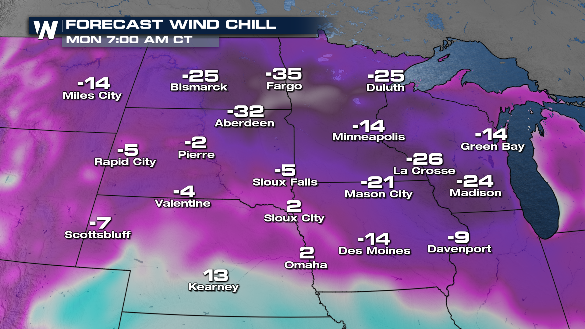
We can also expect the winds to kick up as this arctic air makes its way down south. This could spell trouble as some of these wind chill values will likely breach sub-zero temperatures. Some of these values getting as cold as 35 degrees below zero on Monday morning.
With such a major cool down on the way, it's likely to shake things up in our atmosphere. Starting over the weekend, heavy snowfall and rainfall will likely impact several major cities nationwide, which could cause some issues for folks on their way back from their Thanksgiving celebrations!
Make sure to stay tuned to WeatherNation, where we're going to be tracking what this system brings all throughout this weekend!


