Midwest Snow Storm Triggers Blizzard Warnings

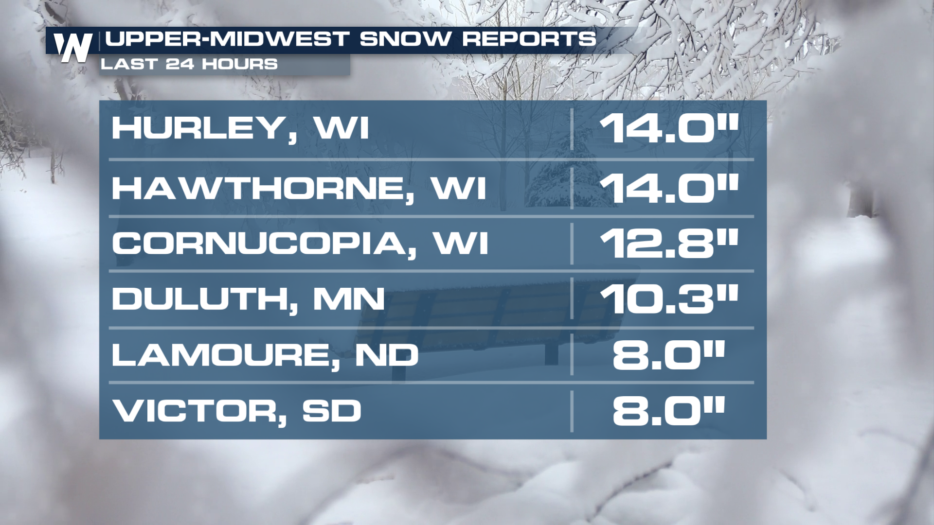
A low-pressure system blowing through the Upper Midwest has produced over a foot of snow and winds up to nearly 80 mph! This system will slow down for these areas for about a day before our next system moves in Friday.
Snow Outlook
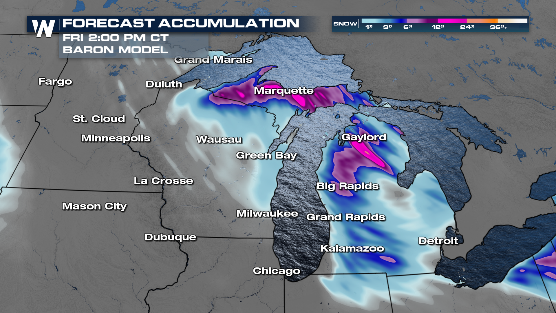
Widespread Winter Weather Alerts have been ending across the Great Lakes for this round of snow, but the next ones will quickly get issued for Friday and Saturday's snow. Heavy snow, with rates of 1-2" per hour, combined with wind gusts upwards of 40-50 mph, will make driving extremely dangerous. Whiteout conditions could make travel nearly impossible.
Blizzard Warnings remain in place for portions of Wisconsin and Michigan. When visibility is reduced to 1/4 or less, winds are greater than 35 mph, and this lasts for 3 hours, this classifies a winter storm as a blizzard.
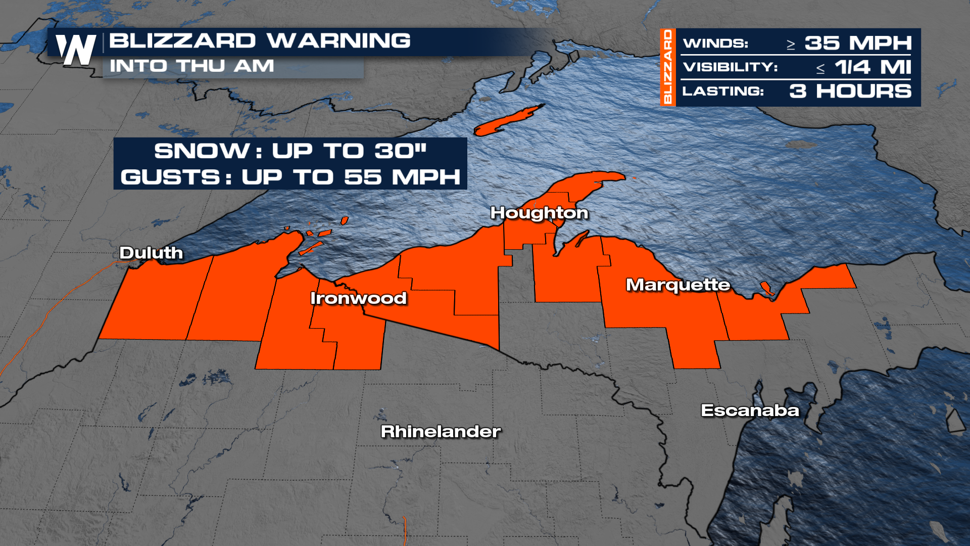 Northern Wisconsin and the Upper Peninsula of Michigan could accumulate up to one to two FEET of snowfall due to the nature of lake effect snow.
For more details, tune in to your Central Regional Forecast :30 past the hour.


