Over a Foot of Rain in California - Cleanup Underway
The torrential rain is finally starting to wind down out west. Heavy rain has led to landslides, mudslides, and debris flow which has caused damage to properties. Some homes have had foundations washed away (below).
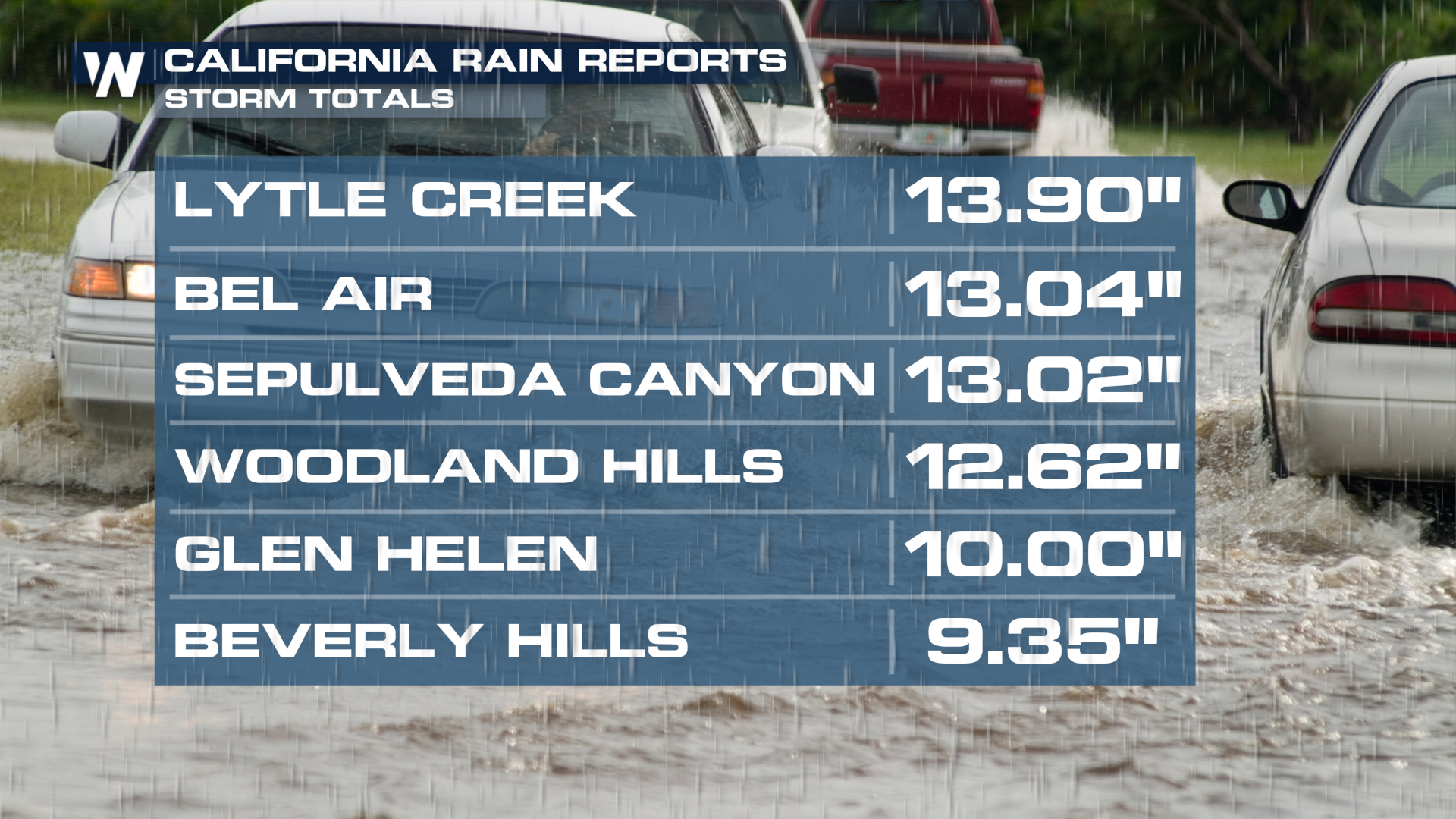
Rain reports are incredible for this part of the country and many records have been broken. Downtown LA not only broke the daily rainfall record on Sunday and Monday, but it also saw its wettest day in 20 years. The last time downtown saw more rainfall than Sunday was Dec. 28, 2004. Nearly a foot of rain has fallen in the hills around Los Angeles, nearly a year's worth of rain in just a few days. A typical year brings about 14" of rain for the city of Los Angeles, meaning we are on the doorstep of that yearly amount in the first two months of the year alone.
 In San Diego County, near El Cajon, there was a tornado-warned storm on Tuesday afternoon. No confirmation of this storm has been made by the NWS team in the area but WeatherNation did obtain video out of Spring Valley.
The heavy rain led to numerous road closures due to flooding, mudslides, and erosion. We caution never to drive through flood waters because you don't know if the ground below is still intact - take a look at roads in southern California that washed away due to heavy rain.
On the coast, large waves in combination with heavy rain led to coastal erosion, with this home hanging off of a bluff!
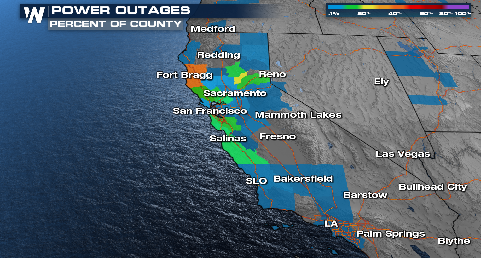
At the height of the storm Sunday into Monday, over 500k customers were without power in southern California due to high winds and heavy rainfall. Winds gusted over 100 mph in the foothills and along the ridges, bringing down large trees and leading to widespread damage.
