Slight Risk of Severe Weather for Nebraska and Kansas Today
Top Stories
23 Mar 2018 5:06 AM
The storm system that is bringing heavy snow to the High Plains and Upper Midwest today will also bring a chance for strong to severe storms of parts of Nebraska and Kansas later this afternoon and evening.
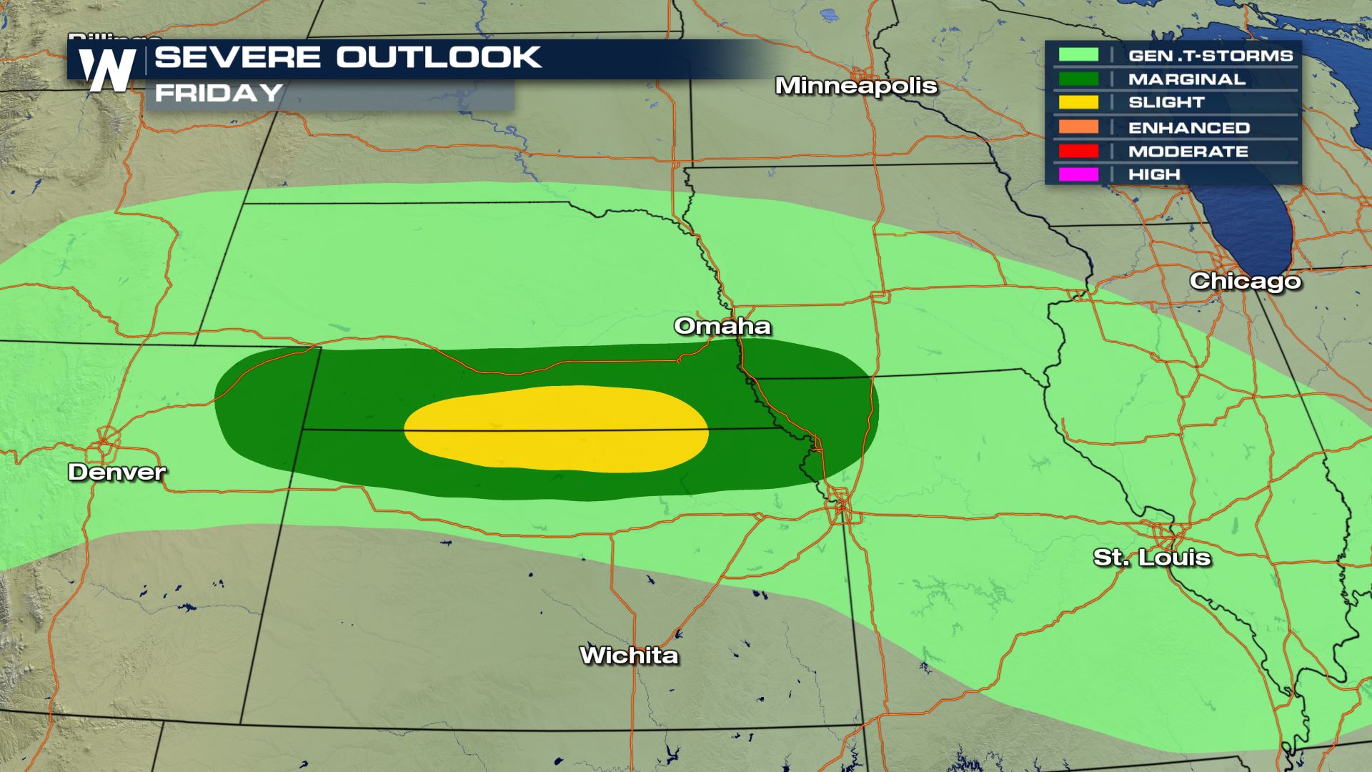 The Storm Prediction Center has a Slight Risk of severe weather over these areas for later today and early Saturday morning.
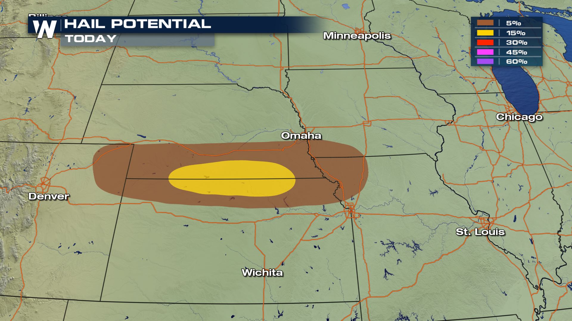
The main risk that we are most concerned about is hail up to 1" in diameter.
 We will continue to monitor this severe weather threat on-air and online.
Meteorologist Patrick Crawford
Severe Outlook
 The Storm Prediction Center has a Slight Risk of severe weather over these areas for later today and early Saturday morning.
The main risk that we are most concerned about is hail up to 1" in diameter.

Forecast
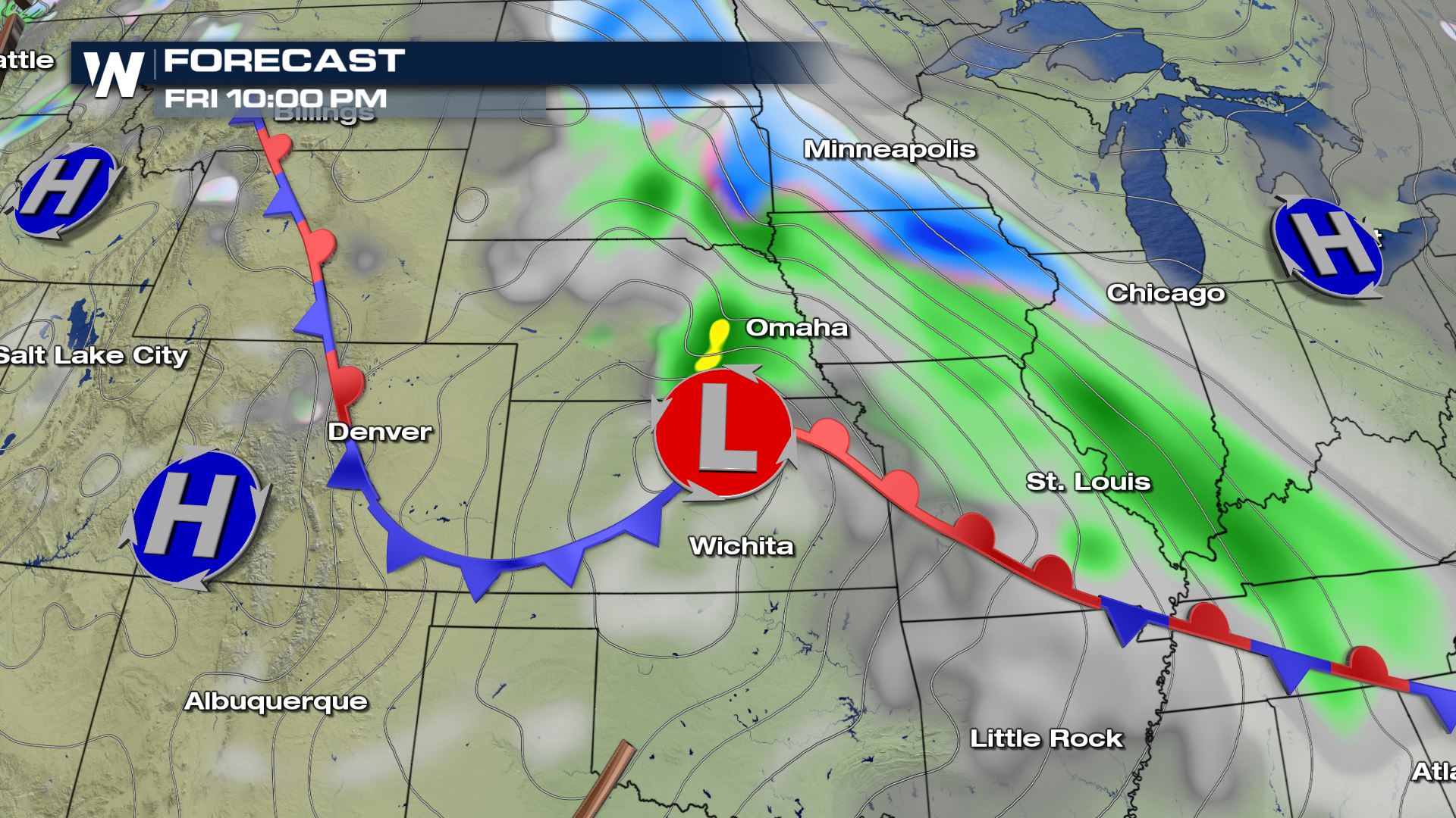
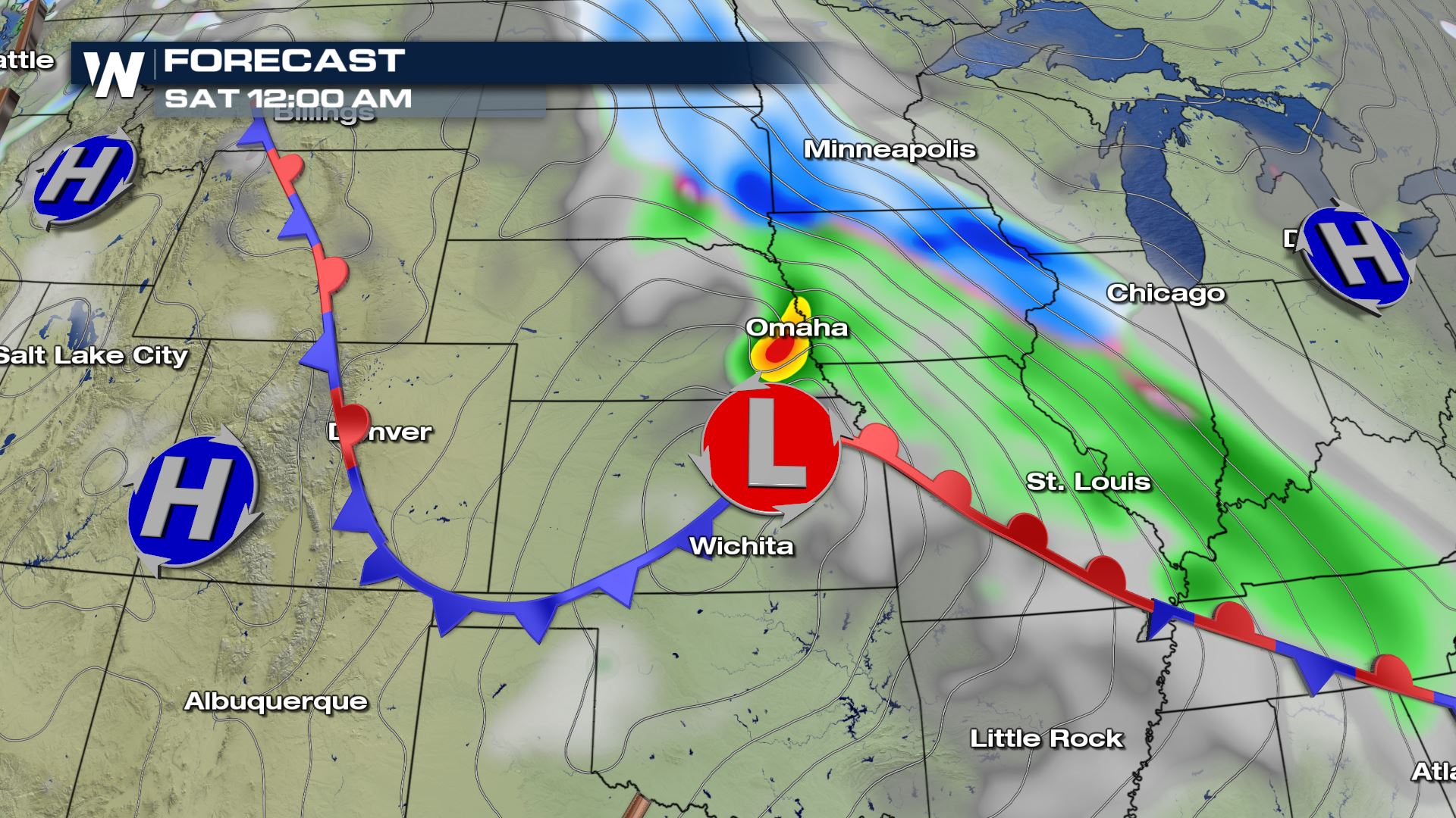
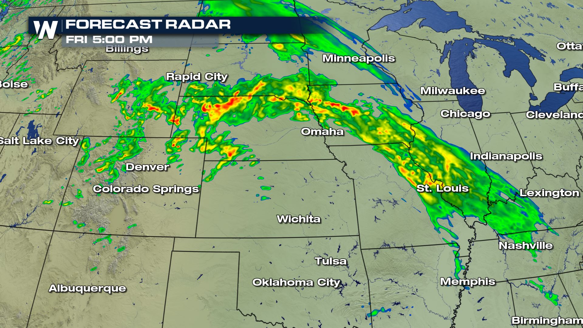
Here is the latest forecast for the low pressure system moving through the Plains. Showers and storms should fire up just north of the low later this evening.

Hi-Resolution Forecast Radar
Here is how the radar imagery could look by 5 PM this afternoon. You can see some strong storms possible in parts of Nebraska, Iowa and South Dakota. We will continue to monitor this severe weather threat on-air and online.
Meteorologist Patrick Crawford
We will continue to monitor this severe weather threat on-air and online.
Meteorologist Patrick CrawfordAll Weather News
More