Massive Hail Fell in Minnesota Monday

Special Stories
5 Aug 2019 3:16 PM
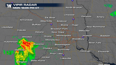
A line of severe thunderstorms moved through the Minneapolis area Monday afternoon. Here's a look at the VIPIR RADAR from noon to just after 2 PM. One severe thunderstorm warning was issued after another, following this storm to the northeast.
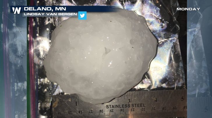
 One of the largest hail reports came out of Delano in Wright County. This particular hail stone measured in at 4.00 inches in diameter. Notice the ruler at the bottom of this photo. That's the size of a grapefruit!
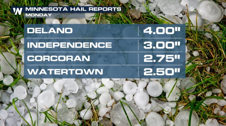
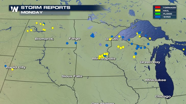
 Several other impressive reports came out of the region Monday with hail ranging from the size of tennis balls to softballs.
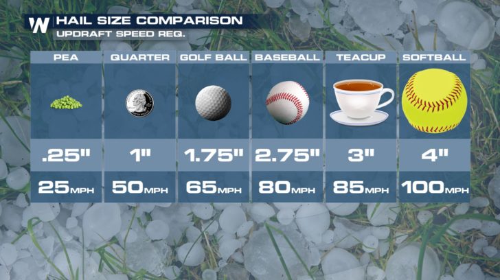
 In order to get hail that big, the updrafts within these storms had to climb up to 100 mph. An updraft is the upward moving air in a thunderstorm. Strong updrafts can support larger hail development.
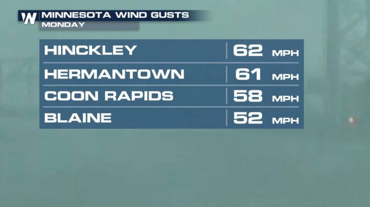
 In addition to large hail, there have already been several damaging wind gust reports as well.
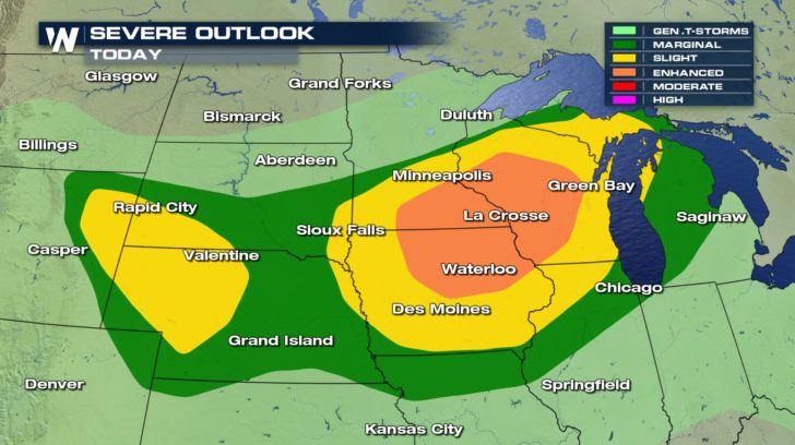
 The threat of severe weather is not over yet. Storms will continue to move through the upper Midwest this evening and then continue overnight for some.
 Join WeatherNation on-air for live severe weather coverage.
-Meteorologist Viki Knapp
Join WeatherNation on-air for live severe weather coverage.
-Meteorologist Viki Knapp
One of the largest hail reports came out of Delano in Wright County. This particular hail stone measured in at 4.00 inches in diameter. Notice the ruler at the bottom of this photo. That's the size of a grapefruit!
Several other impressive reports came out of the region Monday with hail ranging from the size of tennis balls to softballs.
In order to get hail that big, the updrafts within these storms had to climb up to 100 mph. An updraft is the upward moving air in a thunderstorm. Strong updrafts can support larger hail development.
In addition to large hail, there have already been several damaging wind gust reports as well.
The threat of severe weather is not over yet. Storms will continue to move through the upper Midwest this evening and then continue overnight for some.
Join WeatherNation on-air for live severe weather coverage.
-Meteorologist Viki KnappAll Weather News
More
Wildfire Outbreak in the Pacific Northwest
SPOKANE, WA - On Saturday, August 1st, the Ol
3 Aug 2026 1:55 AM

More Storms for the East Through Monday
A low-pressure system that moved through the
3 Aug 2026 1:50 AM


After Reaching Category 5, Genevieve Weakens in the Pacific
PacificGenevieve formed last Friday south of
3 Aug 2026 12:30 AM

Flooding, Severe Storms Target the Midwest Again
After an active week of storms across the nor
1 Aug 2026 1:40 AM

Flooding Risk Increases as Heavy Rain Targets the Tri-State Area
Tuesday, heavy rainfall moved across the Nort
30 Jul 2026 12:25 AM

Severe Weather: Energy From the Midwest Now in the Southeast
UPPER MIDWEST - Through Monday, dangerous tor
29 Jul 2026 10:30 PM