'Melissa' Grazes Northeast with Rain, Wind, Flooding
Special Stories
11 Oct 2019 8:57 AM
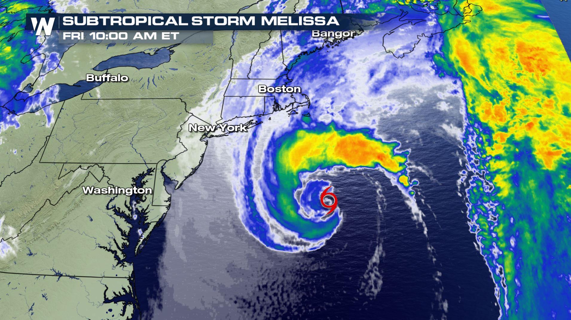
On Friday, Subtropical Storm Melissa formed off the northeast U.S. coast. The system gained some tropical characteristics, but is the same storm system causing ongoing rain, wind, and coastal flooding from the mid Atlantic to New England.
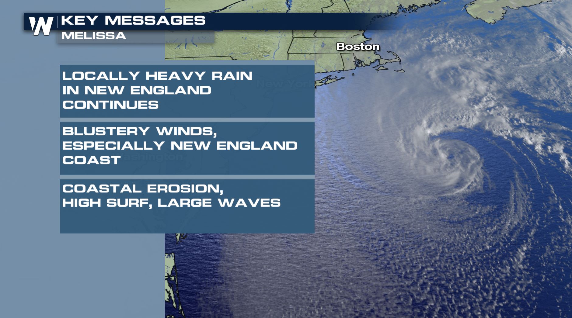 Despite gaining tropical traits, the storm system will continue to have the same impacts as have been forecast for days across the northeast. The main impacts will be locally heavy rain for parts of New England through Friday, strong winds (especially at the coast), and large surf and rough waves leading to coastal flooding and erosion. This has been ongoing since mid-week and will continue until the storm pulls away through the weekend.
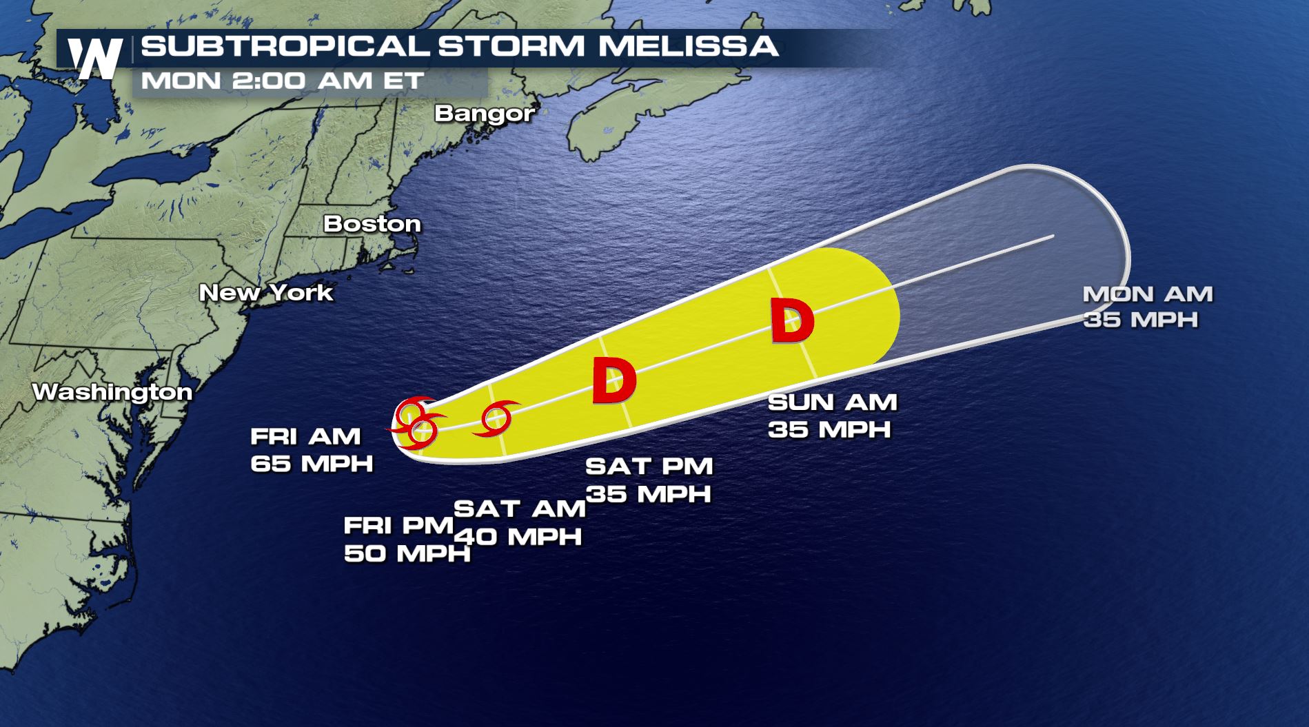
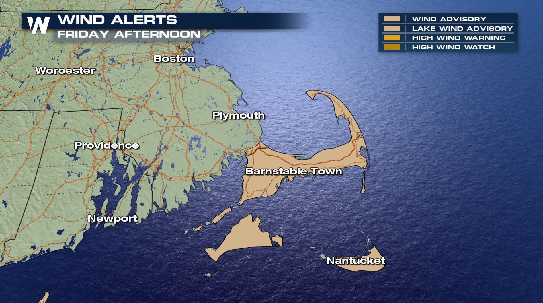
The strongest winds will occur around the Massachussetts Cape, with winds sustained between 20 and 30 mph through Friday, with gusts near 50 mph. This could cause power outages and may cause trees/power lines to fall. Stay alert, and avoid travel if possible.
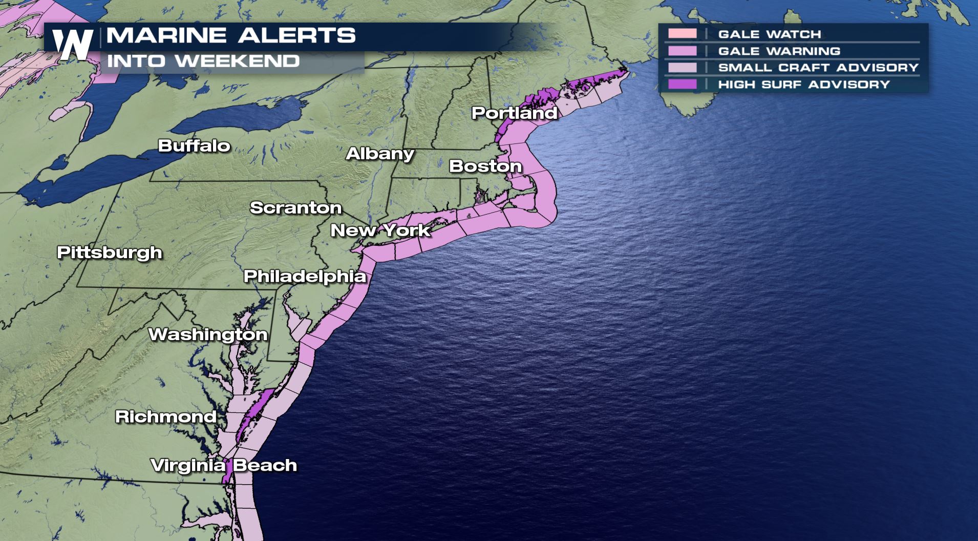
 Gale warnings have been issued up and down the eastern seaboard as high waves, strong winds, and rough seas continue. Marine interests should use extreme caution anywhere along the coast into weekend. Extra high tides due to the storm and Sunday's full moon will also lead to coastal flooding and beach erosion.
 The storm has already caused heavy rain and large waves for the northeast over the last few days. Stay safe and stay tuned to WeatherNation for the latest updates.
https://www.facebook.com/WeatherNation/videos/495940494593737/
The storm has already caused heavy rain and large waves for the northeast over the last few days. Stay safe and stay tuned to WeatherNation for the latest updates.
https://www.facebook.com/WeatherNation/videos/495940494593737/
Despite gaining tropical traits, the storm system will continue to have the same impacts as have been forecast for days across the northeast. The main impacts will be locally heavy rain for parts of New England through Friday, strong winds (especially at the coast), and large surf and rough waves leading to coastal flooding and erosion. This has been ongoing since mid-week and will continue until the storm pulls away through the weekend.
IMPACTS
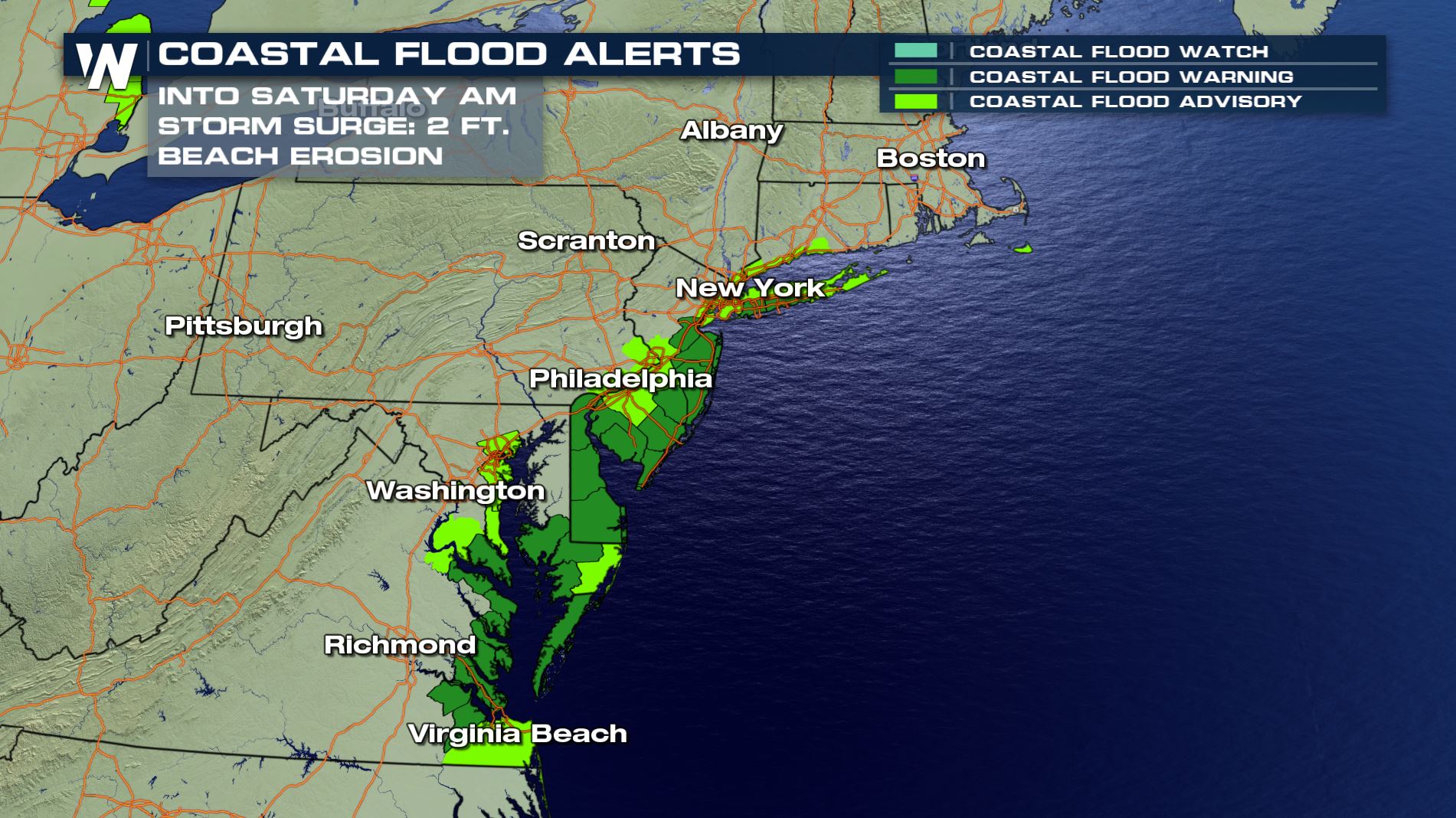
Strong, gusty winds will continue to impact the northeast, especially near the coastline. As winds blow from the ocean toward to coast, waves will batter the coastline causing flooding and erosion. Winds will be sustained between 10 and 30 mph for many parts of the northeast.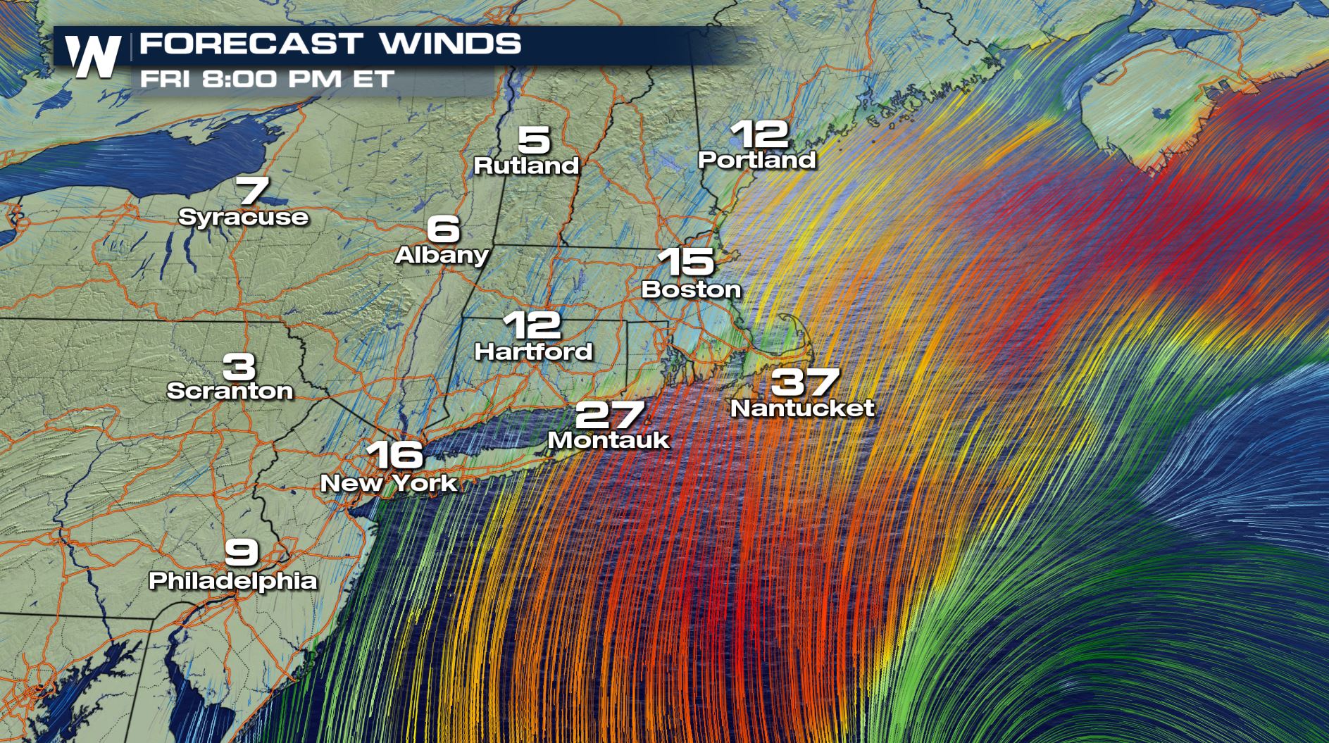 Gale warnings have been issued up and down the eastern seaboard as high waves, strong winds, and rough seas continue. Marine interests should use extreme caution anywhere along the coast into weekend. Extra high tides due to the storm and Sunday's full moon will also lead to coastal flooding and beach erosion.
The storm has already caused heavy rain and large waves for the northeast over the last few days. Stay safe and stay tuned to WeatherNation for the latest updates.
https://www.facebook.com/WeatherNation/videos/495940494593737/
Gale warnings have been issued up and down the eastern seaboard as high waves, strong winds, and rough seas continue. Marine interests should use extreme caution anywhere along the coast into weekend. Extra high tides due to the storm and Sunday's full moon will also lead to coastal flooding and beach erosion.
The storm has already caused heavy rain and large waves for the northeast over the last few days. Stay safe and stay tuned to WeatherNation for the latest updates.
https://www.facebook.com/WeatherNation/videos/495940494593737/All Weather News
More
Fronts Continue To Spark Severe Weather Across the Plains
A cold front that brought record lows to the
18 Jul 2025 10:40 PM

Extreme Heat Impacts for the East Coast & South
Extreme heat continues to impact several area
18 Jul 2025 10:05 PM

Flooding Threat Remains Elevated in the East
A cold front pushing through the Eastern Seab
18 Jul 2025 9:10 PM

EF-2 Firenado from the Deer Creek Fire in Utah
A fire tornado was spotted near La Sal, Utah
18 Jul 2025 7:30 AM

Tropical System Brings Flood Risk to the Central Gulf
Time has run out for notable tropical develop
18 Jul 2025 3:05 AM

Heavy Rain, Flooding Threat Returns to Florida
Keep the rain boots handy in Florida - heavy
13 Jul 2025 12:50 PM

Severe Storm Risk Pushes into the Great Lakes, Ohio Valley
Friday was another busy day with severe weath
12 Jul 2025 8:00 PM