Middle Tennessee Tornado Was A Record
Top Stories
6 Mar 2020 4:45 PM
New data from the National Weather Service in Nashville, Tennessee shows the tornado that struck Nashville and raced east in the middle of the night was a record-breaking twister.
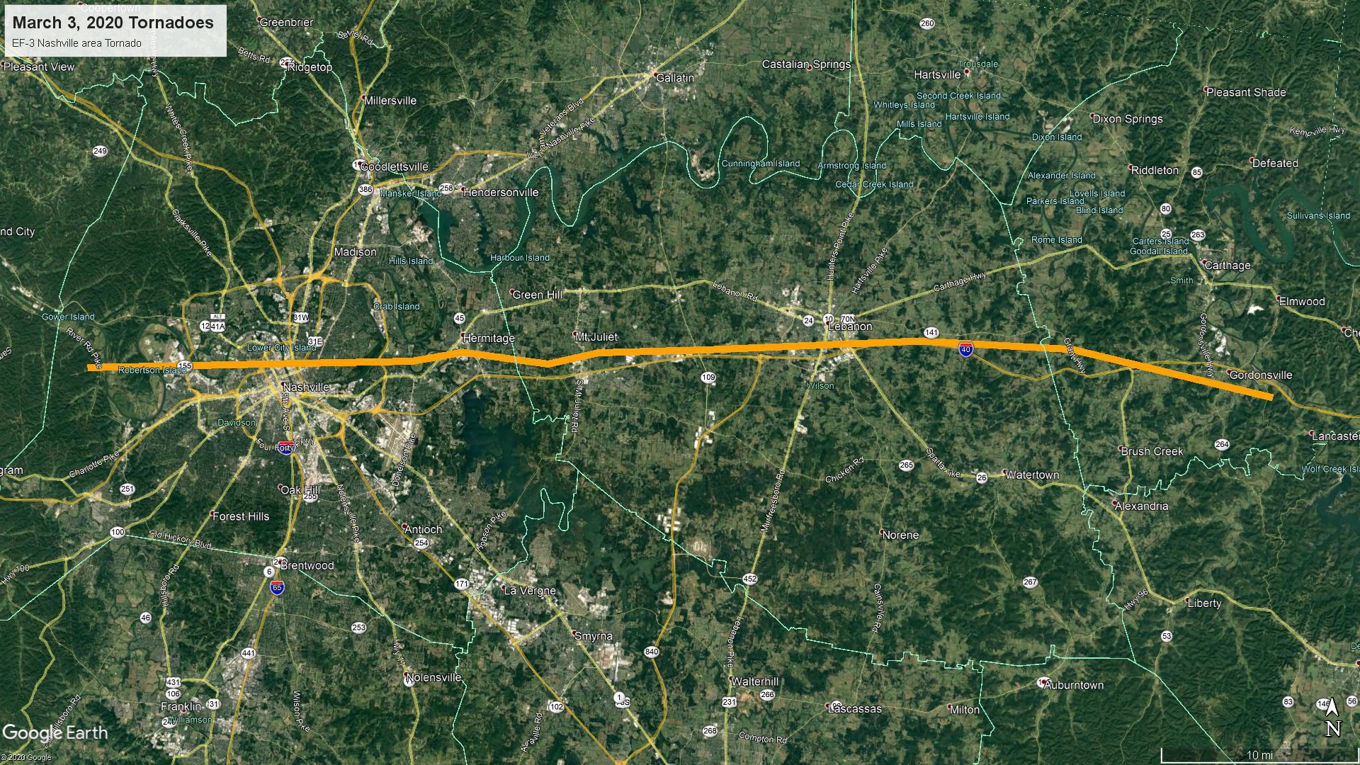
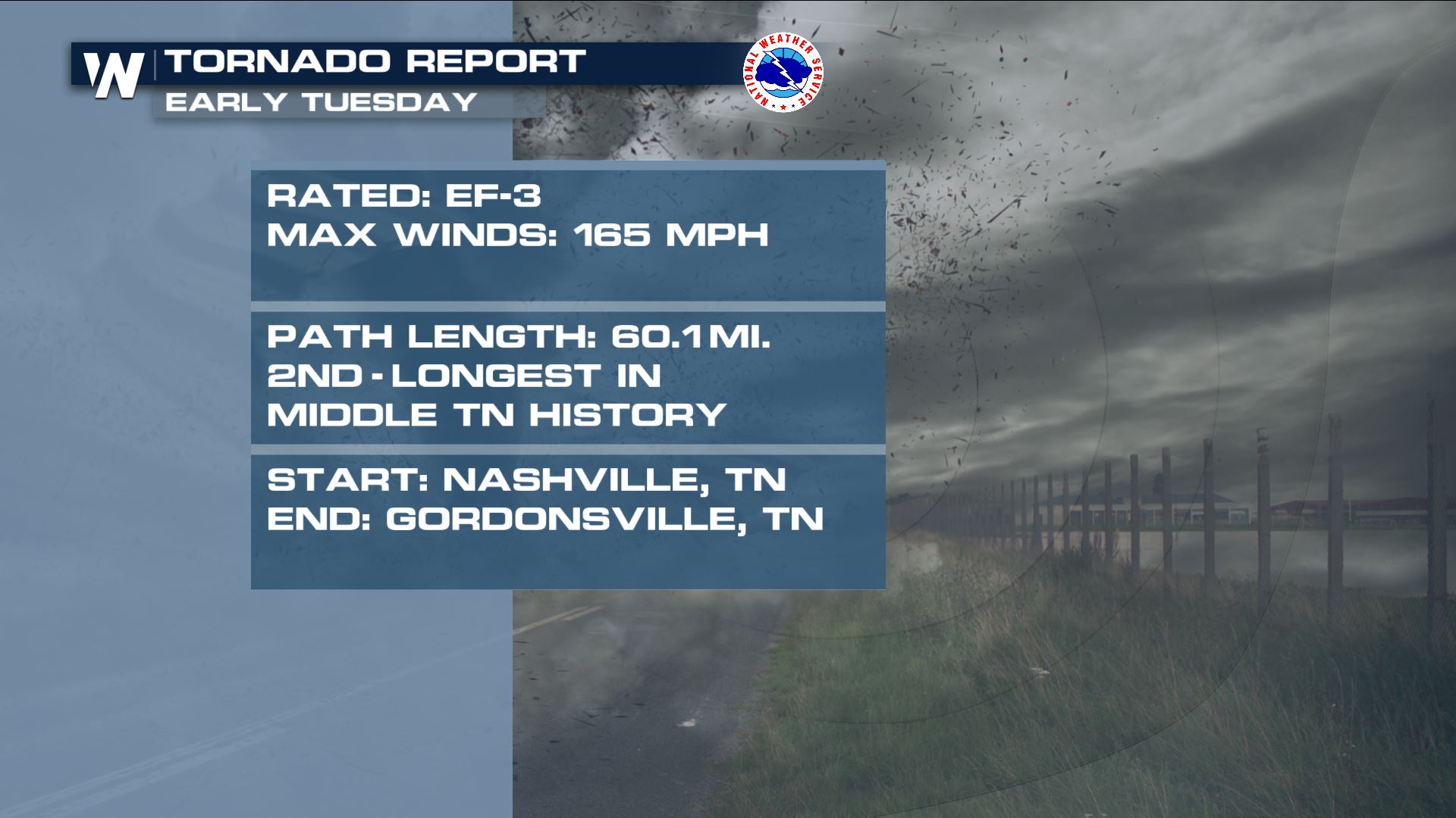 Storm surveys from NWS Nashville meteorologists concluded the tornado was on the ground for more than 60 miles. This makes the twister the second-longest tornado on record for Middle Tennessee. Here is a path of the storm's damage (orange line) courtesy NWS Nashville.
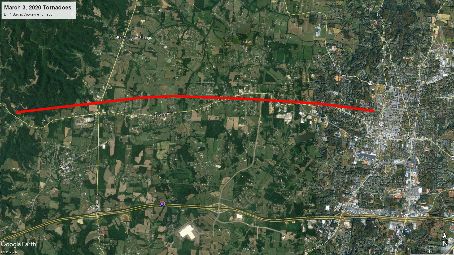
 The tornado killed 5 people and injured another 220 folks. One of the many scary parts of the storm was that it was 1) in the middle of the night and 2) moving east at about 65 miles per hour. This tornado lifted and a separate tornado then struck Putnam County, Tennessee and the town of Cookeville. That twister was rated an EF-4 with maximum winds up to 175 mph. It also tracked east around 65 miles per hour, killed 18 people and injured another 88 folks. It The red line below shows that storm's path, courtesy NWS Nashville.
 Storm surveys continue and so does the rebuilding process. We will continue to provide updates as they come in from the National Weather Service office in Nashville.
Storm surveys from NWS Nashville meteorologists concluded the tornado was on the ground for more than 60 miles. This makes the twister the second-longest tornado on record for Middle Tennessee. Here is a path of the storm's damage (orange line) courtesy NWS Nashville.
The tornado killed 5 people and injured another 220 folks. One of the many scary parts of the storm was that it was 1) in the middle of the night and 2) moving east at about 65 miles per hour. This tornado lifted and a separate tornado then struck Putnam County, Tennessee and the town of Cookeville. That twister was rated an EF-4 with maximum winds up to 175 mph. It also tracked east around 65 miles per hour, killed 18 people and injured another 88 folks. It The red line below shows that storm's path, courtesy NWS Nashville.
Storm surveys continue and so does the rebuilding process. We will continue to provide updates as they come in from the National Weather Service office in Nashville.All Weather News
More
Tropics: Pacific Stays Hyperactive, Atlantic Quiets Down
Isaias ended the late-season streak of no hur
13 Oct 2026 11:45 AM

Hot Weather Baking the Heartland This Week, Cooler Air Incoming
More records were broken across the central p
13 Oct 2026 11:35 AM

Severe Storms and Flooding Return to the Plains & Midwest
Severe weather looks to return to parts of th
13 Oct 2026 11:30 AM

Rachel Spreading Moisture Across the Southwest
Rachel came ashore in far northwestern Mexico
13 Oct 2026 12:10 AM

Isaias Makes Landfall as A Category 2, Recapping it's Impacts
Hurricane Isaias made landfall near Destin, F
12 Oct 2026 11:00 PM

Digging Trough Brings Wind and Snow to the Rockies this Week
A strong upper-level trough digging south fro
12 Oct 2026 5:30 PM

Flooding, Tornadoes Target Central Florida Thursday
Deep tropical moisture streaming north from t
8 Oct 2026 1:00 PM