Severe Storms & Heavy Rain in the Southeast
Special Stories
16 Dec 2020 5:00 AM
After an early week coastal storm exits the Mid-Atlantic, our next big storm is moving toward the East Coast mid-week. This system will not only bring the potential for heavy snow up north, heavy rain and severe thunderstorms are possible across portions of the Southeast. The chance for strong thunderstorms will be focused around Florida's Big Bend and also through Eastern North Carolina, including the Outer Banks.
 The 'northern' low in the Mid-Atlantic will bring snow to the north and rain to the south. Similar to the set-up we saw with Monday's coastal storm, the south side will see a severe storm threat and the north-side seeing snow.

 For the rest of the story watch us 24/7 on WeatherNation!
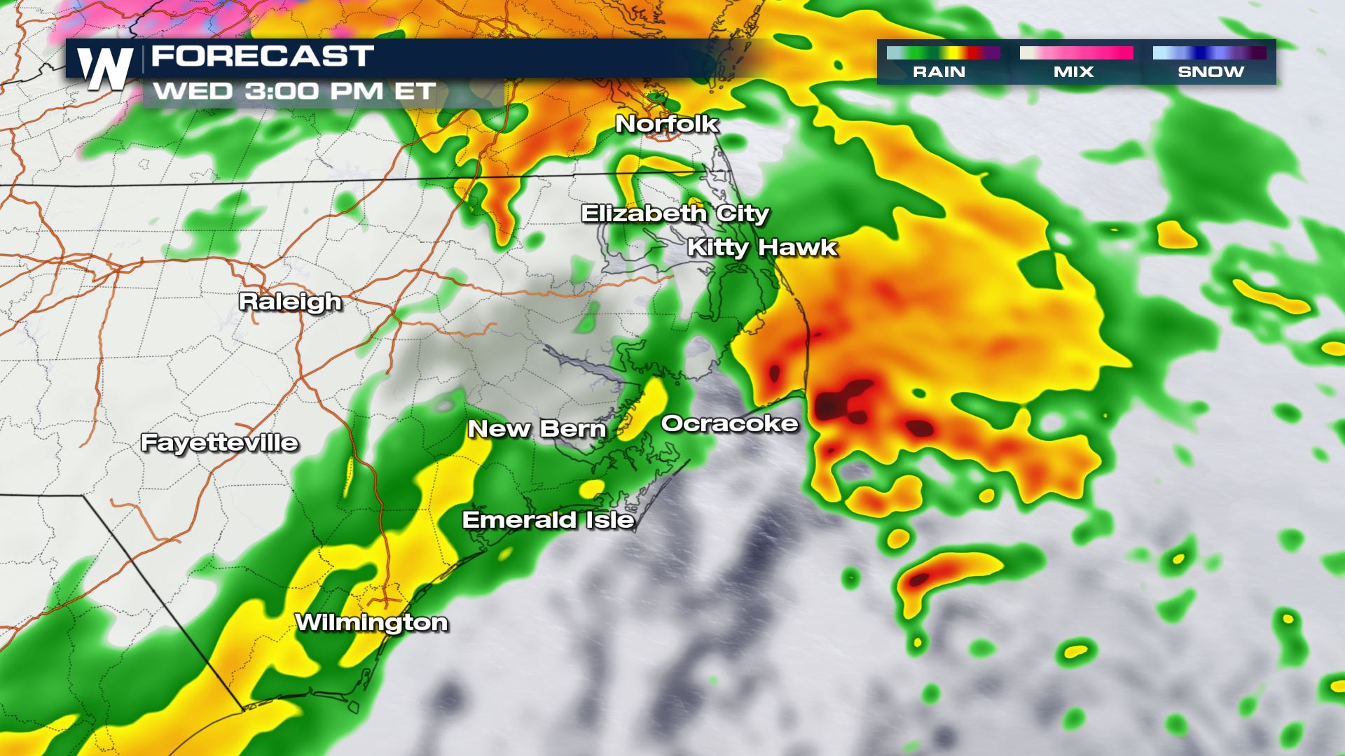
Forecast
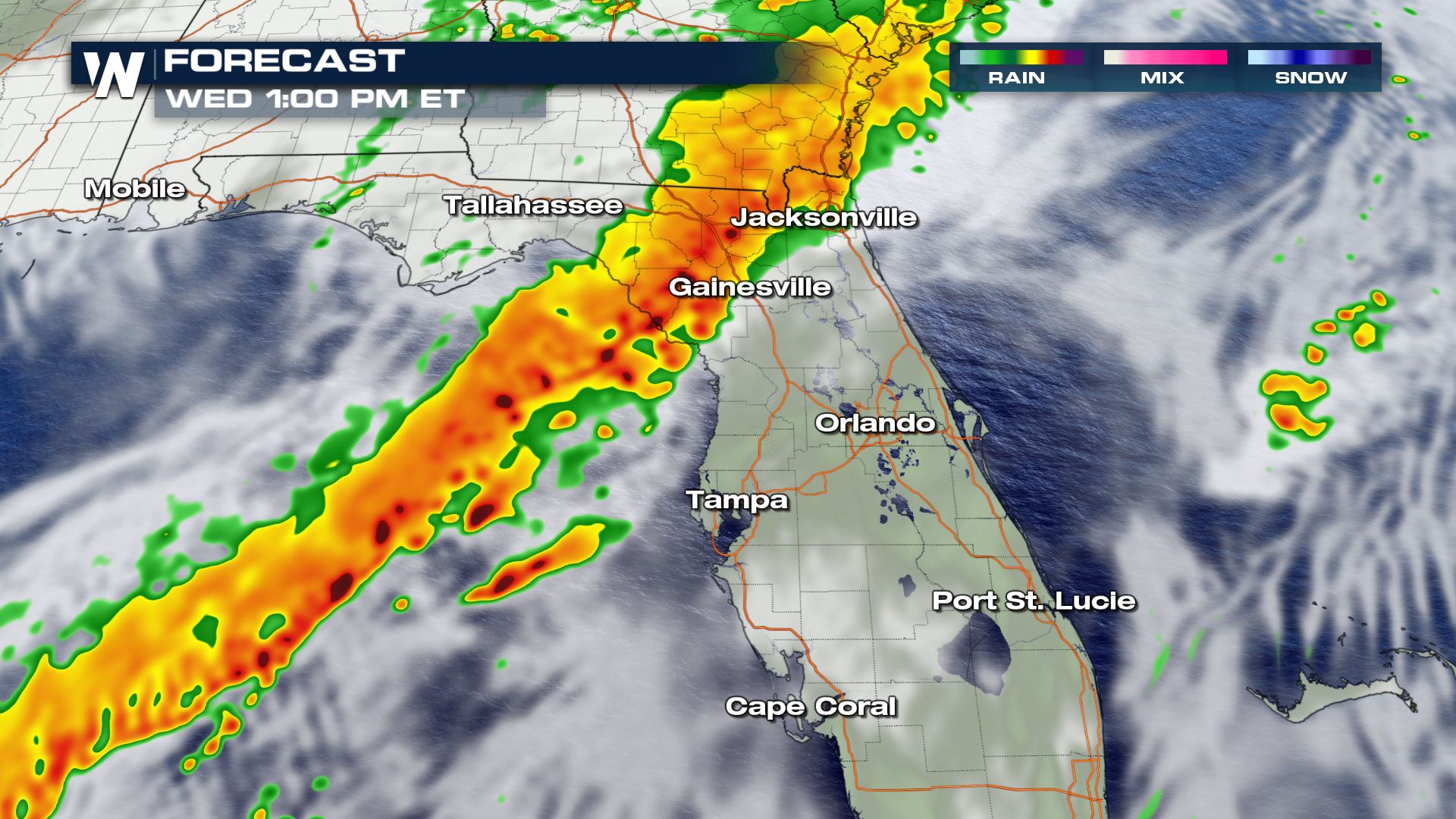
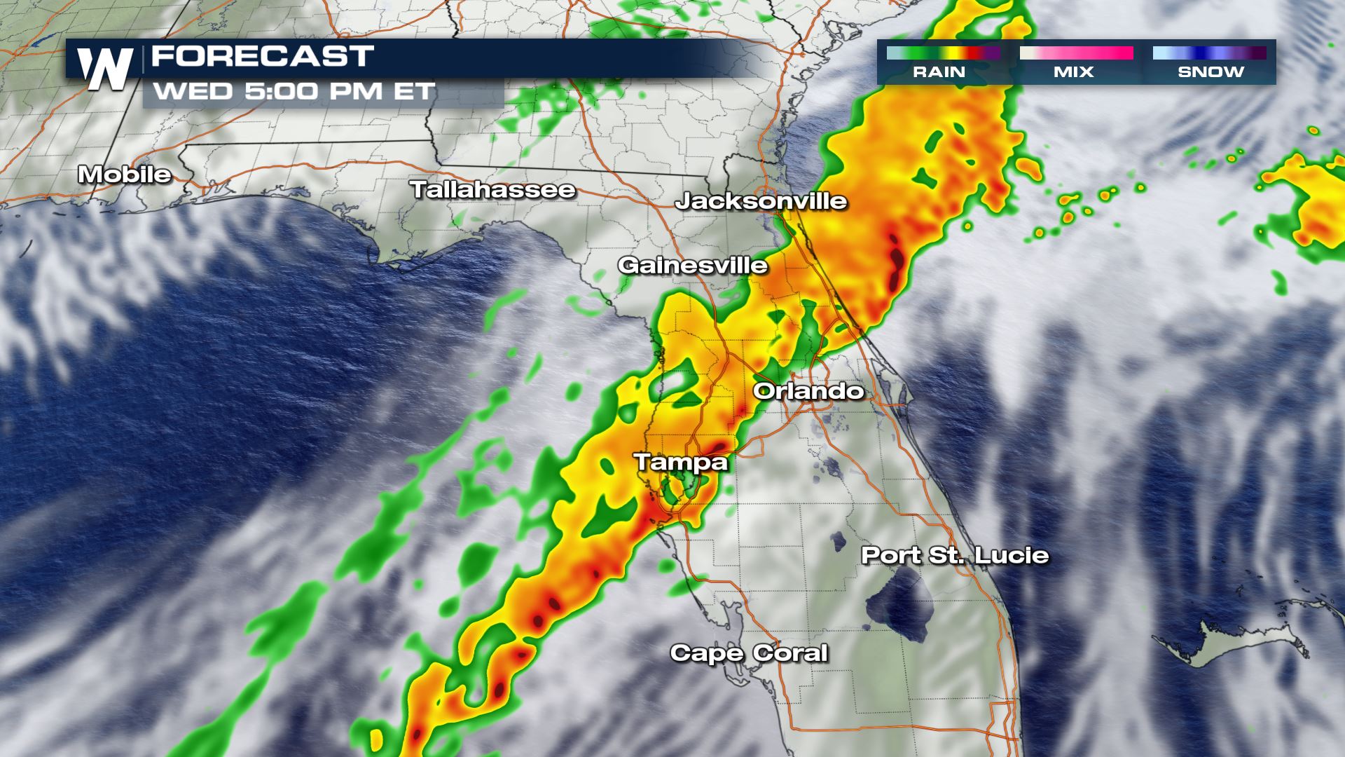
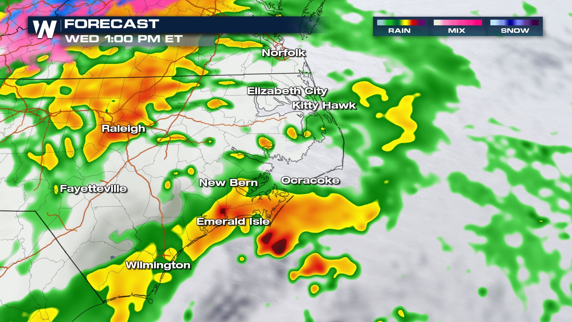
A low pressure system that moved over the Southern Rockies earlier in the week is expected to move across the Southeast Wednesday. Alongside this low pressure system, another low will develop in the Southeast along the Atlantic coast and move northward into the Mid-Atlantic on Wednesday. With two low pressure systems, there will be two areas that have a risk for severe storms. For more on the severe weather outlook, scroll down. Forecast snapshots of the Florida region are posted first, followed by several across Eastern North Carolina.
The 'northern' low in the Mid-Atlantic will bring snow to the north and rain to the south. Similar to the set-up we saw with Monday's coastal storm, the south side will see a severe storm threat and the north-side seeing snow.
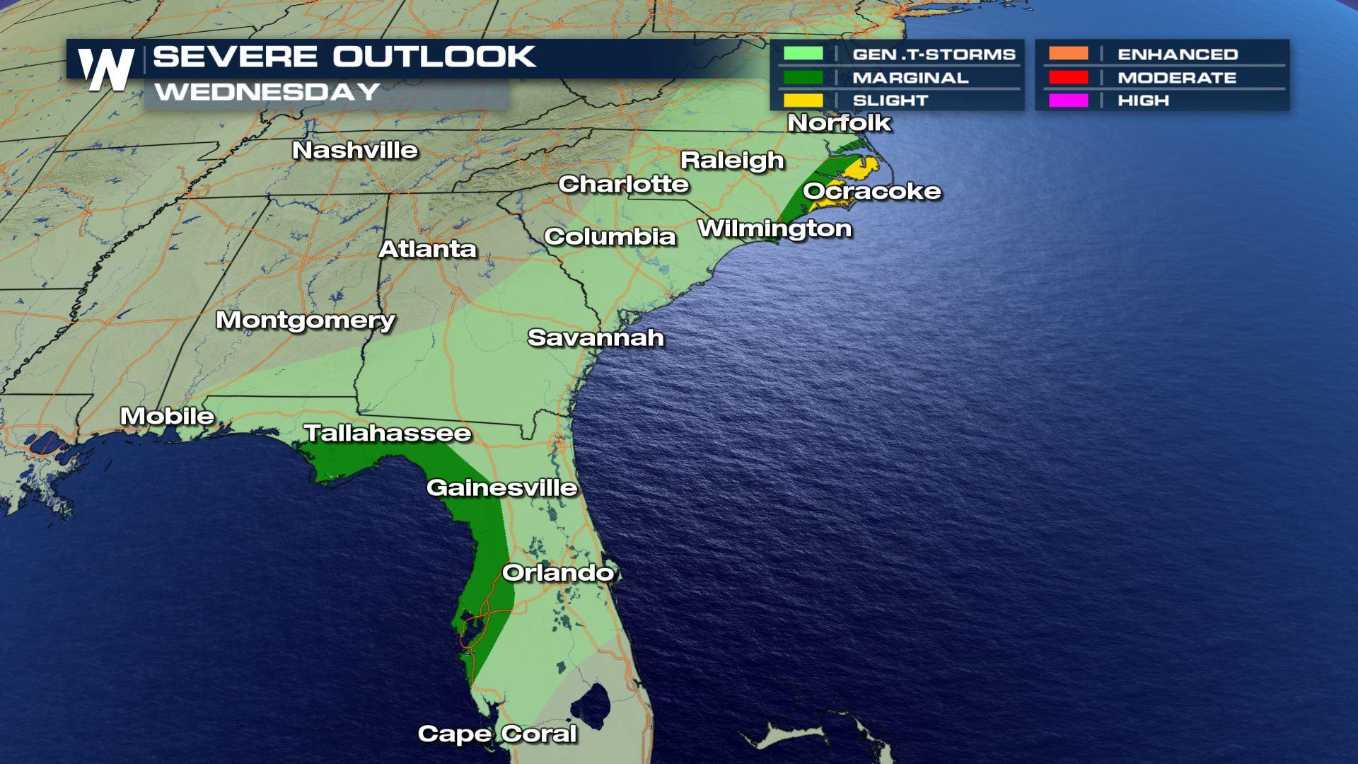
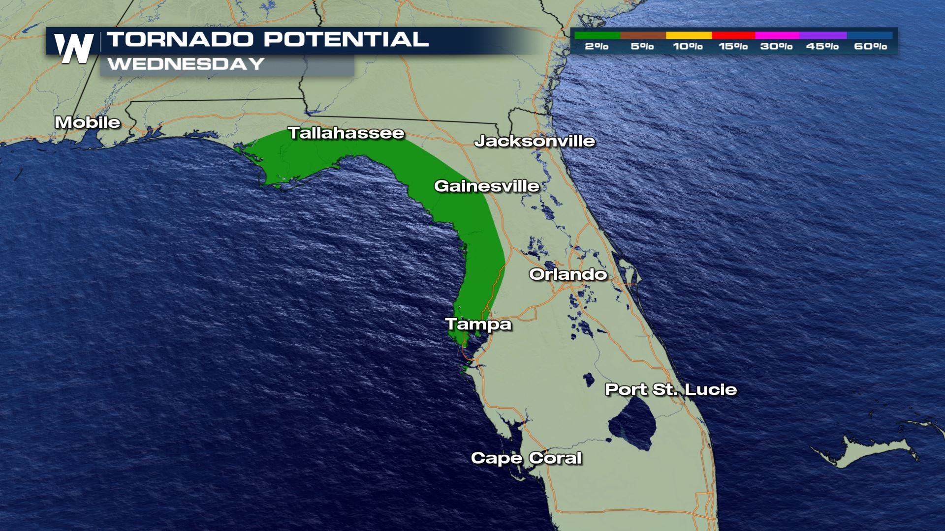
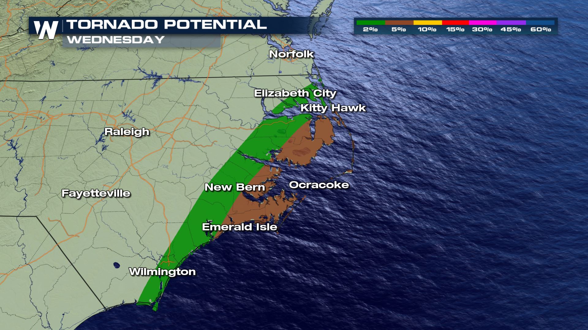
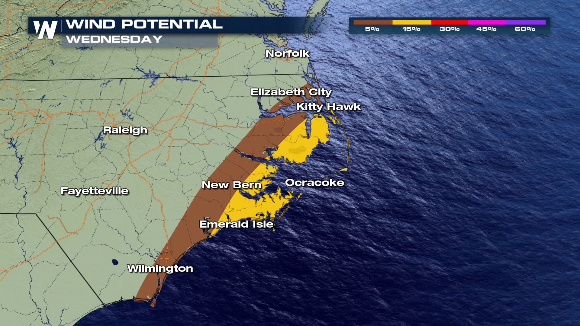
Severe Outlook
The Storm Prediction Center has issued a slight risk for severe storms (level 2 on a scale 1 to 5) for Eastern North Carolina, with a marginal risk (1 out of 5) for Florida. The main concern with both risk areas will be for damaging straight-line winds, with gusts over 58 mph. Gusts this strong can down big branches or entire trees. Downed power lines are also a concern. If enough destabilization occurs in either region, there will be enough shear in the atmosphere for supercells. This means a few isolated tornadoes are possible. Tornadoes are slightly more likely in the Outer Banks Wednesday afternoon, according to the SPC.
Forecast Accumulation
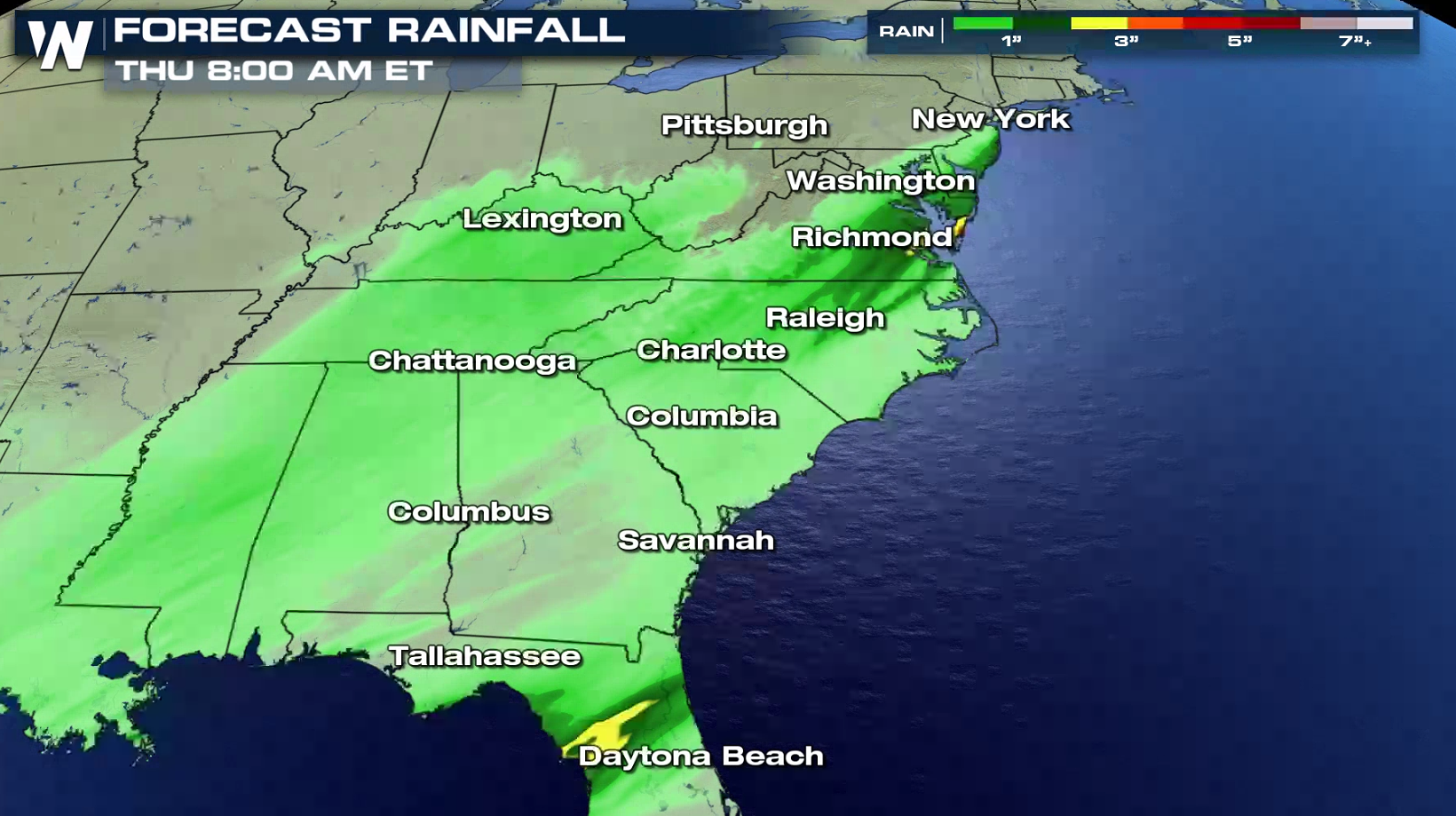
On the warm side of these low pressure systems, we may see up to 1-2" of rain. Here's a look at our rainfall forecast:
Coastal Alerts
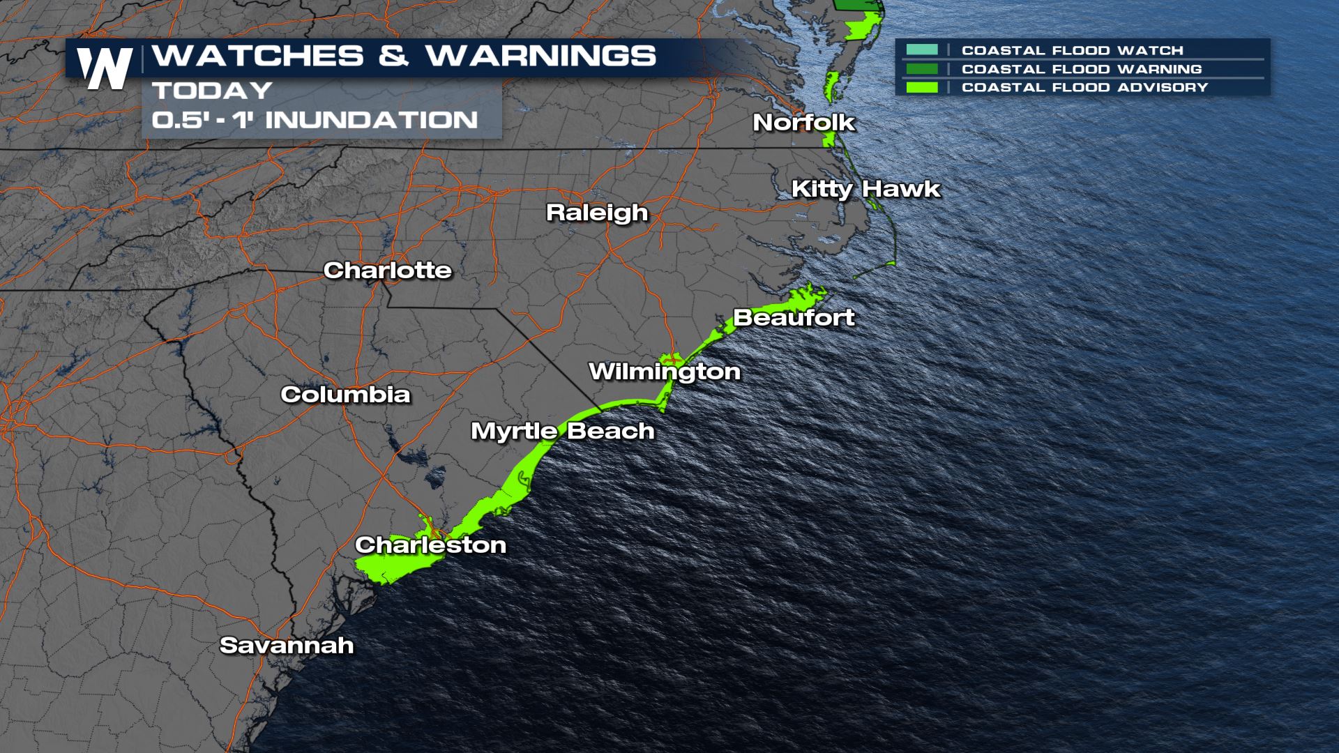
For the Carolina region, minor coastal flooding will also be possible along the immediate coast with 1-2 feet of inundation possible. This will be most noticeable around high tide, which will primarily occur during the middle to late morning.
For the rest of the story watch us 24/7 on WeatherNation!All Weather News
More
Fronts Continue To Spark Severe Weather Across the Plains
A cold front that brought record lows to the
18 Jul 2025 10:40 PM

Extreme Heat Impacts for the East Coast & South
Extreme heat continues to impact several area
18 Jul 2025 10:05 PM

Flooding Threat Remains Elevated in the East
A cold front pushing through the Eastern Seab
18 Jul 2025 9:10 PM

EF-2 Firenado from the Deer Creek Fire in Utah
A fire tornado was spotted near La Sal, Utah
18 Jul 2025 7:30 AM

Tropical System Brings Flood Risk to the Central Gulf
Time has run out for notable tropical develop
18 Jul 2025 3:05 AM

Heavy Rain, Flooding Threat Returns to Florida
Keep the rain boots handy in Florida - heavy
13 Jul 2025 12:50 PM

Severe Storm Risk Pushes into the Great Lakes, Ohio Valley
Friday was another busy day with severe weath
12 Jul 2025 8:00 PM