Tuesday Severe Risk for the Great Lakes

Top Stories
7 Sep 2021 2:00 PM
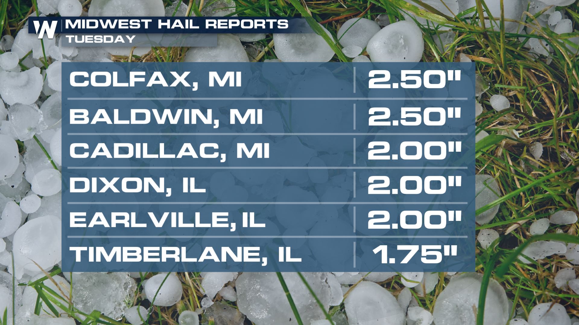
REPORTS
Severe hail moved through Wisconsin Tuesday morning. Here are some of the large hail reports, including a hail reports of softball size in Appleton.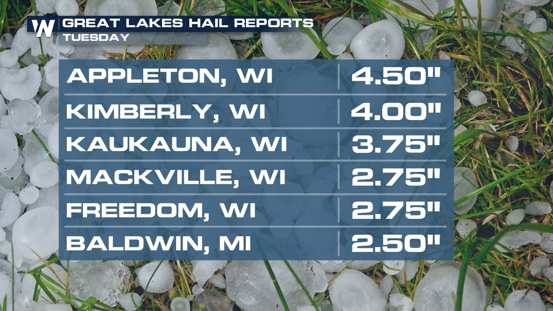 The same complex also dropped hail to the size of limes (2" in diameter) over parts of the Upper Midwest by the midday and afternoon hours too.
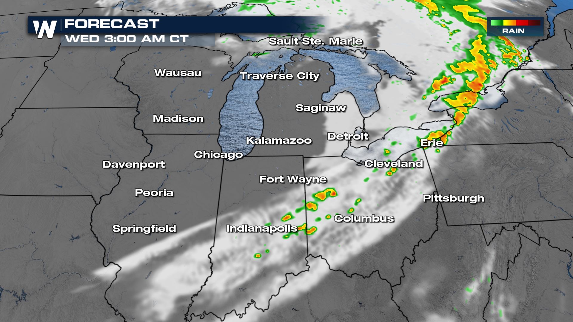
 Where could the severe hail be heading to next? Below is a look at the latest forecast.
An amplifying mid-level trough and a surface cold front will be the focus for producing severe storm chances across the Great Lakes this afternoon and evening. All modes of severe weather will be in the forecast for cities like Chicago, Fort Wayne and Kalamazoo. Here is the latest severe forecast.
Where could the severe hail be heading to next? Below is a look at the latest forecast.
An amplifying mid-level trough and a surface cold front will be the focus for producing severe storm chances across the Great Lakes this afternoon and evening. All modes of severe weather will be in the forecast for cities like Chicago, Fort Wayne and Kalamazoo. Here is the latest severe forecast.
Severe Outlook
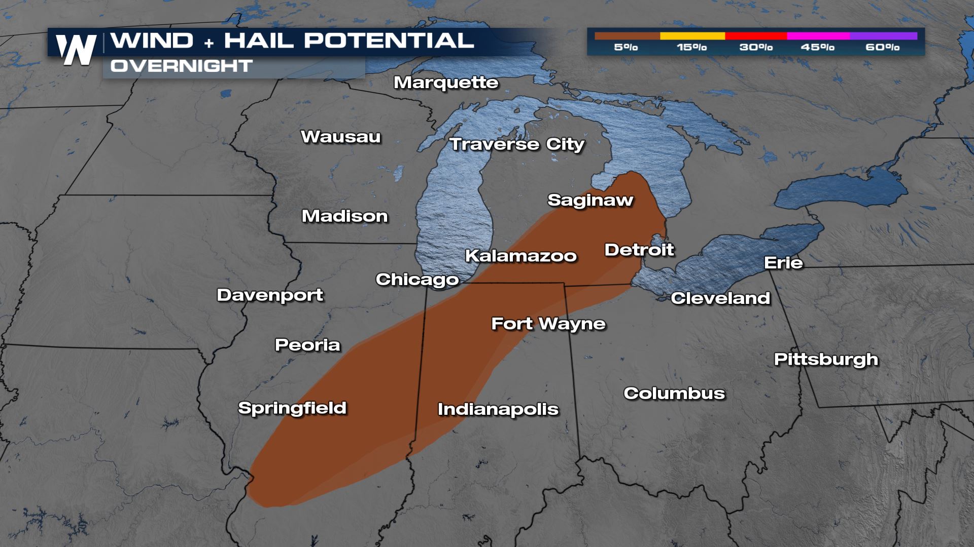
Severe Risks
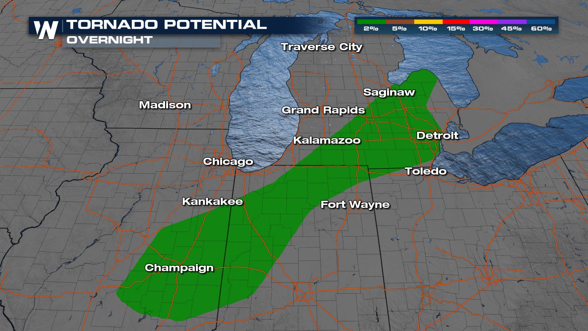
A few tornadoes along with damaging winds and large hail are still possible into the overnight hours. If you are located in the tornado risk, you will want to make sure you have a severe plan in place in case you have to take cover.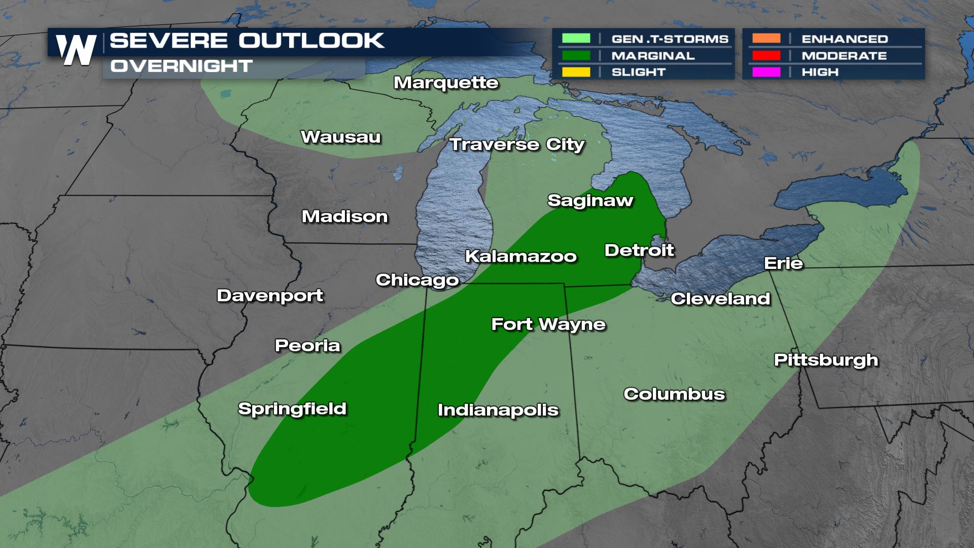
Forecast
Most of the storm activity that could produce the worst severe weather is likelier in the early parts of the nighttime hours.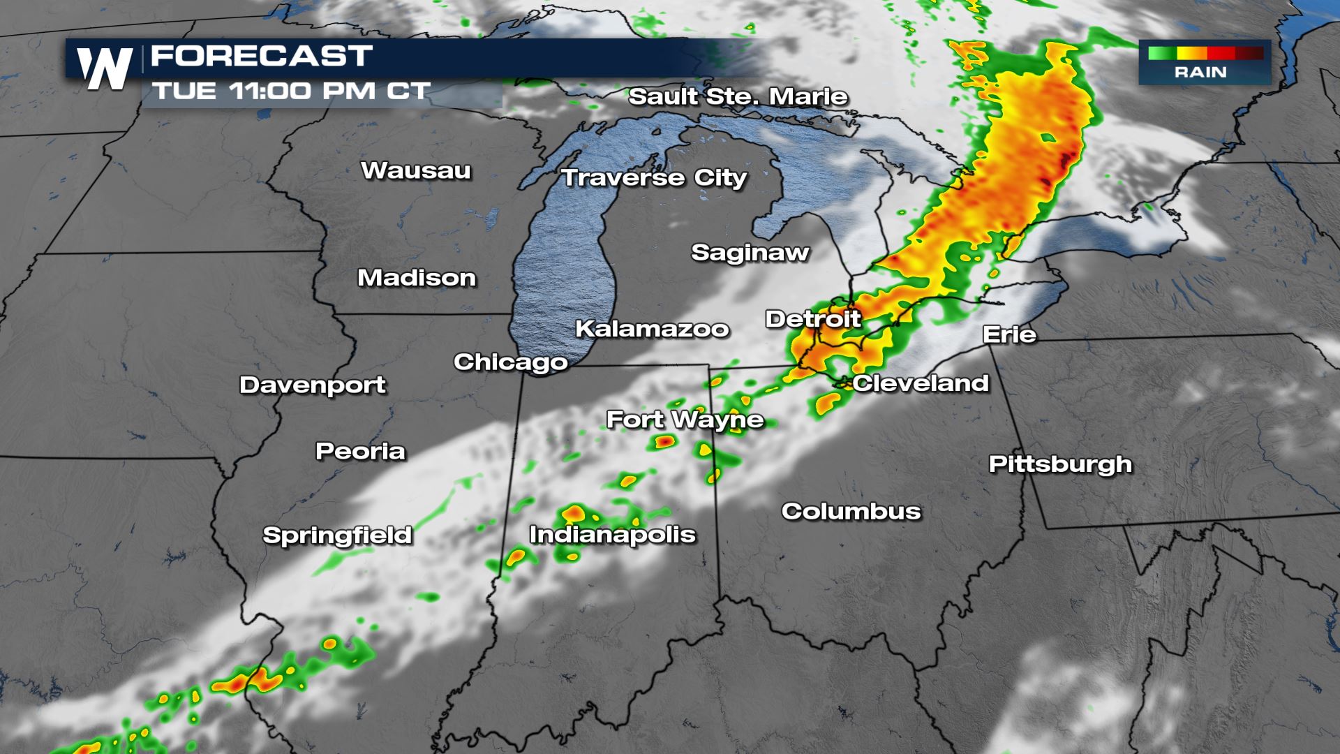
Rainfall Forecast
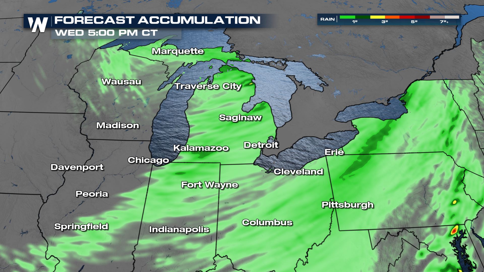 Isolated spots in Michigan could see up to 3 inches of rainfall when all is said and done. This means a very isolated flash flood risk will be in the forecast.
Excessive Rainfall Forecast
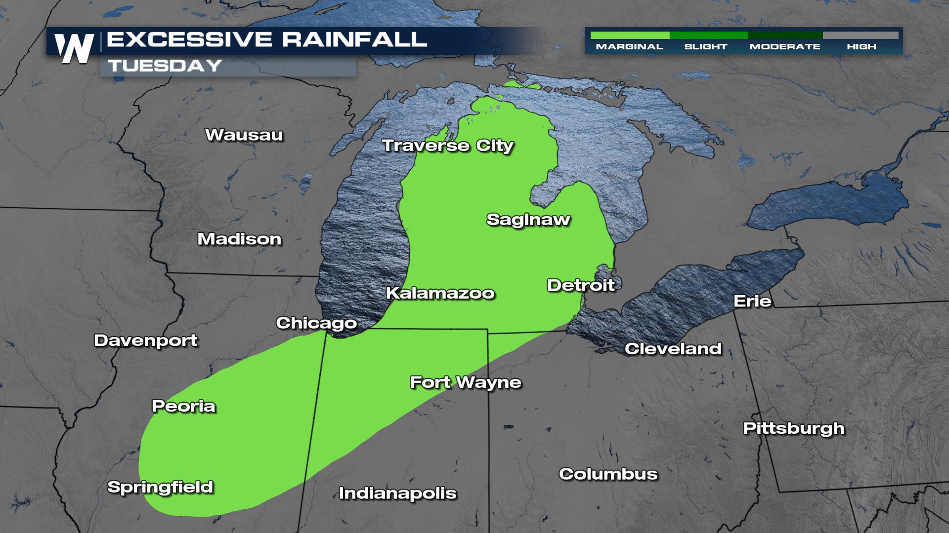 A Marginal risk for excessive rain is in the forecast for the entire state of Michigan today and tonight. This means that a few isolated areas of flash flooding will be possible.
For more updates on today's severe weather, tune-in to WeatherNation. It's so easy to stream 24/7. Here is how you can stream our weather coverage---> STREAMING OPTIONS
A Marginal risk for excessive rain is in the forecast for the entire state of Michigan today and tonight. This means that a few isolated areas of flash flooding will be possible.
For more updates on today's severe weather, tune-in to WeatherNation. It's so easy to stream 24/7. Here is how you can stream our weather coverage---> STREAMING OPTIONSAll Weather News
More
Fronts Continue To Spark Severe Weather Across the Plains
A cold front that brought record lows to the
18 Jul 2025 10:40 PM

Extreme Heat Impacts for the East Coast & South
Extreme heat continues to impact several area
18 Jul 2025 10:05 PM

Flooding Threat Remains Elevated in the East
A cold front pushing through the Eastern Seab
18 Jul 2025 9:10 PM

EF-2 Firenado from the Deer Creek Fire in Utah
A fire tornado was spotted near La Sal, Utah
18 Jul 2025 7:30 AM

Tropical System Brings Flood Risk to the Central Gulf
Time has run out for notable tropical develop
18 Jul 2025 3:05 AM

Heavy Rain, Flooding Threat Returns to Florida
Keep the rain boots handy in Florida - heavy
13 Jul 2025 12:50 PM

Severe Storm Risk Pushes into the Great Lakes, Ohio Valley
Friday was another busy day with severe weath
12 Jul 2025 8:00 PM